Home > Europe > United Kingdom > England > Cheshire > Scholar Green
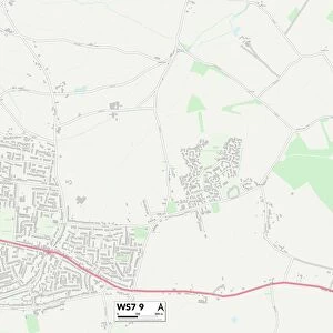
Lichfield WS7 9 Map

![]()
Wall Art and Photo Gifts from Map Marketing
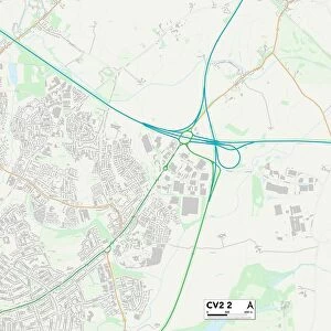
Lichfield WS7 9 Map
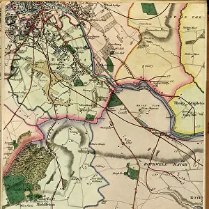
Postcode Sector Map of Lichfield WS7 9
Media ID 19980866
Anson Close Blythe Close Bracken Close Bramble Lane Browning Road Brunel Close Burns Drive Cannock Road Canterbury Drive Cheshire Close Church Road Dale Drive Darwin Close Derwent Grove Dove Close Emmanuel Road Green Lane Gregory Road Highfield Avenue Highfield Close Highfield Road Highfields Hunter Avenue Keble Close Laurel Drive Leigh Avenue Lichfield Morley Road Mulberry Drive Nether Lane Nightingale Walk Reid Close Rose Lane Selwyn Road Severn Drive St Matthews Road Stour Close Telford Close The Hollies The Orchard Trent Close Trevithick Close Wedgewood Close Wentworth Close Westbourne Crescent Whitehouse Crescent Wilkinson Close
FEATURES IN THESE COLLECTIONS
> Animals
> Birds
> Charadriiformes
> Sandpipers
> Sanderling
> Animals
> Birds
> Columbiformes
> Doves
> Related Images
> Animals
> Birds
> Passerines
> Chats And Flycatchers
> Nightingale
> Animals
> Birds
> Passerines
> Finches
> Brambling
> Europe
> United Kingdom
> England
> Cheshire
> Morley Green
> Europe
> United Kingdom
> England
> Cheshire
> Related Images
> Europe
> United Kingdom
> England
> Cheshire
> Scholar Green
> Europe
> United Kingdom
> England
> Yorkshire
> Burn
> Europe
> United Kingdom
> England
> Yorkshire
> Highfield
> Europe
> United Kingdom
> England
> Yorkshire
> Hunslet
> Map Marketing
> Postcode Sector Maps
> WS - Walsall
MADE IN THE USA
Safe Shipping with 30 Day Money Back Guarantee
FREE PERSONALISATION*
We are proud to offer a range of customisation features including Personalised Captions, Color Filters and Picture Zoom Tools
SECURE PAYMENTS
We happily accept a wide range of payment options so you can pay for the things you need in the way that is most convenient for you
* Options may vary by product and licensing agreement. Zoomed Pictures can be adjusted in the Cart.