Home > Europe > United Kingdom > England > Oxfordshire > Idbury
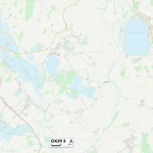
West Oxfordshire OX28 5 Map

![]()
Wall Art and Photo Gifts from Map Marketing
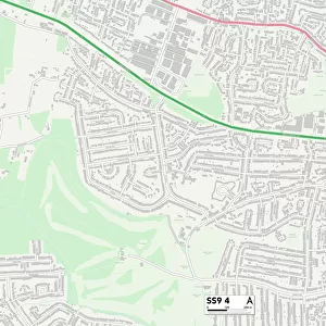
West Oxfordshire OX28 5 Map
Postcode Sector Map of West Oxfordshire OX28 5
Media ID 19978970
Abbey Road Barrington Close Blenheim Drive Bourton Close Broadway Close Burwell Close Cornfield Close Deer Park Road Edington Road Elm Close Fairfield Drive Liberty Close Mountfield Road Sherbourne Road Spring Meadow Stanton Close Tower Hill Vale Road Walnut Close West Oxfordshire Windrush Close Wychwood Close
FEATURES IN THESE COLLECTIONS
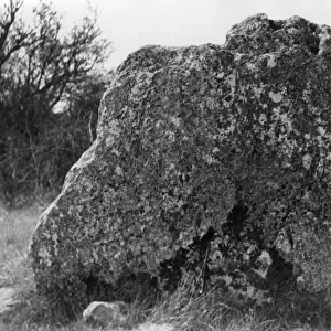
> Architecture
> Towers
> Churches
> Europe
> United Kingdom
> England
> Oxfordshire
> Bourton
> Europe
> United Kingdom
> England
> Oxfordshire
> Idbury
> Europe
> United Kingdom
> England
> Oxfordshire
> Lyneham
> Europe
> United Kingdom
> England
> Oxfordshire
> Related Images
> Europe
> United Kingdom
> England
> Oxfordshire
> Windrush
> Map Marketing
> Postcode Sector Maps
> OX - Oxford
> Maps and Charts
> Related Images
MADE IN THE USA
Safe Shipping with 30 Day Money Back Guarantee
FREE PERSONALISATION*
We are proud to offer a range of customisation features including Personalised Captions, Color Filters and Picture Zoom Tools
SECURE PAYMENTS
We happily accept a wide range of payment options so you can pay for the things you need in the way that is most convenient for you
* Options may vary by product and licensing agreement. Zoomed Pictures can be adjusted in the Cart.