Home > Europe > United Kingdom > England > Staffordshire > Lane Green
Staffordshire ST2 0 Map

![]()
Wall Art and Photo Gifts from Map Marketing
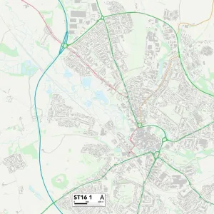
Staffordshire ST2 0 Map
Postcode Sector Map of Staffordshire ST2 0
Media ID 19978776
Alton Grove Aylesbury Road Beverley Drive Brecon Way Chelmsford Drive Dalton Grove Dawlish Drive Discovery Drive Galloway Road Holly Court Kendal Grove Kipling Way Middlefield Road Norwich Road Ruthin Road Staffordshire Stirling Close Taunton Way Thornhill Road Tiverton Road Wellfield Road Winchester Avenue Leicester Place
FEATURES IN THESE COLLECTIONS
> Arts
> Portraits
> Pop art gallery
> Street art portraits
> Europe
> United Kingdom
> England
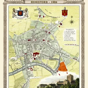
> Herefordshire
> Maps
> Europe
> United Kingdom
> England
> Staffordshire
> Alton
> Europe
> United Kingdom
> England
> Staffordshire
> Lane Green
> Europe
> United Kingdom
> England
> Staffordshire
> Related Images
> Europe
> United Kingdom
> England
> Staffordshire
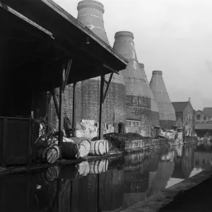
> Stoke on Trent
> Europe
> United Kingdom
> Scotland
> Dumfries and Galloway
> Moffat
> Europe
> United Kingdom
> Scotland
> Dumfries and Galloway
> Related Images
> Europe
> United Kingdom
> Scotland
> Dumfries and Galloway
> Thornhill
> Europe
> United Kingdom
> Scotland
> Scottish Borders
> Lauder
> Map Marketing
> Postcode Sector Maps
> ST - Stoke-on-Trent
MADE IN THE USA
Safe Shipping with 30 Day Money Back Guarantee
FREE PERSONALISATION*
We are proud to offer a range of customisation features including Personalised Captions, Color Filters and Picture Zoom Tools
SECURE PAYMENTS
We happily accept a wide range of payment options so you can pay for the things you need in the way that is most convenient for you
* Options may vary by product and licensing agreement. Zoomed Pictures can be adjusted in the Cart.