Home > Europe > United Kingdom > England > London > Sights > Holland Park
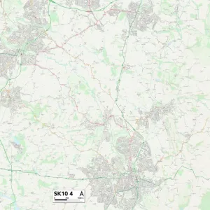
Stockport SK7 2 Map

![]()
Wall Art and Photo Gifts from Map Marketing
Stockport SK7 2 Map
Postcode Sector Map of Stockport SK7 2
Media ID 19977546
Adelaide Road Ainsdale Close Birchway Birkdale Close Boston Close Bramley Close Bramley Drive Bramley Road Brookdale Road Bude Close Camberley Close Colwyn Road Dale Avenue Dawlish Close Denham Drive Fairhaven Close Fir Avenue Fir Road Gawsworth Close Gleneagles Close Grasmere Crescent Hardy Drive Hartington Road Helston Close Hillside Close Holland Road Huxley Close Launceston Close Laurel Way Lumb Lane Lytham Drive Maple Road Milton Road Moreton Avenue Newlands Avenue Northcote Road Pine Road Robins Close Robins Lane Rowan Drive St Michaels Avenue Stockport Sunningdale Drive Troon Close Truro Close Valley Road Victoria Close Waterloo Road Weavers Lane Wentworth Drive Willow Way Wyndham Close Bramhall
FEATURES IN THESE COLLECTIONS
> Animals
> Mammals
> Muridae
> House Mouse
> Europe
> United Kingdom
> England
> London
> Sights
> Holland Park
> Europe
> United Kingdom
> England
> London
> Sights
> Victoria Park
> Europe
> United Kingdom
> Scotland
> Strathclyde
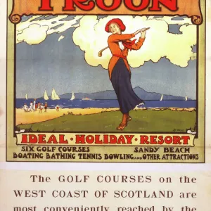
> Troon
> Map Marketing
> Postcode Sector Maps
> SK - Stockport
> Maps and Charts
> Related Images
> Popular Themes
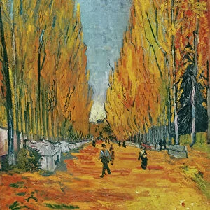
> Laurel & Hardy
MADE IN THE USA
Safe Shipping with 30 Day Money Back Guarantee
FREE PERSONALISATION*
We are proud to offer a range of customisation features including Personalised Captions, Color Filters and Picture Zoom Tools
SECURE PAYMENTS
We happily accept a wide range of payment options so you can pay for the things you need in the way that is most convenient for you
* Options may vary by product and licensing agreement. Zoomed Pictures can be adjusted in the Cart.