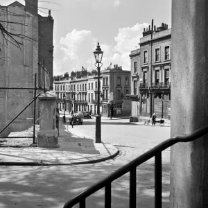
Home > Europe > United Kingdom > England > London > Towns > New Southgate
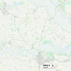
Norfolk NR21 9 Map

![]()
Wall Art and Photo Gifts from Map Marketing
Norfolk NR21 9 Map
Postcode Sector Map of Norfolk NR21 9
Media ID 19976342
Arthur Road Back Lane Back Street Bridge Street Burnham Road Butchers Lane Chapel Lane Church Lane Church Street Clarendon Road Claypit Lane Dunns Lane Fakenham Road Field Lane Fisher Road Foundry Close Grove Road Hayes Lane Highfield Road Holgate Road Kings Road Lawrence Close London Lane Market Place Meadow Rise Mill Court Moor Lane Nelson Road New Road Norfolk Norman Close North Park Oak Street Quaker Lane Roman Road Sandy Lane Southgate Swan Street Sycamore Drive The Green The Square The Street Wells Road West Street Winston Drive Fakenham Toll Bar
FEATURES IN THESE COLLECTIONS
> Animals
> Farm
> Cattle
> Related Images
> Animals
> Mammals
> Bovidae
> Cattle
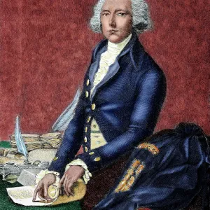
> Arts
> Portraits
> Pop art gallery
> Street art portraits
> Europe
> United Kingdom
> England
> London
> Sights
> Green Park
> Europe
> United Kingdom
> England
> London
> Towns
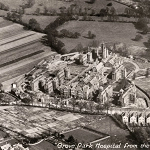
> Grove Park
> Europe
> United Kingdom
> England
> London
> Towns
> Hayes
> Europe
> United Kingdom
> England
> London
> Towns
> Mill Hill
> Europe
> United Kingdom
> England
> London
> Towns
> New Southgate
> Europe
> United Kingdom
> England
> London
> Towns
> Southgate
> Europe
> United Kingdom
> England
> London
> Towns
> Welling
> Map Marketing
> Postcode Sector Maps
> NR - Norwich
MADE IN THE USA
Safe Shipping with 30 Day Money Back Guarantee
FREE PERSONALISATION*
We are proud to offer a range of customisation features including Personalised Captions, Color Filters and Picture Zoom Tools
SECURE PAYMENTS
We happily accept a wide range of payment options so you can pay for the things you need in the way that is most convenient for you
* Options may vary by product and licensing agreement. Zoomed Pictures can be adjusted in the Cart.