Home > Europe > United Kingdom > Scotland > West Lothian > Whitburn
Sunderland SR6 7 Map

![]()
Wall Art and Photo Gifts from Map Marketing
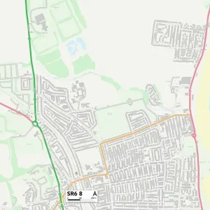
Sunderland SR6 7 Map
Postcode Sector Map of Sunderland SR6 7
Media ID 19981486
Arthur Street Ash Grove Beech Avenue Birch Avenue Broadlands Buckingham Close Buttermere Cedar Grove Central Avenue Church Lane East Drive East Street Elm Drive Fairfield Drive Fern Avenue Fern Drive Fieldside Front Street Grasmere Grosvenor Drive Hall View Heather Close Hillside Drive Holly Avenue Kelvin Grove Kitchener Road Laburnum Grove Larch Avenue Lilac Avenue Lilac Gardens Low Meadow Maple Grove Markham Avenue Marsden Road Marsham Close Mayfield Drive Meadowfield Drive Mill Lane Moor Lane Moor View Myrtle Avenue North Drive North Street Nursery Lane Oak Crescent Oakleigh Gardens Orchard Gardens Paddock Close Poplar Drive Redhill Rose Crescent Rupert Street Saxon Close Sea Lane Shields Road South Drive Sunderland Sunderland Road Sycamore Road The Close The Crescent The Leas Thirlmere Underhill Road West Avenue West Drive West Park Road Westcroft Whitburn Road Windermere Windsor Drive Woodlands Drive Woodlands Road Woodlands View Shearwater Whitburn
FEATURES IN THESE COLLECTIONS
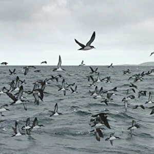
> Animals
> Birds
> Seabirds
> Shearwaters
> Related Images
> Animals
> Mammals
> Muridae
> House Mouse
> Arts
> Portraits
> Pop art gallery
> Street art portraits
> Europe
> United Kingdom
> Scotland
> West Lothian
> Whitburn
> Map Marketing
> Postcode Sector Maps
> SR - Sunderland
> Maps and Charts
> Related Images
> Posters
> Movie Posters
> Laburnum Grove
MADE IN THE USA
Safe Shipping with 30 Day Money Back Guarantee
FREE PERSONALISATION*
We are proud to offer a range of customisation features including Personalised Captions, Color Filters and Picture Zoom Tools
SECURE PAYMENTS
We happily accept a wide range of payment options so you can pay for the things you need in the way that is most convenient for you
* Options may vary by product and licensing agreement. Zoomed Pictures can be adjusted in the Cart.