Home > Europe > United Kingdom > England > London > Boroughs > Bromley
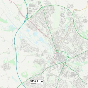
Staffordshire ST1 5 Map

![]()
Wall Art and Photo Gifts from Map Marketing
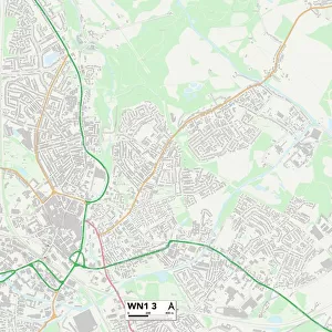
Staffordshire ST1 5 Map
Postcode Sector Map of Staffordshire ST1 5
Media ID 19978818
Black Horse Lane Boundary Street Brewery Street Bromley Street Cape Street Cavendish Street Cecil Avenue Crown Road Denbigh Street Derwent Street Douglas Street Edgeware Road Festival Close Forge Lane Foundry Street Hanover Street Hope Street Lowther Street Marina Way Mulgrave Street Pavilion Drive Portland Street Powell Street Rutland Street Salem Street Sandon Street Severn Street Shaw Street Staffordshire Trafalgar Street Trinity Street Union Street Weaver Street Windermere Street Winifred Street York Street
FEATURES IN THESE COLLECTIONS
> Animals
> Birds
> Passerines
> Weavers
> Cape Weaver
> Animals
> Fishes
> G
> Garibaldi
> Animals
> Mammals
> Muridae
> Water Mouse
> Arts
> Portraits
> Pop art gallery
> Street art portraits
> Europe
> United Kingdom
> England
> London
> Boroughs
> Bromley
> Europe
> United Kingdom
> England
> Rutland
> Related Images
> Europe
> United Kingdom
> England
> Staffordshire
> Related Images
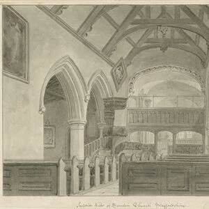
> Europe
> United Kingdom
> England
> Staffordshire
> Sandon
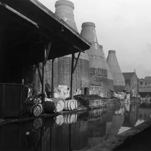
> Europe
> United Kingdom
> England
> Staffordshire
> Stoke on Trent
> Europe
> United Kingdom
> Wales
> South Glamorgan
> Penarth
> Map Marketing
> Postcode Sector Maps
> ST - Stoke-on-Trent
MADE IN THE USA
Safe Shipping with 30 Day Money Back Guarantee
FREE PERSONALISATION*
We are proud to offer a range of customisation features including Personalised Captions, Color Filters and Picture Zoom Tools
SECURE PAYMENTS
We happily accept a wide range of payment options so you can pay for the things you need in the way that is most convenient for you
* Options may vary by product and licensing agreement. Zoomed Pictures can be adjusted in the Cart.