Jigsaw Puzzle > Europe > Republic of Ireland > Maps
Jigsaw Puzzle : MAPS / BRITAIN / 1763


![]()
Jigsaw Puzzles from Mary Evans Picture Library
MAPS / BRITAIN / 1763
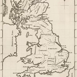
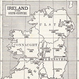
An accurate map of Great Britain and Ireland from the best authorities
Mary Evans Picture Library makes available wonderful images created for people to enjoy over the centuries
Media ID 620765
© Mary Evans Picture Library 2015 - https://copyrighthub.org/s0/hub1/creation/maryevans/MaryEvansPictureID/10074331
1763 Accurate Authorities Best Maps
Jigsaw Puzzle (1014 Pieces)
Discover the captivating world of history with our "MAPS / BRITAIN / 1763" jigsaw puzzle from the Media Storehouse collection, proudly featuring an authentic map of Great Britain and Ireland from the esteemed Mary Evans Picture Library, sourced from Mary Evans Prints Online. This intricately detailed puzzle is a must-have for history enthusiasts, geography aficionados, and puzzle lovers alike. Immerse yourself in the intricacies of the map, meticulously created from the best available authoritative sources. Assemble the pieces to reveal the rich historical details of Great Britain and Ireland in 1763, and transport yourself back in time. A challenging and rewarding experience awaits with the "MAPS / BRITAIN / 1763" jigsaw puzzle from Media Storehouse.
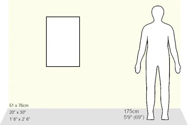
Made in the USA, 1014-piece puzzles measure 20" x 30" (50.8 x 76.2 cm). Every puzzle is meticulously printed on glossy photo paper, which has a strong 1.33 mm thickness. Delivered in a black storage cardboard box, these puzzles are both stylish and practical. (Note: puzzles contain small parts and are not suitable for children under 3 years of age.)
Jigsaw Puzzles are an ideal gift for any occasion
Estimated Product Size is 50.8cm x 76cm (20" x 29.9")
These are individually made so all sizes are approximate
Artwork printed orientated as per the preview above, with portrait (vertical) orientation to match the source image.
FEATURES IN THESE COLLECTIONS
> Europe
> Republic of Ireland
> Maps
> Maps and Charts
> Early Maps
> Maps and Charts
> Related Images
EDITORS COMMENTS
This stunning print captures a piece of history with an accurate map of Great Britain and Ireland from 1763. Created by the best authorities of the time, this detailed map provides a glimpse into the geographical landscape of Britain and Ireland during this significant period in history.
The intricate details on the map showcase the various regions, cities, and landmarks that were present over two centuries ago. From London to Dublin, Edinburgh to Cardiff, each location is meticulously labeled, giving viewers a sense of how these countries were structured in the past.
As we study this historical map, we can appreciate the craftsmanship and expertise that went into creating such an accurate representation of Great Britain and Ireland. It serves as a reminder of how far cartography has come since then while also highlighting the importance of preserving these pieces of our past.
Whether you're a history buff or simply fascinated by maps, this print from Mary Evans Picture Library is sure to captivate your imagination. Step back in time and explore Great Britain and Ireland as it was seen through the eyes of experts in 1763 - a true treasure for any lover of historical artifacts.
MADE IN THE USA
Safe Shipping with 30 Day Money Back Guarantee
FREE PERSONALISATION*
We are proud to offer a range of customisation features including Personalised Captions, Color Filters and Picture Zoom Tools
SECURE PAYMENTS
We happily accept a wide range of payment options so you can pay for the things you need in the way that is most convenient for you
* Options may vary by product and licensing agreement. Zoomed Pictures can be adjusted in the Cart.