Jigsaw Puzzle > Asia > Israel > Maps
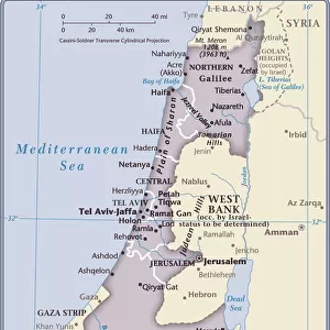
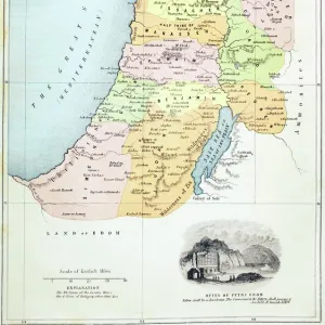
Jigsaw Puzzle : Map Extent Jewish landholdings issued Jewish National


![]()
Jigsaw Puzzles From Liszt Collection
Map Extent Jewish landholdings issued Jewish National
Map. Extent of Jewish landholdings, issued by Jewish National Foundation, Jerusalem; Another view of map of Jewish landholdings 1934, Israel
Liszt Collection of nineteenth-century engravings and images to browse and enjoy
Media ID 18518795
© Liszt Collection
Another View Foundation Extent Issued
Jigsaw Puzzle (1014 Pieces)
Discover the fascinating history of Jewish landholdings with our captivating jigsaw puzzle from the Media Storehouse collection. This intricately detailed puzzle, featuring the "Map Extent of Jewish Landholdings" issued by the Jewish National Foundation in Jerusalem, invites you on a journey back in time to 1934. The Liszt Collection map offers a unique perspective into the history of Israel, making this puzzle an educational and engaging addition to your home. Piece together the rich history and intricate details of this historic map, and immerse yourself in the stories it tells. Perfect for puzzle enthusiasts, history buffs, or anyone looking for a challenging and rewarding pastime.
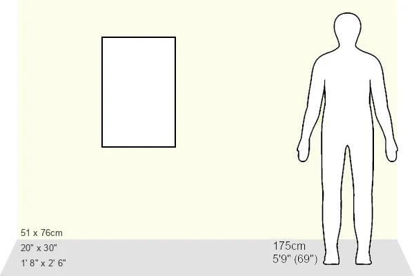
Made in the USA, 1014-piece puzzles measure 20" x 30" (50.8 x 76.2 cm). Every puzzle is meticulously printed on glossy photo paper, which has a strong 1.33 mm thickness. Delivered in a black storage cardboard box, these puzzles are both stylish and practical. (Note: puzzles contain small parts and are not suitable for children under 3 years of age.)
Jigsaw Puzzles are an ideal gift for any occasion
Estimated Product Size is 50.8cm x 76cm (20" x 29.9")
These are individually made so all sizes are approximate
Artwork printed orientated as per the preview above, with portrait (vertical) orientation to match the source image.
FEATURES IN THESE COLLECTIONS
> Asia
> Israel
> Related Images
> Maps and Charts
> Related Images
EDITORS COMMENTS
This print showcases a historically significant artifact titled "Map Extent Jewish landholdings issued Jewish National". Published by the esteemed Jewish National Foundation in Jerusalem, this map provides a fascinating glimpse into the extent of Jewish land ownership in 1934 Israel. The intricate details and precise cartography depicted on this map are truly remarkable. As we delve deeper into the image, we are presented with another view of this invaluable document, further emphasizing its importance. The Liszt Collection has expertly preserved and reproduced this piece, allowing us to appreciate its historical significance from the comfort of our own homes. Examining this map offers a unique opportunity to explore the distribution and scale of Jewish landholdings during that era. It serves as a testament to both the resilience and determination of the Jewish people who sought to establish their presence in their ancestral homeland. The Liszt Collection's dedication to preserving such culturally rich artifacts is commendable. Through their meticulous attention to detail, they have ensured that future generations can continue to learn from and appreciate these valuable pieces of history. In summary, this print captures an extraordinary representation of "Map Extent Jewish landholdings issued by Jewish National Foundation" providing us with an insightful window into Israel's past. Thanks to the Liszt Collection's commitment to preservation, we can now admire and study this important historical document for years to come.
MADE IN THE USA
Safe Shipping with 30 Day Money Back Guarantee
FREE PERSONALISATION*
We are proud to offer a range of customisation features including Personalised Captions, Color Filters and Picture Zoom Tools
SECURE PAYMENTS
We happily accept a wide range of payment options so you can pay for the things you need in the way that is most convenient for you
* Options may vary by product and licensing agreement. Zoomed Pictures can be adjusted in the Basket.