Jigsaw Puzzle > Asia > Philippines > Maps
Jigsaw Puzzle : Philippines map 1898


![]()
Jigsaw Puzzles From Fine Art Storehouse
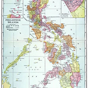
Philippines map 1898
Map from Physical Geography by R. S. Tarr - The MacMillan Company - London 1898
Unleash your creativity and transform your space into a visual masterpiece!
THEPALMER
Media ID 20773159
Jigsaw Puzzle (1014 Pieces)
Discover the rich history of the Philippines with our stunning jigsaw puzzle from Media Storehouse's Fine Art Storehouse collection. Featuring an intricately detailed map of the Philippines from the year 1898, this puzzle is a must-have for history enthusiasts and puzzle lovers alike. The map, titled "Physical Geography" and published by The MacMillan Company in London, offers a captivating glimpse into the past, showcasing the political boundaries of the Philippines during that era. Assemble this beautiful puzzle and adorn your wall with a piece of history. Experience the joy of piecing together this intricate jigsaw puzzle, perfect for solo puzzling or as a family activity. Immerse yourself in the journey of exploration and discovery with the Philippines map 1898 by THEPALMER from Media Storehouse's Fine Art Storehouse collection.
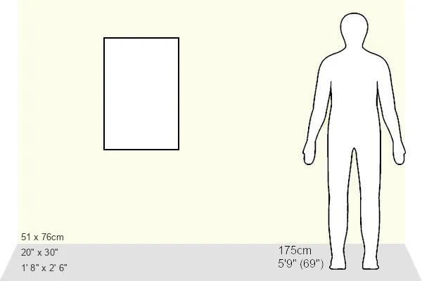
Made in the USA, 1014-piece puzzles measure 20" x 30" (50.8 x 76.2 cm). Every puzzle is meticulously printed on glossy photo paper, which has a strong 1.33 mm thickness. Delivered in a black storage cardboard box, these puzzles are both stylish and practical. (Note: puzzles contain small parts and are not suitable for children under 3 years of age.)
Jigsaw Puzzles are an ideal gift for any occasion
Estimated Product Size is 50.8cm x 76cm (20" x 29.9")
These are individually made so all sizes are approximate
Artwork printed orientated as per the preview above, with portrait (vertical) orientation to match the source image.
FEATURES IN THESE COLLECTIONS
> Asia
> Philippines
> Maps
> Asia
> Philippines
> Related Images
> Maps and Charts
> Related Images
EDITORS COMMENTS
This print showcases a historical gem, the Philippines map from 1898. A true testament to the rich tapestry of our world's history, this particular map was featured in "Physical Geography" by R. S. Tarr and published by The MacMillan Company in London back in 1898. With its intricate details and delicate craftsmanship, it offers a glimpse into the past, allowing us to explore how our understanding of geography has evolved over time. The Philippines map takes center stage as it unfolds before our eyes, revealing an archipelago brimming with natural wonders and cultural diversity. Each island is meticulously depicted, highlighting their unique shapes and sizes. From Luzon to Mindanao, one can trace the contours of these lands that have witnessed countless stories unfold throughout centuries. As we delve deeper into this vintage masterpiece captured by THEPALMER for Fine Art Storehouse, we are transported back to an era when cartography was both artistry and science intertwined. This print serves as a reminder of the importance placed on exploration and discovery during that period. Whether you are a history enthusiast or simply appreciate fine art prints that tell tales of yesteryears, this Philippines map from 1898 will surely captivate your imagination. It invites us to reflect upon our roots while igniting curiosity about how far we have come since then - both geographically and culturally.
MADE IN THE USA
Safe Shipping with 30 Day Money Back Guarantee
FREE PERSONALISATION*
We are proud to offer a range of customisation features including Personalised Captions, Color Filters and Picture Zoom Tools
SECURE PAYMENTS
We happily accept a wide range of payment options so you can pay for the things you need in the way that is most convenient for you
* Options may vary by product and licensing agreement. Zoomed Pictures can be adjusted in the Basket.