Home > North America > Canada > Maps
Framed Print : Hudsons Bay Map


![]()
Framed Photos from Mary Evans Picture Library
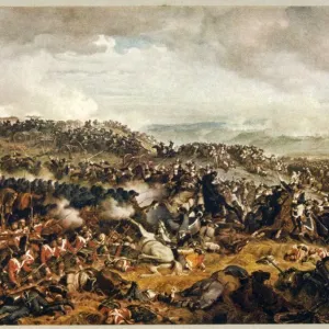
Hudsons Bay Map
HUDSONs BAY, at the time of the Seven Years War, showing French and English forts including Fort York, the principal settlement of the Hudsons Bay Company
Mary Evans Picture Library makes available wonderful images created for people to enjoy over the centuries
Media ID 611103
© Mary Evans Picture Library 2015 - https://copyrighthub.org/s0/hub1/creation/maryevans/MaryEvansPictureID/10100649
1757 Fort Forts Hudsons Including Maps Principal Settlement Years
22"x18" Modern Frame
Discover the rich history of the Hudson Bay Company with our stunning Framed Prints from Media Storehouse, featuring the iconic "Hudsons Bay Map" by Mary Evans Picture Library. This captivating image, sourced from Mary Evans Prints Online, showcases the Hudson Bay region during the Seven Years War. Witness the strategic placement of French and English forts, including Fort York, the principal settlement of the Hudson's Bay Company. Bring history into your home or office with this beautifully framed and preserved print, perfect for history enthusiasts, cartographers, or anyone who appreciates the intricacies of the past.
20x16 Print in an MDF Wooden Frame with 180 gsm Satin Finish Paper. Glazed using shatter proof thin plexiglass. Frame thickness is 1 inch and depth 0.75 inch. Fluted cardboard backing held with clips. Supplied ready to hang with sawtooth hanger and rubber bumpers. Spot clean with a damp cloth. Packaged foam wrapped in a card.
Contemporary Framed and Mounted Prints - Professionally Made and Ready to Hang
Estimated Image Size (if not cropped) is 50.8cm x 45.7cm (20" x 18")
Estimated Product Size is 55.9cm x 45.7cm (22" x 18")
These are individually made so all sizes are approximate
Artwork printed orientated as per the preview above, with landscape (horizontal) orientation to match the source image.
FEATURES IN THESE COLLECTIONS
> Maps and Charts
> Early Maps
> North America
> Canada
> Maps
> North America
> Canada
> Related Images
EDITORS COMMENTS
This intricately detailed map, dated circa 1757, offers a captivating glimpse into the geopolitical landscape of North America during the Seven Years War. The focus of the map is the expansive Hudson Bay, a body of water that was of great strategic importance to both the French and English during this period. At the heart of the map, the principal English settlement of Fort York is depicted, marking the center of the Hudsons Bay Company's influence. Fort York, established in 1682, served as a vital trading post and military outpost for the English. The fort's strategic position at the mouth of the Niagara River provided control over the access to the Great Lakes and the rich resources they offered. Surrounding Fort York, several other English forts are shown, including those at Moose Factory, Albany, and James Bay. These forts were crucial to the English defense against French encroachment in the region. On the opposite side of the map, the French forts of New France are depicted. Notable among these is Fort Frontenac, located at the confluence of the St. Lawrence and Cataraqui Rivers. This fort was a significant stronghold for the French, providing access to the Great Lakes and control over the fur trade in the region. The map also highlights several rivers and waterways, including the Niagara, St. Lawrence, and Ottawa Rivers. These waterways were essential for transportation and communication between the various forts and settlements. This map offers a fascinating look into the complex political and military landscape of North America during the Seven Years War. The depiction of the forts and settlements along the Hudson Bay provides insight into the strategic importance of this region and the efforts of both the French and English to establish and maintain their presence in the New World.
MADE IN THE USA
Safe Shipping with 30 Day Money Back Guarantee
FREE PERSONALISATION*
We are proud to offer a range of customisation features including Personalised Captions, Color Filters and Picture Zoom Tools
SECURE PAYMENTS
We happily accept a wide range of payment options so you can pay for the things you need in the way that is most convenient for you
* Options may vary by product and licensing agreement. Zoomed Pictures can be adjusted in the Cart.