Fraud Blocker Skip to main content

Urbanisation Collection (page 2)

"Captivating Urbanisation: A Global Perspective" Sheffield, UK - An aerial image captures the dynamic growth of this industrial city

Background imageUrbanisation Collection: Manhattan and the Hudson River from the Air, New York, c1930s. Creator: Unknown

Manhattan and the Hudson River from the Air, New York, c1930s. Creator: Unknown
Manhattan and the Hudson River from the Air, New York, c1930s. New York City became the most populated city in the world in 1925

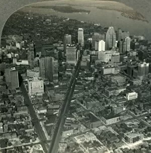
Background imageUrbanisation Collection: Skyscrapers of Downtown Detroit - Michigan Ave. to Detroit River and Belle Isle Park, c1930s

Skyscrapers of Downtown Detroit - Michigan Ave. to Detroit River and Belle Isle Park, c1930s
The Skyscrapers of Downtown Detroit from An Airplace - View over Michigan Ave. to Detroit River and Belle Isle Park, c1930s. Street plan devised by Augustus Woodward

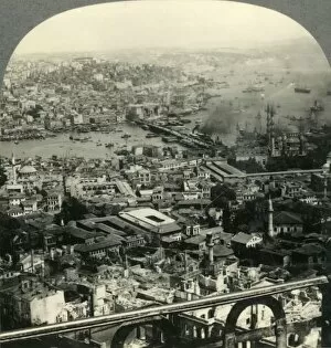
Background imageUrbanisation Collection: Beautiful Istanbul, a City of Two Continents - Asia in Distance to the Northeast (Right), c1930s

Beautiful Istanbul, a City of Two Continents - Asia in Distance to the Northeast (Right), c1930s. View of the Galata Bridge on the Bosphorous strait linking Euope and Asia in Istanbul

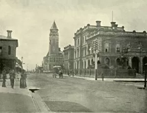
Background imageUrbanisation Collection: Government Offices, Launceston, 1901. Creator: Unknown

Government Offices, Launceston, 1901. Creator: Unknown
Government Offices, Launceston, 1901. City in the north of Tasmania, settled by Europeans in March 1806 and named after Launceston, Cornwall. From " Federated Australia"

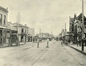
Background imageUrbanisation Collection: Chapel Street. Melbourne, 1901. Creator: Unknown

Chapel Street. Melbourne, 1901. Creator: Unknown
Chapel Street. Melbourne, 1901. Joseph Crook claimed to have built the first house in Chapel Street in 1849. From " Federated Australia". [The Werner Company, London, 1901]

Background imageUrbanisation Collection: Rome, 1890. Creator: Unknown

Rome, 1890. Creator: Unknown
Rome, 1890. Capital city of Italy on the river Tiber, in late 18th and early 19th century, the city was a centres of the Grand Tour. From " Cassells Illustrated Universal History, Vol

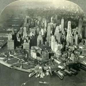
Background imageUrbanisation Collection: The City of New York as seen from the air, 1936. Creator: Unknown

The City of New York as seen from the air, 1936. Creator: Unknown
The City of New York as seen from the air, 1936. Aerial view of Lower Manhattan with Battery Park and the the South Ferry Terminal on the Hudson River

Background imageUrbanisation Collection: Paris in the Seventeenth Century, (1890). Creator: Unknown

Paris in the Seventeenth Century, (1890). Creator: Unknown
Paris in the Seventeenth Century, (1890). During the 17th century, Paris was ruled by three monarchs; Henry IV, Louis XIII, and Louis XIV, From " Cassells Illustrated Universal History, Vol

Background imageUrbanisation Collection: Copenhagen, 1890. Creator: Unknown

Copenhagen, 1890. Creator: Unknown
Copenhagen, 1890. Capital city of Denmark, following plague and fire in the 18th century, the city was redeveloped and during the Danish Golden Age Copenhagens architecture took on a Neoclassical

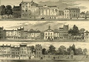
Background imageUrbanisation Collection: The North Side of Knightsbridge in 1820, from the Cannon Brewery to Hyde Park Corner, (c1876)

The North Side of Knightsbridge in 1820, from the Cannon Brewery to Hyde Park Corner, (c1876). From " Old and New London: A Narrative of Its History, Its People, and Its Places

Background imageUrbanisation Collection: Map of Belgravia, 1814, (c1876). Creator: Unknown

Map of Belgravia, 1814, (c1876). Creator: Unknown
Map of Belgravia, 1814, (c1876). Developed in the early 19th century by Richard Grosvenor, 2nd Marquess of Westminster under the direction of Thomas Cubitt

Background imageUrbanisation Collection: Ground Plan of New Road from Islington to Edgware Road, 1755, (c1876). Creator: Unknown

Ground Plan of New Road from Islington to Edgware Road, 1755, (c1876). Creator: Unknown
Ground Plan of New Road from Islington to Edgware Road, 1755, (c1876). The New Road from Paddington to Islington opened in 1756 as Londons first bypass along which to drive cattle to Smithfield

Background imageUrbanisation Collection: The Colosseum in 1827, (c1876). Creator: Unknown

The Colosseum in 1827, (c1876). Creator: Unknown
The Colosseum in 1827, (c1876). London Colosseum to the east of Regents Park, built in 1827 to exhibit Thomas Hornors Panoramic view of London

Background imageUrbanisation Collection: Map of Paddington, in 1815, (c1876). Creator: Unknown

Map of Paddington, in 1815, (c1876). Creator: Unknown
Map of Paddington, in 1815, (c1876). Paddington, in the City of Westminster had Roman roads on north-eastern and southern boundaries which became toll roads in 18th century

Background imageUrbanisation Collection: Sandy Hook, from Highland Light, New Jersey, c1897. Creator: Unknown

Sandy Hook, from Highland Light, New Jersey, c1897. Creator: Unknown
Sandy Hook, from Highland Light, New Jersey, c1897. Community on the Atlantic shore of Sandy Hook, a barrier peninsula along the coast of New Jersey, discovered by Henry Hudson

Background imageUrbanisation Collection: Barrington Street, Halifax, Nova Scotia, c1897. Creator: Unknown

Barrington Street, Halifax, Nova Scotia, c1897. Creator: Unknown
Barrington Street, Halifax, Nova Scotia, c1897. Barrington Street is part of the original grid laid out when Halifax was established as a British fortress

Background imageUrbanisation Collection: Glenwood Springs and Bath-House, Colorado, c1897. Creator: Unknown

Glenwood Springs and Bath-House, Colorado, c1897. Creator: Unknown
Glenwood Springs and Bath-House, Colorado, c1897. Glenwood Springs in the Rocky Mountains is a resort city and hot spring destination on the Colorado River

Background imageUrbanisation Collection: Main Street, Rochester, New York, c1897. Creator: Unknown

Main Street, Rochester, New York, c1897. Creator: Unknown
Main Street, Rochester, New York, c1897. Rochester was one of Americas first boomtowns, inhabited by the Seneca tribe of Native Americans until they lost their claim in the Treaty of Big Tree in

Background imageUrbanisation Collection: Wesley Lake, Asbury Park, New Jersey, c1897. Creator: Unknown

Wesley Lake, Asbury Park, New Jersey, c1897. Creator: Unknown
Wesley Lake, Asbury Park, New Jersey, c1897. A seaside community, on New Jerseys central coast, developed as a resort by New York brush manufacturer James A. Bradley in 1871

Background imageUrbanisation Collection: Second Street, Seattle, Washington, c1897. Creator: Unknown

Second Street, Seattle, Washington, c1897. Creator: Unknown
Second Street, Seattle, Washington, c1897. The Seattle area was inhabited by Native Americans for at least 4, 000 years before the first permanent European settlers, Arthur A

Background imageUrbanisation Collection: Washington Avenue, Minneapolis, Minnesota, c1897. Creator: Unknown

Washington Avenue, Minneapolis, Minnesota, c1897. Creator: Unknown
Washington Avenue, Minneapolis, Minnesota, c1897. Washington Avenue is a major thoroughfare in Minneapolis, Minnesota. Dakota Sioux were the regions sole residents when French explorers arrived in

Background imageUrbanisation Collection: Main Street, Winnipeg, Manitoba, c1897. Creator: Unknown

Main Street, Winnipeg, Manitoba, c1897. Creator: Unknown
Main Street, Winnipeg, Manitoba, c1897. The land where Main street sits was originally purchased by Henry McKenney on 2 June 1862. From " A Tour Through the New World America", by Prof

Background imageUrbanisation Collection: Manitou, Colorado, c1897. Creator: Unknown

Manitou, Colorado, c1897. Creator: Unknown
Manitou, Colorado, c1897. Known for its mineral springs and mountain landscapes, Manitou Springs is a resort city in Colorado. From " A Tour Through the New World America", by Prof. Geo. R

Background imageUrbanisation Collection: Tyrone, Penn, c1897. Creator: Unknown

Tyrone, Penn, c1897. Creator: Unknown
Tyrone, Penn, c1897. Tyrone is a borough in Blair County, Pennsylvania, an outlet for coal and noted for the manufacture of paper products

Background imageUrbanisation Collection: Halifax Harbor, Nova Scotia, near Dartmouth, c1897. Creator: Unknown

Halifax Harbor, Nova Scotia, near Dartmouth, c1897. Creator: Unknown
Halifax Harbor, Nova Scotia, near Dartmouth, c1897. A large natural harbour on the Atlantic coast of Nova Scotia, Canada, From " A Tour Through the New World America", by Prof. Geo. R

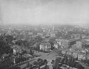
Background imageUrbanisation Collection: Sacramento, Cal. from the Dome of the Capitol, c1897. Creator: Unknown

Sacramento, Cal. from the Dome of the Capitol, c1897. Creator: Unknown
Sacramento, Cal. from the Dome of the Capitol, c1897. From " A Tour Through the New World America", by Prof. Geo. R. Cromwell. [C. N. Greig & Co. London, c1897]

Background imageUrbanisation Collection: Lake Hopateong, New Jersey, c1897. Creator: Unknown

Lake Hopateong, New Jersey, c1897. Creator: Unknown
Lake Hopateong, New Jersey, c1897. Freshwater lake in New Jersey, United States produced by damming and flooding of two ponds and the Musconetcong River

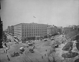
Background imageUrbanisation Collection: Fifth Avenue and Madison Square, New York, c1897. Creator: Unknown

Fifth Avenue and Madison Square, New York, c1897. Creator: Unknown
Fifth Avenue and Madison Square, New York, c1897. The Fifth Avenue Hotel, built 1856-59 by Amos Richards Eno at the intersection of Fifth Avenue and Broadway in Manhattan

Background imageUrbanisation Collection: Michigan Avenue, Chicago, looking south, c1897. Creator: Unknown

Michigan Avenue, Chicago, looking south, c1897. Creator: Unknown
Michigan Avenue, Chicago, looking south, c1897. Prior to the Great Chicago Fire of 1871, the street was known as Michigan Boulevard. From " A Tour Through the New World America", by Prof

Background imageUrbanisation Collection: Genesee Falls, Rochester, N. Y. c1897. Creator: Unknown

Genesee Falls, Rochester, N. Y. c1897. Creator: Unknown
Genesee Falls, Rochester, N.Y. c1897. The Pont De Rennes bridge over one of three waterfalls on the Genesee River, used to power industry with falling water

Background imageUrbanisation Collection: Main Street, Los Angeles, California, c1897. Creator: Unknown

Main Street, Los Angeles, California, c1897. Creator: Unknown
Main Street, Los Angeles, California, c1897. From " A Tour Through the New World America", by Prof. Geo. R. Cromwell. [C. N. Greig & Co. London, c1897]

Background imageUrbanisation Collection: St. Paul from Merriams Hill, c1897. Creator: Unknown

St. Paul from Merriams Hill, c1897. Creator: Unknown
St. Paul from Merriams Hill, c1897. From " A Tour Through the New World America", by Prof. Geo. R. Cromwell. [C. N. Greig & Co. London, c1897]

Background imageUrbanisation Collection: Pacific Avenue, Tacoma, Washington, c1897. Creator: Unknown

Pacific Avenue, Tacoma, Washington, c1897. Creator: Unknown
Pacific Avenue, Tacoma, Washington, c1897. From " A Tour Through the New World America", by Prof. Geo. R. Cromwell. [C. N. Greig & Co. London, c1897]

Background imageUrbanisation Collection: Ashland Avenue, Chicago, c1897. Creator: Unknown

Ashland Avenue, Chicago, c1897. Creator: Unknown
Ashland Avenue, Chicago, c1897. From " A Tour Through the New World America", by Prof. Geo. R. Cromwell. [C. N. Greig & Co. London, c1897]

Background imageUrbanisation Collection: Street in Key West, Florida, c1897. Creator: Unknown

Street in Key West, Florida, c1897. Creator: Unknown
Street in Key West, Florida, c1897. With various ownership claims during 18th and 19th centuries, Key West was relatively isolated until 1912

Background imageUrbanisation Collection: Eutaw Place (looking north), Baltimore, Md. c1897. Creator: Unknown

Eutaw Place (looking north), Baltimore, Md. c1897. Creator: Unknown
Eutaw Place (looking north), Baltimore, Md. c1897. Area known as home to the wealthy, particularly the affluent German-Jewish community of Baltimore

Background imageUrbanisation Collection: The Bowery, looking north, New York, c1897. Creator: Unknown

The Bowery, looking north, New York, c1897. Creator: Unknown
The Bowery, looking north, New York, c1897. Elevated railway and streetcars on the oldest thoroughfare in Manhattan. From " A Tour Through the New World America", by Prof. Geo. R. Cromwell

Background imageUrbanisation Collection: Euclid Avenue, Cleveland, Ohio, c1897. Creator: Unknown

Euclid Avenue, Cleveland, Ohio, c1897. Creator: Unknown
Euclid Avenue, Cleveland, Ohio, c1897. An afluent neighbourhood from 1860s to 1920s, it became known as Millionaires Row. From " A Tour Through the New World America", by Prof. Geo. R

Background imageUrbanisation Collection: Portland, Oregon, c1897. Creator: Unknown

Portland, Oregon, c1897. Creator: Unknown
Portland, Oregon, c1897. Water access provided convenient transportation of goods, the timber industry was a major force in the citys early economy

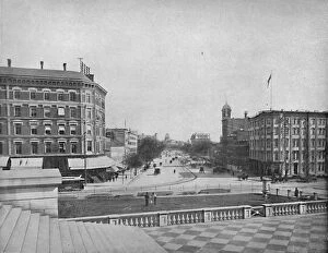
Background imageUrbanisation Collection: Pennsylvania Avenue, Washington, D. C. c1897. Creator: Unknown

Pennsylvania Avenue, Washington, D. C. c1897. Creator: Unknown
Pennsylvania Avenue, Washington, D.C. c1897. Laid out by Pierre (Peter) Charles L Enfant, Pennsylvania Avenue was one of the earliest streets constructed in the Federal City

Background imageUrbanisation Collection: Cripplegate and Neighbourhood, (c1872). Creator: Unknown

Cripplegate and Neighbourhood, (c1872). Creator: Unknown
Cripplegate and Neighbourhood, (c1872). Map of part of the City of London dating from before the development of Finsbury Square in 1777

Background imageUrbanisation Collection: Moorfields and its Neighbourhood (From a Map of about 1720), (c1872). Creator: Unknown

Moorfields and its Neighbourhood (From a Map of about 1720), (c1872). Creator: Unknown
Moorfields and its Neighbourhood (From a Map of about 1720), (c1872). Map of part of the City of London, showing the Moorfields, one of the last pieces of open land in the City

Background imageUrbanisation Collection: Why Paris Needs Constant Planning: Traffic Block in a Main Street, c1935

Why Paris Needs Constant Planning: Traffic Block in a Main Street, c1935. From Our Wonderful World, Volume I, edited by J.A. Hammerton. [The Amalgamated Press, Ltd. London]

Background imageUrbanisation Collection: The Ancient Island Heart of Paris With Its Nine Bridges Seen From The Air, c1935

The Ancient Island Heart of Paris With Its Nine Bridges Seen From The Air, c1935. From Our Wonderful World, Volume I, edited by J.A. Hammerton. [The Amalgamated Press, Ltd. London]

Background imageUrbanisation Collection: Central Architectural Feature of Paris Enhanced By Foresight in Street Design, c1935

Central Architectural Feature of Paris Enhanced By Foresight in Street Design, c1935. From Our Wonderful World, Volume I, edited by J.A. Hammerton. [The Amalgamated Press, Ltd. London]

Background imageUrbanisation Collection: Map of London and south-east England, 1891. Artist: John Bartholomew

Map of London and south-east England, 1891. Artist: John Bartholomew
Map of London and south-east England, 1891. Map showing the population density of London and the surrounding counties

Background imageUrbanisation Collection: Map of London, 1753

Map of London, 1753. Map of Westminster, the City of London, Southwark, the River Thames and surrounding areas, with two tables detailing Hackney coach fares and watermens fares

Background imageUrbanisation Collection: Central Section of Barranquilla, c1940s

Central Section of Barranquilla, c1940s. From Barranquilla. [Raul de la Espriella B. Barranquilla]


All Professionally Made to Order for Quick Shipping

"Captivating Urbanisation: A Global Perspective" Sheffield, UK - An aerial image captures the dynamic growth of this industrial city, where urbanisation has transformed its landscape into a bustling metropolis. Vancouver, Canada - Behold the stunning view of this coastal gem; urbanisation harmoniously blends with nature as skyscrapers rise against a backdrop of majestic mountains and sparkling waters. Europe at night - Witness the mesmerizing satellite image showcasing Europe's vibrant cities illuminated by countless lights, symbolizing the continent's rapid urbanisation and thriving economies. Hong Kong at dawn - As day breaks over this iconic skyline, witness how urbanisation has shaped Hong Kong into an architectural marvel that seamlessly merges tradition with modernity. Swanley, Kent, England - From above, observe the main road that runs through this charming town in Kent; a testament to how even smaller communities contribute to the global phenomenon of urbanisation. India at night - This satellite image reveals India's transformation under the cloak of darkness; sprawling cities light up like constellations as urbanisation propels economic progress across diverse landscapes. Modica Italy's old town view – Step back in time amidst narrow cobblestone streets and ancient architecture; while surrounded by history, Modica showcases pockets untouched by modern-day urbanisation. South America at night – Gaze upon a breathtaking satellite image capturing South America’s nocturnal beauty; twinkling lights signify not only major cities but also emerging hubs embracing rapid urban development. London, UK – A bird’s-eye-view unveils London’s grandeur from above; centuries-old landmarks blend harmoniously with contemporary skyscrapers epitomising successful integration within an ever-changing world driven by relentless urbanisation Reading & Southampton (UK)– These two contrasting towns showcase different facets of British suburban life amid ongoing waves of urban expansion—a tale told through their unique architectural landscapes.