
Tigris River Collection
The Tigris River, flowing through the heart of Ancient Mesopotamia, holds a rich history that spans centuries


All Professionally Made to Order for Quick Shipping
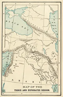
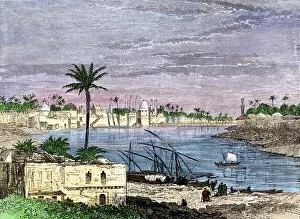
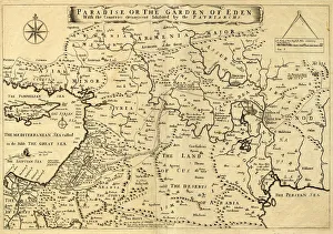
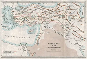
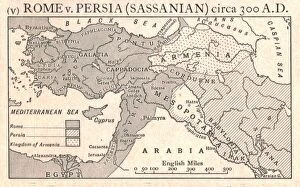
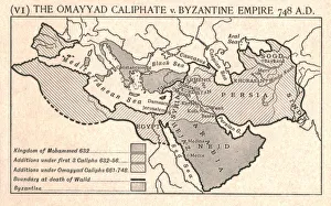
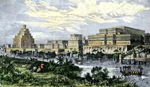
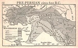
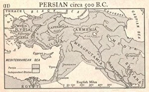
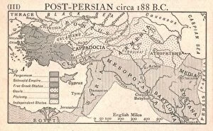
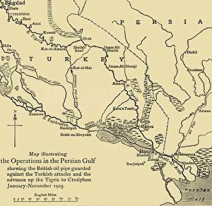
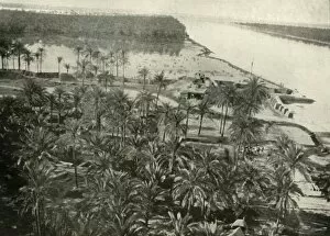
The Tigris River, flowing through the heart of Ancient Mesopotamia, holds a rich history that spans centuries. From the GMDE2A-00032 map depicting Baghdad in the Days of Mansur to Edmund Sandars' Middle East Ancient Map showcasing the Garden of Eden in 1675, this river has witnessed countless civilizations rise and fall. As seen on the Physical Map of the Ottoman Empire from c1915 and Emery Walker Ltd's depiction of The Omayyad Caliphate v. Byzantine Empire circa 748 A. D. , it is evident that the Tigris played a crucial role in shaping political boundaries and conflicts throughout time. Turkey's Eastern region boasts Hasankeyf, where one can witness breathtaking views of the Tigris River from Kale Fortress. This picturesque spot serves as a reminder of nature's beauty intertwined with historical significance. James Grant's view of Bagdad from c1891 takes us back to an era when this vibrant city thrived along its banks. Meanwhile, English translations like Les Six Voyages de J. B provide detailed plans showcasing Baghdad's layout during different periods. One cannot forget pivotal moments such as the Siege of Baghdad depicted in folios dispersed copies like Zafarnama. . 839 A. H. /A. D. , which remind us how wars have shaped destinies along these waters. Finally, The Hour of Fate on the Tigris captured by unknown artists in 1916 encapsulates both mystery and resilience that emanates from this mighty river even during times marked by uncertainty. Whether you explore ancient maps or gaze upon modern photographs capturing its essence today, there is no denying that the Tigris River remains an enduring symbol connecting past civilizations with present aspirations.