Fraud Blocker Skip to main content

Satellite Image Collection (page 14)

"Exploring the vastness of our universe, satellite images capture breathtaking views that redefine our perspective

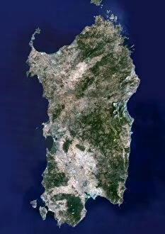
Background imageSatellite Image Collection: Sardinia, satellite image

Sardinia, satellite image. North is at top. Sardinia is an island located in the Mediterranean Sea, northeast of Tunisia and between Italy and Spain. The island is part of Italy
Background imageSatellite Image Collection: San Francisco

San Francisco. Coloured satellite image of the city of San Francisco, USA. Water is blue, vegetation is green, urban areas are grey and bare earth is brown. North is at top

Background imageSatellite Image Collection: Shanghai and the Yangtze

Shanghai and the Yangtze river estuary, satellite image. North is at top. Shanghai, visible as a purple-grey conurbation towards bottom left, is one of the largest cities in the world

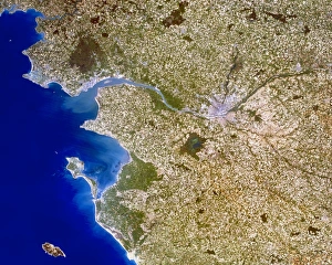
Background imageSatellite Image Collection: Nantes

Nantes. True-colour satellite image of the city of Nantes (centre right), France, and the surrounding area. North is at top

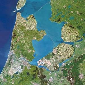
Background imageSatellite Image Collection: Polders, satellite image

Polders, satellite image
Polders, Netherlands, satellite image. A polder is a drained piece of land enclose by walls known as dikes, which are used to prevent water entering

Background imageSatellite Image Collection: Cairo

Cairo, satellite image. North is at top. Cairo is the capital city of Egypt and, as of 2005, the largest city in Africa with a population of 15 million

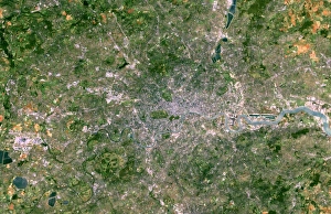
Background imageSatellite Image Collection: London

London. Coloured satellite image of the city of London, in south-eastern England. North is at top. Urban areas are white, vegetation is green and water is blue

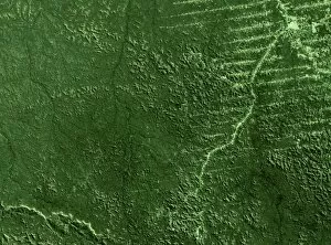
Background imageSatellite Image Collection: Deforestation in the Amazon

Deforestation in the Amazon. Satellite image of the region around the mouth of the Amazon River (upper left) in northern Brazil. North is at top

Background imageSatellite Image Collection: Paris, France

Paris, France
Paris, satellite image. A sweeping bend in the River Seine meanders through the centre of Paris, the capital city of France

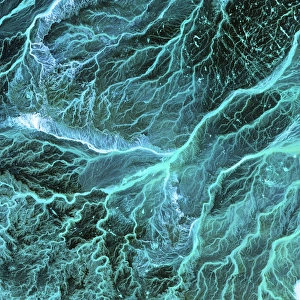
Background imageSatellite Image Collection: Dry river beds, satellite image

Dry river beds, satellite image. North is at top. The bright blue areas are meandering wadis (dry river beds) that have formed in this desert area due to flooding

Background imageSatellite Image Collection: Iceland, satellite image

Iceland, satellite image. North is at top. Green areas are vegetated. White areas are ice. Iceland is an island nation situated just south of the Arctic Circle in the Northern Atlantic Ocean

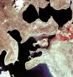
Background imageSatellite Image Collection: Aral Sea reduction 1973-2000

Aral Sea reduction 1973-2000
Aral Sea reduction between 1973 and 2000, satellite images. North is at top. THe middle puicture dates from 1989. Since the 1960s the Aral Sea

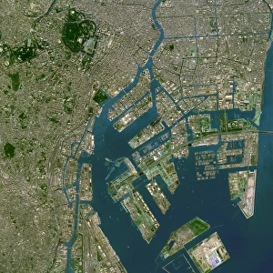
Background imageSatellite Image Collection: Tokyo

Tokyo. Coloured satellite image of the harbour area in the city of Tokyo, Japan. Water is blue, urban areas are grey and vegetation is green. North is at top

Background imageSatellite Image Collection: Aral Sea, satellite image, 1973

Aral Sea, satellite image, 1973
Aral Sea, satellite image. Image 1 of 3. North is at top. This inland lake is found between Uzbekistan (west) and Kazakhstan (east) and used to be the fourth largest lake in the world

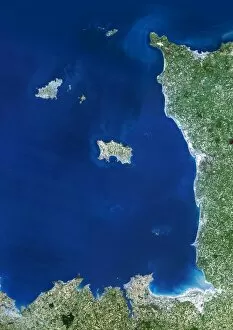
Background imageSatellite Image Collection: Channel Islands, satellite image

Channel Islands, satellite image. North is at top. Water is blue, vegetation is green and urbanised areas are pale brown. The Channel Islands are a group of British crown dependent islands off

Background imageSatellite Image Collection: Deforestation in Rondonia, Brazil, 1975

Deforestation in Rondonia, Brazil, 1975
Deforestation in Rondonia, Brazil. Image 1 of 4. Satellite image of part of the state of Rondonia, Brazil, showing forest (green)

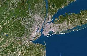
Background imageSatellite Image Collection: New York City

New York City. Coloured satellite image of New York City, on the eastern coast of the USA. North is at top. Urban areas are white, vegetation is green and water is blue

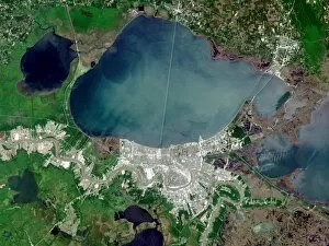
Background imageSatellite Image Collection: New Orleans

New Orleans. True-colour satellite image of the city of New Orleans (lower centre), Louisiana, USA. North is at top. Vegetation is green, water is blue and urban areas are white/grey

Background imageSatellite Image Collection: Aral Sea, satellite image, 2000

Aral Sea, satellite image, 2000
Aral Sea, satellite image. Image 3 of 3. North is at top. This inland lake is found between Uzbekistan (west) and Kazakhstan (east) and used to be the fourth largest lake in the world

Background imageSatellite Image Collection: Easter Island, satellite image

Easter Island, satellite image
Easter Island, Pacific Ocean, satellite image. North is at top. Also known as Rapa Nui, this Pacific island is a territory of Chile

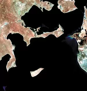
Background imageSatellite Image Collection: Dardanelles, satellite image

Dardanelles, satellite image
Dardanelles. Satellite image of the Dardanelles (centre) in northwestern Turkey, a 61 kilometre long strait that separates European Turkey (top) from Asiatic Turkey (bottom). North is at top

Background imageSatellite Image Collection: Bijagos archipelago, West Africa

Bijagos archipelago, West Africa
Bijagos archipelago off the Guinea-Bissau coast, West Africa, satellite image. North is at top. These islands are inhabited by a primitive people who still practise animism religions

Background imageSatellite Image Collection: Deforestation in Rondonia, Brazil, 1986

Deforestation in Rondonia, Brazil, 1986
Deforestation in Rondonia, Brazil. Image 2 of 4. Satellite image of part of the state of Rondonia, Brazil, showing deforested areas (light green)

Background imageSatellite Image Collection: Deforestation in the Amazon

Deforestation in the Amazon rainforest, Brazil, comparing 1990 (top) and 2000 (bottom), satellite image. Roads take loggers into the centre of the rainforest

Background imageSatellite Image Collection: Mercury, Mariner 10 spacecraft image

Mercury, Mariner 10 spacecraft image
For more than 35 years the Mariner 10 photographs have been the only information about the surface structures and features of the Suns closest planet Mercury

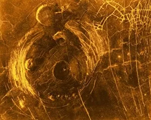
Background imageSatellite Image Collection: Venus, synthetic aperture radar map

Venus, synthetic aperture radar map
This Magellan Radar image of the Venus surafce in January 1991. The large 120 km structure is a socalled corona, the smaller features are called " pancakes" with a diameter of 35

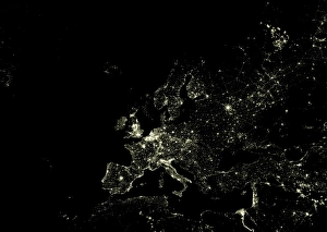
Background imageSatellite Image Collection: Europe at night

Europe at night. Satellite image of city lights at night, centred on Europe. North converges towards top. Bright areas mark dense urban populations, and the European coastline is clearly seen

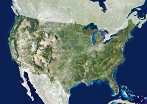
Background imageSatellite Image Collection: USA, satellite image

USA, satellite image. North is at top. The USA consists of the lower 48 states (shown). The Pacific islands of Hawaii and Alaska, which is separated from the lower 48 states by Canada

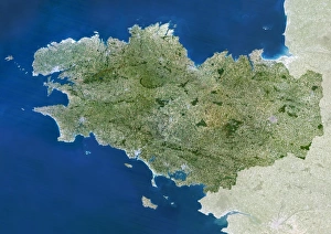
Background imageSatellite Image Collection: Brittany region, France

Brittany region, France, satellite image. North is at top. Vegetation is shown in green, water in blue, and urban areas in grey

Background imageSatellite Image Collection: Brazil, satellite image

Brazil, satellite image. North is at top. Brazil is the largest country in South America. It shares borders with every country in South America with the exception of Chile and Ecuador

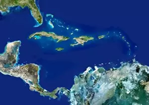
Background imageSatellite Image Collection: Caribbean, satellite image

Caribbean, satellite image. North is at top. The Caribbean comprises over 7000 islands in the Caribbean Sea between the Gulf of Mexico and the USA to the north

Background imageSatellite Image Collection: Earth

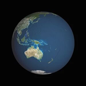
Earth. Satellite image of the Earth, centred on the region of Oceania. North is at top. Water is blue, vegetation is green, arid areas are brown, and snow and ice are white

Background imageSatellite Image Collection: China, satellite image

China, satellite image. North is at top. Green areas are vegetated, brown are desert and white are snow-covered. China is the worlds most populous country

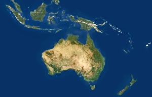
Background imageSatellite Image Collection: Australasia and south-eastern Asia

Australasia and south-eastern Asia. Coloured satellite image of south-eastern Asia and Australasia. North is at top. Vegetation is green, bare earth is brown and water is blue

Background imageSatellite Image Collection: Essex, UK, satellite image

Essex, UK, satellite image. The county of Essex lies to the north east of London (grey area, bottom left) and is one of the key commuter belts of the capital

Background imageSatellite Image Collection: Chile and Argentina, satellite image

Chile and Argentina, satellite image. North is at top. Chile is a long country which occupies the strip of land between the Pacific coast and the Andes mountains in the west of South America

Background imageSatellite Image Collection: Morocco

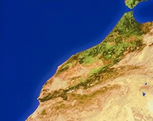
Morocco. True-colour satellite image of Morocco. North is at top. Water is blue, vegetation is green and bare ground is brown

Background imageSatellite Image Collection: Portugal and Spain

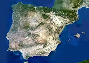
Portugal and Spain. Satellite image of the Iberian Peninsula, consisting of the European countries of Portugal and Spain. North is at top

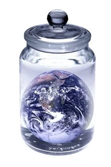
Background imageSatellite Image Collection: Earth in a jar, conceptual image

Earth in a jar, conceptual image

Background imageSatellite Image Collection: Earth

Earth. Satellite image of the Earth, centred on Asia. The North Pole is at upper centre. Water is blue, vegetation is green, arid areas are brown, and snow and ice are white

Background imageSatellite Image Collection: Scandinavia

Scandinavia, true-colour satellite image. North is at top. Water is blue, snow and ice are white, and vegetation is green

Background imageSatellite Image Collection: Infrared satellite image of the Americas

Infrared satellite image of the Americas
The Americas. Infrared satellite image showing the Americas and the Pacific Ocean. The Americas contain the continents of North America and South America with Central America in between

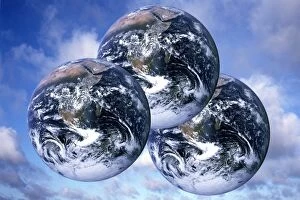
Background imageSatellite Image Collection: Three planet earths, conceptual image

Three planet earths, conceptual image
Three planet earths, conceptual composite image. Three is the number of planets that will be needed if the current world population continues at its present rate of consumption of resources

Background imageSatellite Image Collection: New Zealand, satellite image

New Zealand, satellite image. North is at top. New Zealand is a country in the southwest Pacific Ocean. It consists of two islands known as the North Island and the South Island

Background imageSatellite Image Collection: Egypt, satellite image

Egypt, satellite image. North is at top. Egypt is the most northeastern country in Africa. It borders Libya to the west, Sudan to the south and Israel and the Gaza Strip to the northeast (all shaded)

Background imageSatellite Image Collection: Western Asia, satellite image

Western Asia, satellite image
Western Asia, true-colour satellite image. North is at top. The region is dominated by deserts (brown). Bodies of water include the Red Sea (lower left) and Persian Gulf (centre)

Background imageSatellite Image Collection: Earth

Earth. Computer artwork, based on satellite data of the Earth from space. North is at top. Green shows vegetated areas. Yellow shows desert areas. The image is centred on Australasia

Background imageSatellite Image Collection: Belgium by night, satellite image

Belgium by night, satellite image
Belgium at night, satellite image. North is at top. Bright areas indicate heavily populated areas with a greater intensity of light emissions


All Professionally Made to Order for Quick Shipping

"Exploring the vastness of our universe, satellite images capture breathtaking views that redefine our perspective. Inspired by Voyager 1's iconic 'Pale Blue Dot' image, we witness the beauty and fragility of Earth from space. From the British Isles to Europe at night, these satellite images reveal a tapestry of lights illuminating cities and towns across continents. Marvel at the mesmerizing glow as darkness blankets Europe or gaze in awe at the captivating sight of our entire planet aglow during nighttime. Delve into Tenerife's intricate landscapes, where satellite imagery unveils its hidden wonders with stunning clarity. Venturing beyond our home planet, New Horizons grants us an extraordinary glimpse into Jupiter and its moon Io – a celestial dance frozen in time. Witnessing Earth from afar reminds us of its remarkable diversity; behold Scotland's rugged terrain captured through a lens high above. Satellite imagery also unravels nature's grandeur: observe awe-inspiring solar prominences erupting from the sun’s surface like fiery tendrils reaching towards infinity. In January 2010, witness Mother Nature transforming the United Kingdom into a winter wonderland as snow blankets every corner. Finally, explore North America at night through satellite lenses – an ethereal spectacle showcasing bustling metropolises intertwined with serene natural landscapes under starlit skies. " Note.