Fraud Blocker Skip to main content

Mapping Collection (page 3)

"Exploring the World Through Maps: A Journey of Discovery" Embark on a captivating journey through time and space as we delve into the fascinating world of mapping

Background imageMapping Collection: Nouae Africae delineatio, 1769 (hand-coloured engraving)

Nouae Africae delineatio, 1769 (hand-coloured engraving)
5934083 Nouae Africae delineatio, 1769 (hand-coloured engraving) by Monath, Peter Conrad (1683-1747); 30x26 cm; Boston Public Library, Boston, Massachusetts, USA

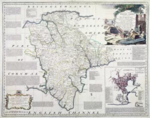
Background imageMapping Collection: Map of Devonshire, published by Bowles, Tinney and Sayer, London, c

Map of Devonshire, published by Bowles, Tinney and Sayer, London, c. 1777 (hand coloured copper plate engraving)
BAL16026 Map of Devonshire, published by Bowles, Tinney and Sayer, London, c.1777 (hand coloured copper plate engraving) by Bowen, Emanuel (c.1694-1767); Map House, London, UK

Background imageMapping Collection: Fra Mauro map, 1460 (map)

Fra Mauro map, 1460 (map)
529889 Fra Mauro map, 1460 (map) by Italian School, (15th century); (add.info.: The Fra Mauro Map orientation (South at the top).is considered the greatest memorial of medieval cartography

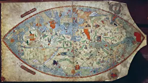
Background imageMapping Collection: Genoese world map, designed by Toscanelli (vellum)

Genoese world map, designed by Toscanelli (vellum)
XPH330307 Genoese world map, designed by Toscanelli (vellum) by Italian School, (15th century); Biblioteca Nazionale Centrale, Florence

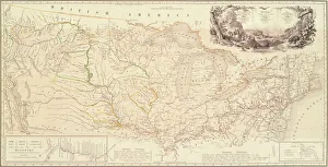
Background imageMapping Collection: Map to Illustrate the Route of Prince Maximilian of Wied in the Interior of North America

Map to Illustrate the Route of Prince Maximilian of Wied in the Interior of North America from Boston to the Upper
5054760 Map to Illustrate the Route of Prince Maximilian of Wied in the Interior of North America from Boston to the Upper Missouri, 1839 (engraving) by Bodmer, Karl (1809-93); Joslyn Museum, Omaha

Background imageMapping Collection: Lunar Orbiter, Engineering Mock-up, 1960s. Creator: Boeing Aircraft Co

Lunar Orbiter, Engineering Mock-up, 1960s. Creator: Boeing Aircraft Co
Lunar Orbiter was the project that mapped the Moon in preparation for the Apollo landings. A total of five Lunar Orbiters were flown to the Moon

Background imageMapping Collection: Camera, Lunar Mapping, Apollo, 1970s. Creator: Fairchild Space & Defense Systems

Camera, Lunar Mapping, Apollo, 1970s. Creator: Fairchild Space & Defense Systems
This is the flight backup for the mapping cameras used on the last three Apollo missions. Mapping the lunar surface was a high priority during Apollo 15, 16, and 17

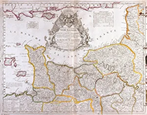
Background imageMapping Collection: Map of Normandy, 1694, from 'Le Theatre du Monde', by Jean-Baptiste Nolin

Map of Normandy, 1694, from "Le Theatre du Monde", by Jean-Baptiste Nolin
LRI3518464 Map of Normandy, 1694, from " Le Theatre du Monde", by Jean-Baptiste Nolin, published 1717 (hand-coloured engraving) by French School

Background imageMapping Collection: Pair of globes, terrestrial and celestial, bearing the Tughra

Pair of globes, terrestrial and celestial, bearing the Tughra
829799 Pair of globes, terrestrial and celestial, bearing the Tughra and Latin inscription of Sultan Murad III, 1579 (gilt metal) by Mercator, Gerardus (1512-94) (attr)

Background imageMapping Collection: Early English terrestrial globe, c. 1673 (engraving, brass, walnut & oak)

Early English terrestrial globe, c. 1673 (engraving, brass, walnut & oak)
3482914 Early English terrestrial globe, c.1673 (engraving, brass, walnut & oak) by Berry, William (1639-1718) & Morden, Robert (c.1650-1703); height: 53 cm; Private Collection; (add.info)

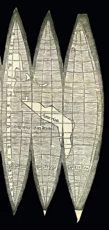
Background imageMapping Collection: World map in the form of a set of terrestrial globe gores, 1507 (woodcut)

World map in the form of a set of terrestrial globe gores, 1507 (woodcut)
3482910 World map in the form of a set of terrestrial globe gores, 1507 (woodcut) by Waldseemuller, Martin (c.1470-c.1522); 18x34.4 cm; Private Collection; (add.info)

Background imageMapping Collection: Large pair of library globes, the terrestrial 1645 / 48, the celestial after c

Large pair of library globes, the terrestrial 1645 / 48, the celestial after c
3482878 Large pair of library globes, the terrestrial 1645/48, the celestial after c.1630 (plaster, wood & engraved paper) by Blaeu

Background imageMapping Collection: Sangoku tsuran zusetsu (Illustrated General Survey of the Three Countries)

Sangoku tsuran zusetsu (Illustrated General Survey of the Three Countries)
3502613 Sangoku tsuran zusetsu (Illustrated General Survey of the Three Countries), 1785 (colour woodblock print) by Shihei, Hayashi (1738-93); Private Collection; (add.info.: SHIHEI)

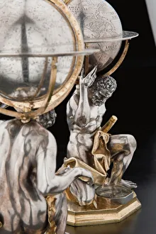
Background imageMapping Collection: Two exceptional terrestrial and celestial globes, supported by Hercules and Atlas

Two exceptional terrestrial and celestial globes, supported by Hercules and Atlas
3482928 Two exceptional terrestrial and celestial globes, supported by Hercules and Atlas, Augsburg, 1697-99 (silver & silver-gilt) by Drentwett

Background imageMapping Collection: Two exceptional terrestrial and celestial globes, supported by Hercules and Atlas

Two exceptional terrestrial and celestial globes, supported by Hercules and Atlas
3482917 Two exceptional terrestrial and celestial globes, supported by Hercules and Atlas, Augsburg, 1697-99 (silver & silver-gilt) by Drentwett

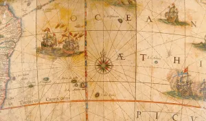
Background imageMapping Collection: Detail of fighting ships in the Atlantic Ocean from a terrestrial globe 1645 / 48 (plaster

Detail of fighting ships in the Atlantic Ocean from a terrestrial globe 1645 / 48 (plaster
3482881 Detail of fighting ships in the Atlantic Ocean from a terrestrial globe 1645/48 (plaster, wood & engraved paper) by Blaeu

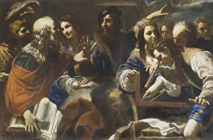
Background imageMapping Collection: Astronomers (oil on canvas)

Astronomers (oil on canvas)
3433125 Astronomers (oil on canvas) by Tornioli, Niccolo (1598-1651/2); 148x218 cm; Galleria Spada, Rome, Lazio, Italy; (add.info.: Tornioli Nicol 1622-51 " Gli astronomi" - Roma)

Background imageMapping Collection: Globe with depictions of modern day North and South America

Globe with depictions of modern day North and South America
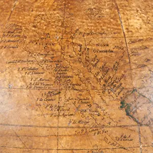
3849531 Globe with depictions of modern day North and South America by English School, (16th-17th century); Middle Temple, London, UK; Photo © Derek Bayes. All rights reserved 2022

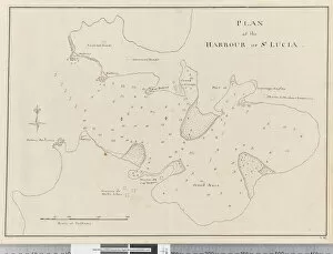
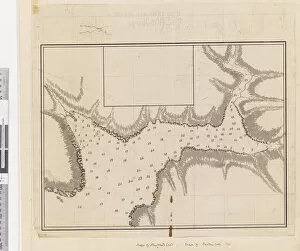
Background imageMapping Collection: Page 37c Plan of the harbour of St. Lucia

Page 37c Plan of the harbour of St. Lucia
5670304 Page 37c Plan of the harbour of St. Lucia by Unknown artist, (18th century); Mitchell Library, State Library of New South Wales; (add.info.: Original Sketches, Drawings)

Background imageMapping Collection: Page 25b / b Profile of unidentified Pacific Island showing a lagoon, 1768-75 (w / c)

Page 25b / b Profile of unidentified Pacific Island showing a lagoon, 1768-75 (w / c)
5670284 Page 25b/b Profile of unidentified Pacific Island showing a lagoon, 1768-75 (w/c) by Hodges, William (1744-97); Mitchell Library

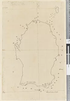
Background imageMapping Collection: Page 38a Map of S. Andehman Island (pen & ink)

Page 38a Map of S. Andehman Island (pen & ink)
5670305 Page 38a Map of S. Andehman Island (pen & ink) by Unknown artist, (18th century); Mitchell Library, State Library of New South Wales; (add.info.: Original Sketches, Drawings)

Background imageMapping Collection: Islands of St. Thomas and St. John, 1719 (engraving)

Islands of St. Thomas and St. John, 1719 (engraving)
5648409 Islands of St. Thomas and St. John, 1719 (engraving) by Keulen, Gerard van (1678-1726); 56x100 cm; Boston Public Library, Boston, Massachusetts

Background imageMapping Collection: Porto Rico and Virgin Isles : Haiti, Hispaniola or St. Domingo

Porto Rico and Virgin Isles : Haiti, Hispaniola or St. Domingo
5648406 Porto Rico and Virgin Isles : Haiti, Hispaniola or St. Domingo, 1817 (hand-coloured engraving) by Thomson, John (1778-1840); 61x52 cm; Boston Public Library, Boston, Massachusetts

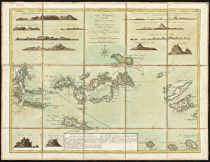
Background imageMapping Collection: The British Virgin Islands, engraved by Georges-Louis Le Rouge

The British Virgin Islands, engraved by Georges-Louis Le Rouge
5648405 The British Virgin Islands, engraved by Georges-Louis Le Rouge, 1779 (hand-coloured engraving) by Jefferys, Thomas (c.1719-71) (after); 44x58 cm; Boston Public Library, Boston, Massachusetts

Background imageMapping Collection: Page 3 Profile of the Island of St. Jago, Cape Verde Island

Page 3 Profile of the Island of St. Jago, Cape Verde Island
5670252 Page 3 Profile of the Island of St. Jago, Cape Verde Island. Titled The Island of St Jago where the point D bears WSW distant 3 leagues

Background imageMapping Collection: ib. A Plan of the Harbour of Croque in Newfoundland, 1763 (pen & ink and wash)

ib. A Plan of the Harbour of Croque in Newfoundland, 1763 (pen & ink and wash)
5670246 ib. A Plan of the Harbour of Croque in Newfoundland, 1763 (pen & ink and wash) by Cook, James (1728-79); Mitchell Library, State Library of New South Wales; (add.info.: Original Sketches)

Background imageMapping Collection: Birds eye view of the city of Lansing, Michigan 1866 (colour litho)

Birds eye view of the city of Lansing, Michigan 1866 (colour litho)
6256737 Birds eye view of the city of Lansing, Michigan 1866 (colour litho) by American School, (19th century); 50x71 cm; Private Collection; American, out of copyright

Background imageMapping Collection: Birds eye view of Boston, c. 1902 (colour litho)

Birds eye view of Boston, c. 1902 (colour litho)
6256305 Birds eye view of Boston, c.1902 (colour litho) by American School, (20th century); 42x63 cm; Private Collection; (add.info.: Boston, Geo. H. Walker & Co); American, out of copyright

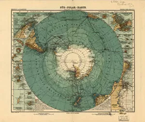
Background imageMapping Collection: Map of the South Pole, 1912 (colour litho)

Map of the South Pole, 1912 (colour litho)
5059814 Map of the South Pole, 1912 (colour litho) by Petermann, August Heinrich (1822-78); 34x41 cm; Private Collection; (add.info.: From: Stielers Hand-Atlas, No)

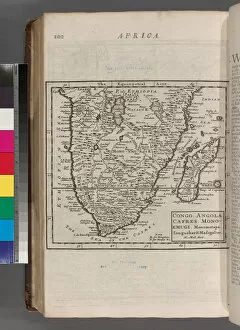
Background imageMapping Collection: Congo. Angola. Cafres. Monoemugi. Monomotapa. Zanguebar & Madagascar, 1701 (engraving)

Congo. Angola. Cafres. Monoemugi. Monomotapa. Zanguebar & Madagascar, 1701 (engraving)
5934082 Congo. Angola. Cafres. Monoemugi. Monomotapa. Zanguebar & Madagascar, 1701 (engraving) by Moll, Hermann (fl.1678-1732); New York Public Library, USA; German, out of copyright

Background imageMapping Collection: City of New-York, Brooklyn, Jersey City & Quarantine Station on Staten Island, c

City of New-York, Brooklyn, Jersey City & Quarantine Station on Staten Island, c
5897737 City of New-York, Brooklyn, Jersey City & Quarantine Station on Staten Island, c.1850 (colour litho) by American School, (19th century); Private Collection; American, out of copyright

Background imageMapping Collection: Map of Philadelphia, from an Atlas of the United States, 1824 (engraving)

Map of Philadelphia, from an Atlas of the United States, 1824 (engraving)
497565 Map of Philadelphia, from an Atlas of the United States, 1824 (engraving) by KlinckowstrAom, Axel Leonhard (1775-1837); 56x44 cm; Gilder Lehrman Collection, New York

Background imageMapping Collection: Map of the United States, 1816 (engraving)

Map of the United States, 1816 (engraving)
497555 Map of the United States, 1816 (engraving) by Melish, John (1771-1822); Gilder Lehrman Collection, New York, USA; eGilder Lehrman Institute of American History; American, out of copyright

Background imageMapping Collection: Plan of the Battle of Culloden, April 16th, 1746 (litho)

Plan of the Battle of Culloden, April 16th, 1746 (litho)
STC373394 Plan of the Battle of Culloden, April 16th, 1746 (litho) by English School, (19th century); Private Collection; (add.info.: Final battle of the 1745 Jacobite Rising)

Background imageMapping Collection: Confederate Civil War map of the Army of Mississippi camp at Corinth, Mississippi

Confederate Civil War map of the Army of Mississippi camp at Corinth, Mississippi
696118 Confederate Civil War map of the Army of Mississippi camp at Corinth, Mississippi, May 1862 (litho) by American School, (19th century); 58.5x50 cm; Gilder Lehrman Collection, New York

Background imageMapping Collection: A sketch of the operations before Charlestown, the capital of South Carolina, c

A sketch of the operations before Charlestown, the capital of South Carolina, c
696019 A sketch of the operations before Charlestown, the capital of South Carolina, c.1780 (colour litho) by DesBarres, Joseph Frederick Wallet (1721-1824); 110x81 cm; Gilder Lehrman Collection

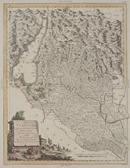
Background imageMapping Collection: The Region of Verona with the District of Cologna, 1783 (hand-coloured etching)

The Region of Verona with the District of Cologna, 1783 (hand-coloured etching)
1067374 The Region of Verona with the District of Cologna, 1783 (hand-coloured etching) by Zatta, Antonio (1757-97); Dallas Museum of Art, Texas

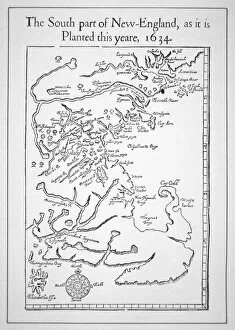
Background imageMapping Collection: Map including Massachusetts Bay (litho)

Map including Massachusetts Bay (litho)
PNP367770 Map including Massachusetts Bay (litho) by American School; Private Collection; (add.info.: the south part of New-England as it is planted this yeare)

Background imageMapping Collection: Map of Mexico or New Spain, 1625 (coloured engraving)

Map of Mexico or New Spain, 1625 (coloured engraving)
REV397909 Map of Mexico or New Spain, 1625 (coloured engraving) by French School, (17th century); Biblioteca Nacional de Mexico

Background imageMapping Collection: Map of the Siege of Mantua, published by William Blackwood and Sons, Edinburgh & London

Map of the Siege of Mantua, published by William Blackwood and Sons, Edinburgh & London
746934 Map of the Siege of Mantua, published by William Blackwood and Sons, Edinburgh & London, 1848 (hand-coloured engraving) by Johnston

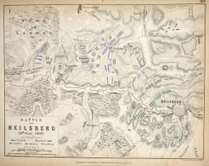
Background imageMapping Collection: Map of the Heilsberg, published by William Blackwood and Sons, Edinburgh & London

Map of the Heilsberg, published by William Blackwood and Sons, Edinburgh & London
746906 Map of the Heilsberg, published by William Blackwood and Sons, Edinburgh & London, 1848 (hand-coloured engraving) by Johnston

Background imageMapping Collection: Map of the Battle of Aspern or Essling, published by William Blackwood and Sons

Map of the Battle of Aspern or Essling, published by William Blackwood and Sons
746902 Map of the Battle of Aspern or Essling, published by William Blackwood and Sons, Edinburgh & London, 1848 (hand-coloured engraving) by Johnston

Background imageMapping Collection: Map of the Battle of Malo-Jaroslawitz, published by William Blackwood and Sons

Map of the Battle of Malo-Jaroslawitz, published by William Blackwood and Sons
746892 Map of the Battle of Malo-Jaroslawitz, published by William Blackwood and Sons, Edinburgh & London, 1848 (hand-coloured engraving) by Johnston

Background imageMapping Collection: Map of the Battle of Hanau, published by William Blackwood and Sons, Edinburgh & London

Map of the Battle of Hanau, published by William Blackwood and Sons, Edinburgh & London
746884 Map of the Battle of Hanau, published by William Blackwood and Sons, Edinburgh & London, 1848 (hand-coloured engraving) by Johnston


All Professionally Made to Order for Quick Shipping

"Exploring the World Through Maps: A Journey of Discovery" Embark on a captivating journey through time and space as we delve into the fascinating world of mapping. From the iconic Wimbledon tennis complex in the UK to the enchanting Theatre of the Empire of Great Britain, these maps offer glimpses into diverse landscapes and historical narratives. Transport yourself back to 1560 Mexico with Alonso de Santa Cruz's Map of Tenochtitlan, where you can trace the ancient streets and waterways that once thrived in this vibrant city. Or marvel at Durer's intricate world map from 1515, which showcases an era when cartography was still in its infancy but held immense potential for exploration. Step foot onto 16th-century Florence with a meticulously detailed plan that captures every nook and cranny of this Renaissance gem. Meanwhile, an Italian map from 1537 unveils Corfu's allure nestled within Greece's Ionian Sea – a testament to both artistic skill and geographical accuracy. As we venture further into history, a stunning 17th-century European map unfolds before our eyes, revealing political boundaries that have since evolved but continue to shape our present-day understanding. Witness Dubrovnik's pre-1667 earthquake charm through an intricately crafted depiction that preserves its architectural grandeur. The allure extends beyond terrestrial realms as well; explore Bermuda’s beauty through a vividly colored engraving or immerse yourself in Roman glory with "A New Map of the Roman Empire. " These maps not only guide us geographically but also provide insights into cultural heritage and societal dynamics. Finally, let us contemplate White Matter Fibres' artwork from 1930 – an abstract representation reminding us that mapping transcends physical borders too. It invites us to explore neural pathways within our own minds while appreciating how cartography has become intertwined with human cognition throughout history. Intricate lines, vibrant colors, and meticulous details come together on these maps, inviting us to embark on a visual and intellectual adventure.