Fraud Blocker Skip to main content

Earth Science Collection (page 2)

Exploring the wonders of Earth through the lens of science and art

Background imageEarth Science Collection: Aquamarine crystal

Aquamarine crystal. Aquamarine is a transparent blue or blue-green variety of beryl (beryllium aluminium silicate). The colour is due to trace amounts of iron within the crystal structure

Background imageEarth Science Collection: Whole Earth, satellite image

Whole Earth, satellite image. This map is centred on the Greenwich meridian, at zero degrees latitude. Arctic and Antarctic ice is white, oceans are blue and land is green and brown

Background imageEarth Science Collection: Africa, satellite image

Africa, satellite image
Africa. Satellite image of the Earth centred on Africa. Clouds are white, oceans are blue and land is green and brown. Also seen are Europe (top) Asia (upper right), the Indian Ocean (right)

Background imageEarth Science Collection: Aurora borealis or northern lights and Ursa Major

Aurora borealis or northern lights and Ursa Major
Aurora Borealis. Green, yellow and red Aurora Borealis or Northern Lights display over clouds and trees. The plough in the constellation of Ursa Major is prominent at upper left

Background imageEarth Science Collection: Allosaurus dinosaur, artwork

Allosaurus dinosaur, artwork. Allosaurs were large carnivorous reptiles that lived during the late Jurassic period (155 to 145 million years ago)

Background imageEarth Science Collection: Richat Structure, satellite image

Richat Structure, satellite image. North is at top. Desert sands are pale yellow/white (top left and lower right), while less sandy, rocky areas are green, and volcanic rocks are blue

Background imageEarth Science Collection: 17th century map of South America

17th century map of South America
South America, 17th century Dutch map. This shows the new continent that was being discovered by European explorers. The shape is distorted because it had not yet been accurately mapped

Background imageEarth Science Collection: Aurora borealis

Aurora borealis over trees by a river. This coloured light display (the northern lights) is visible in the night sky at high latitudes

Background imageEarth Science Collection: Southeast Asia at night, satellite image

Southeast Asia at night, satellite image
Southeast Asia at night. Satellite image of the Earth seen at 18:00 (6pm) GMT (UCT), centred on China. City lights (yellow) show areas of dense population, particularly in India (left)

Background imageEarth Science Collection: Africa, night-day satellite image

Africa, night-day satellite image. This composite image of the Earth is set against a background of stars, and is centred on the continent of Africa. North is at top

Background imageEarth Science Collection: Whole Earth at night, satellite image

Whole Earth at night, satellite image. This map is centred on the Greenwich meridian, at zero degrees latitude. City lights (yellow) show areas of dense population

Background imageEarth Science Collection: Earths limb, Jupiter & crescent moon

Earths limb, Jupiter & crescent moon
Airglow. View from Shuttle Endeavour showing the Earths airglow. The white point near centre is the planet Jupiter, above this is the crescent Moon

Background imageEarth Science Collection: True-colour satellite image of western Scotland

True-colour satellite image of western Scotland

Background imageEarth Science Collection: Satellite image of southwest England

Satellite image of southwest England
Southwest England. True-colour satellite image of southwest England, centred on the counties of Dorset (at right) and Somerset (at left). North is at top

Background imageEarth Science Collection: Native silver

Native silver
Silver found in pure form in the ground is called native silver (Ag) - it is an elemental metal and structure is dendritic or branch-like

Background imageEarth Science Collection: Europe at night, 1993-2003 changes

Europe at night, 1993-2003 changes
Europe at night, showing the change in illumination from 1993-2003. This data is based on satellite observations. Lights are colour-coded. Red lights appeared during that period

Background imageEarth Science Collection: Marcus Manilius, Roman astronomer

Marcus Manilius, Roman astronomer. This woodcut was made by Albrecht Durer in 1515. Manilius was a Roman author. He wrote a book called Astronomica around the year AD15

Background imageEarth Science Collection: Aurora borealis

Aurora borealis. Fish-eye lens view of a tree silhouetted against a red aurora borealis or northern lights display in the night sky

Background imageEarth Science Collection: Allosaurus dinosaur, artwork

Allosaurus dinosaur, artwork. Allosaurs were large carnivorous reptiles that lived during the late Jurassic period (155 to 145 million years ago)

Background imageEarth Science Collection: Eastern Himalayas, satellite image

Eastern Himalayas, satellite image. North is at top. Snow is white, vegetation is red, barren areas are light blue and water is dark blue

Background imageEarth Science Collection: Desert alluvial fan, satellite image

Desert alluvial fan, satellite image. North is at top. Desert areas can sometimes go for years without rain, and then intense storms will cause flooding that fills old dry river beds

Background imageEarth Science Collection: Europe, satellite image

Europe, satellite image
Europe. Satellite image centred on Europe. North converges towards top. Water is blue, vegetation is green, arid areas are brown, and snow and ice are white

Background imageEarth Science Collection: Native copper, macrophotograph

Native copper, macrophotograph
Native copper. Native copper is copper found naturally in a pure (chemically uncombined) state. Native copper deposits are now almost depleted

Background imageEarth Science Collection: Florida peninsula seen from Space Shuttle

Florida peninsula seen from Space Shuttle
Florida peninsula seen from space. To the right of the frame is the Atlantic Ocean, with the Gulf of Mexico to the left. Just right of centre jutting out into the Atlantic is Cape Canaveral

Background imageEarth Science Collection: True-colour satellite image of southwest Scotland

True-colour satellite image of southwest Scotland
Southwest Scotland. True-colour satellite image of the region of Dumfries and Galloway in southwest Scotland, Great Britain. North is at top

Background imageEarth Science Collection: Satellite image of Liverpool and Manchester, UK

Satellite image of Liverpool and Manchester, UK
Northwest England. True-colour satellite image of north-west England, Great Britain, including the cities of Liverpool (at centre left) and Manchester (at upper centre). North is at top

Background imageEarth Science Collection: True-colour satellite image of East Anglia, UK

True-colour satellite image of East Anglia, UK
East Anglia. Satellite image of East Anglia, England. The colours approximate to natural tones. North is at top. East Anglia is a predominantly low-relief agricultural area

Background imageEarth Science Collection: Polarised LM of thin section of gneiss

Polarised LM of thin section of gneiss
Polarised light micrograph of a thin section of gneiss, a type of metamorphic rock (location unknown). Magnification: x7 at 6x6cm size

Background imageEarth Science Collection: Oolitic limestone

Oolitic limestone, with fossils. Limestone mainly consists of calcium carbonate. Ooliths, or ooids, are spherical grains of carbonate composed of concentric layers

Background imageEarth Science Collection: Iceberg

Iceberg floating in the sea. Photographed off the western coast of Greenland, in the Ilulissat Icefjord. This fjord is the birthplace of thousands of icebergs

Background imageEarth Science Collection: 16th Century Plan of Rome

16th Century Plan of Rome
16th century plan of Rome. Details from the map of Latium et Sabina (Southern Lazio), in the Gallery of Maps in the Vatican Museum.The Gallery of Maps holds maps which were commissioned between 1578

Background imageEarth Science Collection: North America at night

North America at night, satellite image. North is at top. Yellow lights mark the major cities. The western coast of the USA is the most brightly lit area, with the urban area of Los Angeles

Background imageEarth Science Collection: Australia at night, satellite image

Australia at night, satellite image. City lights (yellow) show areas of more dense population, particularly in Southeast Asia (top left) and on Australias east coast

Background imageEarth Science Collection: Aurora borealis

Aurora borealis or northern lights display over silhouetted conifer trees. Aurorae are caused by the interaction between energetic charged particles from the Sun

Background imageEarth Science Collection: True-colour satellite image of Cornwall, UK

True-colour satellite image of Cornwall, UK
Cornwall, southwest England. True-colour satellite image of the county of Cornwall in southwest England, Great Britain. North is at top

Background imageEarth Science Collection: True colour satellite image of Wales

True colour satellite image of Wales
Wales. True-colour satellite image of Wales, Great Britain. North is at top. The capital of Wales, Cardiff, is at bottom right

Background imageEarth Science Collection: Aurora borealis in Alaska

Aurora borealis in Alaska
Aurora borealis over the treeline. The aurora borealis (northern lights) is an atmospheric phenomenon that occurs at high latitudes, appearing as shimmering bands of coloured light in the sky

Background imageEarth Science Collection: Europe and North Africa

Europe and North Africa
Europe. Satellite image of the Earth showing the continent of Europe at the centre and north Africa at the bottom

Background imageEarth Science Collection: Illustration of a relief map of the British Isles

Illustration of a relief map of the British Isles

Background imageEarth Science Collection: Cuba

Cuba. True-colour satellite image of the island of Cuba (upper left to lower right) in the Caribbean Sea. North is at top. Vegetation is green, water is blue and clouds are white

Background imageEarth Science Collection: Sun from Earth orbit

Sun from Earth orbit, computer artwork

Background imageEarth Science Collection: Asia

Asia. Computer artwork, based on a satellite image, of Asia. North is at top. Water is blue, vegetation is green and desert is yellow

Background imageEarth Science Collection: Earth and Milky Way

Earth and Milky Way. Artwork of city lights seen on the night side of the Earth with the Milky Way galaxy in the background. Dark bands of dust obscure the view of the bright central region

Background imageEarth Science Collection: Diamond

Diamond
Cut and polished diamond. Diamond is a naturally occurring form of carbon that has crystallised under great pressure. Pure crystals are colourless and transparent

Background imageEarth Science Collection: Moonstone gemstones

Moonstone gemstones. This orthoclase mineral (potassium aluminium silicate) has been cut and polished to produce semi-precious gemstones

Background imageEarth Science Collection: Sandstone, thin section, polarized LM

Sandstone, thin section, polarized LM
Sandstone. Polarised light micrograph of a thin section of sandstone. Sandstone is a type of sedimentary rock, one formed from the deposition over time of small particles of other rocks

Background imageEarth Science Collection: Asia, satellite image

Asia, satellite image. The land is mostly covered by vegetation and seen as the green areas. Deserts are shown in yellow, and mountain ranges are grey

Background imageEarth Science Collection: Grand Canyon

Grand Canyon. Coloured optical and infrared, Landsat satellite image of the Grand Canyon, Arizona, USA. North is at top. Arid areas are brown and purple, forests are green and water is black


All Professionally Made to Order for Quick Shipping

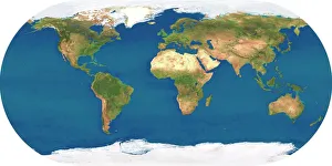
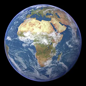
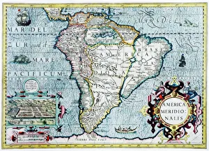
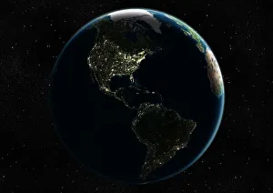
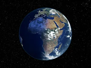
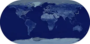
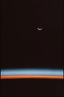
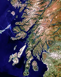
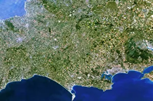
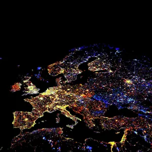
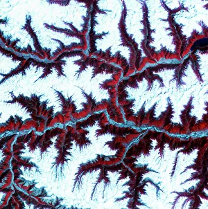
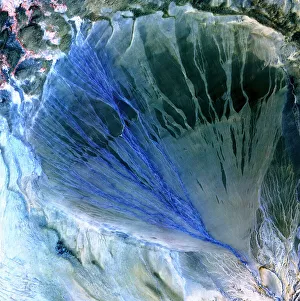
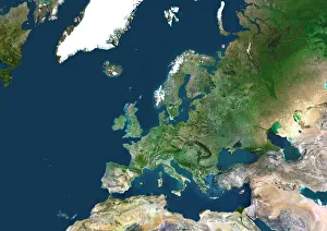
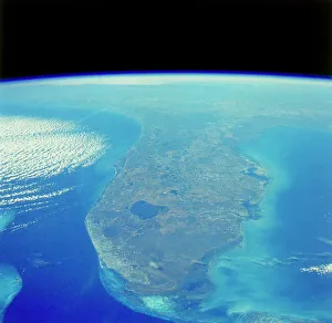
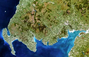
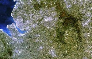
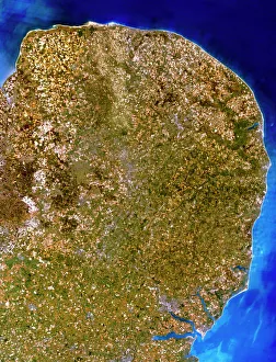
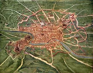
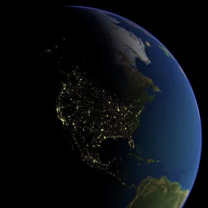
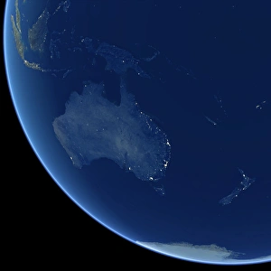
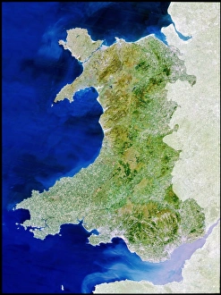
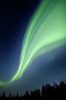
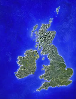
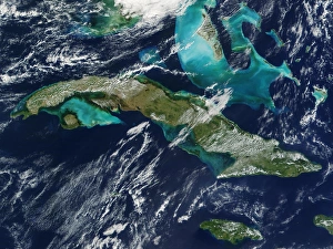
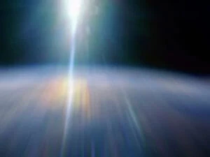
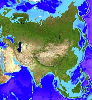
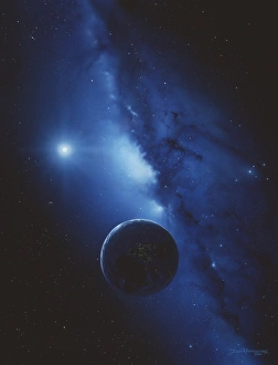
Exploring the wonders of Earth through the lens of science and art. 🌍✨ From the iconic 'Blue Marble 2000' image capturing our Whole Earth's beauty, to Apollo 17's breathtaking photograph showcasing our planet from above, Earth Science invites us to marvel at its grandeur. Satellite images like the British Isles or Europe at night reveal how human activity illuminates our world after sunset, while the captivating view of Whole Earth at night reminds us of our interconnectedness under a starry sky. Inspired by nature's phenomena, artists captured Krakatoa sunsets in 1883 artworks, reminding us of both its destructive power and mesmerizing beauty. Dürer's intricate world map from 1515 offers a glimpse into early cartography and humanity's quest for knowledge. The awe-inspiring 'Earthrise' photo taken from above the moon surface serves as a reminder that we are all inhabitants on this pale blue dot floating in space. Meanwhile, historical maps like the 16th Century Plan of Florence or 17th century map of Europe allow us to trace back centuries-old perspectives on geography. Delving deeper into understanding our environment, soil triangle diagrams provide insights into soil composition and its impact on agriculture and ecosystems. Earth Science takes us on an incredible journey across time and space – revealing not only the physical aspects but also fostering appreciation for our planet’s diversity and fragility.