Fraud Blocker Skip to main content

Earth Science Collection (page 5)

Exploring the wonders of Earth through the lens of science and art

Background imageEarth Science Collection: Earth

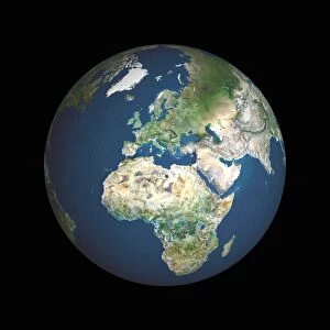
Earth. Satellite image of the Earth, centred on North America. The North Pole is at upper centre. Water is blue, vegetation is green, arid areas are brown, and snow and ice are white

Background imageEarth Science Collection: Historical city map of Imola, Italy

Historical city map of Imola, Italy

Background imageEarth Science Collection: Earth from space

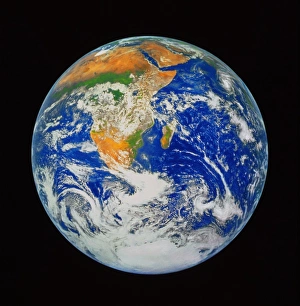
Earth from space
Planet Earth. Enhanced colour version of the classic Apollo 17 view of the Earth taken in December 1972. The image shows the continents of Africa (centre) and Antarctica (bottom)

Background imageEarth Science Collection: Composite image of the Earth and a human eye

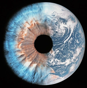
Composite image of the Earth and a human eye
Earth as an eye. Composite image of half a human eye and the Earth, in space. This could represent the Earth as an observatory or eye on the universe

Background imageEarth Science Collection: 16th century map of Sardinia cartouche

16th century map of Sardinia cartouche. Detail from the map of Sardinia contained in the Gallery of Maps in the Vatican Museums. Sardinia is an Italian island in the Mediterranean sea

Background imageEarth Science Collection: Crescent Earth

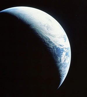
Crescent Earth. View of the Earth taken from the Apollo 4 spacecraft, in orbit 17, 960 kilometres above the surface. The large amount of cloud cover makes it difficult to identify any surface

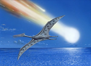
Background imageEarth Science Collection: Cretaceous-Tertiary extinction event

Cretaceous-Tertiary extinction event. Image 3 of 8. Artwork of an asteroid burning up in a fireball as it passes through the Earths atmosphere. A Quetzalcoatlus pterosaur is seen in the foreground

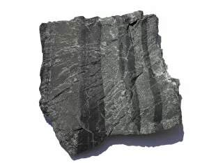
Background imageEarth Science Collection: Chert rock

Chert rock. This carbonaceous chert is from the Barberton greenstone belt in South Africa. The Earths oldest fossil bacteria have been found in this type of rock

Background imageEarth Science Collection: Loam soil

Loam soil

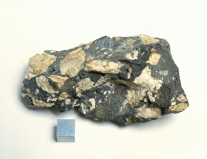
Background imageEarth Science Collection: Material from Chicxulub meteorite impact crater

Material from Chicxulub meteorite impact crater
Chicxulub impact material. Core sample of material taken from the Chicxulub meteorite impact crater. This impact occurred about 65 million years ago & may have caused the extinction of the dinosaurs

Background imageEarth Science Collection: Formation of the Earth, artwork

Formation of the Earth, artwork
Formation of the Earth. Artwork showing stages in the formation of the Earth, up to the present day. The Earth formed 4.5 billion years ago

Background imageEarth Science Collection: Olenellus gilberti trilobite fossil

Olenellus gilberti trilobite fossil. Trilobites were arthropods that fed as they crawled on the seabed. They are now extinct

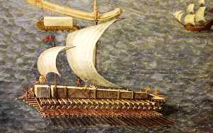
Background imageEarth Science Collection: Transporting the Montecitorio Obelisk

Transporting the Montecitorio Obelisk
Roman Cargo Ship, reconstructed in the form of a raft, being used to transport the Montecitorio obelisk from Egypt to Rome in 10 BC

Background imageEarth Science Collection: Sample of chalk

Sample of chalk. Chalk is a soft, white, porous sedimentary rock. Sedimentary rocks are formed by the compaction of water deposits over long periods of time

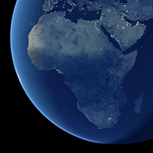
Background imageEarth Science Collection: Africa at night, satellite image

Africa at night, satellite image. City lights (yellow) show areas of dense population, particularly in Europe and the Middle East (top)

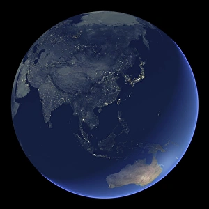
Background imageEarth Science Collection: East Asia at night, satellite image

East Asia at night, satellite image
East Asia at night. Satellite image of the Earth at night, centred over China. City lights (yellow) show areas of dense population

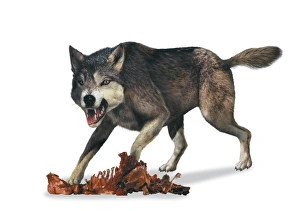
Background imageEarth Science Collection: Canis dirus, dire wolf, side view

Canis dirus, dire wolf, side view

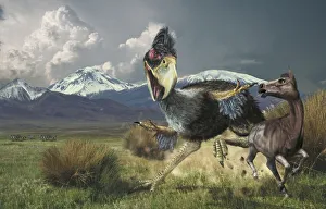
Background imageEarth Science Collection: Titanis, giant, chasing the primitive horse Hipparion in grassy expanse

Titanis, giant, chasing the primitive horse Hipparion in grassy expanse, snow-topped mountains in background

Background imageEarth Science Collection: Scutosaurus, side view

Scutosaurus, side view

Background imageEarth Science Collection: Cretaceous Arcelon, marine turtle, illustration

Cretaceous Arcelon, marine turtle, illustration

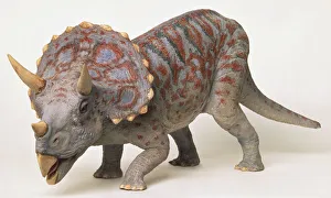
Background imageEarth Science Collection: Front side view of a model Triceratops dinosaur with neck frills, horns, thick scaly skin

Front side view of a model Triceratops dinosaur with neck frills, horns, thick scaly skin

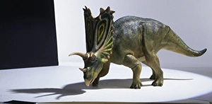
Background imageEarth Science Collection: Model of Pentaceratops dinosaur

Model of Pentaceratops dinosaur

Background imageEarth Science Collection: Profile of model of a Suchomimus dinosaur, crouching, tail raised, mouth open

Profile of model of a Suchomimus dinosaur, crouching, tail raised, mouth open

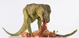
Background imageEarth Science Collection: Tyrannosaurus rex model leaning over and eating meat

Tyrannosaurus rex model leaning over and eating meat

Background imageEarth Science Collection: Zion National Park, Utah. USA. Autumn rain falls on The Watchman & the Virgin River

Zion National Park, Utah. USA. Autumn rain falls on The Watchman & the Virgin River
Zion National Park, Utah. USA. Autumn rain falls on The Watchman and the Virgin River. Colorado Plateau

Background imageEarth Science Collection: Zion National Park, Utah. USA. Great White Throne above grasses

Zion National Park, Utah. USA. Great White Throne above grasses. View from Virgin River flood plain in Zion Canyon

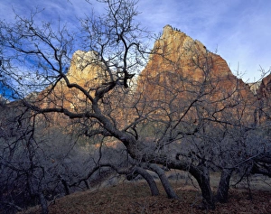
Background imageEarth Science Collection: Zion National Park, Utah. USA. Oak trees in winter. Court of the Patriarchs. Zion Canyon

Zion National Park, Utah. USA. Oak trees in winter. Court of the Patriarchs. Zion Canyon

Background imageEarth Science Collection: Zion National Park, Utah. USA. Paria Point framed by cottonwoods in late autumn

Zion National Park, Utah. USA. Paria Point framed by cottonwoods in late autumn. Kolob Canyons

Background imageEarth Science Collection: Zion National Park, Utah. USA. East Temple rises above frosted cattails & bridge over Pine Creek

Zion National Park, Utah. USA. East Temple rises above frosted cattails & bridge over Pine Creek
Zion National Park, Utah. USA. East Temple rises above frosted cattails and bridge over Pine Creek (built by Civilian Conservation Corps (CCC))

Background imageEarth Science Collection: Zion National Park, Utah. USA. The Pulpit & ephemeral waterfall. Temple of Sinawava in winter

Zion National Park, Utah. USA. The Pulpit & ephemeral waterfall. Temple of Sinawava in winter
Zion National Park, Utah. USA. The Pulpit and ephemeral waterfall. Temple of Sinawava in winter. Zion Canyon

Background imageEarth Science Collection: Zion National Park, Utah. USA. Towers of the Virgin in winter. Zion Canyon

Zion National Park, Utah. USA. Towers of the Virgin in winter. Zion Canyon

Background imageEarth Science Collection: Zion National Park, Utah. USA. Stratus clouds & cliffs of Zion Canyon in winter

Zion National Park, Utah. USA. Stratus clouds & cliffs of Zion Canyon in winter
Zion National Park, Utah. USA. Stratus clouds and cliffs of Zion Canyon in winter

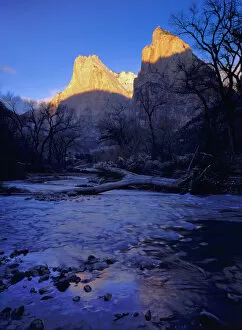
Background imageEarth Science Collection: Zion National Park, Utah. USA. Light of sunrise on towers of Zion Canyon above Virgin

Zion National Park, Utah. USA. Light of sunrise on towers of Zion Canyon above Virgin River in winter

Background imageEarth Science Collection: Utah. USA. View of the Watchman in Zion National Park through pecan trees in Springdale

Utah. USA. View of the Watchman in Zion National Park through pecan trees in Springdale

Background imageEarth Science Collection: Zion National Park, Utah. USA. Snow on trees below vertical cliffs near Upper Emerald Pools

Zion National Park, Utah. USA. Snow on trees below vertical cliffs near Upper Emerald Pools. Zion Canyon

Background imageEarth Science Collection: Zion National Park, Utah. USA. Light of winter sunset on East Temple. Zion Canyon

Zion National Park, Utah. USA. Light of winter sunset on East Temple. Zion Canyon

Background imageEarth Science Collection: Zion National Park, Utah. USA. Mist blows around Towers of the Virgin after heavy

Zion National Park, Utah. USA. Mist blows around Towers of the Virgin after heavy snow storm

Background imageEarth Science Collection: Zion National Park, Utah. USA. Cottonwood trees in winter below Meridian Tower in

Zion National Park, Utah. USA. Cottonwood trees in winter below Meridian Tower in Towers of the Virgin. Virgin River flood plain. Zion Canyon

Background imageEarth Science Collection: Zion National Park, Utah. USA. Timber Top Mountain at sunset in winter. Kolob Canyons

Zion National Park, Utah. USA. Timber Top Mountain at sunset in winter. Kolob Canyons

Background imageEarth Science Collection: Zion National Park, Utah. USA. Deep snow at Middle Emerald Pools. Zion Canyon

Zion National Park, Utah. USA. Deep snow at Middle Emerald Pools. Zion Canyon

Background imageEarth Science Collection: Zion National Park, Utah. USA. Light of sunset on The Watchman above Fremont cottonwood trees

Zion National Park, Utah. USA. Light of sunset on The Watchman above Fremont cottonwood trees (Populus fremonti) in autumn

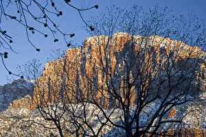
Background imageEarth Science Collection: Zion National Park, Utah. USA. Snow on cliffs & conifers. Zion Canyon

Zion National Park, Utah. USA. Snow on cliffs & conifers. Zion Canyon
Zion National Park, Utah. USA. Snow on cliffs and conifers. Zion Canyon

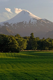
Background imageEarth Science Collection: Chile. South America. Pasture in Rio Liucura valley

Chile. South America. Pasture in Rio Liucura valley. Smoke and vapor rise from active Villarrica Volcano (Volcan Villarrica, 2847 meters) in distance

Background imageEarth Science Collection: Chile. South America. Lago El Toro and Cerro San Sabastian. Huerquehue National Park

Chile. South America. Lago El Toro and Cerro San Sabastian. Huerquehue National Park (Parque Nacional Huerquehue). Lakes District. Araucania Region of Chile (IX Region de la Araucania)

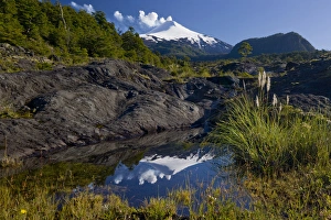
Background imageEarth Science Collection: Villarrica National Park, Chile. South America

Villarrica National Park, Chile. South America. Smoke and vapor rising from active Villarrica Volcano (Volcan Villarrica, 2847 meters) are reflected in pond on young lava flow. Sendero de las Cascadas


All Professionally Made to Order for Quick Shipping

Exploring the wonders of Earth through the lens of science and art. 🌍✨ From the iconic 'Blue Marble 2000' image capturing our Whole Earth's beauty, to Apollo 17's breathtaking photograph showcasing our planet from above, Earth Science invites us to marvel at its grandeur. Satellite images like the British Isles or Europe at night reveal how human activity illuminates our world after sunset, while the captivating view of Whole Earth at night reminds us of our interconnectedness under a starry sky. Inspired by nature's phenomena, artists captured Krakatoa sunsets in 1883 artworks, reminding us of both its destructive power and mesmerizing beauty. Dürer's intricate world map from 1515 offers a glimpse into early cartography and humanity's quest for knowledge. The awe-inspiring 'Earthrise' photo taken from above the moon surface serves as a reminder that we are all inhabitants on this pale blue dot floating in space. Meanwhile, historical maps like the 16th Century Plan of Florence or 17th century map of Europe allow us to trace back centuries-old perspectives on geography. Delving deeper into understanding our environment, soil triangle diagrams provide insights into soil composition and its impact on agriculture and ecosystems. Earth Science takes us on an incredible journey across time and space – revealing not only the physical aspects but also fostering appreciation for our planet’s diversity and fragility.