Fraud Blocker Skip to main content

Continents Collection (page 3)

"Journey through Time and Space: Unveiling the Marvels of Continents" Witness the incredible phenomenon of continental drift after 250 million years

Background imageContinents Collection: Eastern Hemisphere, from a Series of World Maps published by John Tallis & Co

Eastern Hemisphere, from a Series of World Maps published by John Tallis & Co
STC190611 Eastern Hemisphere, from a Series of World Maps published by John Tallis & Co. New York & London, 1850s (engraving) by Rapkin
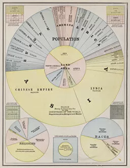
Background imageContinents Collection: World population by continents, countries, religion and race (coloured engraving)

World population by continents, countries, religion and race (coloured engraving)
6014060 World population by continents, countries, religion and race (coloured engraving) by American School, (19th century); Private Collection; (add.info.: World population by continents)

Background imageContinents Collection: Map of the Eastern Hemisphere (coloured engraving)

Map of the Eastern Hemisphere (coloured engraving)
6014056 Map of the Eastern Hemisphere (coloured engraving) by American School, (19th century); Private Collection; (add.info.: Map of the Eastern Hemisphere)

Background imageContinents Collection: Map of Europe, illustration from Le Magasin Pittoresque

Map of Europe, illustration from Le Magasin Pittoresque
869927 Map of Europe, illustration from Le Magasin Pittoresque, 1849 (coloured engraving) by French School, (19th century); Bibliotheque des Arts Decoratifs, Paris

Background imageContinents Collection: Map of the eastern hemisphere, illustration from A journal of a voyage to the South

Map of the eastern hemisphere, illustration from A journal of a voyage to the South
3610754 Map of the eastern hemisphere, illustration from A journal of a voyage to the South Seas : in His Majestys ship, the Endeavour, 1794 (hand-coloured engraving) by Parkinson

Background imageContinents Collection: Jupiter and the four continents (fresco) (detail of 3496591)

Jupiter and the four continents (fresco) (detail of 3496591)
3496592 Jupiter and the four continents (fresco) (detail of 3496591) by Bortoloni, Mattia (1695-1750); Villa Carones (Brentano Palace), Corbetta, Milan, Lombardy

Background imageContinents Collection: Jupiter and the four continents (fresco)

Jupiter and the four continents (fresco)
3496591 Jupiter and the four continents (fresco) by Bortoloni, Mattia (1695-1750); Villa Carones (Brentano Palace), Corbetta, Milan, Lombardy

Background imageContinents Collection: Fac-simile d une carte d Europe gravee en 1628 (engraving)

Fac-simile d une carte d Europe gravee en 1628 (engraving)
3644522 Fac-simile d une carte d Europe gravee en 1628 (engraving) by French School, (19th century); Private Collection; (add.info.: Fac-simile d une carte d Europe gravee en 1628)

Background imageContinents Collection: Globe, from Cosmographia, 1544 (engraving)

Globe, from Cosmographia, 1544 (engraving)
2919589 Globe, from Cosmographia, 1544 (engraving) by Munster, Sebastian (1589-1552); The University of St. Andrews, Scotland

Background imageContinents Collection: Europe (chromolitho)

Europe (chromolitho)
976335 Europe (chromolitho) by European School, (19th century); Private Collection; (add.info.: Europe. Scrap.); © Look and Learn

Background imageContinents Collection: Map of the Western Hemisphere (coloured engraving)

Map of the Western Hemisphere (coloured engraving)
6014050 Map of the Western Hemisphere (coloured engraving) by American School, (19th century); Private Collection; (add.info.: Map of the Western Hemisphere)

Background imageContinents Collection: New Zealand, Australia and the Pacific (colour litho)

New Zealand, Australia and the Pacific (colour litho)
5996923 New Zealand, Australia and the Pacific (colour litho) by English School, (20th century); Private Collection; (add.info.: New Zealand, Australia and the Pacific)

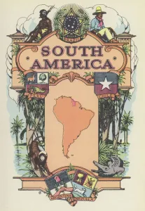
Background imageContinents Collection: South America (colour litho)

South America (colour litho)
5996925 South America (colour litho) by English School, (20th century); Private Collection; (add.info.: South America. Illustration from The Modern World Encyclopedia)

Background imageContinents Collection: Map of the World in the time of the navigators John and Sebastian Cabot (colour litho)

Map of the World in the time of the navigators John and Sebastian Cabot (colour litho)
6029539 Map of the World in the time of the navigators John and Sebastian Cabot (colour litho) by Gill, MacDonald (1884-1947); Private Collection; (add.info)

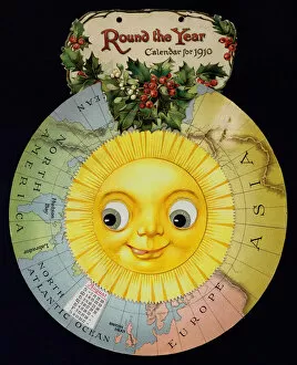
Background imageContinents Collection: Round the year calendar, 1910 (chromolitho)

Round the year calendar, 1910 (chromolitho)
6030604 Round the year calendar, 1910 (chromolitho) by English School, (20th century); Private Collection; (add.info.: Round the year calendar)

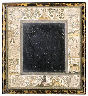
Background imageContinents Collection: Needlework mirror with personifications of the continents

Needlework mirror with personifications of the continents
1142033 Needlework mirror with personifications of the continents (ivory satin ground with silk embroidery & pearls) by English School

Background imageContinents Collection: Asia (chromolitho)

Asia (chromolitho)
976337 Asia (chromolitho) by European School, (19th century); Private Collection; (add.info.: Asia. Scrap.); © Look and Learn

Background imageContinents Collection: Map of Africa (hand-coloured engraving)

Map of Africa (hand-coloured engraving)
619429 Map of Africa (hand-coloured engraving) by Speed, John (1552-1629); Private Collection; The Stapleton Collection; English, out of copyright

Background imageContinents Collection: f. 177v T-in-O map, with letterpress place names, from Isidore of Seville

f. 177v T-in-O map, with letterpress place names, from Isidore of Seville
473521 f.177v T-in-O map, with letterpress place names, from Isidore of Seville, Liber Etimologiarvm (woodcut) by German School, (15th century); Newberry Library, Chicago, Illinois

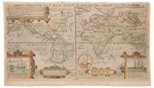
Background imageContinents Collection: La heroike interprinse faict par le Signeur Draeck d avoir cirquit toute la terre, c

La heroike interprinse faict par le Signeur Draeck d avoir cirquit toute la terre, c
2637086 La heroike interprinse faict par le Signeur Draeck d avoir cirquit toute la terre, c.1590 (hand-coloured engraving) by Sype

Background imageContinents Collection: Africa (colour litho)

Africa (colour litho)
5996926 Africa (colour litho) by English School, (20th century); Private Collection; (add.info.: Africa. Illustration from The Modern World Encyclopedia)

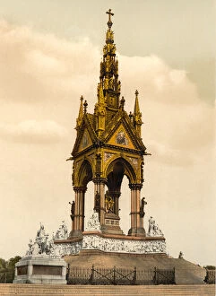
Background imageContinents Collection: Albert Memorial, London, c. 1890-1900 (photochrom)

Albert Memorial, London, c. 1890-1900 (photochrom)
5242393 Albert Memorial, London, c.1890-1900 (photochrom) by Detroit Publishing Co. (1880-1920); Private Collection; (add.info.: In Kensington Gardens, one of Londons most ornate monuments)

Background imageContinents Collection: Oceania (chromolitho)

Oceania (chromolitho)
976338 Oceania (chromolitho) by European School, (19th century); Private Collection; (add.info.: Oceania. Scrap.); © Look and Learn

Background imageContinents Collection: Viewing the Globe

Viewing the Globe
Jacqueline Hammer

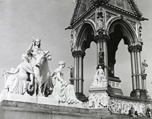
Background imageContinents Collection: The Albert Memorial, designed by George Gilbert Scott, showing the sculptures

The Albert Memorial, designed by George Gilbert Scott, showing the sculptures The Continents: Europe (near left) and The Useful Arts: Agriculture (far right). Date: Built 1864 - 1876

Background imageContinents Collection: ITS A WOMANS WORLD

ITS A WOMANS WORLD
A feminist view of our planet - The World, surrounded by Emblematical Females. Date: circa 1800

Background imageContinents Collection: africa, usa, arctic, continents, earth, global, globe, hemisphere, ice, land, nobody

africa, usa, arctic, continents, earth, global, globe, hemisphere, ice, land, nobody
africa, usa, arctic, continents, earth, global, globe, hemisphere, ice, l, 82047893

Background imageContinents Collection: Globe showing the Americas

Globe showing the Americas
Globe With Dark Background Showing The Americas

Background imageContinents Collection: Earth From Space Centered On East Africa

Earth From Space Centered On East Africa

Background imageContinents Collection: Map World Geography

Map World Geography
Map of the World by Battista Agnese, 1543-45. (Photo by: Universal History Archive/UIG)

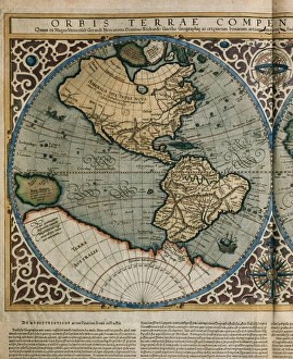
Background imageContinents Collection: World Map by Rumold Mercator (1512-1594)

World Map by Rumold Mercator (1512-1594)
Orbis Terrae Compendiosa Descriptio. World map, 1587. Detail of America. By Rumold Mercator (1545-1599)

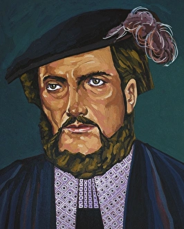
Background imageContinents Collection: Portrait of Amerigo Vespucci Anonymous

Portrait of Amerigo Vespucci Anonymous
VESPUCCI, Amerigo (1454-1512). Italian explorer and cartography; generally considered that the continents of America named after him. Oil

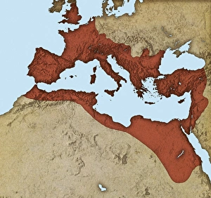
Background imageContinents Collection: Roman Empire, artwork

Roman Empire, artwork
Roman Empire. Computer artwork showing the extent of the Roman Empire (red) during its peak in the 1st Century AD. The Roman Empire reached its greatest extent under the rain of Emperor Trajan

Background imageContinents Collection: Whole Earth map

Whole Earth map based on satellite data. This is a mosaic of numerous satellite observations of the Earth. Land colours are shaded using topographic data

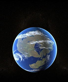
Background imageContinents Collection: Earth at time of Pangea

Earth at time of Pangea
Future Earth. Computer artwork of the position of Earths continents around 250 million years in the future. A new supercontinent, Pangea Ultima, has formed

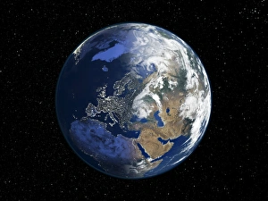
Background imageContinents Collection: Europe, night-day satellite image

Europe, night-day satellite image. This composite image of the Earth is set against a background of stars, and is centred on Europe. North is at top

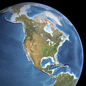
Background imageContinents Collection: North America, topographic map

North America, topographic map. Highlands and lowlands of the continents are also shown, as ridges and flat areas. South America (bottom right) and the Arctic (top) are also seen

Background imageContinents Collection: The Arctic, satellite image

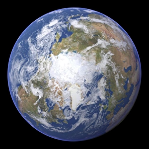
The Arctic, satellite image
The Arctic. Satellite image of the Earth centred on the Arctic. The North Pole is at centre. Clouds and Arctic sea ice are white, oceans are blue and land is green and brown

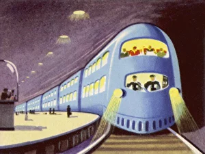
Background imageContinents Collection: Transcontinental Metro

Transcontinental Metro - Travelling Underground between Continents

Background imageContinents Collection: APEX02722WT027

APEX02722WT027
Tectonic plates collide in Pingvellir in Iceland

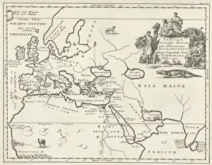
Background imageContinents Collection: Map Europe parts Asia Africa Tubala Universalis Locorum

Map Europe parts Asia Africa Tubala Universalis Locorum
Map of Europe and parts of Asia and Africa Tubala Universalis Locorum, quae Phoenicum Navigationibus Maxime frequentata Sunt a Taprobana Thulen usque (title on object), Print upper right: Pag: 346

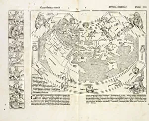
Background imageContinents Collection: Map world Registrum huius operis libri cronicarum

Map world Registrum huius operis libri cronicarum
Map of the world, Registrum huius operis libri cronicarum cu, m, figuris et ymagi, nibus ab inicio mundi, Pleydenwurff, Wilhelm, d

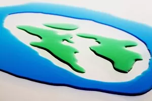
Background imageContinents Collection: Globe And Continents Displayed With Colored Water

Globe And Continents Displayed With Colored Water

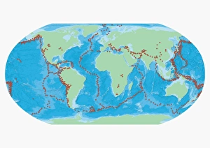
Background imageContinents Collection: Map of the World with red dots marking earthquake zones

Map of the World with red dots marking earthquake zones

Background imageContinents Collection: Corbis Collection

Corbis Collection
Fine Art Storehouse Corbis Collection

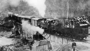
Background imageContinents Collection: Nigerian troops entrained on the Northern Railway German Cameroon WWI

Nigerian troops entrained on the Northern Railway German Cameroon WWI


All Professionally Made to Order for Quick Shipping

"Journey through Time and Space: Unveiling the Marvels of Continents" Witness the incredible phenomenon of continental drift after 250 million years, as Earth's landmasses slowly rearranged themselves over millennia. Explore a 17th-century world map, where cartographers attempted to capture the ever-evolving continents in their intricate designs. Behold the breathtaking Whole Earth at night, captured by satellites, illuminating our planet's diverse landscapes and bustling cities. Step back in time with a 16th-century world map, showcasing early attempts to understand and depict the vastness of our continents. Experience awe-inspiring views from space as satellites capture stunning images of Earth, revealing its majestic beauty and interconnected continents. Delve into history with Oronce Fine's remarkable world map from 1531, offering a glimpse into how people perceived continents centuries ago. Discover the hidden forces shaping our planet on a map marking boundaries of tectonic plates – unveiling nature's powerful influence on continent formation. Marvel at North America at night through satellite imagery, witnessing vibrant city lights that dot this vast continent like sparkling jewels against darkness. Embark on an exploration beneath Earth's surface with topographic and bathymetric maps – revealing both continents' towering mountains and mysterious ocean depths. Illuminate Europe at night through satellite imagery; witness ancient landmarks blending seamlessly with modern metropolises across this culturally rich continent. Travel back in time once more to witness continental drift occurring around 100 million years ago - reshaping our planet as we know it today. Experience Australia like never before through detailed satellite images capturing its unique geography - from arid deserts to lush rainforests - truly a continent unlike any other.