Fraud Blocker Skip to main content

Continents Collection (page 7)

"Journey through Time and Space: Unveiling the Marvels of Continents" Witness the incredible phenomenon of continental drift after 250 million years

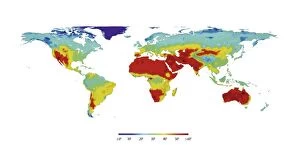
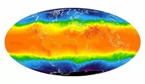
Background imageContinents Collection: Global temperatures, artwork

Global temperatures, artwork
Global temperatures. Computer artwork of a map of the World showing the average temperatures for all the different land areas

Background imageContinents Collection: Sir Francis Drakes voyage 1585-1586

Sir Francis Drakes voyage 1585-1586. 16th century map showing the journey Sir Francis Drake made to the New World from 1585-1586

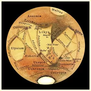
Background imageContinents Collection: Schiaparellis map of Mars, 1877-1888

Schiaparellis map of Mars, 1877-1888
Schiaparellis map of Mars. This drawing of the two hemispheres of Mars was made by the Italian astronomer Giovanni Schiaparelli (1835-1910) between the years 1877 and 1888

Background imageContinents Collection: Cloud world map, artwork

Cloud world map, artwork
Cloud world map, computer artwork

Background imageContinents Collection: Global communications, artwork

Global communications, artwork
Global communications, computer artwork

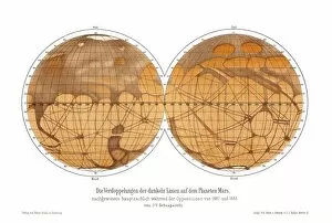
Background imageContinents Collection: Schiaparellis map of Mars, 1882-1888

Schiaparellis map of Mars, 1882-1888
Schiaparellis map of Mars. This drawing of the two hemispheres of Mars was made by the Italian astronomer Giovanni Schiaparelli (1835-1910) between the years 1882 and 1888

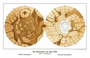
Background imageContinents Collection: Schiaparellis map of Mars, 1879

Schiaparellis map of Mars, 1879
Schiaparellis map of Mars. This drawing of the southern (left) and northern (right) hemipsheres of Mars was made in 1879 by the Italian astronomer Giovanni Schiaparelli (1835-1910)

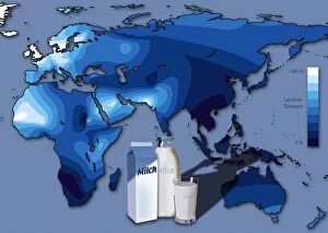
Background imageContinents Collection: Lactose tolerance, Eurasia and Africa

Lactose tolerance, Eurasia and Africa
GERMAN LANGUAGE VERSION. Lactose tolerance. Map of Eurasia, African and Australia, showing the varying tolerance for lactose, the milk sugar found in dairy products from cows milk (lower centre)

Background imageContinents Collection: Earth, topographic and bathymetric map

Earth, topographic and bathymetric map. Computer generated image showing the varying heights and depths of the Worlds landmasses, oceans and seas

Background imageContinents Collection: Global meat eating, conceptual artwork

Global meat eating, conceptual artwork. This global map with the outline of the Earths countries filled in with a close-up of raw beef

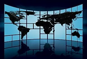
Background imageContinents Collection: World map, artwork

World map, artwork
World map. Artwork of a map of the Earth and its rivers forming the backdrop for a television studio

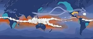
Background imageContinents Collection: La Nina, artwork

La Nina, artwork
La Nina. Computer artwork showing the path and effects of the La Nina climate pattern. La Nina is the cool phase of the El Nino/La Nina-Southern Oscillation (ENSO)

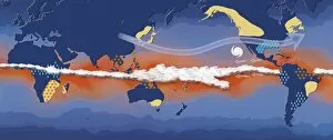
Background imageContinents Collection: El Nino, artwork

El Nino, artwork
El Nino. Computer artwork showing the path and effects of the El Nino climate pattern. El Nino is the warm phase of the El Nino/La Nina-Southern Oscillation (ENSO)

Background imageContinents Collection: Earths rotation

Earths rotation
The Earth in 12 steps, each 30 degrees in the direction of natural rotation, which would be 2 hours

Background imageContinents Collection: Schiaparellis observations of Mars

Schiaparellis observations of Mars. This drawing was made by the Italian astronomer Giovanni Schiaparelli (1835-1910). His most detailed observations were made between 1877 and 1888

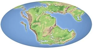
Background imageContinents Collection: Continental drift, 200 million years ago

Continental drift, 200 million years ago, showing the Earth at the time of the break-up of the ancient supercontinent of Pangea. This supercontinent formed around 300 million years ago

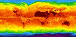
Background imageContinents Collection: Global temperatures, April 2003

Global temperatures, April 2003. Infrared satellite map of worldwide surface and cloud temperatures in April 2003. The colour-coded map shows temperatures in degrees Celsius

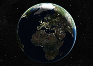
Background imageContinents Collection: Europe at night, satellite image

Europe at night, satellite image
Europe at night. Satellite image of the Earth seen at 00:00 (midnight) GMT (UTC), centred on Europe. City lights (yellow) in dark areas show areas of dense population

Background imageContinents Collection: Global temperatures, May 2009

Global temperatures, May 2009. Infrared satellite map of average daytime air temperatures at 3000 metres elevation worldwide in May 2009

Background imageContinents Collection: The Americas, satellite image

The Americas, satellite image. Oceans are blue and land is green and brown. City lights (yellow) in dark areas show areas of dense population

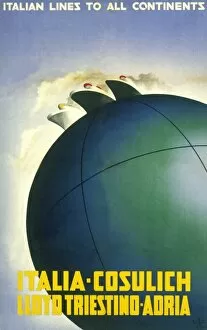
Background imageContinents Collection: Poster advertising Italian Lines to all continents

Poster advertising Italian Lines to all continents, operated by Fratelli Cosulich, Lloyd Triestino and Adria

Background imageContinents Collection: Costume 4 Parts of World

Costume 4 Parts of World
Four stylish scenes depicting fashion and dress in four continents - Europe, Asia, Africa and North America

Background imageContinents Collection: The Arctic, night-day satellite image

The Arctic, night-day satellite image
Asia, night-day satellite image. This composite image of the Earth is set against a background of stars, and is centred on the continent of Asia. North is at top

Background imageContinents Collection: North America, satellite image

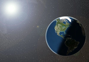
North America, satellite image
North America. Satellite image of the Earth, set against a background of stars, centred on the continent of North America. North is at top. Clouds (white) are seen in the atmosphere

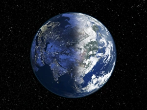
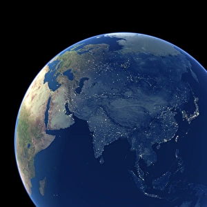
Background imageContinents Collection: Asia at night, satellite image

Asia at night, satellite image. City lights (yellow) show areas of dense population. Large, densely populated areas include India (lower centre), China (lower right) and Japan (right)

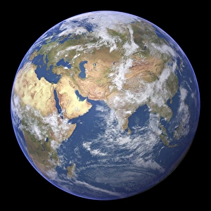
Background imageContinents Collection: Arabian Sea, satellite image

Arabian Sea, satellite image
Arabian Sea. Satellite image of the Earth centred on the Arabian Sea and western India. Clouds and Arctic ice (top) are white, oceans are blue and land is green and brown

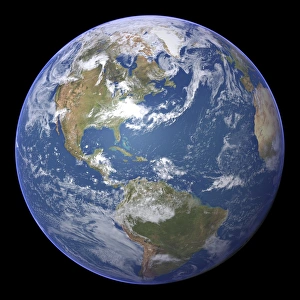
Background imageContinents Collection: The Americas, satellite image

The Americas, satellite image
The Americas. Satellite image of the Earth centred on the Caribbean Islands, with North America at upper left and South America at bottom

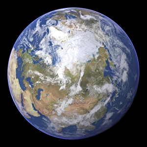
Background imageContinents Collection: Northern Asia and the Arctic

Northern Asia and the Arctic. Satellite image of the Earth centred on Siberia, with the North Pole at upper centre. Clouds and Arctic sea ice are white, oceans are blue and land is green and brown

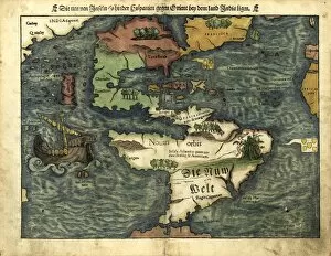
Background imageContinents Collection: Map of the Americas, 1550

Map of the Americas, 1550
16th century map of the Americas. Published in 1550, this German map shows a rudimentary geography of the newly-discovered Americas

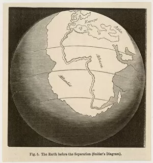
Background imageContinents Collection: Continents Joined

Continents Joined
Sniders conception of how Earths continents were originally one - proposed long before Wegener, longer still before it was accepted by the scientific establishment


All Professionally Made to Order for Quick Shipping

"Journey through Time and Space: Unveiling the Marvels of Continents" Witness the incredible phenomenon of continental drift after 250 million years, as Earth's landmasses slowly rearranged themselves over millennia. Explore a 17th-century world map, where cartographers attempted to capture the ever-evolving continents in their intricate designs. Behold the breathtaking Whole Earth at night, captured by satellites, illuminating our planet's diverse landscapes and bustling cities. Step back in time with a 16th-century world map, showcasing early attempts to understand and depict the vastness of our continents. Experience awe-inspiring views from space as satellites capture stunning images of Earth, revealing its majestic beauty and interconnected continents. Delve into history with Oronce Fine's remarkable world map from 1531, offering a glimpse into how people perceived continents centuries ago. Discover the hidden forces shaping our planet on a map marking boundaries of tectonic plates – unveiling nature's powerful influence on continent formation. Marvel at North America at night through satellite imagery, witnessing vibrant city lights that dot this vast continent like sparkling jewels against darkness. Embark on an exploration beneath Earth's surface with topographic and bathymetric maps – revealing both continents' towering mountains and mysterious ocean depths. Illuminate Europe at night through satellite imagery; witness ancient landmarks blending seamlessly with modern metropolises across this culturally rich continent. Travel back in time once more to witness continental drift occurring around 100 million years ago - reshaping our planet as we know it today. Experience Australia like never before through detailed satellite images capturing its unique geography - from arid deserts to lush rainforests - truly a continent unlike any other.