Fraud Blocker Skip to main content

Chart Collection (page 6)

"Unlocking the Secrets: Exploring the Fascinating World of Charts" Dive into the realm of reflexology with a detailed foot map chart

Background imageChart Collection: Famous rivers: The Hudson (litho)

Famous rivers: The Hudson (litho)
8634759 Famous rivers: The Hudson (litho) by English School, (20th century); Private Collection; (add.info.: The Hudson. Illustration for Chatterbox, 1913.); © Look and Learn.

Background imageChart Collection: Famous rivers: The Tiber (litho)

Famous rivers: The Tiber (litho)
8634756 Famous rivers: The Tiber (litho) by English School, (20th century); Private Collection; (add.info.: The Tiber. Illustration for Chatterbox, 1913.); © Look and Learn.

Background imageChart Collection: Plan of London, England c. 1300. From Historical Atlas, published 1923

Plan of London, England c. 1300. From Historical Atlas, published 1923
2603529 Plan of London, England c. 1300. From Historical Atlas, published 1923..

Background imageChart Collection: Sexual orgasms in men and women (litho)

Sexual orgasms in men and women (litho)
8657074 Sexual orgasms in men and women (litho) by English School, (20th century); Private Collection; (add.info.: Sexual orgasms in men and women)

Background imageChart Collection: The solar system.Theory of the seasons. 1865 (engraving)

The solar system.Theory of the seasons. 1865 (engraving)
8766902 The solar system.Theory of the seasons. 1865 (engraving); Private Collection; (add.info.: The solar system.Theory of the seasons.Engraved by J)

Background imageChart Collection: Map of the inland navigation of England and Wales by the canals and principal rivers, 1809

Map of the inland navigation of England and Wales by the canals and principal rivers, 1809
FLO4974709 Map of the inland navigation of England and Wales by the canals and principal rivers, 1809. Copperplate engraving by Mutlow from John Mason Good's Pantologia, a New Encyclopedia, G

Background imageChart Collection: Pages from 'The First Six Books of the elements of Euclid' by Oliver Byrne published in 1847

Pages from 'The First Six Books of the elements of Euclid' by Oliver Byrne published in 1847
5668984 Pages from 'The First Six Books of the elements of Euclid' by Oliver Byrne published in 1847; (add.info.: Photograph of page from original 1847 first edition)

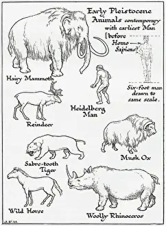
Background imageChart Collection: Diagram of Early Pleistocene animals contemporary with earliest man (print)

Diagram of Early Pleistocene animals contemporary with earliest man (print)
7420078 Diagram of Early Pleistocene animals contemporary with earliest man (print); (add.info.: Diagram of Early Pleistocene animals contemporary with earliest man, before Homosapiens)

Background imageChart Collection: Map of Europe after the Congress of Vienna, 1814-1815 (print)

Map of Europe after the Congress of Vienna, 1814-1815 (print)
7420062 Map of Europe after the Congress of Vienna, 1814-1815 (print); (add.info.: Map of Europe after the Congress of Vienna, 1814-1815. From the book Outline of History by H.G)

Background imageChart Collection: Diagram of a Hesperornis (print)

Diagram of a Hesperornis (print)
7420075 Diagram of a Hesperornis (print); (add.info.: Diagram of a Hesperornis, a reptilian wingless water-bird. From the book Outline of History by H.G)

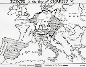
Background imageChart Collection: Map of Europe in the time of Charles V, Holy Roman Emperor, 16th century (print)

Map of Europe in the time of Charles V, Holy Roman Emperor, 16th century (print)
7420056 Map of Europe in the time of Charles V, Holy Roman Emperor, 16th century (print); (add.info.: Map of Europe in the time of Charles V, Holy Roman Emperor, 16th century)

Background imageChart Collection: Map of the empire of Otto the Great, 10th century (print)

Map of the empire of Otto the Great, 10th century (print)
7420046 Map of the empire of Otto the Great, 10th century (print); (add.info.: Map of the empire of Otto the Great, 10th century. From the book Outline of History by H.G)

Background imageChart Collection: Map of England in 640 A.D. (print)

Map of England in 640 A.D. (print)
7420045 Map of England in 640 A.D. (print); (add.info.: Map of England in 640 A.D. From the book Outline of History by H.G. Wells, published 1920.); Photo © Ken Welsh. All rights reserved 2024.

Background imageChart Collection: Changing seasons and day and night as the earth orbits the sun

Changing seasons and day and night as the earth orbits the sun
3480253 Changing seasons and day and night as the earth orbits the sun; (add.info.: Diagram explaining the changing seasons and day and night as the earth orbits the sun)

Background imageChart Collection: Side elevation, diagram of a silk spinning machine, 1851

Side elevation, diagram of a silk spinning machine, 1851
3480175 Side elevation, diagram of a silk spinning machine, 1851; (add.info.: Side elevation, diagram of a silk spinning machine, English 1851.); Universal History Archive/UIG.

Background imageChart Collection: Map showing the naval bases of the North Sea during World War One

Map showing the naval bases of the North Sea during World War One, from The History of the Great War, pub.c.1919
3502817 Map showing the naval bases of the North Sea during World War One, from The History of the Great War, pub.c.1919; (add.info)

Background imageChart Collection: Map of Espanola with the Columbine Forts and settlements. From the book Life of Christopher

Map of Espanola with the Columbine Forts and settlements. From the book Life of Christopher Columbus by Clements R
2915321 Map of Espanola with the Columbine Forts and settlements. From the book Life of Christopher Columbus by Clements R. Markham published 1892.; Photo © Hilary Morgan.

Background imageChart Collection: Map of the Spanish coast from Huelva to Cadiz. From the book Life of Christopher Columbus by

Map of the Spanish coast from Huelva to Cadiz. From the book Life of Christopher Columbus by Clements R
2915320 Map of the Spanish coast from Huelva to Cadiz. From the book Life of Christopher Columbus by Clements R. Markham published 1892.; Photo © Hilary Morgan.

Background imageChart Collection: Western part of the Catalan map of the world, 1275. From the book Life of Christopher Columbus by

Western part of the Catalan map of the world, 1275. From the book Life of Christopher Columbus by Clements R
2915313 Western part of the Catalan map of the world, 1275. From the book Life of Christopher Columbus by Clements R. Markham published 1892.; Photo © Hilary Morgan.

Background imageChart Collection: Acupuncture chart. 19th century (woodcut)

Acupuncture chart. 19th century (woodcut)
536291 Acupuncture chart. 19th century (woodcut); Universal History Archive/UIG.

Background imageChart Collection: View of Cape Town at the Cape of Good Hope (inkwash on paper)

View of Cape Town at the Cape of Good Hope (inkwash on paper)
PEM219478 View of Cape Town at the Cape of Good Hope (inkwash on paper) by English School, (18th century); 19x31.1 cm; Peabody Essex Museum, Salem, Massachusetts, USA.

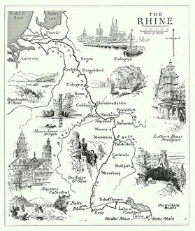
Background imageChart Collection: Famous rivers: The Rhine (litho)

Famous rivers: The Rhine (litho)
8634758 Famous rivers: The Rhine (litho) by English School, (20th century); Private Collection; (add.info.: The Rhine. Illustration for Chatterbox, 1913.); © Look and Learn.

Background imageChart Collection: Pox in animals (colour litho)

Pox in animals (colour litho)
8663541 Pox in animals (colour litho) by German School, (20th century); Private Collection; (add.info.: Section through a smallpox artificially implanted on a rabbit's cornea)

Background imageChart Collection: Battle of Ramillies, 23 May 1706 (engraving)

Battle of Ramillies, 23 May 1706 (engraving)
8641651 Battle of Ramillies, 23 May 1706 (engraving) by English School, (19th century); Private Collection; (add.info.: Battle of Ramillies, 23 May 1706)

Background imageChart Collection: Battle of Oudenarde, 11 July 1706 (engraving)

Battle of Oudenarde, 11 July 1706 (engraving)
8641648 Battle of Oudenarde, 11 July 1706 (engraving) by English School, (19th century); Private Collection; (add.info.: Battle of Oudenarde, 11 July 1706)

Background imageChart Collection: Diagram of life in the later Paleozoic or Palaeozoic Era (print)

Diagram of life in the later Paleozoic or Palaeozoic Era (print)
7420068 Diagram of life in the later Paleozoic or Palaeozoic Era (print); (add.info.: Diagram of life in the later Paleozoic or Palaeozoic Era. Swamp forest of the Carboniferous Age)

Background imageChart Collection: Course of Spanish Armada, British Isles and Ireland, 1588 (print)

Course of Spanish Armada, British Isles and Ireland, 1588 (print)
7419890 Course of Spanish Armada, British Isles and Ireland, 1588 (print); (add.info.: Ornamental map, decorated allegorically)

Background imageChart Collection: Map of the Eastern Empire and the Sassanids, 7th century. (print)

Map of the Eastern Empire and the Sassanids, 7th century. (print)
7420040 Map of the Eastern Empire and the Sassanids, 7th century. (print); (add.info.: Map of the Eastern Empire and the Sassanids, 7th century. From the book Outline of History by H.G)

Background imageChart Collection: Map of Rome and Carthage at the beginning of the Second Punic War, 218 BC, publ. 1923 (colour litho)

Map of Rome and Carthage at the beginning of the Second Punic War, 218 BC, publ. 1923 (colour litho)
2603515 Map of Rome and Carthage at the beginning of the Second Punic War, 218 BC, publ. 1923 (colour litho) by American School, (20th century); (add.info.: From Historical Atlas, published 1923.).

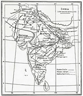
Background imageChart Collection: Map of India in the second century AD. From Hutchinson's History of the Nations, published 1915

Map of India in the second century AD. From Hutchinson's History of the Nations, published 1915
3033767 Map of India in the second century AD. From Hutchinson's History of the Nations, published 1915.; Private Collection.

Background imageChart Collection: Plan of Athens, Greece c.200 AD. From Historical Atlas, published 1923

Plan of Athens, Greece c.200 AD. From Historical Atlas, published 1923
2603507 Plan of Athens, Greece c.200 AD. From Historical Atlas, published 1923..

Background imageChart Collection: Map of the Athenian Empire at its height, c.450 B.C. From Historical Atlas

Map of the Athenian Empire at its height, c.450 B.C. From Historical Atlas, published 1923 (colour litho)
2603503 Map of the Athenian Empire at its height, c.450 B.C. From Historical Atlas, published 1923 (colour litho) by American School, (20th century).

Background imageChart Collection: Edmond Halley's solar eclipse chart

Edmond Halley's solar eclipse chart
5312010 Edmond Halley's solar eclipse chart; (add.info.: Engraving depicting Edmond Halley's solar eclipse chart, showing the path of the Moon's shadow)

Background imageChart Collection: 19th century Japanese acupuncture chart, 19th century

19th century Japanese acupuncture chart, 19th century
5309454 19th century Japanese acupuncture chart, 19th century; (add.info.: 19th century Japanese acupuncture chart. Dated 19th century 01/02/1860); Universal History Archive/UIG.

Background imageChart Collection: Diagram of Meteorology, displaying the various phenomena of the atmosphere, 1846-60 (engraving)

Diagram of Meteorology, displaying the various phenomena of the atmosphere, 1846-60 (engraving)
7340562 Diagram of Meteorology, displaying the various phenomena of the atmosphere, 1846-60 (engraving) by Reynolds, James (fl.c.1846-60) & Emslie

Background imageChart Collection: Map of the Waterloo Campaign, 1815. From The Story of England, published 1930

Map of the Waterloo Campaign, 1815. From The Story of England, published 1930
3058423 Map of the Waterloo Campaign, 1815. From The Story of England, published 1930.; Photo © Hilary Morgan.

Background imageChart Collection: Diagram of a special dry dock for hauling up a ship for repairs, 1850

Diagram of a special dry dock for hauling up a ship for repairs, 1850
3330796 Diagram of a special dry dock for hauling up a ship for repairs, 1850; (add.info.: Diagram of a special dry dock for hauling up a ship for repairs designed by Thomas Morton of Leith)

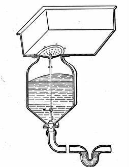
Background imageChart Collection: The workings of a toilet, 1850

The workings of a toilet, 1850
3359122 The workings of a toilet, 1850; (add.info.: Cutaway diagram showing the workings of a toilet. Dated 19th Century.); Universal History Archive/UIG.

Background imageChart Collection: Map of Spain in the middle ages during the Muslim occupation

Map of Spain in the middle ages during the Muslim occupation
3253078 Map of Spain in the middle ages during the Muslim occupation; (add.info.: Map of Spain in the middle ages during the Muslim occupation. From Enciclopedia Ilustrada Segui, published c. 1900).

Background imageChart Collection: Map of portion of the West Indies, from the Weimar Map of 1527, ascribed to Fernando Columbus

Map of portion of the West Indies, from the Weimar Map of 1527, ascribed to Fernando Columbus
2915343 Map of portion of the West Indies, from the Weimar Map of 1527, ascribed to Fernando Columbus. From the book Life of Christopher Columbus by Clements R

Background imageChart Collection: Hydrographia sive Charta Marina Portugalensium, c.1504. From the book Life of Christopher Columbus

Hydrographia sive Charta Marina Portugalensium, c.1504. From the book Life of Christopher Columbus by Clements R
2915325 Hydrographia sive Charta Marina Portugalensium, c.1504. From the book Life of Christopher Columbus by Clements R. Markham published 1892.; Photo © Hilary Morgan.

Background imageChart Collection: Map showing the course of Christopher Columbus from Guanahani to Cuba in 1492

Map showing the course of Christopher Columbus from Guanahani to Cuba in 1492
2915328 Map showing the course of Christopher Columbus from Guanahani to Cuba in 1492. From the book Life of Christopher Columbus by Clements R. Markham published 1892.; Photo © Hilary Morgan.

Background imageChart Collection: Ptolemaeus Map A.D. 150. From the book Life of Christopher Columbus by Clements R

Ptolemaeus Map A.D. 150. From the book Life of Christopher Columbus by Clements R. Markham published 1892
2915322 Ptolemaeus Map A.D. 150. From the book Life of Christopher Columbus by Clements R. Markham published 1892.; Photo © Hilary Morgan.

Background imageChart Collection: Diagram of a carburettor (litho)

Diagram of a carburettor (litho)
8636676 Diagram of a carburettor (litho) by English School, (20th century); Private Collection; (add.info.: Diagram of a carburettor)

Background imageChart Collection: Ancient Roman walls of Chester (litho)

Ancient Roman walls of Chester (litho)
8672213 Ancient Roman walls of Chester (litho) by English School, (20th century); Private Collection; (add.info.: The ancient Roman walls of the city of Chester, Cheshire)

Background imageChart Collection: A bird's-eye-view of some trenches, WW1 (litho)

A bird's-eye-view of some trenches, WW1 (litho)
8641510 A bird's-eye-view of some trenches, WW1 (litho) by English School, (20th century); Private Collection; (add.info.: A bird's-eye-view of some trenches, WW1)

Background imageChart Collection: Constellation of Andromeda from Johannes Bayer Uranometria Ulm 1723 (engraving)

Constellation of Andromeda from Johannes Bayer Uranometria Ulm 1723 (engraving)
531609 Constellation of Andromeda from Johannes Bayer Uranometria Ulm 1723 (engraving); (add.info.: Andromeda chained to rocks waiting for rescue by Perseus)

Background imageChart Collection: Republican presidents and statistics, 1876

Republican presidents and statistics, 1876
1576400 Republican presidents and statistics, 1876; (add.info.: National Republican chart 1876' Print shows Rutherford B. Hayes, facing right, and William A)


All Professionally Made to Order for Quick Shipping

"Unlocking the Secrets: Exploring the Fascinating World of Charts" Dive into the realm of reflexology with a detailed foot map chart, revealing hidden connections between pressure points and overall well-being. Immerse yourself in breathtaking artwork as "Kiss of the Oceans" captures the meeting point between Atlantic and Pacific through a mesmerizing chart inspired by the Panama Canal. Travel back in time with a captivating map showcasing the vast Ancient Persian Empire, unraveling its grandeur and historical significance. Follow in the footsteps of greatness as you trace King Alexander the Great's conquests on an intricate chart mapping his empire's expansion across continents. Join forces with The Salvation Army Campaign through their emblematic chart, highlighting their noble mission to bring hope and aid to those in need. Unveil Masonic mysteries through an enchanting chart that delves into both symbolic imagery and rich history surrounding Free and Accepted Masons. Embark on a journey through time with a remarkable Masonic chart, shedding light on ancient rituals, traditions, and brotherhood within this enigmatic society. Explore distant lands from centuries past as an Anglo-Saxon 10th-century world map unfolds before your eyes, offering insights into early cartography techniques. Discover rugged beauty amidst towering peaks with an old map of the Alps; let it guide you through nature's wonders while tracing historic routes taken by explorers long ago. Gain strategic insight during WWII using a military-focused map of Beirut, Lebanon; uncover hidden locations crucial for wartime operations throughout this historically significant cityscape. Step back in time to 1768 Edinburgh as James Craig's Map reveals New Town's first plan—a testament to meticulous topography shaping Scotland's capital cityscape over centuries. Test your vision acuity against an eye-catching eyesight test chart; decipher letters or symbols while appreciating the importance of visual health in our daily lives.