Fraud Blocker Skip to main content

Chart Collection (page 3)

"Unlocking the Secrets: Exploring the Fascinating World of Charts" Dive into the realm of reflexology with a detailed foot map chart

Background imageChart Collection: PEXP2A-00015

PEXP2A-00015
Captain James Cook regarding a map. Hand-colored woodcut of a painting

Background imageChart Collection: Chinese Acupuncture Char

Chinese Acupuncture Char
An ancient Chinese acupuncture chart

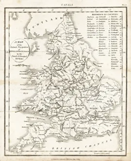
Background imageChart Collection: Inland navigation of England and Wales by

Inland navigation of England and Wales by
Map of the inland navigation of England and Wales by the canals and principal rivers, 1809. Copperplate engraving by Mutlow from John Mason Goods Pantologia, a New Encyclopedia, G

Background imageChart Collection: The Western Front battleground - map of August 1914

The Western Front battleground - map of August 1914
WW1 - The Western Front battleground - map of August 1914 Date: 1914

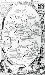
Background imageChart Collection: Natural and Moral Philosophy diagram, from The Gentlemans Recreation

Natural and Moral Philosophy diagram, from The Gentlemans Recreation
483354 Natural and Moral Philosophy diagram, from The Gentlemans Recreation published by Richard Blome, 1686 (engraving) by English School

Background imageChart Collection: Christmas scene at the Evelina Childrens Hospital

Christmas scene at the Evelina Childrens Hospital
Christmas comes but once a year -- a scene at the Evelina Childrens Hospital, founded in Southwark, London, in 1869. A sick little girl is visited by her mother and younger sister

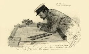
Background imageChart Collection: A Hansen, first officer on the Knivsberg, 1898. Creator: Christian Wilhelm Allers

A Hansen, first officer on the Knivsberg, 1898. Creator: Christian Wilhelm Allers
A Hansen, first officer on the Knivsberg, 1898. Portrait of a German crew member using compasses and parallel rulers to plot the course of the SS Knivsberg through the South China Sea

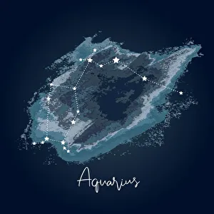
Background imageChart Collection: Modern Night Sky Constellation - Aquarius

Modern Night Sky Constellation - Aquarius
Simple, modern depiction of a celestial constellation on a navy backdrop. Aquarius is located near other water-related constellations: Cetus (the whale), Pisces (the fish)

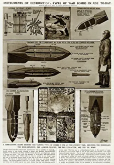
Background imageChart Collection: Types of war bombs in use by G. H. Davis

Types of war bombs in use by G. H. Davis
Instruments of destruction: types of war bombs in use during the Second World War. A comparative chart showing the various types, including the incendiary, the high explosive, the armour piercing

Background imageChart Collection: 1864, Johnson Map of Washington, Oregon, and Idaho, topography, cartography, geography

1864, Johnson Map of Washington, Oregon, and Idaho, topography, cartography, geography
1864, Johnson Map of Washington, Oregon, and Idaho

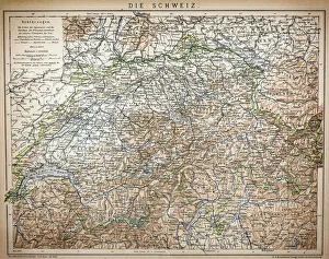
Background imageChart Collection: Antique Map of Switzerland

Antique Map of Switzerland from 1898

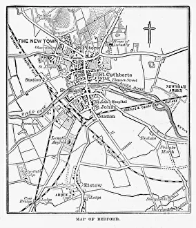
Background imageChart Collection: Map of the City of Bedford, England Victorian Engraving, 1840

Map of the City of Bedford, England Victorian Engraving, 1840
Very Rare, Beautifully Illustrated Antique Engraving of Map of the City of Bedford, England Victorian Engraving, 1840. Source: Original edition from my own archives

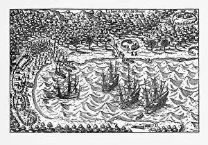
Background imageChart Collection: Island of Principe Historical Map by Van Noort, Circa 1598

Island of Principe Historical Map by Van Noort, Circa 1598
Very Rare, Beautifully Illustrated Antique Engraved Victorian Illustration of Historical Map of Van Noort at the Island of Principe, 1598. Copyright has expired on this artwork. Digitally restored

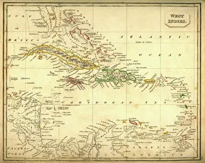
Background imageChart Collection: Antquie Map of The West Indies

Antquie Map of The West Indies
Vintage map of The West Indies from 1837

Background imageChart Collection: Commercial chart of the world map 1875

Commercial chart of the world map 1875
The Independent Course Comprehensive Geography by James Monteith, A.S. Barnes & Co, New York & Chicago 1875

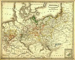
Background imageChart Collection: Antquie Map of Prussia

Antquie Map of Prussia
Vintage map of Prussia from 1837

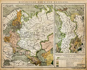
Background imageChart Collection: Historic map of Russia

Historic map of Russia
Illustration of a historic map of Russia

Background imageChart Collection: Map of Basses-Pyrenees, France

Map of Basses-Pyrenees, France

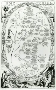
Background imageChart Collection: Rhetorick, from The Gentlemans Recreation published by Richard Blome

Rhetorick, from The Gentlemans Recreation published by Richard Blome
XJF483400 Rhetorick, from The Gentlemans Recreation published by Richard Blome, 1686 (engraving) by English School, (17th century); Private Collection; (add.info)

Background imageChart Collection: Map Of The World Showing In Red The Extent Of The British Empire In 1901

Map Of The World Showing In Red The Extent Of The British Empire In 1901

Background imageChart Collection: The Cantino planisphere, 1502. Artist: Anonymous master

The Cantino planisphere, 1502. Artist: Anonymous master
The Cantino planisphere, 1502. Found in the collection of the Biblioteca Estense Universitaria, Modena

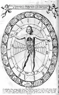
Background imageChart Collection: Influence of the Universe, the Macrocosm, on Man, the Microcosm, 1678

Influence of the Universe, the Macrocosm, on Man, the Microcosm, 1678. From Mundus Subterraneus by Athanasius Kircher. (Amsterdam, 1678)

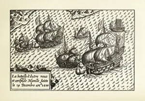
Background imageChart Collection: Engraving of Van Noort Landing in Manila Bay, Philippines, 1600

Engraving of Van Noort Landing in Manila Bay, Philippines, 1600
Very Rare, Beautifully Illustrated Antique Engraved Victorian Illustration of Historical Engraving of Van Noort Landing in Manila Bay, Philippines, 1600. Copyright has expired on this artwork

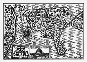
Background imageChart Collection: Historical Map of Dutch Navigators Island of Bali Illustration

Historical Map of Dutch Navigators Island of Bali Illustration
Very Rare, Beautifully Illustrated Antique Engraved Victorian Illustration of Historical Map of Dutch Navigators on the Island of Bali. Copyright has expired on this artwork. Digitally restored

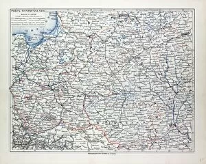
Background imageChart Collection: Map of Poland, Belarus and Ukraine, 1899

Map of Poland, Belarus and Ukraine, 1899

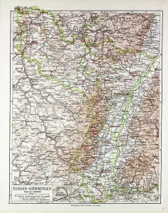
Background imageChart Collection: Map of Elsass-Lothringen, 1899

Map of Elsass-Lothringen, 1899

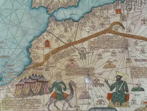
Background imageChart Collection: Detail from the Catalan Atlas, 1375 (vellum) (detail of 151844)

Detail from the Catalan Atlas, 1375 (vellum) (detail of 151844)
XZL387496 Detail from the Catalan Atlas, 1375 (vellum) (detail of 151844) by Cresques, Abraham (1325-87); Bibliotheque Nationale, Paris

Background imageChart Collection: Beerometer

Beerometer 1897 Date: 1897

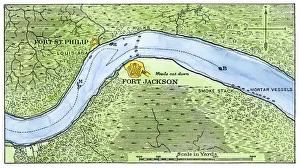
Background imageChart Collection: Lower Mississippi River defenses against Union ships, 1862

Lower Mississippi River defenses against Union ships, 1862
Route of the USS " Brooklyn" past Fort Jackson, Civil War battle of New Orleans, 1862. Hand-colored woodcut of a 19th-century illustration

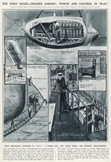
Background imageChart Collection: Power and control in R101

Power and control in R101
The first diesel-engined airship: power and control in R101. Illustrations of some of the features of R101: a power car, the chart room, and mooring arrangements

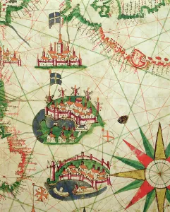
Background imageChart Collection: The Cities of Marseille and Genoa with their ports, from a nautical atlas, 1651

The Cities of Marseille and Genoa with their ports, from a nautical atlas, 1651
XOT330921 The Cities of Marseille and Genoa with their ports, from a nautical atlas, 1651 (ink on vellum) (detail from 330919) by Pietro Giovanni Prunes (fl)

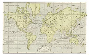
Background imageChart Collection: Wind chart map 1889

Wind chart map 1889
Indiana Educational Series The Complete Geography - Indianapolis 1889

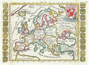
Background imageChart Collection: 1706, De La Feuille Map of Europe, topography, cartography, geography, land, illustration

1706, De La Feuille Map of Europe, topography, cartography, geography, land, illustration
1706, De La Feuille Map of Europe

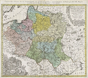
Background imageChart Collection: 1750, Homann Heirs Map of Poland, topography, cartography, geography, land, illustration

1750, Homann Heirs Map of Poland, topography, cartography, geography, land, illustration
1750, Homann Heirs Map of Poland

Background imageChart Collection: 1890, Bacon Travelers Pocket Map of London, England, topography, cartography

1890, Bacon Travelers Pocket Map of London, England, topography, cartography
1890, Bacon Travelers Pocket Map of London, England

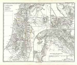
Background imageChart Collection: 1865, Spruner Map of Israel, Canaan, or Palestine in Ancient Times, topography, cartography

1865, Spruner Map of Israel, Canaan, or Palestine in Ancient Times, topography, cartography
1865, Spruner Map of Israel, Canaan, or Palestine in Ancient Times

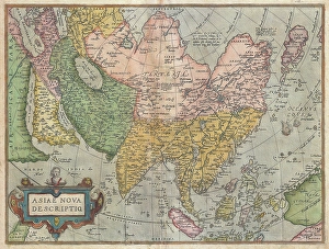
Background imageChart Collection: 1570, Ortelius Map of Asia, first edition, Abraham Ortelius, also Orthellius, 1527 - 1598

1570, Ortelius Map of Asia, first edition, Abraham Ortelius, also Orthellius, 1527 - 1598, Flemish, Netherlandish cartographer and geographer

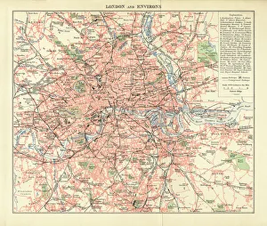
Background imageChart Collection: London and Environs Historical Map, Engraving, 1892

London and Environs Historical Map, Engraving, 1892
Very rare, beautifully detailed engraving of London and Environs Historical Map, Engraving, Published in 1892. Original edition from my own archives. Copyright has expired on this artwork
Background imageChart Collection: Map of the Umayyad Caliphate Empire in 750 and the Islamic Empire in 1215

Map of the Umayyad Caliphate Empire in 750 and the Islamic Empire in 1215

Background imageChart Collection: Map of Tarn, France

Map of Tarn, France
MAP OF TARN, FRANCE

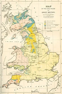
Background imageChart Collection: Map Showing The Coalfields Of Great Britain In The 19th Century

Map Showing The Coalfields Of Great Britain In The 19th Century. From The National Encyclopaedia, Published C. 1890
Map Showing The Coalfields Of Great Britain In The 19th Century. From The National Encyclopaedia, Published C.1890

Background imageChart Collection: 1818, Pinkerton Map of Chile, John Pinkerton, 1758 - 1826, Scottish antiquarian, cartographer

1818, Pinkerton Map of Chile, John Pinkerton, 1758 - 1826, Scottish antiquarian, cartographer, UK

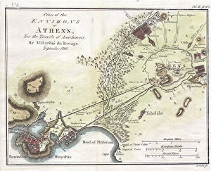
Background imageChart Collection: 1784, Bocage Map of the City of Athens in Ancient Greece, topography, cartography

1784, Bocage Map of the City of Athens in Ancient Greece, topography, cartography
1784, Bocage Map of the City of Athens in Ancient Greece

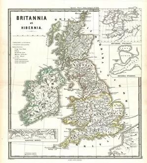
Background imageChart Collection: 1865, Spruner Map of the British Isles, England, Scotland, Ireland, topography, cartography

1865, Spruner Map of the British Isles, England, Scotland, Ireland, topography, cartography
1865, Spruner Map of the British Isles, England, Scotland, Ireland

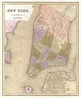
Background imageChart Collection: 1839, Bradford Map of New York City, New York, topography, cartography, geography

1839, Bradford Map of New York City, New York, topography, cartography, geography
1839, Bradford Map of New York City, New York

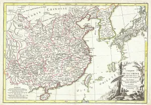
Background imageChart Collection: 1770, Bonne Map of China, Korea, Japan and Formosa, Rigobert Bonne 1727 - 1794, one

1770, Bonne Map of China, Korea, Japan and Formosa, Rigobert Bonne 1727 - 1794, one of the most important cartographers of the late 18th century

Background imageChart Collection: 1683, Mortier Map of North America, the West Indies, and the Atlantic Ocean, topography

1683, Mortier Map of North America, the West Indies, and the Atlantic Ocean, topography
1683, Mortier Map of North America, the West Indies, and the Atlantic Ocean


All Professionally Made to Order for Quick Shipping

"Unlocking the Secrets: Exploring the Fascinating World of Charts" Dive into the realm of reflexology with a detailed foot map chart, revealing hidden connections between pressure points and overall well-being. Immerse yourself in breathtaking artwork as "Kiss of the Oceans" captures the meeting point between Atlantic and Pacific through a mesmerizing chart inspired by the Panama Canal. Travel back in time with a captivating map showcasing the vast Ancient Persian Empire, unraveling its grandeur and historical significance. Follow in the footsteps of greatness as you trace King Alexander the Great's conquests on an intricate chart mapping his empire's expansion across continents. Join forces with The Salvation Army Campaign through their emblematic chart, highlighting their noble mission to bring hope and aid to those in need. Unveil Masonic mysteries through an enchanting chart that delves into both symbolic imagery and rich history surrounding Free and Accepted Masons. Embark on a journey through time with a remarkable Masonic chart, shedding light on ancient rituals, traditions, and brotherhood within this enigmatic society. Explore distant lands from centuries past as an Anglo-Saxon 10th-century world map unfolds before your eyes, offering insights into early cartography techniques. Discover rugged beauty amidst towering peaks with an old map of the Alps; let it guide you through nature's wonders while tracing historic routes taken by explorers long ago. Gain strategic insight during WWII using a military-focused map of Beirut, Lebanon; uncover hidden locations crucial for wartime operations throughout this historically significant cityscape. Step back in time to 1768 Edinburgh as James Craig's Map reveals New Town's first plan—a testament to meticulous topography shaping Scotland's capital cityscape over centuries. Test your vision acuity against an eye-catching eyesight test chart; decipher letters or symbols while appreciating the importance of visual health in our daily lives.