Fraud Blocker Skip to main content

Chart Collection (page 15)

"Unlocking the Secrets: Exploring the Fascinating World of Charts" Dive into the realm of reflexology with a detailed foot map chart

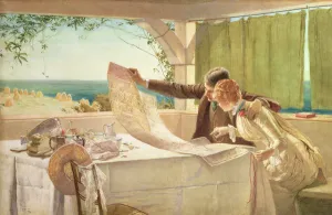
Background imageChart Collection: Where Next? (w / c on paper)

Where Next? (w / c on paper)
CW102919 Where Next? (w/c on paper) by Brewtnall, Edward Frederick (1846-1902); 47x73 cm; Private Collection; eChristopher Wood Gallery, London, UK; English, out of copyright

Background imageChart Collection: Submarine Blasting (engraving)

Submarine Blasting (engraving)
5207120 Submarine Blasting (engraving) by American School, (19th century); Private Collection; (add.info.: Submarine Blasting)

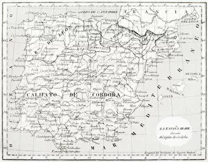
Background imageChart Collection: Map of Spain showing Caliphate of Cordoba

Map of Spain showing Caliphate of Cordoba
6317526 Map of Spain showing Caliphate of Cordoba by Spanish School, (19th century); (add.info.: Map of Spain showing the Caliphate of Cordoba, 929 - 1031)

Background imageChart Collection: Chart of the English Channel (coloured engraving)

Chart of the English Channel (coloured engraving)
5996473 Chart of the English Channel (coloured engraving) by English School, (19th century); Private Collection; (add.info.: Chart of the English Channel)

Background imageChart Collection: Illustration depicting mathematical charts, from 1538 edition

Illustration depicting mathematical charts, from 1538 edition
2626694 Illustration depicting mathematical charts, from 1538 edition, of Aju ib al-makhlA'qut wa-gharu ib al-mawjA'dut (Marvels of Things Created and Miraculous Aspects of Things Existing)

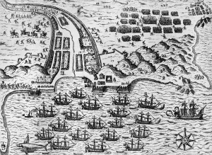
Background imageChart Collection: Attack on Santiago on 27th November 1585 (engraving)

Attack on Santiago on 27th November 1585 (engraving)
3740307 Attack on Santiago on 27th November 1585 (engraving) by Bry, Theodore de (1528-98); Private Collection; (add.info)

Background imageChart Collection: Map of Normandy after an illustration from Theatrum Orbis Terrarum sive Atlas Novus by

Map of Normandy after an illustration from Theatrum Orbis Terrarum sive Atlas Novus by
3518953 Map of Normandy after an illustration from Theatrum Orbis Terrarum sive Atlas Novus by Willem and Joan Blaeu, plate representing Normandia Ducatus (Normandy: Calvados, Manche, Orne, Eure)

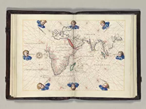
Background imageChart Collection: Fos. 11v-12r Chart 3: Indian Ocean, Portolan atlas of the world, Venice, c

Fos. 11v-12r Chart 3: Indian Ocean, Portolan atlas of the world, Venice, c
3482942 Fos. 11v-12r Chart 3: Indian Ocean, Portolan atlas of the world, Venice, c.1542-46 (pen & ink and tempera on vellum) by Agnese

Background imageChart Collection: Cartegena, from Drakes West Indian Voyage 1585 - 86, pub

Cartegena, from Drakes West Indian Voyage 1585 - 86, pub
2909734 Cartegena, from Drakes West Indian Voyage 1585 - 86, pub. 1589 (hand coloured engraving) by Boazio, Baptista (fl.1588-1606); Private Collection; (add.info)

Background imageChart Collection: Augustine from Drakes West Indian Voyage 1585 - 86, pub

Augustine from Drakes West Indian Voyage 1585 - 86, pub
2909619 Augustine from Drakes West Indian Voyage 1585 - 86, pub. 1589 (hand coloured engraving) by Boazio, Baptista (fl.1588-1606); Private Collection; (add.info)

Background imageChart Collection: Santiago, from Drakes West Indian Voyage 1585 - 86, pub

Santiago, from Drakes West Indian Voyage 1585 - 86, pub
2909617 Santiago, from Drakes West Indian Voyage 1585 - 86, pub. 1589 (hand coloured engraving) by Boazio, Baptista (fl.1588-1606); Private Collection; (add.info)

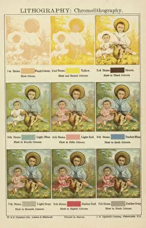
Background imageChart Collection: Lithography: Chromolithography (colour litho)

Lithography: Chromolithography (colour litho)
729317 Lithography: Chromolithography (colour litho) by English School, (19th century); Private Collection; (add.info.: Lithography: Chromolithography. W & R Chambers Ltd, London & Edinburgh)

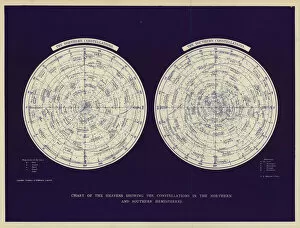
Background imageChart Collection: Chart of the heavens showing the constellations in the Northern and Southern Hemispheres

Chart of the heavens showing the constellations in the Northern and Southern Hemispheres (colour litho)
2813111 Chart of the heavens showing the constellations in the Northern and Southern Hemispheres (colour litho) by English School

Background imageChart Collection: Geological chart for Conversations with Little Geologists on the Six Days of Creation (colour litho)

Geological chart for Conversations with Little Geologists on the Six Days of Creation (colour litho)
3115202 Geological chart for Conversations with Little Geologists on the Six Days of Creation (colour litho) by English School

Background imageChart Collection: A Consultation previous to an Aerial Voyage from London to Wellburg in Nassau on the 7th

A Consultation previous to an Aerial Voyage from London to Wellburg in Nassau on the 7th
2652870 A Consultation previous to an Aerial Voyage from London to Wellburg in Nassau on the 7th day of November, 1836, pub

Background imageChart Collection: Family tree of the Davanzati family (oil on canvas)

Family tree of the Davanzati family (oil on canvas)
XOT361239 Family tree of the Davanzati family (oil on canvas) by Italian School, (18th century); 142x192 cm; Museo della Casa Fiorentina Antica, Palazzo Davanzati, Florence, Tuscany

Background imageChart Collection: Meta phisicks, from The Gentlemans Recreation published by Richard Blome

Meta phisicks, from The Gentlemans Recreation published by Richard Blome
483390 Meta phisicks, from The Gentlemans Recreation published by Richard Blome, 1686 (engraving) by English School, (17th century); Private Collection; (add.info)

Background imageChart Collection: Cosmgrarhy and Astrology, from The Gentlemans Recreation

Cosmgrarhy and Astrology, from The Gentlemans Recreation
483376 Cosmgrarhy and Astrology, from The Gentlemans Recreation published by Richard Blome, 1686 (engraving) by English School

Background imageChart Collection: A guide to navigation, from The Gentlemans Recreation

A guide to navigation, from The Gentlemans Recreation
483359 A guide to navigation, from The Gentlemans Recreation published by Richard Blome, 1686 (engraving) by English School

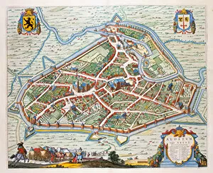
Background imageChart Collection: Aalst, 1649 (hand-coloured engraving)

Aalst, 1649 (hand-coloured engraving)
478387 Aalst, 1649 (hand-coloured engraving) by Blaeu, Joan (1596-1673); Private Collection; (add.info.: Aalst, a town in Flanders)

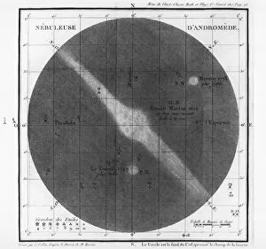
Background imageChart Collection: Charles-Joseph Messier (1730-1817) observations of a nebula of Andromeda

Charles-Joseph Messier (1730-1817) observations of a nebula of Andromeda
ACD224709 Charles-Joseph Messier (1730-1817) observations of a nebula of Andromedas belt 1807 (engraving) (b/w photo) by French School, (19th century); Academie des Sciences, Paris

Background imageChart Collection: Chart of English Channel and Thames showing Track taken by Orient Line Steamers between Plymouth

Chart of English Channel and Thames showing Track taken by Orient Line Steamers between Plymouth and London (litho)
3651367 Chart of English Channel and Thames showing Track taken by Orient Line Steamers between Plymouth and London (litho) by English School

Background imageChart Collection: Happy Businessman Pointing to Bulletin Board, 1920s (line print)

Happy Businessman Pointing to Bulletin Board, 1920s (line print)
3035837 Happy Businessman Pointing to Bulletin Board, 1920s (line print) by American School, (20th century); (add.info.: Vintage illustration of a smiling businessman pointing to a blank chart or)

Background imageChart Collection: The Missing India Mail, Total Loss of the Memnon Steamer, with the Bombay Mail of the 20 July

The Missing India Mail, Total Loss of the Memnon Steamer, with the Bombay Mail of the 20 July (engraving)
1100779 The Missing India Mail, Total Loss of the Memnon Steamer, with the Bombay Mail of the 20 July (engraving) by English School

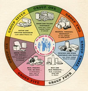
Background imageChart Collection: Illustration of the Basic Food Groups, 1946 (screen print)

Illustration of the Basic Food Groups, 1946 (screen print)
2622221 Illustration of the Basic Food Groups, 1946 (screen print) by American School, (20th century); Private Collection; (add.info.: Vintage diagram of the Basic Seven Food Groups; screen print)

Background imageChart Collection: Chart of the Armadas Course (engraving)

Chart of the Armadas Course (engraving)
662636 Chart of the Armadas Course (engraving) by English School, (19th century); Private Collection; (add.info.: Chart of the Armadas Course)

Background imageChart Collection: Constellation of Cetus the Whale, from Atlas Coelestis

Constellation of Cetus the Whale, from Atlas Coelestis
STC128637 Constellation of Cetus the Whale, from Atlas Coelestis by John Flamsteed (1646-1719), pub. in 1729 (hand coloured engraving) by Thornhill

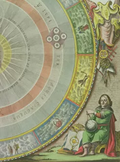
Background imageChart Collection: Nicolaus Copernicus (1473-1543), detail from a Map showing the Copernican System of

Nicolaus Copernicus (1473-1543), detail from a Map showing the Copernican System of
STC129826 Nicolaus Copernicus (1473-1543), detail from a Map showing the Copernican System of Planetary Orbits, Planisphaerium Copernicanum, from The Celestial Atlas

Background imageChart Collection: Map of Southern India and Ceylon, after a work made circa 1720 by Dutch cartographer

Map of Southern India and Ceylon, after a work made circa 1720 by Dutch cartographer
5892377 Map of Southern India and Ceylon, after a work made circa 1720 by Dutch cartographer Adriaan Reland (engraving) by Reland, Adriaan (1676-1718) (after); Private Collection; Dutch

Background imageChart Collection: Chart of business conditions (litho)

Chart of business conditions (litho)
6008313 Chart of business conditions (litho) by English School, (20th century); Private Collection; (add.info.: Chart of business conditions)

Background imageChart Collection: English History: The fourteenth century (colour litho)

English History: The fourteenth century (colour litho)
6029601 English History: The fourteenth century (colour litho) by English School, (19th century); Private Collection; (add.info.: The fourteenth century)

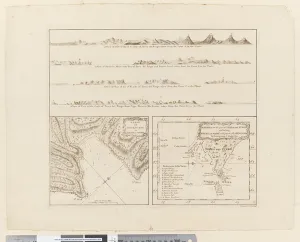
Background imageChart Collection: ii. (a) Four profiles of the coast of Terra del Fuego (b

ii. (a) Four profiles of the coast of Terra del Fuego (b
5670247 ii. (a) Four profiles of the coast of Terra del Fuego (b) A plan of Success Bay in Strait le Maire (c) A chart of the S.E. part of Terra del Fuego, engraved by T. Borven and J

Background imageChart Collection: Out of their Reckoning, 1892 (oil on canvas)

Out of their Reckoning, 1892 (oil on canvas)
1147315 Out of their Reckoning, 1892 (oil on canvas) by Starling, Albert (c.1878-1922); Private Collection; Peter Newark Pictures; British, out of copyright

Background imageChart Collection: The Four Voyages of Christopher Columbus, from Life of Christopher Columbus

The Four Voyages of Christopher Columbus, from Life of Christopher Columbus
1772340 The Four Voyages of Christopher Columbus, from Life of Christopher Columbus by Clements R. Markham, published 1892 (colour litho) by English School

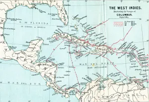
Background imageChart Collection: Map of the West Indies illustrating the voyages of Christopher Columbus

Map of the West Indies illustrating the voyages of Christopher Columbus
1772337 Map of the West Indies illustrating the voyages of Christopher Columbus, from Life of Christopher Columbus by Clements R

Background imageChart Collection: Chart of the Sea of Azoff and the Straits of Kertch and Yenikale (engraving)

Chart of the Sea of Azoff and the Straits of Kertch and Yenikale (engraving)
1602299 Chart of the Sea of Azoff and the Straits of Kertch and Yenikale (engraving) by Dower, John (fl.c.1845-55); Private Collection; (add.info)

Background imageChart Collection: The Reinterment of Christopher Columbus at Seville (engraving)

The Reinterment of Christopher Columbus at Seville (engraving)
1598436 The Reinterment of Christopher Columbus at Seville (engraving) by English School, (19th century); Private Collection; (add.info.: The Reinterment of Christopher Columbus at Seville)

Background imageChart Collection: The celestial chart of the southern hemisphere (woodcut)

The celestial chart of the southern hemisphere (woodcut)
1217327 The celestial chart of the southern hemisphere (woodcut) by DAorer or Duerer, Albrecht (1471-1528); 43.4x41.9 cm; Ashmolean Museum, University of Oxford, UK; eAshmolean Museum; German

Background imageChart Collection: Field of Waterloo, c. 1820 (coloured engraving)

Field of Waterloo, c. 1820 (coloured engraving)
1268355 Field of Waterloo, c.1820 (coloured engraving) by Jackson, W. (fl.1820); National Army Museum, London; (add.info.: Based on a trigonometrical survey of 1815 by S)

Background imageChart Collection: Pages from Kitab Durr Al-Munazzam Fi Al-Sirr Al-A zam

Pages from Kitab Durr Al-Munazzam Fi Al-Sirr Al-A zam
3281669 Pages from Kitab Durr Al-Munazzam Fi Al-Sirr Al-A zam by Kamal Al-Din Abu Salim Muhammad Bin Talha Al-Qurashi Al- Adawi Al-Rasibi Al-Halabi (d.1254)

Background imageChart Collection: Chart of the Island of Timor, c. 1760 (ink and wash on paper)

Chart of the Island of Timor, c. 1760 (ink and wash on paper)
986261 Chart of the Island of Timor, c.1760 (ink and wash on paper) by Dutch School, (18th century); 90x58.5 cm; Private Collection; (add.info.: Chart of the Island of Timor)

Background imageChart Collection: Portolan Chart of Western Europe and North Africa, c. 1580 (sepia ink and colour on vellum

Portolan Chart of Western Europe and North Africa, c. 1580 (sepia ink and colour on vellum
986016 Portolan Chart of Western Europe and North Africa, c.1580 (sepia ink and colour on vellum) by Dutch School, (16th century); 89x73 cm; Private Collection; (add.info)

Background imageChart Collection: Portolan Chart of Western Europe and North Africa, 1578 (sepia ink and colours on vellum)

Portolan Chart of Western Europe and North Africa, 1578 (sepia ink and colours on vellum)
986015 Portolan Chart of Western Europe and North Africa, 1578 (sepia ink and colours on vellum) by Teixeira, Luis (fl.1564-1612); 69x61 cm; Private Collection; (add.info)

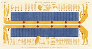
Background imageChart Collection: Thebes, Byban el Molouk, c. 1809-1812 (colour engraving)

Thebes, Byban el Molouk, c. 1809-1812 (colour engraving)
985775 Thebes, Byban el Molouk, c.1809-1812 (colour engraving) by Legentil (19th century) (after); Private Collection; (add.info.: Thebes)

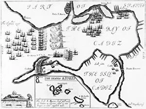
Background imageChart Collection: The Capture of Cadiz in 1596 (engraving)

The Capture of Cadiz in 1596 (engraving)
3740308 The Capture of CAadiz in 1596 (engraving) by English School, (16th century); Private Collection; (add.info.: During the Anglo-Spanish War, English and Dutch troops under Robert Devereux)

Background imageChart Collection: View of London by Wenceslaus Hollar, 1647 (engraving) (detail of 560194)

View of London by Wenceslaus Hollar, 1647 (engraving) (detail of 560194)
1077811 View of London by Wenceslaus Hollar, 1647 (engraving) (detail of 560194) by English School, (19th century); Private Collection; (add.info.: From the original in the Guildhall Library)

Background imageChart Collection: Deviation of the Alexander on the 27th July, illustration from A Voyage of discovery

Deviation of the Alexander on the 27th July, illustration from A Voyage of discovery
931422 Deviation of the Alexander on the 27th July, illustration from A Voyage of discovery... 1819 (litho) by Ross, John (1777-1856) (after); Private Collection; (add.info.: A Voyage of discovery)


All Professionally Made to Order for Quick Shipping

"Unlocking the Secrets: Exploring the Fascinating World of Charts" Dive into the realm of reflexology with a detailed foot map chart, revealing hidden connections between pressure points and overall well-being. Immerse yourself in breathtaking artwork as "Kiss of the Oceans" captures the meeting point between Atlantic and Pacific through a mesmerizing chart inspired by the Panama Canal. Travel back in time with a captivating map showcasing the vast Ancient Persian Empire, unraveling its grandeur and historical significance. Follow in the footsteps of greatness as you trace King Alexander the Great's conquests on an intricate chart mapping his empire's expansion across continents. Join forces with The Salvation Army Campaign through their emblematic chart, highlighting their noble mission to bring hope and aid to those in need. Unveil Masonic mysteries through an enchanting chart that delves into both symbolic imagery and rich history surrounding Free and Accepted Masons. Embark on a journey through time with a remarkable Masonic chart, shedding light on ancient rituals, traditions, and brotherhood within this enigmatic society. Explore distant lands from centuries past as an Anglo-Saxon 10th-century world map unfolds before your eyes, offering insights into early cartography techniques. Discover rugged beauty amidst towering peaks with an old map of the Alps; let it guide you through nature's wonders while tracing historic routes taken by explorers long ago. Gain strategic insight during WWII using a military-focused map of Beirut, Lebanon; uncover hidden locations crucial for wartime operations throughout this historically significant cityscape. Step back in time to 1768 Edinburgh as James Craig's Map reveals New Town's first plan—a testament to meticulous topography shaping Scotland's capital cityscape over centuries. Test your vision acuity against an eye-catching eyesight test chart; decipher letters or symbols while appreciating the importance of visual health in our daily lives.