Fraud Blocker Skip to main content

Cartography Collection (page 100)

Cartography, the art of mapmaking, has a rich history that spans centuries and continents

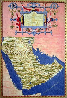
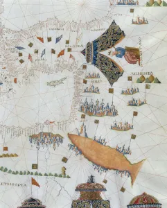
Background imageCartography Collection: Map of Sixteenth Century Arabia, from the Sala delle Carte Geografiche

Map of Sixteenth Century Arabia, from the Sala delle Carte Geografiche
BEN90575 Map of Sixteenth Century Arabia, from the Sala delle Carte Geografiche (Hall of Geographical Maps) 1575 (oil on panel) by Bonsignori, Stefano and Danti

Background imageCartography Collection: Map of Sixteenth Century Germany, from the Sala delle Carte Geografiche

Map of Sixteenth Century Germany, from the Sala delle Carte Geografiche
BEN90572 Map of Sixteenth Century Germany, from the Sala delle Carte Geografiche (Hall of Geographical Maps) 1575 (oil on panel) by Bonsignori, Stefano and Danti

Background imageCartography Collection: Map of Sixteenth Century Europe, from the Sala del Mappamondo

Map of Sixteenth Century Europe, from the Sala del Mappamondo
BEN95818 Map of Sixteenth Century Europe, from the Sala del Mappamondo (Hall of the World Maps) c.1574-5 (fresco) by Vecchi, Giovanni de (1536-1615) (and workshop); Villa Farnese, Caprarola, Voterbo

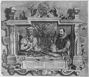
Background imageCartography Collection: Double portrait of Gerard Mercator (1512-94) and Jodocus Hondius (1563-1612

Double portrait of Gerard Mercator (1512-94) and Jodocus Hondius (1563-1612
XIR174686 Double portrait of Gerard Mercator (1512-94) and Jodocus Hondius (1563-1612) engraved for inclusion in the Mercator and Hondius series of atlases

Background imageCartography Collection: Page 37b Map of Charlestown and state of the Kings troops, March 11 1780 (pencil

Page 37b Map of Charlestown and state of the Kings troops, March 11 1780 (pencil
5670303 Page 37b Map of Charlestown and state of the Kings troops, March 11 1780 (pencil, pen & ink) by Hodges, William (1744-97); Mitchell Library

Background imageCartography Collection: ia. A Plan of the Harbour of St Johns in Newfoundland, 1760s (pen & ink and wash)

ia. A Plan of the Harbour of St Johns in Newfoundland, 1760s (pen & ink and wash)
5670245 ia. A Plan of the Harbour of St Johns in Newfoundland, 1760s (pen & ink and wash) by Cook, James (1728-79); Mitchell Library, State Library of New South Wales; (add.info.: Original Sketches)

Background imageCartography Collection: Globe, 16th century (wood, metal, engraving)

Globe, 16th century (wood, metal, engraving)
AIS5338586 Globe, 16th century (wood, metal, engraving) by Mercator, Gerardus (1512-94); 64 x 55 cm; Mercatormuseum, Sint-Nikls

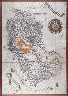
Background imageCartography Collection: Map of the Arabian Peninsula, with wind rose and details of ports and sea coasts

Map of the Arabian Peninsula, with wind rose and details of ports and sea coasts
AIS5334416 Map of the Arabian Peninsula, with wind rose and details of ports and sea coasts, in Atlas de Joan Martines, 1587 (manuscript) by Martines, Joan (1556-1590); Biblioteca Nacional, Madrid

Background imageCartography Collection: Page 38b The Track of His Majestys ship Perseverance between Rutland

Page 38b The Track of His Majestys ship Perseverance between Rutland
5670306 Page 38b The Track of His Majestys ship Perseverance between Rutland and the Cinque Islands (pen & ink) by Unknown artist, (18th century); Mitchell Library

Background imageCartography Collection: Catalan Atlas, Sheet 7, 1375 (pen and coloured inks on parchment)

Catalan Atlas, Sheet 7, 1375 (pen and coloured inks on parchment)
5054643 Catalan Atlas, Sheet 7, 1375 (pen and coloured inks on parchment) by Cresques, Abraham (1325-87); Bibliotheque Nationale, Paris, France; (add.info.: World map made in Majorca)

Background imageCartography Collection: Cathay, China from the Catalan Atlas (reproduction)

Cathay, China from the Catalan Atlas (reproduction)
5054664 Cathay, China from the Catalan Atlas (reproduction) by Cresques, Abraham (1325-87) (after); (add.info.: Detail from the reproduction of 1375 World map made in Majorca)

Background imageCartography Collection: Catalan Atlas, Sheet 4 (pen with coloured inks on parchment)

Catalan Atlas, Sheet 4 (pen with coloured inks on parchment)
5054648 Catalan Atlas, Sheet 4 (pen with coloured inks on parchment) by Cresques, Abraham (1325-87); Bibliotheque Nationale, Paris

Background imageCartography Collection: Catalan Atlas, Sheet 3, 1375 (pen and coloured inks on parchment)

Catalan Atlas, Sheet 3, 1375 (pen and coloured inks on parchment)
5054642 Catalan Atlas, Sheet 3, 1375 (pen and coloured inks on parchment) by Cresques, Abraham (1325-87); Bibliotheque Nationale, Paris

Background imageCartography Collection: Map of the city of Vienna, 1692 (colour engraving)

Map of the city of Vienna, 1692 (colour engraving)
1195493 Map of the city of Vienna, 1692 (colour engraving) by Sanson D Abbeville, Nicolas (1600-1667) (after); Private Collection; Photo eChristies Images; French, out of copyright

Background imageCartography Collection: Town Plan of Paris, 1572 (engraving)

Town Plan of Paris, 1572 (engraving)
1195492 Town Plan of Paris, 1572 (engraving) by Braun, Georg (1541-1622) and Hogenberg, Franz (1535-90); 34x48 cm; Private Collection; Photo eChristies Images; German, out of copyright

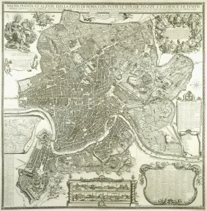
Background imageCartography Collection: Town Plan of Rome, 1730 (etching and engraving)

Town Plan of Rome, 1730 (etching and engraving)
1195491 Town Plan of Rome, 1730 (etching and engraving) by Falda, Giovanni Battista (c.1648-78) (after); 46x31 cm; Private Collection; Photo eChristies Images; Italian, out of copyright

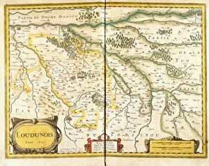
Background imageCartography Collection: Map of Loudunois in 1627, 1631 (hand-coloured engraving)

Map of Loudunois in 1627, 1631 (hand-coloured engraving)
1195405 Map of Loudunois in 1627, 1631 (hand-coloured engraving) by European School, (17th century); 42x28 cm; Private Collection; Photo eChristies Images; out of copyright

Background imageCartography Collection: Map showing Portugal, c. 1680 (hand-coloured engraving)

Map showing Portugal, c. 1680 (hand-coloured engraving)
1195404 Map showing Portugal, c.1680 (hand-coloured engraving) by Wit, Frederik de (c.1629-1706) (after); 52x32 cm; Private Collection; (add.info.: Wit)

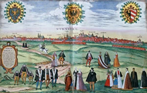
Background imageCartography Collection: A panoramic view of Nuremberg, with figures in local dress in the foreground, c

A panoramic view of Nuremberg, with figures in local dress in the foreground, c
1195402 A panoramic view of Nuremberg, with figures in local dress in the foreground, c.1575 (hand-coloured engraving) by German School

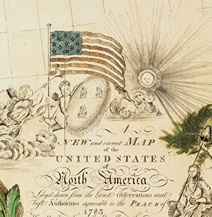
Background imageCartography Collection: Americas first national map, 1784 (hand-coloured engraving)

Americas first national map, 1784 (hand-coloured engraving)
1268148 Americas first national map, 1784 (hand-coloured engraving) by Buell, Abel (1742-1822); 115.2x128.6 cm; Private Collection; (add.info)

Background imageCartography Collection: Map of New England, from Historia Mundi: or Mercators Atlas, London

Map of New England, from Historia Mundi: or Mercators Atlas, London
3964030 Map of New England, from Historia Mundi: or Mercators Atlas, London, 1635 (engraving) by Mercator, Gerardus (1512-94)

Background imageCartography Collection: Fabriano Terra Famosissima di Italia, 1630 (engraving)

Fabriano Terra Famosissima di Italia, 1630 (engraving)
1272182 Fabriano Terra Famosissima di Italia, 1630 (engraving) by Buti, Michele (fl.1630s) & Greuter, Matthaus (c.1556-1638); 41.3x55 cm; Private Collection; Photo eChristies Images; out of copyright

Background imageCartography Collection: Navigation chart showing China, Ceylon and the Philippines and the Tropics of Cancer

Navigation chart showing China, Ceylon and the Philippines and the Tropics of Cancer and Capricorn, c. 1540 (vellum)
3854274 Navigation chart showing China, Ceylon and the Philippines and the Tropics of Cancer and Capricorn, c.1540 (vellum) by Agnese, Battista (1514-64); Photo © Derek Bayes

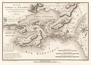
Background imageCartography Collection: Plan du Combat de Salamine Pour le Voyage du Jeune Anacharsis

Plan du Combat de Salamine Pour le Voyage du Jeune Anacharsis
5615776 Plan du Combat de Salamine Pour le Voyage du Jeune Anacharsis (Plan of the Battle of Salamis 480 BC) by Jean Denis Barbie du Bocage (1760-1825)

Background imageCartography Collection: Map of the Azores archipelago by Benedetto Bordone, 16th century

Map of the Azores archipelago by Benedetto Bordone, 16th century
AIS5389758 Map of the Azores archipelago by Benedetto Bordone, 16th century by Bordone, Benedetto (c.1450-1530); Museo Navale di Pegli, Genoa, Italy; (add.info.: Map of the Azores archipelago)

Background imageCartography Collection: Siege of la Rochelle, 17th century painting after Jacques Caillot

Siege of la Rochelle, 17th century painting after Jacques Caillot
AIS5348047 Siege of la Rochelle, 17th century painting after Jacques Caillot by Callot, Jacques (1592-1635) (after); Musee et Domaine National de Versailles et de Trianon, Versailles

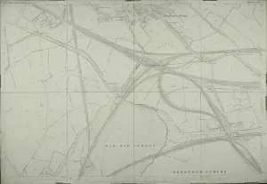
Background imageCartography Collection: Map of Willesden, London (litho)

Map of Willesden, London (litho)
1762027 Map of Willesden, London (litho) by English School; London Metropolitan Archives, City of London; (add.info.: Willesden is an area in North West London which forms part of the London Borough)

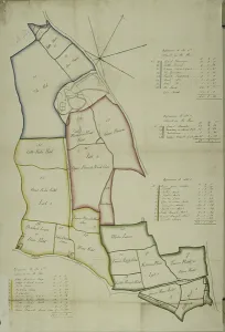
Background imageCartography Collection: Map of Willesden, London (litho)

Map of Willesden, London (litho)
1762021 Map of Willesden, London (litho) by English School; London Metropolitan Archives, City of London; (add.info.: Willesden is an area in North West London which forms part of the London Borough)

Background imageCartography Collection: Oronce Fine (engraving)

Oronce Fine (engraving)
816560 Oronce Fine (engraving) by Thevet, Andre (1504-92) (after); Private Collection; (add.info.: Oronce Fine, French mathematician and cartographer)

Background imageCartography Collection: A Nautical Map, detail of the Gran Turco, 1564 (colour litho)

A Nautical Map, detail of the Gran Turco, 1564 (colour litho)
955466 A Nautical Map, detail of the Gran Turco, 1564 (colour litho) by Maggiolo, Giacomo (16th Century); Biblioteca Civica Bertoliana, Vicenza, Italy; Alinari

Background imageCartography Collection: Europe, 1814 (litho)

Europe, 1814 (litho)
955444 Europe, 1814 (litho) by Bower, John (fl.1810-19); New York Public Library, USA; (add.info.: Published by Mathew Carey (1760-1839)); American, out of copyright

Background imageCartography Collection: Map of Rutland (colour engraving)

Map of Rutland (colour engraving)
979826 Map of Rutland (colour engraving) by English School, (18th century); Private Collection; (add.info.: Map of Rutland)

Background imageCartography Collection: Map of the East Riding of Yorkshire (colour engraving)

Map of the East Riding of Yorkshire (colour engraving)
979803 Map of the East Riding of Yorkshire (colour engraving) by Morden, Robert (fl.1682-1703); Private Collection; (add.info.: Map of the East Riding of Yorkshire, by Robert Morden)

Background imageCartography Collection: Map of Durham (colour engraving)

Map of Durham (colour engraving)
979802 Map of Durham (colour engraving) by Morden, Robert (fl.1682-1703); Private Collection; (add.info.: Map of Durham (Episdopaius Dunelmensis vulgo the Bishoprick of Durham), by Robert Morden

Background imageCartography Collection: Mexico or New Spain containing New Mexico, California with a portion of adjacent countries

Mexico or New Spain containing New Mexico, California with a portion of adjacent countries
3658102 Mexico or New Spain containing New Mexico, California with a portion of adjacent countries, from Tome IV of the " New Atlas", engraved by G

Background imageCartography Collection: Vernal Equinox, Plate 2 from Globi coelestis in tabulas planas redacti descriptio, pub

Vernal Equinox, Plate 2 from Globi coelestis in tabulas planas redacti descriptio, pub
3075758 Vernal Equinox, Plate 2 from Globi coelestis in tabulas planas redacti descriptio, pub. 1674 (hand coloured engraving) by Pardies

Background imageCartography Collection: Map of the Region of Basse-Normandie in France (litho)

Map of the Region of Basse-Normandie in France (litho)
LRI3024911 Map of the Region of Basse-Normandie in France (litho) by French School; (add.info.: Manche (French pronunciation: ai[mE IzEz]) is a French department in Normandy (Normandie)

Background imageCartography Collection: Map of Florida and Cuba by Jacques Le Moyne, 1591 (engraving)

Map of Florida and Cuba by Jacques Le Moyne, 1591 (engraving)
3036188 Map of Florida and Cuba by Jacques Le Moyne, 1591 (engraving) by Le Moyne, Jacques (de Morgues) (1533-88); (add.info.: Map of Florida and Cuba by Jacques Le Moyne (French, c)

Background imageCartography Collection: Gerardus Mercator (colour litho)

Gerardus Mercator (colour litho)
3098174 Gerardus Mercator (colour litho) by American School, (20th century); Private Collection; (add.info.: Gerardus Mercator (1512-1594), Flemish cartographer and mathematician

Background imageCartography Collection: The March of Ancona, 1783 (hand-coloured etching)

The March of Ancona, 1783 (hand-coloured etching)
1067373 The March of Ancona, 1783 (hand-coloured etching) by Zatta, Antonio (1757-97); Dallas Museum of Art, Texas, USA; (add.info.: La Marca di Ancona Engraver giuliano zuliani (Italian)

Background imageCartography Collection: A Map of the World, 1511 (woodcut, red and black ink)

A Map of the World, 1511 (woodcut, red and black ink)
985939 A Map of the World, 1511 (woodcut, red and black ink) by Italian School, (16th century); 42.5x28.5 cm; Private Collection; (add.info.: A Map of the World)


All Professionally Made to Order for Quick Shipping

Cartography, the art of mapmaking, has a rich history that spans centuries and continents. From ancient civilizations to modern times, maps have been used as powerful tools for navigation, exploration, and understanding the world around us. One notable example of early the Hereford Mappa Mundi, created in 1285 by Richard de Bello. This intricate map depicts a combination of geographical features and religious symbolism, offering a unique perspective on medieval Europe. Another remarkable piece is Al-Idrisi's world map from 1154. Crafted during the Islamic Golden Age, this map showcases an impressive level of detail and accuracy for its time. It highlights trade routes and important cities across Africa, Asia, and Europe. For those interested in British history, antique maps provide fascinating insights into different eras. An antique map depicting Britain under the Anglo Saxons offers a glimpse into the island's past before Norman conquests reshaped its landscape. Similarly captivating is an antique map showcasing the vast Roman Empire at its height. This visual representation allows us to trace their expansive territories across Europe, North Africa, and parts of Asia. Moving forward in time brings us to more recent cartographic works like the Map of Cyprus published in 1880. This detailed depiction captures not only geographical features but also cultural landmarks that define this Mediterranean island nation. Maps are not limited to landmasses alone; they can also illustrate political boundaries on larger scales. A Political Map of Africa provides valuable information about countries' borders and capital cities within this diverse continent. On a smaller scale but equally significant is California Highway Map—a practical tool for travelers navigating through one of America's most populous states with ease. Exploring historical empires leads us to delve into Byzantine history with a Map of the Byzantine Empire from the 9th century—showcasing Constantinople as its vibrant heart while encompassing regions stretching from Greece to Egypt.