Home > Europe > France > Maps
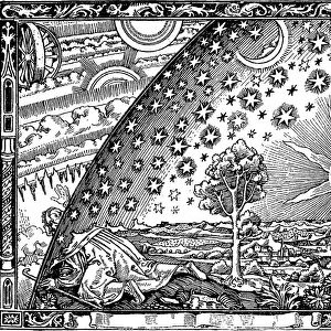
Map of Loudunois in 1627, 1631 (hand-coloured engraving)
")
![]()
Wall Art and Photo Gifts from Fine Art Finder
Map of Loudunois in 1627, 1631 (hand-coloured engraving)
1195405 Map of Loudunois in 1627, 1631 (hand-coloured engraving) by European School, (17th century); 42x28 cm; Private Collection; Photo eChristies Images; out of copyright
Media ID 22317730
© Christie's Images / Bridgeman Images
1620s 1627 1630s Artist German Capital Letter Cartography Double Page Early Seventeenth Century Elevated Elevated View Engraved French Text Geographic Gerard Gerard Mercator German Art German Artist Hand Colored Hand Coloring Hand Coloured Hand Colouring Hand Tinted Handcolored Hillside Hilly Language Lettering Navigational Equipment Page Printed Prints Word 1631 Early 17th Century Handcoloured Mercator Natural Space
FEATURES IN THESE COLLECTIONS
> Arts
> Artists
> Related Images
> Fine Art Finder
> Artists
> European School
> Fine Art Finder
> Artists
> Frederik de (after) Wit
> Maps and Charts
> Early Maps
EDITORS COMMENTS
This hand-coloured engraving from the 17th century showcases a captivating map of Loudunois in 1627 and 1631. Measuring at a size of 42x28 cm, this print is part of a private collection that beautifully captures the essence of cartography during this era. The elevated view allows us to appreciate the intricate details and craftsmanship put into creating this piece. The artist's skillful hand tinting brings life to the hilly landscapes depicted on the map, showcasing natural spaces with precision and artistry. The inclusion of navigational equipment further adds to its historical significance, providing insight into how maps were used for exploration during the early seventeenth century. French text accompanies the map, adding an authentic touch to its overall aesthetic. The lettering is meticulously engraved, emphasizing both clarity and elegance. This close-up view highlights every minute detail, including color variations and delicate lines that make up this remarkable work. As we delve deeper into this print, we are transported back in time to witness European cartography at its finest. With no people present within the image itself, our focus remains solely on appreciating the artistry behind it. Overall, this hand-coloured engraving by an unknown European artist truly encapsulates both beauty and functionality in one stunning piece. Its historical significance combined with meticulous attention to detail makes it a valuable addition to any collection or display dedicated to exploring Europe's rich geography during the seventeenth century.
MADE IN THE USA
Safe Shipping with 30 Day Money Back Guarantee
FREE PERSONALISATION*
We are proud to offer a range of customisation features including Personalised Captions, Color Filters and Picture Zoom Tools
SECURE PAYMENTS
We happily accept a wide range of payment options so you can pay for the things you need in the way that is most convenient for you
* Options may vary by product and licensing agreement. Zoomed Pictures can be adjusted in the Cart.