Framed Print > Maps and Charts > World
Framed Print : NOSTRADAMUS - CLIMATA Nostradamus frequently made references to places by way of


![]()
Framed Photos From TopFoto
NOSTRADAMUS - CLIMATA Nostradamus frequently made references to places by way of
NOSTRADAMUS - CLIMATA
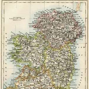
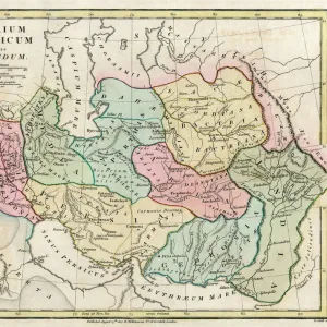
Nostradamus frequently made references to places by way of latitudes (in the 16th century normally called climata) familiar to him from ancient literature. This map of the World, as it was known to Stabo, offers an example of how remote from the modern visualisation the ancient realm was, and how inappropriate it is to translate the climata in terms merely of latitudes
TopFoto independent historic photographs and images all subjects and eras
Media ID 10975883
© 2003 Charles Walker / Topham
18"x14" Modern Frame
Discover the mystical world of Nostradamus with our captivating framed print from TopFoto. This exquisite piece showcases a portrait of the renowned seer, Nostradamus, surrounded by the intriguing concept of his frequent references to climata or latitudes. Drawing from ancient literature, Nostradamus' predictions have captivated generations, making this print a mesmerizing addition to any home or office. Immerse yourself in the enigma of Nostradamus' prophecies and elevate your space with this beautiful, framed work of art.
16x12 Print in an MDF Wooden Frame with 180 gsm Satin Finish Paper. Glazed using shatter proof thin plexiglass. Frame thickness is 1 inch and depth 0.75 inch. Fluted cardboard backing held with clips. Supplied ready to hang with sawtooth hanger and rubber bumpers. Spot clean with a damp cloth. Packaged foam wrapped in a card.
Contemporary Framed and Mounted Prints - Professionally Made and Ready to Hang
Estimated Image Size (if not cropped) is 40.6cm x 35.6cm (16" x 14")
Estimated Product Size is 45.7cm x 35.6cm (18" x 14")
These are individually made so all sizes are approximate
Artwork printed orientated as per the preview above, with landscape (horizontal) orientation to match the source image.
FEATURES IN THESE COLLECTIONS
> Arts
> Literature
> Maps and Charts
> Early Maps
> Maps and Charts
> Related Images
> Maps and Charts
> World
> TopFoto
> Man, Myth and Magic
EDITORS COMMENTS
This print titled "NOSTRADAMUS - CLIMATA" takes us back to the 16th century, when Nostradamus frequently referred to places using latitudes known as climata. The map depicted in the photograph represents the ancient world as understood by Stabo, showcasing just how different it was from our modern visualization. Nostradamus, renowned for his esoteric and paranormal predictions, often drew inspiration from ancient literature. This map serves as a testament to his deep knowledge of historical geography and his ability to connect past and present. The image transports us into a realm where mystical forces intertwine with earthly locations. It invites us to ponder on the enigmatic mind of Nostradamus and his unique perspective on time and space. While this print does not mention any commercial use or affiliation with a specific company, it captures the essence of Nostradamus' legacy beyond monetary gain. Instead, it offers an opportunity for contemplation and exploration of the unknown. Whether you are fascinated by history, astrology, or simply intrigued by Nostradamus' prophecies, this mesmerizing image is sure to spark your imagination. Let yourself be transported back in time through this intriguing visual representation of climata – a window into both ancient wisdom and future possibilities.
MADE IN THE USA
Safe Shipping with 30 Day Money Back Guarantee
FREE PERSONALISATION*
We are proud to offer a range of customisation features including Personalised Captions, Color Filters and Picture Zoom Tools
SECURE PAYMENTS
We happily accept a wide range of payment options so you can pay for the things you need in the way that is most convenient for you
* Options may vary by product and licensing agreement. Zoomed Pictures can be adjusted in the Basket.