Framed Print > Maps and Charts > Africa
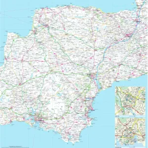
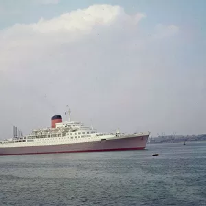
Framed Print : Map Showing Routes of the Union Castle Line to Africa


![]()
Framed Photos From Mary Evans Picture Library
Map Showing Routes of the Union Castle Line to Africa
Map Showing Routes of the Union Castle Line to Africa, . Date: 1927
Mary Evans Picture Library makes available wonderful images created for people to enjoy over the centuries
Media ID 14204000
© The Wentworth Collection / Mary Evans Picture Library
12"x10" Modern Frame
Introducing the captivating and historically significant Framed Print from Media Storehouse, featuring the "Map Showing Routes of the Union Castle Line to Africa." This exquisite piece, sourced from Mary Evans Prints Online, dates back to 1927 and provides a fascinating glimpse into the maritime history of the Union Castle Line's African voyages. The intricate details on this vintage map bring to life the extensive network of shipping routes that once connected Europe and Africa. This beautifully framed print is not just an attractive addition to any room, but also a conversation starter and a reminder of the rich history that lies beneath the surface. Bring a piece of history into your home with our Framed Print of the "Map Showing Routes of the Union Castle Line to Africa."
10x8 Print in an MDF Wooden Frame with 180 gsm Satin Finish Paper. Glazed using shatter proof thin plexi glass. Frame thickness is 1 inch and depth 0.75 inch. Fluted cardboard backing held with clips. Supplied ready to hang with sawtooth hanger and rubber bumpers. Spot clean with a damp cloth. Packaged foam wrapped in a card.
Contemporary Framed and Mounted Prints - Professionally Made and Ready to Hang
Estimated Image Size (if not cropped) is 25.4cm x 25.4cm (10" x 10")
Estimated Product Size is 25.4cm x 30.5cm (10" x 12")
These are individually made so all sizes are approximate
Artwork printed orientated as per the preview above, with landscape (horizontal) or portrait (vertical) orientation to match the source image.
FEATURES IN THESE COLLECTIONS
> Maps and Charts
> Early Maps
> Maps and Charts
> Related Images
MADE IN THE USA
Safe Shipping with 30 Day Money Back Guarantee
FREE PERSONALISATION*
We are proud to offer a range of customisation features including Personalised Captions, Color Filters and Picture Zoom Tools
SECURE PAYMENTS
We happily accept a wide range of payment options so you can pay for the things you need in the way that is most convenient for you
* Options may vary by product and licensing agreement. Zoomed Pictures can be adjusted in the Basket.