


Framed Prints From MapSeeker
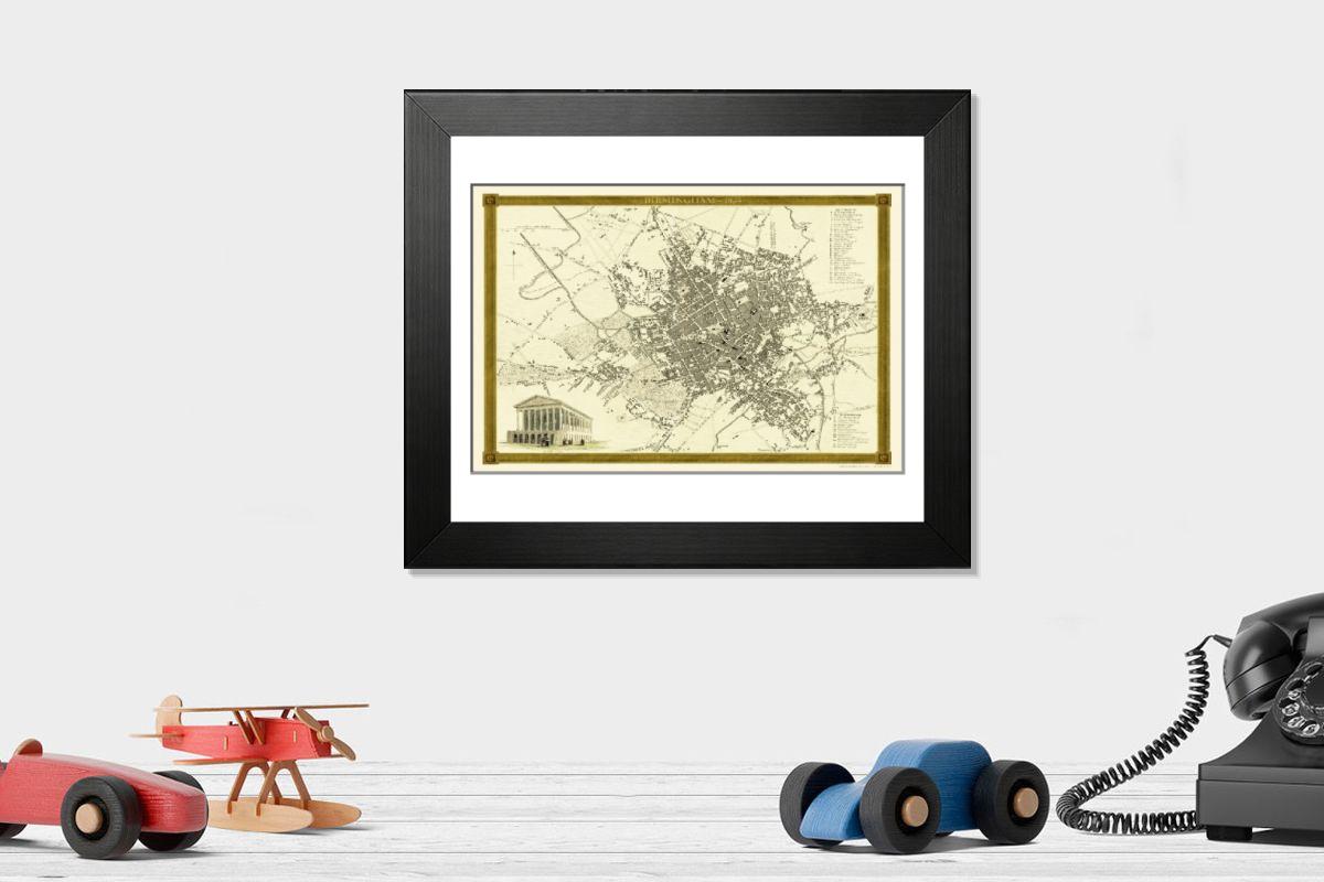
Framed Print of Old Map of Birmingham 1834 by John Dower and William Orr
A highly detailed reproduction city map of Birmingham originally published in London, 1834. Interestingly it shows the planned route of the Grand Junction Railway coming into the North of Birmingham, before the route was changed. Highly respected throughout England and Western Europe, William S. Orr was an early nineteenth century printseller and publisher, particularly of atlases and gazetteers. His maps of cities, counties and countries are noteworthy for their accuracy and very fine detailing. Indeed, few publishers from this period could compete with Orr for the large amount of information his maps contained. This original engraved map hails from Orrs 1834 Atlas, which contained not only all the regions of the world but plans of the primary cities as well. The engraving for the 1834 Atlas was entrusted mainly to the Pentonville artist, John Dower. Dower was well known for his maps and for his engravings of military scenes. So finely engraved is this map of Birmingham that one can only appreciate Dowers work with the aid of a magnifying lens. No finer example of early nineteenth century cartography exists than this engraved city map with its inset engraving of the Town Hall and reference key of major buildings. John Dower and William S. Orr were highly respected mapmakers, print sellers, and publishers of early 19th century London. Their work is known for is stunning accuracy and indeed, their work includes some of the most information rich maps of the period. In addition to his cartographic work, Dower is well known as an engraver of military scenes. Their primary work is the 1834 British Cyclopaedia. Welcome to the Mapseeker Image library and enter an historic gateway to one of the largest on-line collections of Historic Maps, Nostalgic Views, Vista's and Panorama's from a World gone by.
Artwork supplied by MapSeeker
Your chosen combination is quickly and professionally made to order, our shipping page has more details
If you are not entirely happy with your items, simply return them to us within 30 days for a replacement or full refund. Please read our full returns policy.
Media ID 20347146
Editors Comments
Discover the rich history of Birmingham with our Framed Prints featuring the Old Map of Birmingham, originally published in 1834 by John Dower and William Orr. This highly detailed reproduction shows the city as it was over 180 years ago, complete with the planned route of the Grand Junction Railway entering the North of Birmingham. Bring a piece of historical charm into your home or office with this intriguing addition to your decor.
This artwork is also available as...
Photo Prints - Step back in time with our reproduction of the Old Map of Birmingham 1834 by John Dower and William Orr from MapSeeker. This photographic print transports you to a bygone era, offering a fascinating glimpse into the history of England's second city. The intricate details of the map reveal the layout of Birmingham as it was over 180 years ago, complete with the planned route of the Grand Junction Railway making its way into the North of the city. A addition to any home or office, this photographic print is not just a map, but a window into the past.
Photo Mugs - Personalize your home or office with Photo Mugs featuring vintage maps, such as the 1834 Old Map of Birmingham by John Dower and William Orr from MapSeeker. This highly detailed reproduction city map is a gift idea for history enthusiasts and Birmingham lovers. Perfect for coffee breaks, Photo Mugs make thoughtful presents.
Poster Prints - Step back in time with our Old Map of Birmingham 1834 by John Dower and William Orr from the Media Storehouse Poster Prints collection. This highly detailed reproduction captures the historical charm of Birmingham as it once was, featuring the planned route of the Grand Junction Railway entering the North of the city. Add a touch of history to your home or office decor with this intriguing map print.
Metal Prints - Step back in time with our Metal Print of the Old Map of Birmingham 1834 by John Dower and William Orr from MapSeeker. This intricately detailed reproduction transports you back to the historic cityscape of Birmingham as it once was. With the Grand Junction Railway planned route clearly marked in the north, this metal print is not just a piece of decor, but a glimpse into the past. Add a touch of history to your home or office with this wall art.
Canvas Prints - Step back in time with our Canvas Print of the Old Map of Birmingham, originally published in 1834 by John Dower and William Orr. This intricately detailed reproduction transports you back to an era of horse-drawn carriages and bustling streets. A true treasure for history enthusiasts, this map offers a fascinating glimpse into the past, highlighting the planned route of the Grand Junction Railway as it entered the North of Birmingham. Add a touch of history to your home or office with this conversation-starting piece of art.
Mouse Mats - Step back in time and explore the rich history of Birmingham with our Mouse Mats. This reproduction of an 1834 map brings to life the city's early days, showcasing its intricate streets and landmarks. Perfect for anyone who loves vintage maps or has a connection to this city, our mouse mats are not only functional but also a piece of art that adds character to any workspace.
Modern Frame 12"x10"
Ready to Hang Contemporary Framed Prints adds style, protection, and a polished touch to your space - effortlessly.
Your artwork will be printed as shown in the preview. To adjust please select Edit Printed Image under the Buy button
Made and Shipped from within the USA or Canada as appropriate. Printed on 10"x8" Premium Matte Paper offering bright, white paper with a matte finish with a digitally rendered mat surround offering the timeless look of professionally mounted artwork. Our 1″ Frames are available in a range of colours with clear acrylic shatterproof glazing and Kraft pad backer. Matte Paper offer a lighter-weight alternative to fine art paper which is optimized for artwork and can be suitable for photography in scenarios where a less glossy appearance is preferred. This sustainable paper printing is an alternative to our premium fine art paper. Each frame is 1″ wide by 3/4″ deep and glazed using standard 1/16” clear PETG to protect and enhance the visibility of each print. Ready to hang with a sawtooth metal hanger and sturdy backer.
These are individually made so all sizes are approximate
Estimated Image Size (if not cropped) is 20.4cm x 13.6cm (8" x 5.4")
Estimated Product Size is 30.5cm x 25.4cm (12" x 10")
Features In These Collections
> Europe > United Kingdom > England > Maps
> Historic > World War I and II > World War I
> Maps and Charts > Early Maps
> MapSeeker > British Town and City Plans > English and Welsh PORTFOLIO