Framed Print > Europe > United Kingdom > Northern Ireland > County Down > Newcastle
Framed Print : Newcastle NE2 3 Map


![]()
Framed Photos from Map Marketing
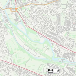
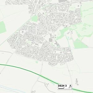
Newcastle NE2 3 Map
Postcode Sector Map of Newcastle NE2 3
Media ID 19976147
Albury Road Bayswater Road Beatty Avenue Brentwood Avenue Clayton Road Crossway Fairfield Road Great North Road Kingsland Kingswood Avenue Lavender Gardens Lyndhurst Avenue Lyndhurst Gardens Mayfair Road Mildmay Road Mitchell Avenue Moorfield Myrtle Grove Newcastle Newlands Road Oakland Road Tavistock Road Highbury
12"x10" Modern Frame
10x8 Print in an MDF Wooden Frame with 180 gsm Satin Finish Paper. Glazed using shatter proof thin plexi glass. Frame thickness is 1 inch and depth 0.75 inch. Fluted cardboard backing held with clips. Supplied ready to hang with sawtooth hanger and rubber bumpers. Spot clean with a damp cloth. Packaged foam wrapped in a card.
Contemporary Framed and Mounted Prints - Professionally Made and Ready to Hang
Estimated Image Size (if not cropped) is 25.4cm x 25.4cm (10" x 10")
Estimated Product Size is 30.5cm x 25.4cm (12" x 10")
These are individually made so all sizes are approximate
Artwork printed orientated as per the preview above, with landscape (horizontal) or portrait (vertical) orientation to match the source image.
FEATURES IN THESE COLLECTIONS
> Architecture
> Towers
> Castles
> Europe
> United Kingdom
> Northern Ireland
> County Down
> Newcastle
> Map Marketing
> Postcode Sector Maps
> NE - Newcastle upon Tyne
MADE IN THE USA
Safe Shipping with 30 Day Money Back Guarantee
FREE PERSONALISATION*
We are proud to offer a range of customisation features including Personalised Captions, Color Filters and Picture Zoom Tools
SECURE PAYMENTS
We happily accept a wide range of payment options so you can pay for the things you need in the way that is most convenient for you
* Options may vary by product and licensing agreement. Zoomed Pictures can be adjusted in the Cart.