Framed Print > North America > United States of America > Maps
Framed Print : Historical World Events map 1964 US version


![]()
Framed Photos from Map Marketing
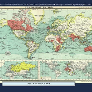
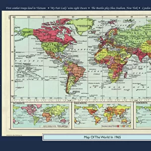
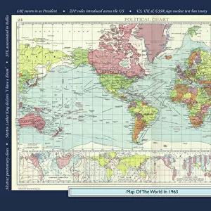
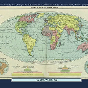
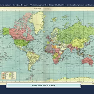
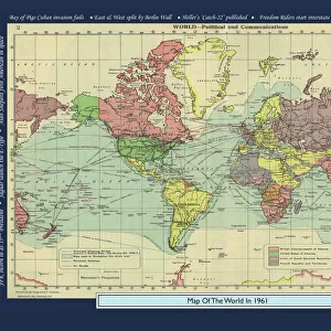
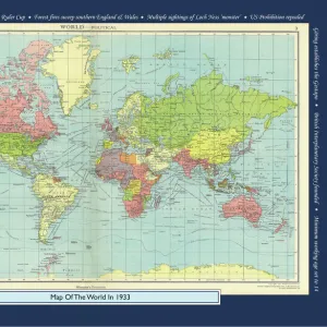
Historical World Events map 1964 US version
A world map originally published in 1964, reproduced from the internationally famousCollins Bartholomew World Through Timehistoric cartographic archive. A perfect reminder of how the world looked in 1964. The map is framed in a stylish text border containing highlights of significant events from 1964
Media ID 19959707
© Design Map Marketing Ltd, Mapping Collins Bartholomew
18"x14" Modern Frame
16x12 Print in an MDF Wooden Frame with 180 gsm Satin Finish Paper. Glazed using shatter proof thin plexiglass. Frame thickness is 1 inch and depth 0.75 inch. Fluted cardboard backing held with clips. Supplied ready to hang with sawtooth hanger and rubber bumpers. Spot clean with a damp cloth. Packaged foam wrapped in a card.
Contemporary Framed and Mounted Prints - Professionally Made and Ready to Hang
Estimated Image Size (if not cropped) is 40.6cm x 35.6cm (16" x 14")
Estimated Product Size is 45.7cm x 35.6cm (18" x 14")
These are individually made so all sizes are approximate
Artwork printed orientated as per the preview above, with landscape (horizontal) orientation to match the source image.
FEATURES IN THESE COLLECTIONS
> Maps and Charts
> Early Maps
> Maps and Charts
> Related Images
> Maps and Charts
> World
> North America
> United States of America
> Maps
> Map Marketing
> Historical World Maps
MADE IN THE USA
Safe Shipping with 30 Day Money Back Guarantee
FREE PERSONALISATION*
We are proud to offer a range of customisation features including Personalised Captions, Color Filters and Picture Zoom Tools
SECURE PAYMENTS
We happily accept a wide range of payment options so you can pay for the things you need in the way that is most convenient for you
* Options may vary by product and licensing agreement. Zoomed Pictures can be adjusted in the Cart.