Map of the Holy Land Print


Framed Prints From Librifly
This artwork is available as
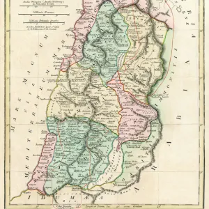
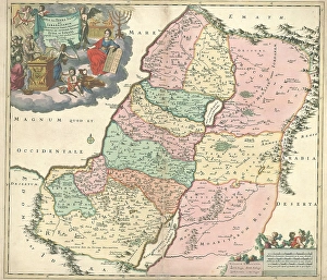
Framed Print of Map Iudaea sive Terra Sancta quae Israelitarum
Map, Iudaea sive Terra Sancta quae Israelitarum in suas duodecim tribus destincta secretis ab invicem regnis Iuda, et Israel expressis in super sex ejusdem terrae provincijs, Theodorus Danckerts (1663-1727), Copperplate print. Librifly - Inspiring Content from Around the World. © Artokoloro
Artwork Licensed From Librifly
Your chosen combination is quickly and professionally made to order - Shipping & Delivery Details
If you are not entirely happy with your items, simply return them to us within 30 days for a replacement or full refund - 30 Day Returns
Media ID 19586991
Editors' Comments
Discover the rich history of the Holy Land with our Framed Prints. This particular piece shows the "Map Iudaea sive Terra Sancta quae Israelitarum" from the Liszt Collection. A detailed representation of the land of Israel, divided into its twelve tribes and the distinct kingdoms of Judah and Israel, this map is a reminder of the ancient history and cultural significance of the region. Each Framed Print is meticulously crafted to preserve the intricate details of the map, ensuring an addition to any home or office space. Bring a piece of history into your world with Media Storehouse Framed Prints.
Discover the beauty of a bygone era with these exquisite prints from Librifly. The intricate details and vibrant colors of Map Iudaea sive Terra Sancta quae Israelitarum transport you to a world of ancient history and wonder.
This artwork is also available as...
Photo Prints - Discover Photo Prints of the historic 'Map Iudaea sive Terra Sancta quae Israelitarum' from the Liszt Collection, featuring a detailed map of ancient Israel with its 12 tribes and provinces. Perfect for history buffs and art lovers, these Photo Prints make decorative pieces for any home or office.
Photo Mugs - Add a touch of history to your morning routine with our Photo Mugs, featuring the intricately detailed Map Iudaea sive Terra Sancta quae Israelitarum from the Liszt Collection. This map, depicting the land of Israel divided into its twelve tribes and the distinct kingdoms of Judah and Israel, is a representation of ancient geography. Each mug holds a rich story in its design, making every sip an opportunity to explore the past. Perfect for history enthusiasts or as a thoughtful gift, our Photo Mugs are not just a mug, but a journey through time.
Poster Prints - Discover the rich history and sacred sites of the Holy Land with our Map Iudaea sive Terra Sancta quae Israelitarum from the Liszt Collection. This detailed and intricately designed poster print shows the land of Israel, divided into its twelve tribes and the distinct realms of Judah and Israel. Each province of this ancient territory is clearly marked, offering a glimpse into the historical and cultural significance of this revered land. Bring the past to life in your home or office with this informative addition to your decor.
Metal Prints - Metal Prints featuring 'Map Iudaea sive Terra Sancta quae Israelitarum' from the Liszt Collection, a rare 16th-century map showcasing ancient Israel's twelve tribes and secret kingdoms. Durable and long-lasting, our Metal Prints are perfect for home decor, office spaces, or galleries seeking art pieces.
Canvas Prints - Discover the rich history and sacred lands of the ancient world with our Canvas Prints. This particular piece shows the intricately detailed Map Iudaea sive Terra Sancta quae Israelitarum from the esteemed Liszt Collection. This map, depicting the land of Judea, or the Holy Land, divided into its twelve tribes and six provinces, is a representation of the and secret kingdoms of Judah and Israel. Bring the history and culture of this fascinating region into your home or office with our premium Canvas Prints, expertly printed on canvas and coated with a protective, archival-grade finish to ensure lasting beauty and vibrancy.
Mouse Mats - Mouse Mats featuring the historic "Map Iudaea sive Terra Sancta quae Israelitarum" from Liszt Collection, showcasing 12 tribes of Israel and secret kingdoms. Perfect for gamers, designers, and history enthusiasts alike, these Mouse Mats provide comfort and style while navigating virtual worlds or working on projects.
Modern 12"x10"
Ready to Hang Contemporary Framed Prints adds style, protection, and a polished touch to your space - effortlessly.
Your artwork will be printed as shown in the preview. To adjust please select Print Options under the Buy button
Made and Shipped from within the USA or Canada as appropriate. Printed on 10"x8" Premium Matte Paper offering bright, white paper with a matte finish with a digitally rendered mat surround offering the timeless look of professionally mounted artwork. Our 1″ Frames are available in a range of colours with clear acrylic shatterproof glazing and Kraft pad backer. Matte Paper offer a lighter-weight alternative to fine art paper which is optimized for artwork and can be suitable for photography in scenarios where a less glossy appearance is preferred. This sustainable paper printing is an alternative to our premium fine art paper. Each frame is 1″ wide by 3/4″ deep and glazed using standard 1/16” clear PETG to protect and enhance the visibility of each print. Ready to hang with a sawtooth metal hanger and sturdy backer.
These are individually made so all sizes are approximate
Estimated Image Size (if not cropped) is 17.9cm x 15.3cm (7" x 6")
Estimated Product Size is 30.5cm x 25.4cm (12" x 10")
Features in These Collections
Home > Maps and Charts > Early Maps