Framed Print > Africa > South Africa > Maps
Framed Print : Districts occidentaux de la Province du Cap; Afrique Australe, 1914. Districts occident... 1914 Creator: Unknown


![]()
Framed Photos from Heritage Images
Districts occidentaux de la Province du Cap; Afrique Australe, 1914. Districts occident... 1914 Creator: Unknown
Districts occidentaux de la Province du Cap; Afrique Australe, 1914. From "Grande Geographie Bong Illustree", 1914
Heritage Images features heritage image collections
Media ID 36296635
© The Print Collector/Heritage Images
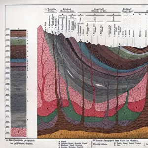
Cartography Geological Map Map Making Mapmaking South Africa
12"x10" Modern Frame
Step back in time with our vintage Framed Print of 'Districts occidentaux de la Province du Cap; Afrique Australe', 1914. This intriguing piece, sourced from Heritage Images, showcases the Districts of the Western Cape Province in South Africa as depicted in Grande Geographie Bong Illustree, 1914. Add an air of historical charm to your home or office with this beautifully preserved, unknown creator's work. Order now and let this captivating print transport you to a bygone era.
10x8 Print in an MDF Wooden Frame with 180 gsm Satin Finish Paper. Glazed using shatter proof thin plexi glass. Frame thickness is 1 inch and depth 0.75 inch. Fluted cardboard backing held with clips. Supplied ready to hang with sawtooth hanger and rubber bumpers. Spot clean with a damp cloth. Packaged foam wrapped in a card.
Contemporary Framed and Mounted Prints - Professionally Made and Ready to Hang
Estimated Image Size (if not cropped) is 25.4cm x 25.4cm (10" x 10")
Estimated Product Size is 25.4cm x 30.5cm (10" x 12")
These are individually made so all sizes are approximate
Artwork printed orientated as per the preview above, with landscape (horizontal) or portrait (vertical) orientation to match the source image.
FEATURES IN THESE COLLECTIONS
> Africa
> South Africa
> Maps
> Africa
> South Africa
> Related Images
> Maps and Charts
> Geological Map
> Maps and Charts
> Related Images
Districts occidentaux de la Province du Cap; Afrique Australe
EDITORS COMMENTS
is an intriguing and historic geographical map print from the early 20th century, specifically from the year 1914. The map, created by an unknown cartographer, is an exquisite representation of the western districts of the Cape Province in South Africa during that era. The map is an essential addition to any collection focused on African cartography or the history of geographical exploration. The vibrant colors and detailed illustrations bring the geographical features of the region to life, making it an engaging and educational piece. The map is noteworthy for its meticulous depiction of the topographical features, including rivers, mountains, and bodies of water, as well as the various political boundaries and settlements. The map's title, "Districts occidentaux de la Province du Cap; Afrique Australe," translates to "Western Districts of the Cape Province; Southern Africa," indicating its focus on the western regions of the Cape Province, which is located in the southwestern tip of Africa. The map was published in "Grande Geographie Bong Illustree," a renowned French geography magazine, further adding to its historical significance. The mapmaking process during the 1900s was a testament to the advancements in cartography and geographical knowledge during that era. The intricacy and detail of this map are a testament to the cartographer's skill and the importance placed on geographical knowledge during that time. This map serves as an essential reminder of the rich history of cartography and the exploration of Africa, making it a valuable addition to any collection.
MADE IN THE USA
Safe Shipping with 30 Day Money Back Guarantee
FREE PERSONALISATION*
We are proud to offer a range of customisation features including Personalised Captions, Color Filters and Picture Zoom Tools
SECURE PAYMENTS
We happily accept a wide range of payment options so you can pay for the things you need in the way that is most convenient for you
* Options may vary by product and licensing agreement. Zoomed Pictures can be adjusted in the Cart.