Framed Print > Europe > United Kingdom > England > London > River Thames
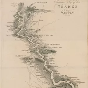
Framed Print : Tomblesons Panoramic Map of the Thames and Medway (engraving)
")

")
![]()
Framed Photos From Fine Art Finder
Tomblesons Panoramic Map of the Thames and Medway (engraving)
587724 Tomblesons Panoramic Map of the Thames and Medway (engraving) by English School, (19th century); Private Collection; (add.info.: Tomblesons Panoramic Map of the Thames and Medway, from Thames Ditton to Gravesend.); Look and Learn / Peter Jackson Collection; English, out of copyright
Media ID 22686176
© Look and Learn / Peter Jackson Collection / Bridgeman Images
18"x14" Modern Frame
Bring history to life in your home with the Media Storehouse Framed Print of Tomblesons Panoramic Map of the Thames and Medway. This beautiful 19th-century engraving, from the English School, showcases a detailed and captivating view of the Thames and Medway rivers. The intricate lines and shading of Bridgeman Images' Fine Art Finder reproduction faithfully capture the original's textures and tonalities. Hang this framed print in your living room, office, or study to add an air of sophistication and historical charm. A perfect addition to any collection of antique maps or nautical decor.
16x12 Print in an MDF Wooden Frame with 180 gsm Satin Finish Paper. Glazed using shatter proof thin plexiglass. Frame thickness is 1 inch and depth 0.75 inch. Fluted cardboard backing held with clips. Supplied ready to hang with sawtooth hanger and rubber bumpers. Spot clean with a damp cloth. Packaged foam wrapped in a card.
Contemporary Framed and Mounted Prints - Professionally Made and Ready to Hang
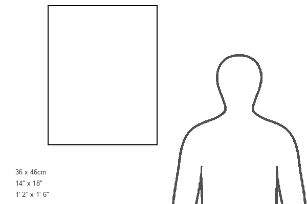
Estimated Image Size (if not cropped) is 35.6cm x 40.6cm (14" x 16")
Estimated Product Size is 35.6cm x 45.7cm (14" x 18")
These are individually made so all sizes are approximate
Artwork printed orientated as per the preview above, with portrait (vertical) orientation to match the source image.
FEATURES IN THESE COLLECTIONS
> Europe
> United Kingdom
> England
> London
> River Thames
> Maps and Charts
> Related Images
EDITORS COMMENTS
This print showcases the intricate details of Tomblesons Panoramic Map of the Thames and Medway. Created by an unknown English artist in the 19th century, this engraving offers a unique perspective on the rivers that have played a significant role in shaping British history. The map spans from Thames Ditton to Gravesend, capturing the meandering course of both the River Thames and River Medway. With meticulous precision, every bend, tributary, and landmark is depicted with remarkable accuracy. It serves as a testament to the skill and artistry involved in cartography during this era. As you delve into this panoramic masterpiece, you are transported back in time to an age when these waterways were bustling hubs of trade and transportation. The sheer scale of detail invites you to explore each nook and cranny along their shores. Whether you are a history enthusiast or simply appreciate fine craftsmanship, this print is sure to captivate your imagination. Hang it on your wall or display it proudly on your desk; let it serve as a reminder of our rich maritime heritage.
MADE IN THE USA
Safe Shipping with 30 Day Money Back Guarantee
FREE PERSONALISATION*
We are proud to offer a range of customisation features including Personalised Captions, Color Filters and Picture Zoom Tools
SECURE PAYMENTS
We happily accept a wide range of payment options so you can pay for the things you need in the way that is most convenient for you
* Options may vary by product and licensing agreement. Zoomed Pictures can be adjusted in the Basket.