Fraud Blocker Skip to main content

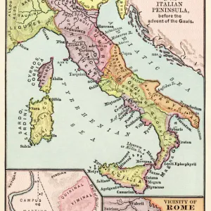
Roman Republic and Carthage during the Second Punic War (218-201-BC)

Roman Republic and Carthage during the Second Punic War (218-201-BC)
Sold 7
In Stock
We accept all major payment options so you can pay for the things you need in the way that is most convenient for you

Fine Art Storehouse Photo Prints and Wall Art

Roman Republic and Carthage during the Second Punic War (218-201-BC)

Ancient map of the Roman Republic and Carthage during the Second Punic War (218 to 201 BC). Legend in Latin language. Steel engraving with hand colored borderlines, published in 1861. Unleash your creativity and transform your space into a visual masterpiece. © ZU_09

Media ID 13666871

Afrika Afrika Ancient Rome Carthage Tunisia Europa Mediterranean Sea Republic Roman Steel Engraving Gaul Punic Republik Roman Republic

SECURE PAYMENTS
We accept all major payment options so you can pay for the things you need in the way that is most convenient for you

Made in USA
Safe Shipping, Easy Returns

FREE PERSONALISATION
We are proud to offer a range of customisation including Cropping, Captions, and Filters. Zoom Cropping can be adjusted in the basket


EDITORS COMMENTS

This print takes us back in time to the era of the Second Punic War, a monumental conflict between the Roman Republic and Carthage that shaped the course of history. The ancient map depicted here showcases the territories held by both powers during this tumultuous period from 218 to 201 BC. The steel engraving, meticulously hand-colored with vibrant borderlines, was published in 1861, offering us a glimpse into how people visualized these historical events over a century ago. The Latin legend accompanying the map adds an air of authenticity and scholarly depth to this remarkable piece. Stretching across Europe and Africa, we can trace the vast expanse of this war's theater. From Spain to Italy, Gaul to Tunisia (the location of ancient Carthage), every inch is intricately detailed on this horizontal etching. The Mediterranean Sea acts as a natural boundary separating these two mighty empires engaged in fierce struggle for dominance. As we explore this image further, it becomes evident that it represents more than just geographical boundaries; it symbolizes power dynamics and political aspirations. It reminds us of Rome's relentless pursuit of expansionism and Carthage's desperate fight for survival against overwhelming odds. While devoid of human figures, this photograph speaks volumes about government structures and military strategies employed during those times. It serves as a testament to our fascination with history and our desire to understand how past civilizations shaped our present world.


Framed Prints of Roman Republic and Carthage during the Second Punic War (218-201-BC)

Introducing the Media Storehouse Framed Print of the Ancient Map of the Roman Republic and Carthage during the Second Punic War (218-201 BC). This exquisite piece is a steel engraving, meticulously hand-colored, and published in 1861. Feast your eyes on the intricate details of this fine art piece, which beautifully illustrates the geographical expanse of the Roman Republic and Carthaginian territories during this pivotal period in history. The Latin legend adds an authentic touch to this historical masterpiece. Bring a piece of the ancient world into your home or office with this stunning Framed Print from the Fine Art Storehouse by Media Storehouse.


Photo Prints of Roman Republic and Carthage during the Second Punic War (218-201-BC)

Step back in time with our exquisite Fine Art Storehouse print, featuring an ancient steel engraving of the Roman Republic and Carthage during the Second Punic War (218-201 BC). This meticulously hand-colored print, published in 1861, showcases intricate detail and a legendary inscription in Latin language. Bring the history of this pivotal era to life in your home or office, and add a touch of timeless elegance to your decor.


Poster Prints of Roman Republic and Carthage during the Second Punic War (218-201-BC)

Introducing the Media Storehouse collection of historic poster prints, featuring an awe-inspiring depiction of the Roman Republic and Carthage during the Second Punic War (218-201 BC). This exquisite print is a rare find, hailing from the Fine Art Storehouse and boasting an authentic steel engraving with intricately hand-colored borderlines. Published in 1861, this captivating piece showcases an ancient map of the two great civilizations locked in one of the most significant conflicts in history. The Latin legend adds an authentic touch to this captivating piece, transporting you back in time to witness the grandeur and complexity of the Roman Republic and Carthage as they battled for supremacy. Add this stunning piece to your collection and bring a touch of history into your home or office. The perfect addition for history enthusiasts, educators, or anyone with an appreciation for the ancient world. Order now and let the story of the Second Punic War unfold before your eyes!


Jigsaw Puzzles of Roman Republic and Carthage during the Second Punic War (218-201-BC)

Discover the rich history of the ancient world with our stunning Roman Republic and Carthage Jigsaw Puzzle from Media Storehouse, brought to you in partnership with Fine Art Storehouse. This captivating puzzle features an intricately detailed steel engraving of a map, showcasing the Roman Republic and Carthage during the Second Punic War (218-201 BC). The map is adorned with hand-colored borderlines and includes a legend in Latin language, adding an authentic touch to this historical puzzle. Immerse yourself in the intrigue and strategy of one of the most significant conflicts in ancient history. Engage your mind and challenge your problem-solving skills as you piece together this intricate jigsaw puzzle, perfect for history enthusiasts, collectors, or anyone looking for a stimulating pastime.

diamond
Made With High Grade Materials
thumb_up
Professional Quality Finish
package_2
Carefully Packed To Aid Safe Arrival

You May Also Like


Antique map of the Roman EmpireAntique map of the Roman Empire
Add to Basket
Ancient Greece and its colonies around the AegeanAncient Greece and its colonies around the Aegean
Add to Basket
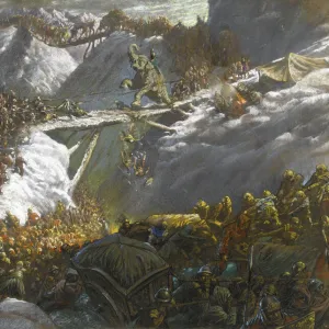
Hannibal crossing the AlpsHannibal crossing the Alps
Add to Basket
Death of Nelson (West)Death of Nelson (West)
Add to Basket
Greece at the beginning of the Peloponnesian War (431-404 BC)Greece at the beginning of the Peloponnesian War (431-404 BC)
Add to Basket
Gaul in the time of Julius Caesar, published in 1867Gaul in the time of Julius Caesar, published in 1867
Add to Basket
Don Quixote riding with Sancho PanzaDon Quixote riding with Sancho Panza
Add to Basket
Scipio Africanus meeting Hannibal at Battle of ZamaScipio Africanus meeting Hannibal at Battle of Zama
Add to Basket
Myth / Iliad / PatroclusMyth / Iliad / Patroclus
Add to Basket
Menelas and PatrocleMenelas and Patrocle
Add to Basket
Battle instructions written by the Duke of Wellington K050231Battle instructions written by the Duke of Wellington K050231
Add to Basket
Leslie - Duke of Wellington looking at bust of Napoleon N070535Leslie - Duke of Wellington looking at bust of Napoleon N070535
Add to Basket

Gallery Wall Inspiration

Italy Map - illustration
Italy country map
Sicily map 1895
Roman Republic and Carthage during the Second Punic War (218-201-BC)
Europe Map with France, Portugal, Spain and Netherlands
Italy Reference Map
Antique colored illustrations: Geological map of England and Wales
Cartoon map of ITALY
Antique Damaged Map of Italy 19th Century
Antquie Map of Italy
Map of Venice 1897
City map of Florence, Italy, lithograph, published in 1897
Austro-Hungarian Empire, Habsburg Monarchy, lithograph, published in 1877
Travels of The Apostle Paul Map Engraving
Vintage map of Magna Graecia
Europe map 1867
Bosnia, dalmatia, istria, croatia, slavonia
Antique Map of Italy, with detail of straits of Messina, 19th Century
Map of Naples and surrounding, Campania, Italy, lithograph, published 1897
Map of Capri, Italian island, wood engraving published in 1897
Gaul in the time of Julius Caesar, published in 1867
City map of Rome, lithograph, published in 1878
Italy map 1875
Map of Venice 1898
City map of Naples (Italian: Napoli), Italy, lithograph, published 1897
western europe map 1883
old map of europe


© Copyright Media Storehouse, All Rights Reserved 2003 - 2024
Facebook     Pinterest     100% Payment Secure     Reviews IO