Fraud Blocker Skip to main content

Home > Africa > Tunisia > Maps

Maps Collection

Tunisia is a country located in North Africa, bordered by Algeria

Choose a picture from our Maps Collection for your Wall Art and Photo Gifts

117 items

Background imageMaps Collection: Roman Republic and Carthage during the Second Punic War (218-201-BC)

Roman Republic and Carthage during the Second Punic War (218-201-BC)
Ancient map of the Roman Republic and Carthage during the Second Punic War (218 to 201 BC). Legend in Latin language. Steel engraving with hand colored borderlines, published in 1861

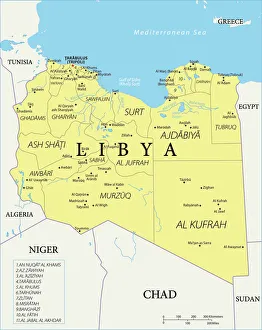
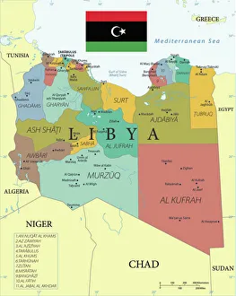
Background imageMaps Collection: Reference Map of Libya

Reference Map of Libya
Libya is an African nation situated in North Africa, along the Mediterranean Sea. Libya shares borders with Egypt, Sudan, Chad, Niger, Algeria, and Tunisia

Background imageMaps Collection: Tunisia country map

Tunisia country map
2011 edition

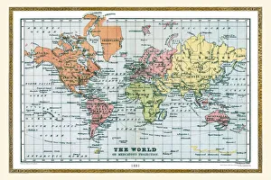
Background imageMaps Collection: Old Map of The World 1881

Old Map of The World 1881
Irish Land War (1879-1882); home rule movement led by Parnell. End of First Boer War (1880-1881). French establish a protectorate in Tunisia

Background imageMaps Collection: Africa Political Map

Africa Political Map
Antique illustration of a Africa Political Map from 1893

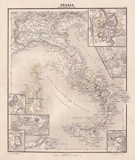
Background imageMaps Collection: Ancent Italy, c. 450 BC, steel engraving, published in 1861

Ancent Italy, c. 450 BC, steel engraving, published in 1861
The territory of Italy around 450 BC with separate maps of Rome, Roman Forum, surrounding area of Rome, Syracuse, Carthage and surrounding area of Pompeji and Naples. Legend in Latin language

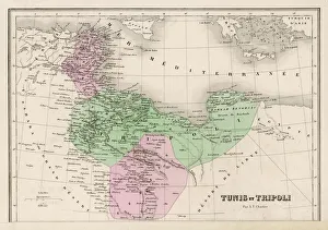
Background imageMaps Collection: Map / North Africa 19C

Map / North Africa 19C
Tunisia and Tripoli (now largely Libya)

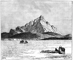
Background imageMaps Collection: The Jebel Zaghwan, c1890. Artist: Meunier

The Jebel Zaghwan, c1890. Artist: Meunier
The Jebel Zaghwan, c1890. Jebel Zaghouan, a mountain in Tunisia. Illustration from The Universal Geography with Illustrations and Maps, Division XXI, (Virtue & Co Limited, London, c1890)

Background imageMaps Collection: Plan of the Battle of Navarino, 21 October 1827, 1827 (coloured manuscript)

Plan of the Battle of Navarino, 21 October 1827, 1827 (coloured manuscript)
7339519 Plan of the Battle of Navarino, 21 October 1827, 1827 (coloured manuscript) by Unknown Artist, (19th century); 32x42 cm; National Maritime Museum, London

Background imageMaps Collection: Geographic atlas: view of the Mediterranean Sea and the coasts of Barbaria (Algeria, Tunisia)

Geographic atlas: view of the Mediterranean Sea and the coasts of Barbaria (Algeria, Tunisia, Tripolitan)
JEB4874639 Geographic atlas: view of the Mediterranean Sea and the coasts of Barbaria (Algeria, Tunisia, Tripolitan). Atlas de Nicolas et Guillaume Sanson, 1670

Background imageMaps Collection: Map of african coasts from Ras El Hadid (Algeria) to Cap Negre (Tunisia), 1821, engraving

Map of african coasts from Ras El Hadid (Algeria) to Cap Negre (Tunisia), 1821, engraving
1754351 Map of african coasts from Ras El Hadid (Algeria) to Cap Negre (Tunisia), 1821, engraving; (add.info.: Map of african coasts from Ras El Hadid (Algeria) to Cap Negre (Tunisia), 1821

Background imageMaps Collection: Geographic atlas: detail of Augustin Roussin's portulan representing the coasts of Tunisia, 1630

Geographic atlas: detail of Augustin Roussin's portulan representing the coasts of Tunisia, 1630
JEB4874870 Geographic atlas: detail of Augustin Roussin's portulan representing the coasts of Tunisia, 1630. Municipal library of Marseille.; (add.info.: Geographic atlas)

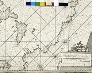
Background imageMaps Collection: Ports and rades of the Mediterranean Sea. Detail depicting North Africa's coasts with Tunisia

Ports and rades of the Mediterranean Sea. Detail depicting North Africa's coasts with Tunisia and Libya
JEB4874599 Ports and rades of the Mediterranean Sea. Detail depicting North Africa's coasts with Tunisia and Libya, map by Henri Michelot and Laurent Bremond. Municipal library of Marseille

Background imageMaps Collection: Map of Africa: This map by Nicolas Sanson d'Abbeville (1600-1667)

Map of Africa: This map by Nicolas Sanson d'Abbeville (1600-1667) depicts the kingdoms of Tunis and Tripoli
JEB4874533 Map of Africa: This map by Nicolas Sanson d'Abbeville (1600-1667) depicts the kingdoms of Tunis and Tripoli. 1656 Municipal Library of Marseille; (add.info.: Map of Africa)

Background imageMaps Collection: 'Le Climat, distribution des pluies; Afrique du nord, 1914. Creator: Unknown

'Le Climat, distribution des pluies; Afrique du nord, 1914. Creator: Unknown
'Le Climat, distribution des pluies; Afrique du nord, 1914. From "Grande Geographie Bong Illustree", 1914

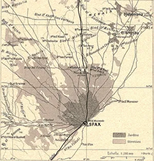
Background imageMaps Collection: 'Olivettes de Sfax; Afrique du nord, 1914. Creator: Unknown

'Olivettes de Sfax; Afrique du nord, 1914. Creator: Unknown
'Olivettes de Sfax; Afrique du nord, 1914. From "Grande Geographie Bong Illustree", 1914

Background imageMaps Collection: 'Tunis et Bizerte. La basse Medjerda; Afrique du nord, 1914. Creator: Unknown

'Tunis et Bizerte. La basse Medjerda; Afrique du nord, 1914. Creator: Unknown
'Tunis et Bizerte. La basse Medjerda; Afrique du nord, 1914. From "Grande Geographie Bong Illustree", 1914

Background imageMaps Collection: 'Carte geologique; Afrique du nord, 1914. Creator: Unknown

'Carte geologique; Afrique du nord, 1914. Creator: Unknown
'Carte geologique; Afrique du nord, 1914. From "Grande Geographie Bong Illustree", 1914

Background imageMaps Collection: 'Relief Map of Tunisie, 1914. Creator: Unknown

'Relief Map of Tunisie, 1914. Creator: Unknown
'Relief Map of Tunisie, 1914. From "Grande Geographie Bong Illustree", 1914

Background imageMaps Collection: 'Relief Map of Berberie, 1914. Creator: Unknown

'Relief Map of Berberie, 1914. Creator: Unknown
'Relief Map of Berberie, 1914. From "Grande Geographie Bong Illustree", 1914

Background imageMaps Collection: Reference Map of Libya with Keys

Reference Map of Libya with Keys
Libya is an African nation situated in North Africa, along the Mediterranean Sea. Libya shares borders with Egypt, Sudan, Chad, Niger, Algeria, and Tunisia

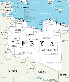
Background imageMaps Collection: Map of Libya

Map of Libya
Reference Map of Libya

Background imageMaps Collection: Tunisia - Lithograph Map Published 1890, Leipzig for 'Italie. Manuel du Voyageur' by Karl Baedeker

Tunisia - Lithograph Map Published 1890, Leipzig for "Italie. Manuel du Voyageur" by Karl Baedeker

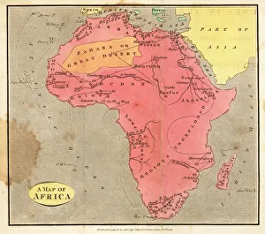
Background imageMaps Collection: Map of Africa, 1820

Map of Africa, 1820. Showing Morocco, Barbary and the Sahara in the north, Soudan and Guinea in the west, Khoikhoi (Hottentots) and Bantu (Caffres) in the south, and Abyssinia and Sennaar in the east

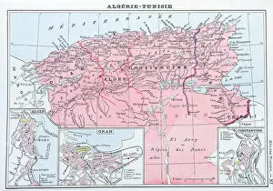
Background imageMaps Collection: Antique map of Algeria and Tunisia

Antique map of Algeria and Tunisia

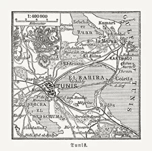
Background imageMaps Collection: Map of Tunis and surroundings, Tunisia, wood engraving, published 1897

Map of Tunis and surroundings, Tunisia, wood engraving, published 1897
Historical map of Tunis and surroundings - capital city of Tunisia. Wood engraving, published in 1897

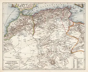
Background imageMaps Collection: Map of Algeria, Morocco, Tunisia, 1900

Map of Algeria, Morocco, Tunisia, 1900
Meyers hand-Atlas Leipzig und Wien Verlag des Bibliographischen Instituts 1900

Background imageMaps Collection: North Africa, from a nautical atlas, 1520 (ink on vellum) (detail from 330916)

North Africa, from a nautical atlas, 1520 (ink on vellum) (detail from 330916)
XOT330918 North Africa, from a nautical atlas, 1520 (ink on vellum) (detail from 330916) by Giovanni Xenodocus da Corfu (fl. 16th Century); Museo Correr, Venice, Italy; Greek, out of copyright

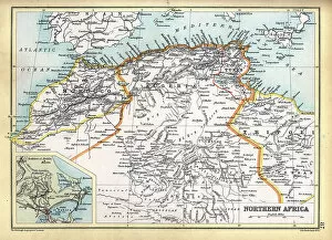
Background imageMaps Collection: Old Antique map of North Africa, Morocco, Algeria, Tunisia, Libya, detail of Tunis, 1890s

Old Antique map of North Africa, Morocco, Algeria, Tunisia, Libya, detail of Tunis, 1890s, Victorian 19th Century history

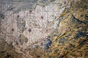
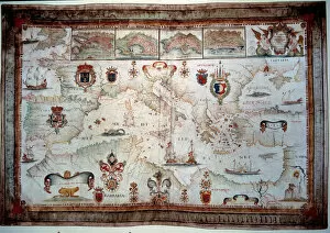
Background imageMaps Collection: Map of the Mediterranean Sea - Detail of the conquete of Tunis (Tunisia) - Tapestry by Francisco

Map of the Mediterranean Sea - Detail of the conquete of Tunis (Tunisia) - Tapestry by Francisco
LSE4317460 Map of the Mediterranean Sea - Detail of the conquete of Tunis (Tunisia) - Tapestry by Francisco and Cornelius Van der Ggot (18th century), woven into the royal tapestry factory

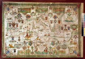
Background imageMaps Collection: Geographic map of the Mediterranean Sea and the Black Sea showing the coasts of Europe (France)

Geographic map of the Mediterranean Sea and the Black Sea showing the coasts of Europe (France, Spain)
JLJ4592326 Geographic map of the Mediterranean Sea and the Black Sea showing the coasts of Europe (France, Spain, Italy and Africa (Tunisia, Algeria, Egypt)

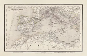
Background imageMaps Collection: Map of the Roman provinces of Hispania, Mauretania and Africa (coloured engraving)

Map of the Roman provinces of Hispania, Mauretania and Africa (coloured engraving)
7148256 Map of the Roman provinces of Hispania, Mauretania and Africa (coloured engraving) by Kiepert, Heinrich (1818-99); Private Collection; (add.info.: Map of the Roman provinces of Hispania)

Background imageMaps Collection: Geographic map of the Mediterranean Sea showing the coasts of Europe (France, Spain)

Geographic map of the Mediterranean Sea showing the coasts of Europe (France, Spain, Italy and Africa (Tunisia)
JLJ4656950 Geographic map of the Mediterranean Sea showing the coasts of Europe (France, Spain, Italy and Africa (Tunisia, Algeria, Egypt)

Background imageMaps Collection: Marcus Atilius Regulus, Roman soldier and consul (engraving)

Marcus Atilius Regulus, Roman soldier and consul (engraving)
7173412 Marcus Atilius Regulus, Roman soldier and consul (engraving) by German School, (19th century); Private Collection; (add.info.: Marcus Atilius Regulus (c307-250 BC), Roman soldier and consul

Background imageMaps Collection: The Bab-el-Bahr (litho)

The Bab-el-Bahr (litho)
7180354 The Bab-el-Bahr (litho) by Boot, William Henry James (1848-1918) (after); Private Collection; (add.info.: The Bab-el-Bahr)

Background imageMaps Collection: Site and Bay of Carthage (litho)

Site and Bay of Carthage (litho)
7180352 Site and Bay of Carthage (litho) by Boot, William Henry James (1848-1918) (after); Private Collection; (add.info.: Site and Bay of Carthage)

Background imageMaps Collection: Destruction of Carthage by the Romans, 146 BC (engraving)

Destruction of Carthage by the Romans, 146 BC (engraving)
7173408 Destruction of Carthage by the Romans, 146 BC (engraving) by German School, (19th century); Private Collection; (add.info.: Destruction of Carthage by the Romans, 146 BC)

Background imageMaps Collection: Romans fighting Carthaginians (colour litho)

Romans fighting Carthaginians (colour litho)
7201048 Romans fighting Carthaginians (colour litho) by English School, (20th century); Private Collection; (add.info.: Romans fighting Carthaginians)

Background imageMaps Collection: Flemish tapestry. Series The Conquest of Tunis; Review of the Troops at Barcelona

Flemish tapestry. Series The Conquest of Tunis; Review of the Troops at Barcelona
7209349 Flemish tapestry. Series The Conquest of Tunis; Review of the Troops at Barcelona (La revista de las tropas en Barcelona). Second tapestry in the series

Background imageMaps Collection: Banquet of Queen Dido of Carthage in honour of the Trojans (litho)

Banquet of Queen Dido of Carthage in honour of the Trojans (litho)
7149450 Banquet of Queen Dido of Carthage in honour of the Trojans (litho) by Kley, Heinrich (1863-1945); Private Collection; (add.info.: Banquet of Queen Dido of Carthage in honour of the Trojans)

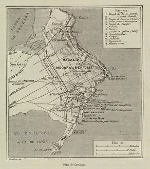
Background imageMaps Collection: Plan de Carthage (engraving)

Plan de Carthage (engraving)
7179854 Plan de Carthage (engraving) by French School, (19th century); Private Collection; (add.info.: Plan de Carthage. Illustration for L Habitation Humaine by Charles Garnier and A Ammann)

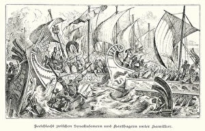
Background imageMaps Collection: Sea battle between the fleet of Syracuse and the Carthaginians under Hamilcar

Sea battle between the fleet of Syracuse and the Carthaginians under Hamilcar, 4th Century BC (engraving)
7173419 Sea battle between the fleet of Syracuse and the Carthaginians under Hamilcar, 4th Century BC (engraving) by German School

Background imageMaps Collection: Heroism of the Carthaginian women (engraving)

Heroism of the Carthaginian women (engraving)
7150811 Heroism of the Carthaginian women (engraving) by English School, (19th century); Private Collection; (add.info.: Heroism of the Carthaginian women)

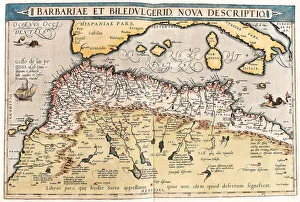
Background imageMaps Collection: Map of northern Africa, 1570 (engraving)

Map of northern Africa, 1570 (engraving)
LRI4705031 Map of northern Africa, 1570 (engraving) by Ortelius, Abraham (1527-98); Museo Navale di Pegli, Genoa, Italy; (add.info.: Barbariae and Biledulgerid, Nova Descriptio)

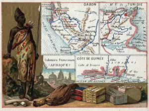
Background imageMaps Collection: Gabon, Tunisia and the Guinee Coast in Africa. Series on the French colonies

Gabon, Tunisia and the Guinee Coast in Africa. Series on the French colonies
XEE4193076 Gabon, Tunisia and the Guinee Coast in Africa. Series on the French colonies. Raw material: gum, sponge, tobacco and silks, ivory

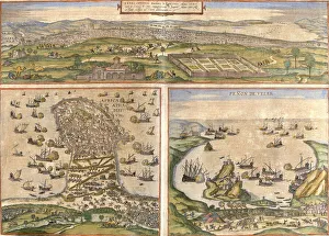
Background imageMaps Collection: Views of Tunis (Tunes) and Mahdia (Aphrodisium) in Tunisia

Views of Tunis (Tunes) and Mahdia (Aphrodisium) in Tunisia
LRI4707713 Views of Tunis (Tunes) and Mahdia (Aphrodisium) in Tunisia, and Penon de Velez de la Gomera or Badis (Bades) (Penon de Veles), penon de Veles, disputed between Spain and Morocco (etching)

Background imageMaps Collection: North Africa with siege of Tunis and Nile delta (engraving, 1596)

North Africa with siege of Tunis and Nile delta (engraving, 1596)
LRI4718587 North Africa with siege of Tunis and Nile delta (engraving, 1596) by Mercator, Gerardus (1512-94); Private Collection; (add.info.: Barbaria)

Background imageMaps Collection: Map of Tunis, from Civitates Orbis Terrarum by Georg Braun (1541-1622

Map of Tunis, from Civitates Orbis Terrarum by Georg Braun (1541-1622
STC121078 Map of Tunis, from Civitates Orbis Terrarum by Georg Braun (1541-1622) and Frans Hogenberg (1535-90), 1574 (coloured engraving) by Hoefnagel


All Professionally Made to Order for Quick Shipping


-

Maps Collection

Tunisia is a country located in North Africa, bordered by Algeria, Libya and the Mediterranean Sea and has a population of over 11 million people and its capital city is Tunis. Tunisia has a rich history and culture that dates back to ancient times. Its landscape includes mountains, deserts, forests and beaches. The country is home to many archaeological sites from the Roman Empire as well as some of the oldest cities in Africa. Maps of Tunisia are essential for anyone travelling or exploring this fascinating country. They provide an overview of its geography, including major cities, roads, rivers and lakes as well as national parks and other points of interest. They also show political boundaries such as provinces or regions which can be useful when planning trips or researching local customs or cultures.
+

Our beautiful pictures are available as Framed Prints, Photos, Wall Art and Photo Gifts

The Maps of Tunisia Africa collection from Media Storehouse is a fascinating and unique assortment of wall art and framed prints that depict the geography, history, and culture of Tunisia. Our collection features a range of maps dating back to the 16th century, including antique maps that showcase the country's cities, regions, and landmarks. These maps provide insight into Tunisia's rich history as well as its current political landscape. They also offer an opportunity for viewers to explore the diverse landscapes of this North African nation, from its sandy beaches to its rugged mountains. In addition to traditional cartographic depictions, the Maps of Tunisia Africa collection includes artistic renderings that highlight different aspects of Tunisian life such as agriculture or religion. These prints are perfect for anyone interested in exploring this beautiful country or adding some cultural flair to their home decor.
+

What are Maps of Tunisia Africa art prints?

Maps of Tunisia Africa art prints are high-quality reproductions of maps that depict the geography and topography of Tunisia, a country located in North Africa. These prints showcase the intricate details and features of the region, including its cities, towns, rivers, mountains, deserts and other landmarks. They are created using advanced printing techniques that ensure accurate reproduction of colors and fine details. Maps of Tunisia Africa art prints can be used for various purposes such as home decor or educational resources. They are perfect for those who love to travel or have an interest in geography or history. These prints also make great gifts for friends and family members who share similar interests. We offer a wide range of Maps of Tunisia Africa art prints to choose from. Our collection includes vintage maps as well as modern designs that cater to different tastes and preferences. All our products come with a quality guarantee so you can be assured that you're getting nothing but the best when you shop with us.
+

What Maps of Tunisia Africa art prints can I buy from Media Storehouse?

We offer a wide range of Maps of Tunisia Africa art prints that you can buy. These maps are available in various sizes and formats, including framed and unframed prints, canvas wraps, and photo gifts. You can choose from vintage or contemporary styles to suit your taste. Some popular options include the Tunis Map 1899 Vintage Style Print, which features intricate details of the city's streets and landmarks; the Tunisia Map Watercolor Art Print, which adds a splash of color to your walls with its vibrant hues; and the North Africa Political Map Poster, which provides an overview of the region's geography. Whether you're looking for a decorative piece for your home or office or a unique gift for someone who loves travel or history, we have plenty of Maps of Tunisia Africa art prints to choose from.
+

How do I buy Maps of Tunisia Africa art prints?

To buy Maps of Tunisia Africa art prints from Media Storehouse, you can browse our extensive collection of artwork online. Simply search for "Maps of Tunisia Africa" in the search bar on our website and select the print that catches your eye. Once you have found a print that you like, add it to your cart and proceed to checkout. During checkout, you will be prompted to enter your shipping information and payment details. After completing these steps, your order will be processed and shipped directly to your doorstep. We offer high-quality art prints that are perfect for adding a touch of culture and sophistication to any space. Whether you're looking for a unique piece of wall decor or a thoughtful gift for someone special, Maps of Tunisia Africa art prints are sure to impress. So why wait? Start browsing today.
+

How much do Maps of Tunisia Africa art prints cost?

We offer a wide range of Maps of Tunisia Africa art prints that are available at varying prices. The cost of each print depends on several factors such as the size, quality, and type of paper used to produce it. Our collection includes vintage maps, contemporary designs and artistic interpretations that cater to different tastes and preferences. We take pride in providing high-quality art prints that are affordable without compromising on their aesthetic value. Our Maps of Tunisia Africa art prints make great additions to any home or office space and can be purchased for personal use or as gifts for loved ones. Our website features an easy-to-use interface where you can browse through our extensive collection, select their preferred print(s), add them to cart and checkout securely. We also offer various payment options for convenience. The cost of our Maps of Tunisia Africa art prints is reasonable considering the quality they offer.
+

How will my Maps of Tunisia Africa art prints be delivered to me?

We take pride in delivering your Maps of Tunisia Africa art prints with utmost care and efficiency. Your order will be processed promptly upon receipt and dispatched to you via our trusted courier partners. We use only the best quality packaging materials to ensure that your artwork arrives at your doorstep in pristine condition. We offer a range of delivery options for you to choose from, depending on your location and urgency. Our standard delivery service is reliable and usually takes between 3-5 working days within the UK, while international deliveries may take slightly longer. Rest assured that we will keep you informed every step of the way through email notifications about the status of your order. You can also track its progress online using our tracking system. We are committed to providing a hassle-free experience when it comes to delivering your Maps of Tunisia Africa art prints right to your door.