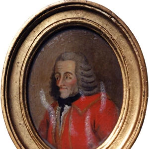
Fine Art Print : Map /s America 1582


![]()
Fine Art Prints from Mary Evans Picture Library
Map /s America 1582
Part of a map by Juan Martinez atlas, published at Messina, of the Northern countries of South America
Mary Evans Picture Library makes available wonderful images created for people to enjoy over the centuries
Media ID 613456
© Mary Evans Picture Library 2015 - https://copyrighthub.org/s0/hub1/creation/maryevans/MaryEvansPictureID/10090799
1582 Atlas Countries Juan Maps Messina
20"x16" (+3" Border) Fine Art Print
Discover the rich history and intrigue of the New World with our exquisite selection of Fine Art Prints from the Media Storehouse. This captivating piece, "Map of America 1582" by Juan Martinez, showcases the Northern countries of South America as depicted in the atlas published at Messina. The intricate details and vibrant colors of this rare map from the Mary Evans Picture Library transport you back in time, making it a stunning addition to any home or office. Bring history to life with our high-quality Fine Art Prints, perfect for collectors, historians, or anyone with a passion for the past.
20x16 image printed on 26x22 Fine Art Rag Paper with 3" (76mm) white border. Our Fine Art Prints are printed on 300gsm 100% acid free, PH neutral paper with archival properties. This printing method is used by museums and art collections to exhibit photographs and art reproductions.
Our fine art prints are high-quality prints made using a paper called Photo Rag. This 100% cotton rag fibre paper is known for its exceptional image sharpness, rich colors, and high level of detail, making it a popular choice for professional photographers and artists. Photo rag paper is our clear recommendation for a fine art paper print. If you can afford to spend more on a higher quality paper, then Photo Rag is our clear recommendation for a fine art paper print.
Estimated Image Size (if not cropped) is 50.8cm x 40.6cm (20" x 16")
Estimated Product Size is 66cm x 55.9cm (26" x 22")
These are individually made so all sizes are approximate
Artwork printed orientated as per the preview above, with landscape (horizontal) orientation to match the source image.
EDITORS COMMENTS
This stunning print captures a piece of history with a map of South America from 1582. Part of a larger atlas by Juan Martinez, this particular section focuses on the northern countries of the continent. Published in Messina, Italy, this map provides a glimpse into the geographical knowledge and cartography techniques of the time.
The intricate details and ornate design showcase the artistry and skill that went into creating maps during this period. Each country is labeled with precision, giving viewers an insight into how these regions were perceived centuries ago. From Venezuela to Colombia, each area is depicted with care and accuracy.
As we gaze upon this historical artifact, we are transported back in time to an era when exploration and discovery were at the forefront of human endeavor. The map serves as a reminder of the importance of geography in shaping our understanding of the world around us.
Thanks to Mary Evans Picture Library, we are able to appreciate and admire this piece of history from their collection. It serves as a valuable resource for researchers, historians, and anyone interested in delving into the past through visual representations like maps.
MADE IN THE USA
Safe Shipping with 30 Day Money Back Guarantee
FREE PERSONALISATION*
We are proud to offer a range of customisation features including Personalised Captions, Color Filters and Picture Zoom Tools
SECURE PAYMENTS
We happily accept a wide range of payment options so you can pay for the things you need in the way that is most convenient for you
* Options may vary by product and licensing agreement. Zoomed Pictures can be adjusted in the Cart.