Fine Art Print > Maps and Charts > Africa
Fine Art Print : MAP / AFRICA 1763


![]()
Fine Art Prints from Mary Evans Picture Library
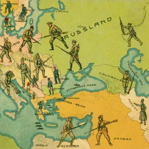
MAP / AFRICA 1763
Map of Africa
Mary Evans Picture Library makes available wonderful images created for people to enjoy over the centuries
Media ID 608768
© Mary Evans Picture Library 2015 - https://copyrighthub.org/s0/hub1/creation/maryevans/MaryEvansPictureID/10113847
20"x16" (+3" Border) Fine Art Print
20x16 image printed on 26x22 Fine Art Rag Paper with 3" (76mm) white border. Our Fine Art Prints are printed on 300gsm 100% acid free, PH neutral paper with archival properties. This printing method is used by museums and art collections to exhibit photographs and art reproductions.
Our fine art prints are high-quality prints made using a paper called Photo Rag. This 100% cotton rag fibre paper is known for its exceptional image sharpness, rich colors, and high level of detail, making it a popular choice for professional photographers and artists. Photo rag paper is our clear recommendation for a fine art paper print. If you can afford to spend more on a higher quality paper, then Photo Rag is our clear recommendation for a fine art paper print.
Estimated Image Size (if not cropped) is 40.6cm x 50.8cm (16" x 20")
Estimated Product Size is 55.9cm x 66cm (22" x 26")
These are individually made so all sizes are approximate
Artwork printed orientated as per the preview above, with portrait (vertical) orientation to match the source image.
FEATURES IN THESE COLLECTIONS
> Africa
> Related Images
> Maps and Charts
> Early Maps
> Maps and Charts
> Related Images
EDITORS COMMENTS
This stunning print of a historical map of Africa from 1763 takes us on a journey back in time to explore the continent as it was centuries ago. The intricate details and vibrant colors of this map provide a fascinating glimpse into the geography and political boundaries of Africa during this period.
As we study the map, we can see how different regions were divided and labeled, giving us insight into the diverse cultures and civilizations that existed across the continent. From the vast deserts of North Africa to the lush jungles of Central Africa, each area is depicted with precision and accuracy.
The historical significance of this map cannot be understated, as it serves as a valuable resource for understanding how African nations have evolved over time. It offers a window into colonialism, trade routes, and cultural exchanges that have shaped the continent's rich history.
Whether you are a history buff or simply appreciate beautiful cartography, this print is sure to captivate your imagination and spark your curiosity about Africa's past. Display it proudly in your home or office to add a touch of elegance and intrigue to your decor.
MADE IN THE USA
Safe Shipping with 30 Day Money Back Guarantee
FREE PERSONALISATION*
We are proud to offer a range of customisation features including Personalised Captions, Color Filters and Picture Zoom Tools
SECURE PAYMENTS
We happily accept a wide range of payment options so you can pay for the things you need in the way that is most convenient for you
* Options may vary by product and licensing agreement. Zoomed Pictures can be adjusted in the Cart.