Fine Art Print > Europe > Netherlands > Maps
Fine Art Print : Map of Sint-Omaars, 1650-1700. Creator: Anon


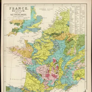
![]()
Fine Art Prints From Heritage Images
Map of Sint-Omaars, 1650-1700. Creator: Anon
Map of Sint-Omaars, 1650-1700
Heritage Images features heritage image collections
Media ID 36330195
© Heritage Art/Heritage Images
Fortified Saint Omer Watercolour Paint
20"x16" (+3" Border) Fine Art Print
Discover the captivating history of Sint-Omaars with our exquisite Fine Art Print of this intricately detailed map from Heritage Images. Dating back to the 17th century, this Anonymous creation transports you back in time, showcasing the city's layout and architectural gems as they once were. Bring a piece of historical charm into your home or office with this stunning, museum-quality print. Perfect for history enthusiasts, map collectors, or anyone looking to add a unique touch to their decor. Order now and let the story of Sint-Omaars unfold in your space.
20x16 image printed on 26x22 Fine Art Rag Paper with 3" (76mm) white border. Our Fine Art Prints are printed on 300gsm 100% acid free, PH neutral paper with archival properties. This printing method is used by museums and art collections to exhibit photographs and art reproductions.
Our fine art prints are high-quality prints made using a paper called Photo Rag. This 100% cotton rag fibre paper is known for its exceptional image sharpness, rich colors, and high level of detail, making it a popular choice for professional photographers and artists. Photo rag paper is our clear recommendation for a fine art paper print. If you can afford to spend more on a higher quality paper, then Photo Rag is our clear recommendation for a fine art paper print.
Estimated Image Size (if not cropped) is 50.8cm x 40.6cm (20" x 16")
Estimated Product Size is 66cm x 55.9cm (26" x 22")
These are individually made so all sizes are approximate
Artwork printed orientated as per the preview above, with landscape (horizontal) orientation to match the source image.
FEATURES IN THESE COLLECTIONS
> Europe
> Netherlands
> Maps
> Europe
> Netherlands
> Posters
> Europe
> Netherlands
> Related Images
> Maps and Charts
> Early Maps
> Maps and Charts
> Netherlands
> Maps and Charts
> Related Images
EDITORS COMMENTS
This stunning 17th century map print, titled "Map of Sint-Omaars," is an anonymous masterpiece from the Rijksmuseum's vast collection. The intricately detailed drawing showcases the fortified city of Sint-Omaars, located in the French department of Pas-de-Calais, near the border of the Netherlands. The map, created between 1650 and 1700, is believed to be of Dutch origin due to the Dutch influence in the region during this time. The map is rendered in ink and watercolour paint on paper, with vibrant hues of blue and green used to depict bodies of water and lush green landscapes. The city of Sint-Omaars is depicted as a well-fortified town, with its walls and bastions clearly visible. The map also includes various topographical features, such as rivers, forests, and roads, as well as the locations of churches, mills, and other important structures. The historical significance of this map lies in its ability to provide a glimpse into the geography and layout of Sint-Omaars during the 17th century. This era was marked by political and military tensions between France and the Netherlands, making the fortification of cities like Sint-Omaars crucial for the defense of territories. The map serves as an important record of the strategic importance of this city during this time. The intricate details and beautiful color palette make this map a work of art in its own right, showcasing the skill and talent of the anonymous artist. The map is a valuable addition to any collection of historic maps or European art, and a fascinating glimpse into the history of Sint-Omaars and the region during the 17th century.
MADE IN THE USA
Safe Shipping with 30 Day Money Back Guarantee
FREE PERSONALISATION*
We are proud to offer a range of customisation features including Personalised Captions, Color Filters and Picture Zoom Tools
SECURE PAYMENTS
We happily accept a wide range of payment options so you can pay for the things you need in the way that is most convenient for you
* Options may vary by product and licensing agreement. Zoomed Pictures can be adjusted in the Basket.