Fine Art Print > Arts > Photorealistic artworks > Detailed art pieces > Masterful detailing in art
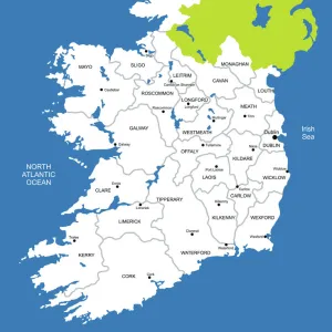
Fine Art Print : Ireland Vector Map


![]()
Fine Art Prints from Fine Art Storehouse
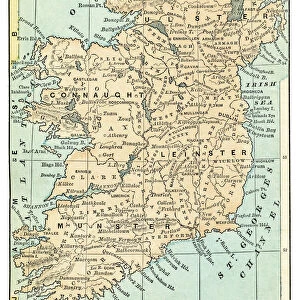
Ireland Vector Map
Highly detailed vector map of the Republic of Ireland. File was created on June 24, 2011. The colors in the.eps-file are ready for print (CMYK). Included files: EPS (v8) and Hi-Res JPG
Unleash your creativity and transform your space into a visual masterpiece!
Media ID 14833465
20"x20" (+3" Border) Fine Art Print
Discover the intricacies of Ireland's geography with our exquisite Fine Art Print of the Republic of Ireland Vector Map. This highly detailed vector design, created on June 24, 2011, showcases the Emerald Isle's borders and features in vibrant CMYK colors, ready for professional printing. Included in your purchase are an EPS (version 8) file and a high-resolution JPG, ensuring a stunning and accurate representation of this beloved land. Bring a piece of Ireland's rich history and culture into your home or office with this captivating work of art.
20x20 image printed on 26x26 Fine Art Rag Paper with 3" (76mm) white border. Our Fine Art Prints are printed on 300gsm 100% acid free, PH neutral paper with archival properties. This printing method is used by museums and art collections to exhibit photographs and art reproductions.
Our fine art prints are high-quality prints made using a paper called Photo Rag. This 100% cotton rag fibre paper is known for its exceptional image sharpness, rich colors, and high level of detail, making it a popular choice for professional photographers and artists. Photo rag paper is our clear recommendation for a fine art paper print. If you can afford to spend more on a higher quality paper, then Photo Rag is our clear recommendation for a fine art paper print.
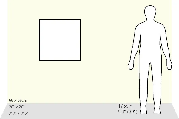
Estimated Image Size (if not cropped) is 50.8cm x 50.8cm (20" x 20")
Estimated Product Size is 66cm x 66cm (26" x 26")
These are individually made so all sizes are approximate
Artwork printed orientated as per the preview above, with landscape (horizontal) or portrait (vertical) orientation to match the source image.
FEATURES IN THESE COLLECTIONS
> Arts
> Photorealistic artworks
> Detailed art pieces
> Masterful detailing in art
> Europe
> Republic of Ireland
> Maps
> Europe
> Republic of Ireland
> Related Images
> Maps and Charts
> Related Images
> Fine Art Storehouse
> Map
> Map Illustrations
EDITORS COMMENTS
This stunning print showcases the beauty and intricacy of Ireland's geography through a highly detailed vector map. Created on June 24,2011, this file captures the essence of the Republic of Ireland with remarkable precision. The colors in the. eps-file are specifically designed for print using CMYK technology, ensuring vibrant and accurate reproduction. The rich green hues that dominate this map perfectly encapsulate Ireland's lush landscapes and rolling hills. From its rugged coastlines to its charming countryside, every corner of this enchanting island is meticulously depicted in this artwork. Whether you have a deep connection to Ireland or simply appreciate fine cartography, this print is sure to captivate your imagination. Hang it proudly on your wall as a testament to your love for travel or use it as an educational tool to explore the various regions and cities within Ireland. Included in this purchase are both an EPS (v8) file and a high-resolution JPG image, offering flexibility for different printing needs.
MADE IN THE USA
Safe Shipping with 30 Day Money Back Guarantee
FREE PERSONALISATION*
We are proud to offer a range of customisation features including Personalised Captions, Color Filters and Picture Zoom Tools
SECURE PAYMENTS
We happily accept a wide range of payment options so you can pay for the things you need in the way that is most convenient for you
* Options may vary by product and licensing agreement. Zoomed Pictures can be adjusted in the Cart.