Fine Art Print > Europe > Serbia > Maps
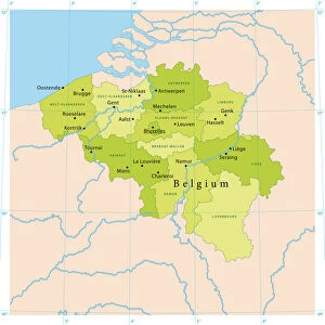
Fine Art Print : Brussels map

![]()
Fine Art Prints From Fine Art Storehouse
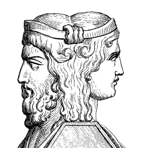
Brussels map
Illustration of a Brussels map
Unleash your creativity and transform your space into a visual masterpiece!
Nastasic
Media ID 13750703
© This content is subject to copyright
Belgium Benelux Brussels Capital Region City Map Flanders Belgium Image Date Serbia
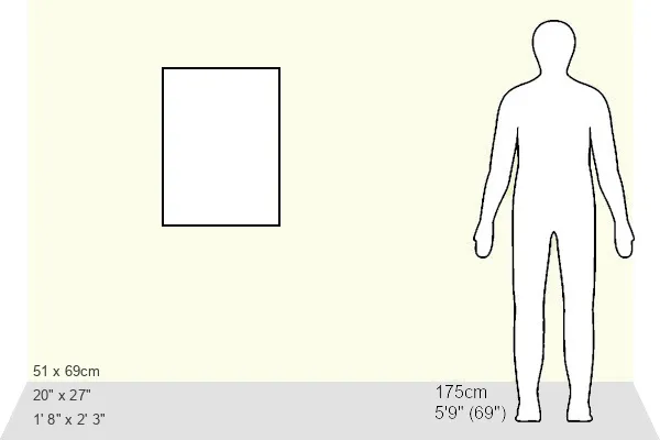
21"x14" (+3" Border) Fine Art Print
Discover the enchanting allure of Brussels with our exquisite Brussels map fine art print by Nastasic from the Media Storehouse collection. This stunning piece of art transports you to the heart of Europe's cultural melting pot, where ancient architecture and modern wonders harmoniously coexist. The intricate details of this map bring the city's rich history and vibrant energy to life, making it a captivating addition to any home or office space. Experience the charm of Brussels like never before with our museum-quality fine art print.
21x14 image printed on 27x20 Fine Art Rag Paper with 3" (76mm) white border. Our Fine Art Prints are printed on 300gsm 100% acid free, PH neutral paper with archival properties. This printing method is used by museums and art collections to exhibit photographs and art reproductions.
Our fine art prints are high-quality prints made using a paper called Photo Rag. This 100% cotton rag fibre paper is known for its exceptional image sharpness, rich colors, and high level of detail, making it a popular choice for professional photographers and artists. Photo rag paper is our clear recommendation for a fine art paper print. If you can afford to spend more on a higher quality paper, then Photo Rag is our clear recommendation for a fine art paper print.
Estimated Image Size (if not cropped) is 35.5cm x 53.3cm (14" x 21")
Estimated Product Size is 50.8cm x 68.6cm (20" x 27")
These are individually made so all sizes are approximate
Artwork printed orientated as per the preview above, with portrait (vertical) orientation to match the source image.
FEATURES IN THESE COLLECTIONS
> Europe
> Belgium
> Related Images
> Europe
> Serbia
> Related Images
> Maps and Charts
> Related Images
EDITORS COMMENTS
This print showcases an exquisite illustration of a Brussels map, taking us back in time to the 19th century. The intricate details and delicate lines of this engraving are truly mesmerizing, capturing the essence of cartography as both an art form and a historical record. The Brussels map depicted here is not just a geographical representation but also a window into the rich history and cultural significance of Belgium's capital city. From its position within the Benelux region to its connection with Flanders, this map provides valuable insights into the geopolitical landscape of Europe during that era. The artist behind this remarkable piece is Nastasic, whose skillful use of illustration techniques such as woodcut and etching brings depth and character to every stroke. The result is a visually stunning engraved image that transports viewers through time. Whether you have an affinity for maps or simply appreciate fine art, this vertical print will undoubtedly make a striking addition to any space. Its timeless charm serves as a reminder of how our world has evolved over centuries while preserving traces of our past.
MADE IN THE USA
Safe Shipping with 30 Day Money Back Guarantee
FREE PERSONALISATION*
We are proud to offer a range of customisation features including Personalised Captions, Color Filters and Picture Zoom Tools
SECURE PAYMENTS
We happily accept a wide range of payment options so you can pay for the things you need in the way that is most convenient for you
* Options may vary by product and licensing agreement. Zoomed Pictures can be adjusted in the Basket.