Fine Art Print > North America > Canada > Maps
Fine Art Print : Antique map of Canada, 1897, late 19th Century


![]()
Fine Art Prints From Fine Art Storehouse
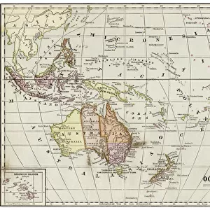
Antique map of Canada, 1897, late 19th Century
Vintage engraving of a Antique map of Canada, 1897, late 19th Century. British America, Canada, New Brunswick, Nova Scotia
Unleash your creativity and transform your space into a visual masterpiece!
duncan1890
Media ID 18206099
© of Duncan P Walker
20"x16" (+3" Border) Fine Art Print
Step back in time with our exquisite antique map of Canada from the Fine Art Storehouse. This vintage engraving, created in 1897, offers a captivating glimpse into the late 19th century. Detailing British America and Canada, this fine art print showcases New Brunswick and Nova Scotia with intricate lines and meticulous detail. Add an air of history and sophistication to any room with this stunning antique map, a perfect addition to your home or office decor.
20x16 image printed on 26x22 Fine Art Rag Paper with 3" (76mm) white border. Our Fine Art Prints are printed on 300gsm 100% acid free, PH neutral paper with archival properties. This printing method is used by museums and art collections to exhibit photographs and art reproductions.
Our fine art prints are high-quality prints made using a paper called Photo Rag. This 100% cotton rag fibre paper is known for its exceptional image sharpness, rich colors, and high level of detail, making it a popular choice for professional photographers and artists. Photo rag paper is our clear recommendation for a fine art paper print. If you can afford to spend more on a higher quality paper, then Photo Rag is our clear recommendation for a fine art paper print.
Estimated Image Size (if not cropped) is 50.8cm x 40.6cm (20" x 16")
Estimated Product Size is 66cm x 55.9cm (26" x 22")
These are individually made so all sizes are approximate
Artwork printed orientated as per the preview above, with landscape (horizontal) orientation to match the source image.
FEATURES IN THESE COLLECTIONS
> Maps and Charts
> Related Images
> North America
> Canada
> Maps
> North America
> Canada
> Related Images
> Fine Art Storehouse
> Map
> Historical Maps
EDITORS COMMENTS
This print showcases an exquisite antique map of Canada, dating back to the late 19th century. A true testament to the rich history and intricate craftsmanship of cartography, this vintage engraving takes us on a journey through time. The map depicts British America in all its glory, with a particular focus on Canada's provinces such as New Brunswick and Nova Scotia. Every detail is meticulously etched onto the paper, revealing the geographical features and boundaries that shaped this vast land over a century ago. As we gaze upon this piece of art, we are transported to an era when exploration was at its peak and borders were still being defined. The sepia tones lend a sense of nostalgia, evoking memories of bygone days where maps like these were cherished possessions for adventurers and scholars alike. It serves as a reminder of how far we have come in our understanding of geography while honoring those who paved the way for our knowledge today. Duncan1890 has masterfully captured not only the physical beauty but also the historical significance encapsulated within this antique map. This print is sure to be treasured by collectors or anyone with an appreciation for both artistry and history.
MADE IN THE USA
Safe Shipping with 30 Day Money Back Guarantee
FREE PERSONALISATION*
We are proud to offer a range of customisation features including Personalised Captions, Color Filters and Picture Zoom Tools
SECURE PAYMENTS
We happily accept a wide range of payment options so you can pay for the things you need in the way that is most convenient for you
* Options may vary by product and licensing agreement. Zoomed Pictures can be adjusted in the Basket.