Fine Art Print > Africa > Related Images
Fine Art Print : The Central Mediterranean, from a nautical atlas, 1520 (ink on vellum) (see also
 (see also")

Please select a smaller print size for this image
![]()
Fine Art Prints From Fine Art Finder
The Central Mediterranean, from a nautical atlas, 1520 (ink on vellum) (see also
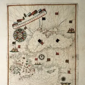
XOT330915 The Central Mediterranean, from a nautical atlas, 1520 (ink on vellum) (see also ) by Giovanni Xenodocus da Corfu (fl. 16th Century); 32x22.3 cm; Museo Correr, Venice, Italy; Greek, out of copyright
Media ID 12852589
© www.bridgemanimages.com
Adriatic Sea Chart Corsica Croatia Ionian Sea Mapping Portolan Sardinia Sicily
20"x16" (+3" Border) Fine Art Print
Discover the rich history of maritime exploration with our exquisite selection of Fine Art Prints from Media Storehouse. This captivating image, "The Central Mediterranean, from a Nautical Atlas, 1520 (ink on vellum)" (XOT330915), showcases the intricate detail and masterful artistry of Giovanni Xenodocus da Corfu. Drawn on vellum, this rare and antique map transports you back in time, offering a glimpse into the world as it was discovered over 500 years ago. Add a touch of history and sophistication to your home or office with this stunning piece of art. For more nautical treasures, explore our collection of Fine Art Prints at Media Storehouse.
20x16 image printed on 26x22 Fine Art Rag Paper with 3" (76mm) white border. Our Fine Art Prints are printed on 300gsm 100% acid free, PH neutral paper with archival properties. This printing method is used by museums and art collections to exhibit photographs and art reproductions.
Our fine art prints are high-quality prints made using a paper called Photo Rag. This 100% cotton rag fibre paper is known for its exceptional image sharpness, rich colors, and high level of detail, making it a popular choice for professional photographers and artists. Photo rag paper is our clear recommendation for a fine art paper print. If you can afford to spend more on a higher quality paper, then Photo Rag is our clear recommendation for a fine art paper print.
Estimated Image Size (if not cropped) is 50.8cm x 35.5cm (20" x 14")
Estimated Product Size is 66cm x 55.9cm (26" x 22")
These are individually made so all sizes are approximate
Artwork printed orientated as per the preview above, with landscape (horizontal) orientation to match the source image.
FEATURES IN THESE COLLECTIONS
> Africa
> Related Images
> Europe
> Italy
> Related Images
EDITORS COMMENTS
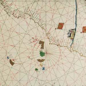
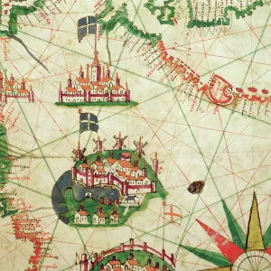
This print takes us back in time to the year 1520, when Giovanni Xenodocus da Corfu created an exquisite nautical atlas. The image showcases the Central Mediterranean region, beautifully rendered with ink on vellum. Measuring 32x22.3 cm, this historical masterpiece is now housed in the Museo Correr in Venice, Italy. As we gaze upon this ancient map, our eyes are drawn to the intricate details that bring life to its surface. From Italy's boot-shaped peninsula and the enchanting islands of Corsica, Sardinia, and Sicily to North Africa's coastline and Croatia's Adriatic Sea shores - every contour has been meticulously depicted by da Corfu. The artistry of cartography shines through as we marvel at how effortlessly da Corfu captured the essence of these lands and seas. This portolan chart not only serves as a navigational tool but also stands as a testament to human curiosity and exploration during that era. Transported by this visual journey through time, one can almost imagine sailors relying on similar maps for their daring voyages across treacherous waters. It reminds us of how far we have come in terms of mapping technology while appreciating the ingenuity required by those who came before us. Thanks to Fine Art Finder and www. bridgemanimages. com for preserving this remarkable piece of history for all generations to admire and learn from. Let it serve as a reminder that even centuries-old works continue to inspire awe and fascination
MADE IN THE USA
Safe Shipping with 30 Day Money Back Guarantee
FREE PERSONALISATION*
We are proud to offer a range of customisation features including Personalised Captions, Color Filters and Picture Zoom Tools
SECURE PAYMENTS
We happily accept a wide range of payment options so you can pay for the things you need in the way that is most convenient for you
* Options may vary by product and licensing agreement. Zoomed Pictures can be adjusted in the Basket.