Fine Art Print > Maps and Charts > Early Maps
Fine Art Print : Map to illustrate the Geographical Position of the City of Sarai (litho)
")

![]()
Fine Art Prints From Fine Art Finder
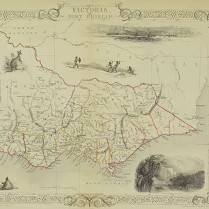
Map to illustrate the Geographical Position of the City of Sarai (litho)
3628566 Map to illustrate the Geographical Position of the City of Sarai (litho) by English School, (20th century); Private Collection; (add.info.: Map to illustrate the Geographical Position of the City of Sarai. Illustration for The Book of Ser Marco Polo, translated and edited by Henry Yule (3rd edn, John Murray, 1921).); © Look and Learn
Media ID 22985252
© Look and Learn / Bridgeman Images
Far East Illustrate Journeys Marco Polo Travels
20"x16" (+3" Border) Fine Art Print
Discover the rich history of the City of Sarai with this stunning Fine Art Print from Media Storehouse and Bridgeman Images. This beautiful lithograph, titled "Map to illustrate the Geographical Position of the City of Sarai," is a captivating representation of the city's geographical location in the 20th century. Created by the English School, this private collection piece is a must-have for history enthusiasts and art collectors alike. Bring a piece of the past into your home or office and transport yourself to another time and place with this exquisite work of art.
20x16 image printed on 26x22 Fine Art Rag Paper with 3" (76mm) white border. Our Fine Art Prints are printed on 300gsm 100% acid free, PH neutral paper with archival properties. This printing method is used by museums and art collections to exhibit photographs and art reproductions.
Our fine art prints are high-quality prints made using a paper called Photo Rag. This 100% cotton rag fibre paper is known for its exceptional image sharpness, rich colors, and high level of detail, making it a popular choice for professional photographers and artists. Photo rag paper is our clear recommendation for a fine art paper print. If you can afford to spend more on a higher quality paper, then Photo Rag is our clear recommendation for a fine art paper print.
Estimated Image Size (if not cropped) is 50.8cm x 40.6cm (20" x 16")
Estimated Product Size is 66cm x 55.9cm (26" x 22")
These are individually made so all sizes are approximate
Artwork printed orientated as per the preview above, with landscape (horizontal) orientation to match the source image.
FEATURES IN THESE COLLECTIONS
> Fine Art Finder
> Artists
> English School
> Maps and Charts
> Early Maps
> Maps and Charts
> Related Images
EDITORS COMMENTS
This lithograph print titled "Map to illustrate the Geographical Position of the City of Sarai" takes us on a visual journey through time and space. Created by an English School in the 20th century, this artwork is part of a private collection. The map serves as an illustration for The Book of Ser Marco Polo, translated and edited by Henry Yule in 1921. It offers a glimpse into the historical travels of Marco Polo, one of history's most renowned explorers. As we examine this intricate engraving, we are transported to the Far East and immersed in its rich history. The city of Sarai takes center stage on this map, showcasing its geographical position within Asia. Through detailed cartography and meticulous craftsmanship, we witness how travel was perceived during that era. This piece not only provides insight into ancient trade routes but also highlights the importance of Sarai as a hub connecting various regions. As our eyes wander across this print, we can't help but marvel at the skillful execution and attention to detail captured by Bridgeman Images. Whether you are an avid historian or simply appreciate fine art, this lithograph invites you to explore distant lands while unraveling layers upon layers of historical significance.
MADE IN THE USA
Safe Shipping with 30 Day Money Back Guarantee
FREE PERSONALISATION*
We are proud to offer a range of customisation features including Personalised Captions, Color Filters and Picture Zoom Tools
SECURE PAYMENTS
We happily accept a wide range of payment options so you can pay for the things you need in the way that is most convenient for you
* Options may vary by product and licensing agreement. Zoomed Pictures can be adjusted in the Basket.