Fraud Blocker Skip to main content

Home > Fine Art Finder > Maps (celestial & Terrestrial)

Maps (celestial & Terrestrial) Collection (#27)

1,541 Items

Background imageMaps (celestial & Terrestrial) Collection: Map of the eatern territories of the Republic of Mexico as they were in 1862

Map of the eatern territories of the Republic of Mexico as they were in 1862
KW403239 Map of the eatern territories of the Republic of Mexico as they were in 1862, from The Universal Museum, published 1862 (engraving) by Spanish School

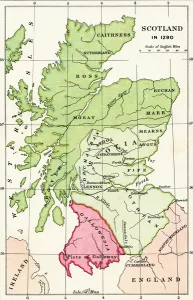
Background imageMaps (celestial & Terrestrial) Collection: Map of Scotland in 1290, from A Short History of the English People by J

Map of Scotland in 1290, from A Short History of the English People by J
KW392520 Map of Scotland in 1290, from A Short History of the English People by J. R. Green, published 1893 (colour litho) by English School, (19th century); Private Collection; Ken Welsh; English

Background imageMaps (celestial & Terrestrial) Collection: Map illustrating the Welsh wars of William Rufus and Henry I, from A Short History

Map illustrating the Welsh wars of William Rufus and Henry I, from A Short History
KW392517 Map illustrating the Welsh wars of William Rufus and Henry I, from A Short History of the English People by J. R

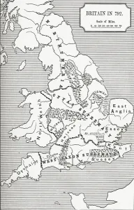
Background imageMaps (celestial & Terrestrial) Collection: Map of Britain in 792, from The Three Kingdoms 685 to 828 in A Short History

Map of Britain in 792, from The Three Kingdoms 685 to 828 in A Short History
KW392506 Map of Britain in 792, from The Three Kingdoms 685 to 828 in A Short History of the English People by J. R. Green, published 1893 (litho) by English School

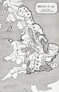
Background imageMaps (celestial & Terrestrial) Collection: Map of Britain in 626, from The Northumbrian Kingdom 588 to 685 in A Short History

Map of Britain in 626, from The Northumbrian Kingdom 588 to 685 in A Short History
KW392502 Map of Britain in 626, from The Northumbrian Kingdom 588 to 685 in A Short History of the English People by J. R

Background imageMaps (celestial & Terrestrial) Collection: Map of Barbados (engraving)

Map of Barbados (engraving)
XJF384013 Map of Barbados (engraving) by French School, (18th century); Private Collection; (add.info.: Plan de l Isle de la Barbade; ); French, out of copyright

Background imageMaps (celestial & Terrestrial) Collection: The seventeen regions of the Belgian lion, c. 1583 (coloured engraving)

The seventeen regions of the Belgian lion, c. 1583 (coloured engraving)
XOT366574 The seventeen regions of the Belgian lion, c.1583 (coloured engraving) by Visscher, Claes Jansz (c.1550-c.1612); Private Collection; Netherlandish, out of copyright

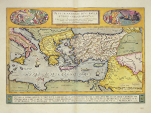
Background imageMaps (celestial & Terrestrial) Collection: Peregrinationis Divi Pauli Typus Corographicus page from the Atlas Major

Peregrinationis Divi Pauli Typus Corographicus page from the Atlas Major
XOT366482 Peregrinationis Divi Pauli Typus Corographicus page from the Atlas Major, 1662 (coloured engraving) by Blaeu, Joan (1596-1673); Private Collection; (add.info)

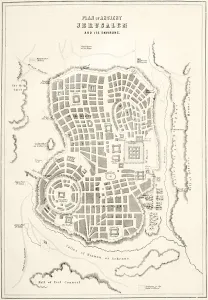
Background imageMaps (celestial & Terrestrial) Collection: Plan of ancient Jerusalem as it was presumed to be at the time of Jesus Christ (litho)

Plan of ancient Jerusalem as it was presumed to be at the time of Jesus Christ (litho)
KW360491 Plan of ancient Jerusalem as it was presumed to be at the time of Jesus Christ (litho) by English School, (19th century); Private Collection; (add.info.: from The Holy Bible)

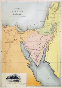
Background imageMaps (celestial & Terrestrial) Collection: Countries between Egypt and Canaan (colour litho)

Countries between Egypt and Canaan (colour litho)
KW360488 Countries between Egypt and Canaan (colour litho) by English School, (19th century); Private Collection; (add.info)

Background imageMaps (celestial & Terrestrial) Collection: Antiquae Urbis Perfecta Imago, Map of Rome, c. 1600 (engraving)

Antiquae Urbis Perfecta Imago, Map of Rome, c. 1600 (engraving)
XJF359082 Antiquae Urbis Perfecta Imago, Map of Rome, c.1600 (engraving) by Brambilla, Ambrogio (1549-1629); Private Collection; (add.info.: drawn by Nicolas van Aelst; ); Italian, out of copyright

Background imageMaps (celestial & Terrestrial) Collection: Map of the Polar Region (oil on panel)

Map of the Polar Region (oil on panel)
XOT351164 Map of the Polar Region (oil on panel) by Italian School, (16th century); Palazzo Vecchio (Cappella dei Priori) Florence, Italy; Italian, out of copyright

Background imageMaps (celestial & Terrestrial) Collection: Map of Cuba and the Caribbean (oil on panel)

Map of Cuba and the Caribbean (oil on panel)
XOT351168 Map of Cuba and the Caribbean (oil on panel) by Bonsignori, Stefano (fl.1575); Palazzo Vecchio (Cappella dei Priori) Florence, Italy; Italian, out of copyright

Background imageMaps (celestial & Terrestrial) Collection: Map of the Caribbean islands (oil on panel)

Map of the Caribbean islands (oil on panel)
XOT351167 Map of the Caribbean islands (oil on panel) by Bonsignori, Stefano (fl.1575); Palazzo Vecchio (Cappella dei Priori) Florence, Italy; Italian, out of copyright

Background imageMaps (celestial & Terrestrial) Collection: Map of the Bay of Bengal, the China Sea and Java (oil on panel)

Map of the Bay of Bengal, the China Sea and Java (oil on panel)
XOT351159 Map of the Bay of Bengal, the China Sea and Java (oil on panel) by Bonsignori, Stefano (fl.1575); Palazzo Vecchio (Cappella dei Priori) Florence, Italy; Italian, out of copyright

Background imageMaps (celestial & Terrestrial) Collection: The Troglodyte Region (oil on panel)

The Troglodyte Region (oil on panel)
XOT351157 The Troglodyte Region (oil on panel) by Bonsignori, Stefano (fl.1575); Palazzo Vecchio (Cappella dei Priori) Florence, Italy; Italian, out of copyright

Background imageMaps (celestial & Terrestrial) Collection: Map of Hamburg showing its first Opera House, 1690 (engraving)

Map of Hamburg showing its first Opera House, 1690 (engraving)
XJF336956 Map of Hamburg showing its first Opera House, 1690 (engraving) by German School, (17th century); Private Collection; (add.info)

Background imageMaps (celestial & Terrestrial) Collection: The Pacific Ocean, from an Atlas of the World in 33 Maps, Venice, 1st September 1553

The Pacific Ocean, from an Atlas of the World in 33 Maps, Venice, 1st September 1553
XOT330960 The Pacific Ocean, from an Atlas of the World in 33 Maps, Venice, 1st September 1553 (ink on vellum) (see also 330962) by Agnese, Battista (1514-64); 29x49 cm; Museo Correr, Venice

Background imageMaps (celestial & Terrestrial) Collection: Mount Sinai and the Red Sea, from an Atlas of the World in 33 Maps, Venice, 1st September 1553

Mount Sinai and the Red Sea, from an Atlas of the World in 33 Maps, Venice, 1st September 1553
XOT330964 Mount Sinai and the Red Sea, from an Atlas of the World in 33 Maps, Venice, 1st September 1553 (ink on vellum) (detail from 330963) by Agnese, Battista (1514-64); Museo Correr, Venice

Background imageMaps (celestial & Terrestrial) Collection: India and Malaysia, from an Atlas of the World in 33 Maps, Venice, 1st September 1553

India and Malaysia, from an Atlas of the World in 33 Maps, Venice, 1st September 1553
XOT330958 India and Malaysia, from an Atlas of the World in 33 Maps, Venice, 1st September 1553 (ink on vellum) (detail from 330955) by Agnese, Battista (1514-64); Museo Correr, Venice

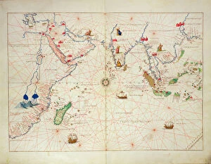
Background imageMaps (celestial & Terrestrial) Collection: The Indian Ocean, from an Atlas of the World in 33 Maps, Venice, 1st September 1553

The Indian Ocean, from an Atlas of the World in 33 Maps, Venice, 1st September 1553
XOT330955 The Indian Ocean, from an Atlas of the World in 33 Maps, Venice, 1st September 1553 (ink on vellum) (see also 330956) by Agnese, Battista (1514-64); 29x49 cm; Museo Correr, Venice

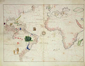
Background imageMaps (celestial & Terrestrial) Collection: The New World, from an Atlas of the World in 33 Maps, Venice, 1st September 1553

The New World, from an Atlas of the World in 33 Maps, Venice, 1st September 1553
XOT330959 The New World, from an Atlas of the World in 33 Maps, Venice, 1st September 1553 (ink on vellum) (see also 330961) by Agnese, Battista (1514-64); 29x49 cm; Museo Correr, Venice

Background imageMaps (celestial & Terrestrial) Collection: The Middle East, from an Atlas of the World in 33 Maps, Venice, 1st September 1553

The Middle East, from an Atlas of the World in 33 Maps, Venice, 1st September 1553
XOT330963 The Middle East, from an Atlas of the World in 33 Maps, Venice, 1st September 1553 (ink on vellum) (see also 330964) by Agnese, Battista (1514-64); 29x49 cm; Museo Correr, Venice

Background imageMaps (celestial & Terrestrial) Collection: South America, from an Atlas of the World in 33 Maps, Venice, 1st September 1553

South America, from an Atlas of the World in 33 Maps, Venice, 1st September 1553
XOT330961 South America, from an Atlas of the World in 33 Maps, Venice, 1st September 1553 (ink on vellum) (detail from 330959) by Agnese, Battista (1514-64); Museo Correr, Venice, Italy; Italian

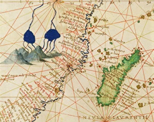
Background imageMaps (celestial & Terrestrial) Collection: Madagascar, from an Atlas of the World in 33 Maps, Venice, 1st September 1553 (ink on vellum)

Madagascar, from an Atlas of the World in 33 Maps, Venice, 1st September 1553 (ink on vellum)
XOT330957 Madagascar, from an Atlas of the World in 33 Maps, Venice, 1st September 1553 (ink on vellum) (detail from 330955) by Agnese, Battista (1514-64); Museo Correr, Venice, Italy; Italian

Background imageMaps (celestial & Terrestrial) Collection: Northern Europe, from an Atlas of the World in 33 maps, Venice, 1st September 1553

Northern Europe, from an Atlas of the World in 33 maps, Venice, 1st September 1553
XOT330951 Northern Europe, from an Atlas of the World in 33 maps, Venice, 1st September 1553 (ink on vellum) (see also 330952) by Agnese, Battista (1514-64); 29x49 cm; Museo Correr, Venice

Background imageMaps (celestial & Terrestrial) Collection: Europe and Central Asia, from an Atlas of the World in 33 Maps, Venice, 1st September 1553

Europe and Central Asia, from an Atlas of the World in 33 Maps, Venice, 1st September 1553
XOT330953 Europe and Central Asia, from an Atlas of the World in 33 Maps, Venice, 1st September 1553 (ink on vellum) (see also 330954) by Agnese, Battista (1514-64); 29x49 cm; Museo Correr, Venice

Background imageMaps (celestial & Terrestrial) Collection: The Continent of Europe, from an Atlas of the World in 33 Maps, Venice, 1st September 1553

The Continent of Europe, from an Atlas of the World in 33 Maps, Venice, 1st September 1553
XOT330949 The Continent of Europe, from an Atlas of the World in 33 Maps, Venice, 1st September 1553 (ink on vellum) (see also 330950) by Agnese, Battista (1514-64); 29x49 cm; Museo Correr, Venice

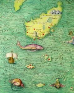
Background imageMaps (celestial & Terrestrial) Collection: Iceland, from an Atlas of the World in 33 maps, Venice, 1st September 1553 (ink on vellum)

Iceland, from an Atlas of the World in 33 maps, Venice, 1st September 1553 (ink on vellum)
XOT330952 Iceland, from an Atlas of the World in 33 maps, Venice, 1st September 1553 (ink on vellum) (detail from 330951) by Agnese, Battista (1514-64); Museo Correr, Venice, Italy; Italian

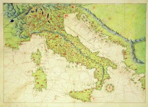
Background imageMaps (celestial & Terrestrial) Collection: Italy, from an Atlas of the World in 33 Maps, Venice, 1st September 1553 (ink on vellum)

Italy, from an Atlas of the World in 33 Maps, Venice, 1st September 1553 (ink on vellum)
XOT330948 Italy, from an Atlas of the World in 33 Maps, Venice, 1st September 1553 (ink on vellum) by Agnese, Battista (1514-64); Museo Correr, Venice, Italy; Italian, out of copyright

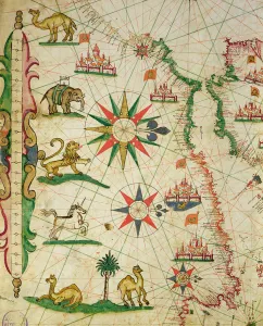
Background imageMaps (celestial & Terrestrial) Collection: Ethiopia, the Red Sea and Saudi Arabia, from an Atlas of the World in 33 Maps, Venice

Ethiopia, the Red Sea and Saudi Arabia, from an Atlas of the World in 33 Maps, Venice
XOT330947 Ethiopia, the Red Sea and Saudi Arabia, from an Atlas of the World in 33 Maps, Venice, 1st September 1553 (ink on vellum) (detail from 330946) by Agnese, Battista (1514-64); Museo Correr

Background imageMaps (celestial & Terrestrial) Collection: The Turkish Empire, from a nautical atlas, 1646 (ink on vellum)

The Turkish Empire, from a nautical atlas, 1646 (ink on vellum)
XOT330941 The Turkish Empire, from a nautical atlas, 1646 (ink on vellum) by Italian School, (17th century); Museo Correr, Venice, Italy; Italian, out of copyright

Background imageMaps (celestial & Terrestrial) Collection: The Coast of Turkey and Cyprus, from a nautical atlas of the Mediterranean and Middle East

The Coast of Turkey and Cyprus, from a nautical atlas of the Mediterranean and Middle East
XOT330933 The Coast of Turkey and Cyprus, from a nautical atlas of the Mediterranean and Middle East (ink on vellum) by Calopodio da Candia (fl)

Background imageMaps (celestial & Terrestrial) Collection: The Coast of Turkey and Cyprus, from a nautical atlas of the Mediterranean and Middle East

The Coast of Turkey and Cyprus, from a nautical atlas of the Mediterranean and Middle East
XOT330934 The Coast of Turkey and Cyprus, from a nautical atlas of the Mediterranean and Middle East (ink on vellum) by Calopodio da Candia (fl)

Background imageMaps (celestial & Terrestrial) Collection: The Island of Crete, from a nautical atlas, 1651 (ink on vellum) (detail from 330925)

The Island of Crete, from a nautical atlas, 1651 (ink on vellum) (detail from 330925)
XOT330926 The Island of Crete, from a nautical atlas, 1651 (ink on vellum) (detail from 330925) by Pietro Giovanni Prunes (fl. 17th Century); Museo Correr, Venice, Italy; Italian, out of copyright

Background imageMaps (celestial & Terrestrial) Collection: The Mediterranean Basin, from a nautical atlas, 1651 (ink on vellum) (see also 330923-330924)

The Mediterranean Basin, from a nautical atlas, 1651 (ink on vellum) (see also 330923-330924)
XOT330922 The Mediterranean Basin, from a nautical atlas, 1651 (ink on vellum) (see also ) by Pietro Giovanni Prunes (fl. 17th Century); 41.6x28 cm; Museo Correr, Venice, Italy; Italian

Background imageMaps (celestial & Terrestrial) Collection: The North African Coast, from a nautical atlas, 1651 (ink on vellum) (detail from 330919)

The North African Coast, from a nautical atlas, 1651 (ink on vellum) (detail from 330919)
XOT330920 The North African Coast, from a nautical atlas, 1651 (ink on vellum) (detail from 330919) by Pietro Giovanni Prunes (fl. 17th Century); Museo Correr, Venice, Italy; Italian, out of copyright

Background imageMaps (celestial & Terrestrial) Collection: The Atlantic coasts of Europe and the Western Mediterranean, from a nautical atlas

The Atlantic coasts of Europe and the Western Mediterranean, from a nautical atlas
XOT330919 The Atlantic coasts of Europe and the Western Mediterranean, from a nautical atlas, 1651 (ink on vellum) (see also ) by Pietro Giovanni Prunes (fl)

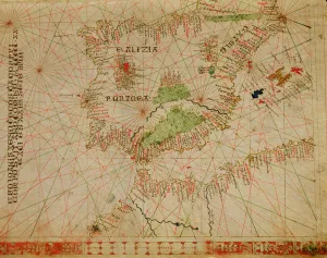
Background imageMaps (celestial & Terrestrial) Collection: The Iberian Peninsula and the north coast of Africa, from a nautical atlas, 1520

The Iberian Peninsula and the north coast of Africa, from a nautical atlas, 1520
XOT330912 The Iberian Peninsula and the north coast of Africa, from a nautical atlas, 1520 (ink on vellum) (detail from 330910) by Giovanni Xenodocus da Corfu (fl)

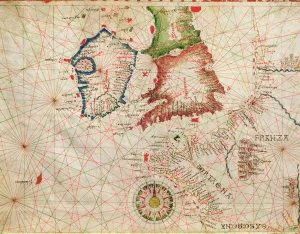
Background imageMaps (celestial & Terrestrial) Collection: The French Coast, England, Scotland and Ireland, from a nautical atlas, 1520 (ink on vellum)

The French Coast, England, Scotland and Ireland, from a nautical atlas, 1520 (ink on vellum)
XOT330911 The French Coast, England, Scotland and Ireland, from a nautical atlas, 1520 (ink on vellum) (detail from 330910) by Giovanni Xenodocus da Corfu (fl)

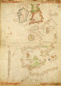
Background imageMaps (celestial & Terrestrial) Collection: The Atlantic Coasts of Europe and Africa, from a nautical Atlas, 1520 (ink on vellum)

The Atlantic Coasts of Europe and Africa, from a nautical Atlas, 1520 (ink on vellum)
XOT330910 The Atlantic Coasts of Europe and Africa, from a nautical Atlas, 1520 (ink on vellum) (see also ) by Giovanni Xenodocus da Corfu (fl)

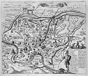
Background imageMaps (celestial & Terrestrial) Collection: Map of Ancient Rome (etching) (b / w photo)

Map of Ancient Rome (etching) (b / w photo)
XJF324409 Map of Ancient Rome (etching) (b/w photo) by English School, (16th century); Private Collection; English, out of copyright

Background imageMaps (celestial & Terrestrial) Collection: View of Rome, 1493 (woodcut) (b / w photo)

View of Rome, 1493 (woodcut) (b / w photo)
XJF324406 View of Rome, 1493 (woodcut) (b/w photo) by German School, (15th century); Private Collection; German, out of copyright

Background imageMaps (celestial & Terrestrial) Collection: Map of Palestine, from Theatrvm Orbis Terrarvm, 1570 (hand coloured engraving)

Map of Palestine, from Theatrvm Orbis Terrarvm, 1570 (hand coloured engraving)
XCF324389 Map of Palestine, from Theatrvm Orbis Terrarvm, 1570 (hand coloured engraving) by Ortelius, Abraham (1527-98); Private Collection; (add.info)

Background imageMaps (celestial & Terrestrial) Collection: Plan of Lucknow showing Operations in 1857-58, pub. by William Mackenzie, c. 1860

Plan of Lucknow showing Operations in 1857-58, pub. by William Mackenzie, c. 1860
XCF324372 Plan of Lucknow showing Operations in 1857-58, pub. by William Mackenzie, c.1860 (coloured engraving) by English School, (19th century); Private Collection; English, out of copyright

Background imageMaps (celestial & Terrestrial) Collection: Map of the Suez Canal, c. 1869 (engraving) (b / w photo)

Map of the Suez Canal, c. 1869 (engraving) (b / w photo)
XJF323065 Map of the Suez Canal, c.1869 (engraving) (b/w photo) by French School, (19th century); Private Collection; (add.info.: canal opened on November 17th 1869; ); French, out of copyright

Background imageMaps (celestial & Terrestrial) Collection: Map of Central Europe, from the Sala Del Mappamondo (Hall of the World Maps)

Map of Central Europe, from the Sala Del Mappamondo (Hall of the World Maps)
XIR315970 Map of Central Europe, from the Sala Del Mappamondo (Hall of the World Maps) (fresco) by Varese, Antonio Giovanni de (16th century); Villa Farnese, Caprarola, Lazio

Background imageMaps (celestial & Terrestrial) Collection: Map of the Countries of the Persian Golf, from the Sala Del Mappamondo

Map of the Countries of the Persian Golf, from the Sala Del Mappamondo
XIR315969 Map of the Countries of the Persian Golf, from the Sala Del Mappamondo (Hall of the World Maps) (fresco) by Varese, Antonio Giovanni de (16th century); Villa Farnese, Caprarola, Lazio


All Professionally Made to Order for Quick Shipping


-

Why Choose Us?

We are a leading provider of Art Prints and Photo Gifts since 2003, working in partnership with a range of Sporting Clubs, Charities, Museums and Picture Libraries. A large share of profits from any of their images will go directly towards supporting that charity or club. Our archive of images is carefully curated to bring you a wide range of subjects, including landscapes, wildlife, architecture, and more. We ship from our partner labs in the UK, USA, EU (Netherlands) and Australia.
+

How do I place an order?

Ordering is quick & easy - Just follow 5 Simple Steps:
  1. Find your image: Use our search box or browse our online photo Collections to find the image you want.

  2. Choose your print format: Select your desired product and add it to your cart.

  3. Enter your details: If you're a returning customer, simply enter your email address and password, and we'll fill in your billing and shipping address details. All personal details are held securely and are fully GDPR compliant. As standard, we remove all Personally Identifiable Information after 12 months.

  4. Pay for your purchase: We use state-of-the-art security for online shopping and do not have access to your card details.

  5. Sit back and relax: We'll email you confirmation of your order and when it's dispatched. Registered customers can also track orders in the 'My Account' area.

+

How do I pay for an order?

You can pay for your order with most of the major credit and debit cards, or PayPal. For added security, major financial institutions process payment details separately and securely on our behalf. We do not have access to your online payment card details. Online payments are preferred however we do take phone orders. For UK customers only we accept cheques issued against a UK bank.
+

Is my data safe?

We take data security very seriously. We do not have access to your full card details and all payments are requested over a fully secure connection. Additionally, we fully comply with current European and GDPR legislation, and automatically remove all personal data after at most 12 months (unless you have an account with us and have signed in recently). We also have a strict opt-in policy and would never sell your personal details. Your data is only used to fulfill your order promptly and efficiently.
+

Is wall art ready to hang?

For quick and easy installation all wall art, including framed prints, canvas prints and metal prints are supplied with a ready to hang solution on the back. Generally, saw tooth hangers are applied as they allow wall art to hang flush against the wall. The serrated edge of the hanger prevents the frame from shifting or tilting when hung.
+

Are the photo prints fade resistant?

Yes, we use archival quality photo paper photographic paper for vivid reproduction Prints are an accurate representations of the original artwork, which is preserved for artistic character and authenticity. We guarantee they match previews shown on our web site