Home > Maps and Charts > Early Maps
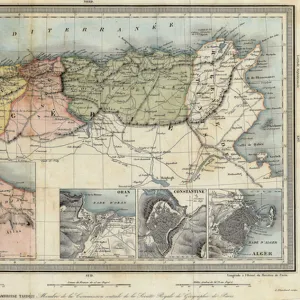
Geographic map of the Sumatra, years 1870. 19th century colour engraving
![]()

Wall Art and Photo Gifts from Fine Art Finder
Geographic map of the Sumatra, years 1870. 19th century colour engraving
NWI4879416 Geographic map of the Sumatra, years 1870. 19th century colour engraving.; (add.info.: Geographic map of the Sumatra, years 1870. 19th century colour engraving.); Photo © North Wind Pictures
Media ID 38267014
© Photo © North Wind Pictures / Bridgeman Images
Geographical Map Indonesia Indonesia Indonesian Indonesian South East Asia Sumatra
FEATURES IN THESE COLLECTIONS
> Asia
> Indonesia
> Related Images
> Fine Art Finder
> Artists
> Unknown Artist
> Maps and Charts
> Early Maps
EDITORS COMMENTS
This stunning 19th-century color engraving captures the intricate details of a Geographic map of Sumatra from the year 1870. The map, with its vibrant colors and precise lines, offers a glimpse into the geographical landscape of this Indonesian island during that time period.
Sumatra, known for its lush rainforests, diverse wildlife, and rich cultural heritage, is depicted in all its glory on this historical map. From the rugged mountains in the interior to the coastal plains along the shores, every aspect of Sumatra's topography is meticulously illustrated.
The intricate engravings showcase rivers winding their way through dense forests, mountain ranges towering over valleys, and villages scattered throughout the countryside. This detailed representation provides valuable insight into how Sumatra was perceived and understood by cartographers in the 19th century.
As we gaze upon this image, we are transported back in time to an era when exploration and discovery were at their peak. The artistry and precision of this engraving serve as a testament to both the beauty of Sumatra's natural landscapes and the skill of those who sought to document them.
This Geographic map of Sumatra from 1870 is not just a visual masterpiece but also a valuable historical artifact that sheds light on our understanding of this fascinating island in Southeast Asia.
MADE IN THE USA
Safe Shipping with 30 Day Money Back Guarantee
FREE PERSONALISATION*
We are proud to offer a range of customisation features including Personalised Captions, Color Filters and Picture Zoom Tools
SECURE PAYMENTS
We happily accept a wide range of payment options so you can pay for the things you need in the way that is most convenient for you
* Options may vary by product and licensing agreement. Zoomed Pictures can be adjusted in the Cart.


