Fraud Blocker Skip to main content

Home > Fine Art Finder > Artists > John Rocque

John Rocque Collection

Choose a picture from our John Rocque Collection for your Wall Art and Photo Gifts

66 items

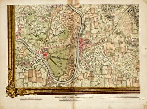
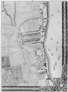
Background imageJohn Rocque Collection: A Map of Limehouse and Rotherhithe, London, 1746 (engraving)

A Map of Limehouse and Rotherhithe, London, 1746 (engraving)
XJF438443 A Map of Limehouse and Rotherhithe, London, 1746 (engraving) by Rocque, John (c.1704-d.1762); Private Collection; British, out of copyright

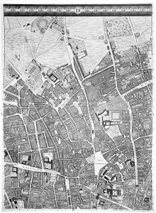
Background imageJohn Rocque Collection: A Map of Clerkenwell, City of London, 1746 (engraving)

A Map of Clerkenwell, City of London, 1746 (engraving)
XJF438448 A Map of Clerkenwell, City of London, 1746 (engraving) by Rocque, John (c.1704-d.1762); Private Collection; British, out of copyright

Background imageJohn Rocque Collection: Flag or hanging depicting Ziwei Dadi, 1849 (cotton)

Flag or hanging depicting Ziwei Dadi, 1849 (cotton)
7340527 Flag or hanging depicting Ziwei Dadi, 1849 (cotton) by Unknown Artist, (19th century); 221x284.5 cm; National Maritime Museum, London, UK; (add.info.: Unknown Artist)

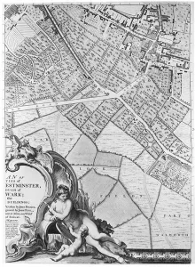
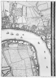
Background imageJohn Rocque Collection: Sheet 16 from: An exact survey of the cities of London and Westminster, the Borough of Southwark

Sheet 16 from: An exact survey of the cities of London and Westminster, the Borough of Southwark
7340520 Sheet 16 from: An exact survey of the cities of London and Westminster, the Borough of Southwark, with the country near ten miles round..., 1746 (coloured engraving) by Rocque

Background imageJohn Rocque Collection: Chart of River Thames from London to the Buoy of the Noure, 1686 (print)

Chart of River Thames from London to the Buoy of the Noure, 1686 (print)
7340613 Chart of River Thames from London to the Buoy of the Noure, 1686 (print) by Unknown Artist, (17th century); National Maritime Museum, London

Background imageJohn Rocque Collection: Map of Willesden and Hampstead, 1746 (coloured engraving)

Map of Willesden and Hampstead, 1746 (coloured engraving)
7340515 Map of Willesden and Hampstead, 1746 (coloured engraving) by Rocque, John (c.1704-d.1762); 51x67 cm; National Maritime Museum, London

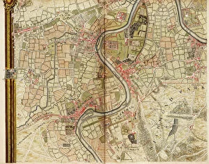
Background imageJohn Rocque Collection: Map of Acton, Paddington, Hyde Park and Kensington, 1746 (coloured engraving)

Map of Acton, Paddington, Hyde Park and Kensington, 1746 (coloured engraving)
7340514 Map of Acton, Paddington, Hyde Park and Kensington, 1746 (coloured engraving) by Rocque, John (c.1704-d.1762); 51x67 cm; National Maritime Museum, London

Background imageJohn Rocque Collection: Map of Hackney, Waltham and Wanstead, 1746 (coloured engraving)

Map of Hackney, Waltham and Wanstead, 1746 (coloured engraving)
7340505 Map of Hackney, Waltham and Wanstead, 1746 (coloured engraving) by Rocque, John (c.1704-d.1762); 51x67 cm; National Maritime Museum, London

Background imageJohn Rocque Collection: Map of Mottingham, Bromley and Chislehurst, 1746 (coloured engraving)

Map of Mottingham, Bromley and Chislehurst, 1746 (coloured engraving)
7340504 Map of Mottingham, Bromley and Chislehurst, 1746 (coloured engraving) by Rocque, John (c.1704-d.1762); 51x67 cm; National Maritime Museum, London

Background imageJohn Rocque Collection: Portrait of Edouard Drumont (b / w photo)

Portrait of Edouard Drumont (b / w photo)
698817 Portrait of Edouard Drumont (b/w photo) by Pirou, Eugene (fl.1884-1925); Private Collection; (add.info.: founded the Antisemitic League of France in 1889; founder)

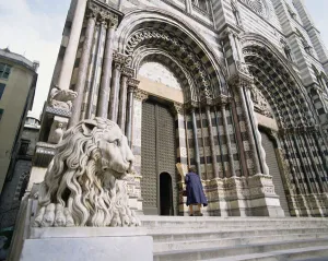
Background imageJohn Rocque Collection: Facade of the Cathedral of San Lorenzo photo)

Facade of the Cathedral of San Lorenzo photo)
KW153118 Facade of the Cathedral of San Lorenzo photo) by Italian School, (13th century); Genoa, Italy; (add.info.: black and white marble bands; construction of the cathedral began in 1118;)

Background imageJohn Rocque Collection: The Bowling Green at Claremont, 1738 (engraving)

The Bowling Green at Claremont, 1738 (engraving)
STC153081 The Bowling Green at Claremont, 1738 (engraving) by Rocque, John (c.1704-d.1762); Private Collection; (add.info.: owned by Clive of India 1768; ); The Stapleton Collection; British

Background imageJohn Rocque Collection: Detail of a historiated initial with an illustration of a vintner at work

Detail of a historiated initial with an illustration of a vintner at work
ARN170177 Detail of a historiated initial with an illustration of a vintner at work, from the Register of the Abbey of Saint-Germain-des-Pres (vellum) by French School

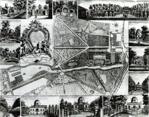
Background imageJohn Rocque Collection: Plan of the Garden and View of the Houses at Chiswick on the Thames (engraving

Plan of the Garden and View of the Houses at Chiswick on the Thames (engraving
STC171949 Plan of the Garden and View of the Houses at Chiswick on the Thames (engraving) (b/w photo) by Rocque, John (c.1704-d.1762); Victoria & Albert Museum, London

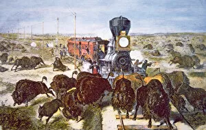
Background imageJohn Rocque Collection: Train Passengers on the Kansas Pacific Railroad, shooting buffalo for sport in

Train Passengers on the Kansas Pacific Railroad, shooting buffalo for sport in
PNP332186 Train Passengers on the Kansas Pacific Railroad, shooting buffalo for sport in the 1870s (colour litho) by American School

Background imageJohn Rocque Collection: Stratford, London, 1746 (litho)

Stratford, London, 1746 (litho)
GHL332169 Stratford, London, 1746 (litho) by Rocque, John (c.1704-d.1762); Guildhall Art Gallery, City of London; (add.info.: 2012 Olympic site; ); eLondon Metropolitan Archives; British

Background imageJohn Rocque Collection: Chart of the North Sea and Dutch coast, 1661 (coloured engraving)

Chart of the North Sea and Dutch coast, 1661 (coloured engraving)
7340609 Chart of the North Sea and Dutch coast, 1661 (coloured engraving) by British School, (17th century); 42x52 cm; National Maritime Museum, London

Background imageJohn Rocque Collection: Map of Greenford, Osterley, Ealing and Kew, 1746 (coloured engraving)

Map of Greenford, Osterley, Ealing and Kew, 1746 (coloured engraving)
7340517 Map of Greenford, Osterley, Ealing and Kew, 1746 (coloured engraving) by Rocque, John (c.1704-d.1762); 51x67 cm; National Maritime Museum, London

Background imageJohn Rocque Collection: Map of Wimbledon and Tooting, 1746 (coloured engraving)

Map of Wimbledon and Tooting, 1746 (coloured engraving)
7340512 Map of Wimbledon and Tooting, 1746 (coloured engraving) by Rocque, John (c.1704-d.1762); 51x67 cm; National Maritime Museum, London

Background imageJohn Rocque Collection: England East Coast. Sheet 1, late 19th century (print)

England East Coast. Sheet 1, late 19th century (print)
7340593 England East Coast. Sheet 1, late 19th century (print) by Imray, James & Son (19th century); National Maritime Museum, London

Background imageJohn Rocque Collection: Map of Highgate, Kentish Town, Holloway, Tottenham and Newington, 1746 (coloured engraving)

Map of Highgate, Kentish Town, Holloway, Tottenham and Newington, 1746 (coloured engraving)
7340507 Map of Highgate, Kentish Town, Holloway, Tottenham and Newington, 1746 (coloured engraving) by Rocque, John (c.1704-d.1762); 51x67 cm; National Maritime Museum, London

Background imageJohn Rocque Collection: The fortifications of Monaco and St. Tropez , c.1760? (print)

The fortifications of Monaco and St. Tropez , c.1760? (print)
7340632 The fortifications of Monaco and St. Tropez , c.1760? (print) by French School, (18th century); National Maritime Museum, London, UK; (add.info.: Georges-Louis Le Rouge (c)

Background imageJohn Rocque Collection: Map of Hounslow, Twickenham and Richmond, 1746 (coloured engraving)

Map of Hounslow, Twickenham and Richmond, 1746 (coloured engraving)
7340518 Map of Hounslow, Twickenham and Richmond, 1746 (coloured engraving) by Rocque, John (c.1704-d.1762); 51x67 cm; National Maritime Museum, London

Background imageJohn Rocque Collection: England-East Coast. Outer Gabbard to Outer Dowsing, 1919 (engraving)

England-East Coast. Outer Gabbard to Outer Dowsing, 1919 (engraving)
7340581 England-East Coast. Outer Gabbard to Outer Dowsing, 1919 (engraving) by British School, (20th century) ; 98.5x66 cm; National Maritime Museum, London

Background imageJohn Rocque Collection: Map of Bow, Stratford, Blackwall and Plaistow, 1746 (coloured engraving)

Map of Bow, Stratford, Blackwall and Plaistow, 1746 (coloured engraving)
7340506 Map of Bow, Stratford, Blackwall and Plaistow, 1746 (coloured engraving) by Rocque, John (c.1704-d.1762); 51x67 cm; National Maritime Museum, London

Background imageJohn Rocque Collection: A chart of the sea coasts of England, Flanders and Holland, c.1672 (print)

A chart of the sea coasts of England, Flanders and Holland, c.1672 (print)
7340614 A chart of the sea coasts of England, Flanders and Holland, c.1672 (print) by Seller, John (1632-97); National Maritime Museum, London

Background imageJohn Rocque Collection: Map of Streatham, Croydon and Sydenham, 1746 (coloured engraving)

Map of Streatham, Croydon and Sydenham, 1746 (coloured engraving)
7340510 Map of Streatham, Croydon and Sydenham, 1746 (coloured engraving) by Rocque, John (c.1704-d.1762); 51x67 cm; National Maritime Museum, London

Background imageJohn Rocque Collection: Chart of the southern hemisphere, post Cook, 1777 (print)

Chart of the southern hemisphere, post Cook, 1777 (print)
7340543 Chart of the southern hemisphere, post Cook, 1777 (print) by Forster, Georg (1754-94); 64x71 cm; National Maritime Museum, London

Background imageJohn Rocque Collection: Map of Barnes, Battersea, Putney and Wandsworth, 1746 (coloured engraving)

Map of Barnes, Battersea, Putney and Wandsworth, 1746 (coloured engraving)
7340513 Map of Barnes, Battersea, Putney and Wandsworth, 1746 (coloured engraving) by Rocque, John (c.1704-d.1762); 51x67 cm; National Maritime Museum, London

Background imageJohn Rocque Collection: An unidentified young lady of the time of Charles I, c.1635 (oil painting)

An unidentified young lady of the time of Charles I, c.1635 (oil painting)
7340626 An unidentified young lady of the time of Charles I, c.1635 (oil painting) by English School, (17th century); 72x61 cm; National Maritime Museum, London

Background imageJohn Rocque Collection: Map of Islington, Westminster, City and Southwark, 1746 (coloured engraving)

Map of Islington, Westminster, City and Southwark, 1746 (coloured engraving)
7340509 Map of Islington, Westminster, City and Southwark, 1746 (coloured engraving) by Rocque, John (c.1704-d.1762); 51x67 cm; National Maritime Museum, London

Background imageJohn Rocque Collection: Map of Northolt, Harrow and Wembley, 1746 (coloured engraving)

Map of Northolt, Harrow and Wembley, 1746 (coloured engraving)
7340516 Map of Northolt, Harrow and Wembley, 1746 (coloured engraving) by Rocque, John (c.1704-d.1762); 51x67 cm; National Maritime Museum, London

Background imageJohn Rocque Collection: Map of Vauxhall, Clapham, Peckham and Dulwich, 1746 (coloured engraving)

Map of Vauxhall, Clapham, Peckham and Dulwich, 1746 (coloured engraving)
7340511 Map of Vauxhall, Clapham, Peckham and Dulwich, 1746 (coloured engraving) by Rocque, John (c.1704-d.1762); 51x67 cm; National Maritime Museum, London

Background imageJohn Rocque Collection: A young woman seated, reading, possibly Charlotte Nelson, 1802 (graphite)

A young woman seated, reading, possibly Charlotte Nelson, 1802 (graphite)
7339868 A young woman seated, reading, possibly Charlotte Nelson, 1802 (graphite) by Baxter, Thomas (1782-1821); 14.2x9.7 cm; National Maritime Museum, London

Background imageJohn Rocque Collection: 'An exact survey of the cities of London and Westminster, the borough of Southwark

'An exact survey of the cities of London and Westminster, the borough of Southwark
7339846 'An exact survey of the cities of London and Westminster, the borough of Southwark, with the country near ten miles round', c.1746 (engraving) by Rocque

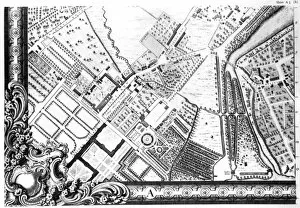
Background imageJohn Rocque Collection: Plan of ye Royal Palace and Gardens of Kensington, 1736 (engraving)

Plan of ye Royal Palace and Gardens of Kensington, 1736 (engraving)
XJF488929 Plan of ye Royal Palace and Gardens of Kensington, 1736 (engraving) by Rocque, John (c.1704-d.1762); British Museum, London, UK; (add.info.: Kensington Palace and Gardens)

Background imageJohn Rocque Collection: Map of Tyburn, 1746 (litho) (detail of 438496)

Map of Tyburn, 1746 (litho) (detail of 438496)
XJF438497 Map of Tyburn, 1746 (litho) (detail of 438496) by Rocque, John (c.1704-d.1762); Private Collection; (add.info.: illustration of the Tyburn Tree; also shows The place where soldiers are shot)

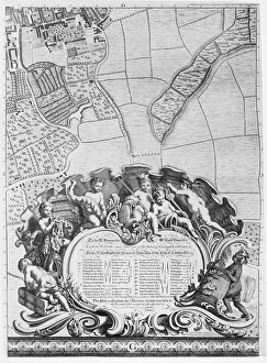
Background imageJohn Rocque Collection: Inscription from Rocques map of London, listing the citys Aldermen and their areas

Inscription from Rocques map of London, listing the citys Aldermen and their areas
XJF438449 Inscription from Rocques map of London, listing the citys Aldermen and their areas, 1746 (engraving) by Rocque, John (c.1704-d.1762); Private Collection; (add.info)

Background imageJohn Rocque Collection: A Map of Bermondsey, London, 1746 (engraving)

A Map of Bermondsey, London, 1746 (engraving)
XJF438442 A Map of Bermondsey, London, 1746 (engraving) by Rocque, John (c.1704-d.1762); Private Collection; British, out of copyright

Background imageJohn Rocque Collection: A Map of Bloomsbury and Holborn, London, 1746 (engraving)

A Map of Bloomsbury and Holborn, London, 1746 (engraving)
XJF438445 A Map of Bloomsbury and Holborn, London, 1746 (engraving) by Rocque, John (c.1704-d.1762); Private Collection; (add.info.: the map shows the Foundling Hospital)

Background imageJohn Rocque Collection: A Map of The Kings Road, London, 1746 (engraving)

A Map of The Kings Road, London, 1746 (engraving)
XJF438447 A Map of The Kings Road, London, 1746 (engraving) by Rocque, John (c.1704-d.1762); Private Collection; British, out of copyright

Background imageJohn Rocque Collection: A Map of the West End and Soho, London, 1746 (engraving)

A Map of the West End and Soho, London, 1746 (engraving)
XJF438446 A Map of the West End and Soho, London, 1746 (engraving) by Rocque, John (c.1704-d.1762); Private Collection; British, out of copyright

Background imageJohn Rocque Collection: A Map of Chelsea, 1746 (engraving)

A Map of Chelsea, 1746 (engraving)
XJF438440 A Map of Chelsea, 1746 (engraving) by Rocque, John (c.1704-d.1762); Private Collection; British, out of copyright

Background imageJohn Rocque Collection: A Map of the Lower Rotherhithe Docks, London, 1746 (engraving)

A Map of the Lower Rotherhithe Docks, London, 1746 (engraving)
XJF438444 A Map of the Lower Rotherhithe Docks, London, 1746 (engraving) by Rocque, John (c.1704-d.1762); Private Collection; (add.info.: Howland Great Wet Dock, now known as Greenland dock)

Background imageJohn Rocque Collection: A Map of Camberwell, London, 1746 (engraving)

A Map of Camberwell, London, 1746 (engraving)
XJF438439 A Map of Camberwell, London, 1746 (engraving) by Rocque, John (c.1704-d.1762); Private Collection; British, out of copyright

Background imageJohn Rocque Collection: A Map of Mile End and Stepney Green, London, 1746 (engraving)

A Map of Mile End and Stepney Green, London, 1746 (engraving)
XJF438441 A Map of Mile End and Stepney Green, London, 1746 (engraving) by Rocque, John (c.1704-d.1762); Private Collection; British, out of copyright

Background imageJohn Rocque Collection: A map of Marylebone, 1746 (engraving)

A map of Marylebone, 1746 (engraving)
XJF438438 A map of Marylebone, 1746 (engraving) by Rocque, John (c.1704-d.1762); Private Collection; British, out of copyright

Background imageJohn Rocque Collection: Map of St. Jamess, London, 1746 (engraving)

Map of St. Jamess, London, 1746 (engraving)
XJF438437 Map of St. James s, London, 1746 (engraving) by Rocque, John (c.1704-d.1762); Private Collection; British, out of copyright


All Professionally Made to Order for Quick Shipping


-

Why Choose Us?

We are a leading provider of Art Prints and Photo Gifts since 2003, working in partnership with a range of Sporting Clubs, Charities, Museums and Picture Libraries. A large share of profits from any of their images will go directly towards supporting that charity or club. Our archive of images is carefully curated to bring you a wide range of subjects, including landscapes, wildlife, architecture, and more. We ship from our partner labs in the UK, USA, EU (Netherlands) and Australia.
+

How do I place an order?

Ordering is quick & easy - Just follow 5 Simple Steps:
  1. Find your image: Use our search box or browse our online photo Collections to find the image you want.

  2. Choose your print format: Select your desired product and add it to your cart.

  3. Enter your details: If you're a returning customer, simply enter your email address and password, and we'll fill in your billing and shipping address details. All personal details are held securely and are fully GDPR compliant. As standard, we remove all Personally Identifiable Information after 12 months.

  4. Pay for your purchase: We use state-of-the-art security for online shopping and do not have access to your card details.

  5. Sit back and relax: We'll email you confirmation of your order and when it's dispatched. Registered customers can also track orders in the 'My Account' area.

+

How do I pay for an order?

You can pay for your order with most of the major credit and debit cards, or PayPal. For added security, major financial institutions process payment details separately and securely on our behalf. We do not have access to your online payment card details. Online payments are preferred however we do take phone orders. For UK customers only we accept cheques issued against a UK bank.
+

Is my data safe?

We take data security very seriously. We do not have access to your full card details and all payments are requested over a fully secure connection. Additionally, we fully comply with current European and GDPR legislation, and automatically remove all personal data after at most 12 months (unless you have an account with us and have signed in recently). We also have a strict opt-in policy and would never sell your personal details. Your data is only used to fulfill your order promptly and efficiently.
+

Is wall art ready to hang?

For quick and easy installation all wall art, including framed prints, canvas prints and metal prints are supplied with a ready to hang solution on the back. Generally, saw tooth hangers are applied as they allow wall art to hang flush against the wall. The serrated edge of the hanger prevents the frame from shifting or tilting when hung.
+

Are the photo prints fade resistant?

Yes, we use archival quality photo paper photographic paper for vivid reproduction Prints are an accurate representations of the original artwork, which is preserved for artistic character and authenticity. We guarantee they match previews shown on our web site