Home > Animals > Mammals > Spalacidae > Antiquus
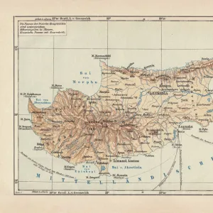
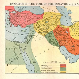
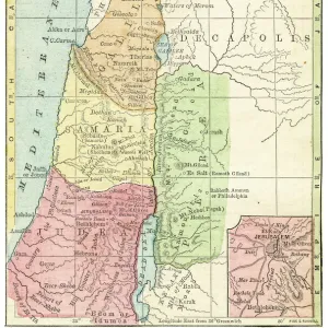
Map of the Near East in ancient times (coloured engraving)
")
![]()
Wall Art and Photo Gifts from Fine Art Finder
Map of the Near East in ancient times (coloured engraving)
7148248 Map of the Near East in ancient times (coloured engraving) by Kiepert, Heinrich (1818-99); Private Collection; (add.info.: Map of the Near East in ancient times. Illustration from Atlas Antiquus, Twelve Maps of the Ancient World for Schools and Colleges, by Dr Henry Kiepert (Dietrich Reimer, Berlin, c1889).); © Look and Learn
Media ID 25142008
© Look and Learn / Bridgeman Images
Atlas Central Turkey City Map City Plan Cyprus General Map Iraq Iraq Iraqi Mediterranean Mesopotamia Palestine Palestine Palestinian Palestinian Palestinians Street Plan Syria Syrian Syrians Afica Antiquit Arab Civilization Arabians Central Africa Greece Greek Greeks Mythological Character Mythological Figure Myths Pagan Paganism Pagans Polytheism Polytheist Sudan Turk
FEATURES IN THESE COLLECTIONS
> Africa
> Sudan
> Related Images
> Animals
> Mammals
> Spalacidae
> Antiquus
> Arts
> Artists
> I
> Iraqi School Iraqi School
> Arts
> Artists
> S
> Syrian Syrian
> Asia
> Cyprus
> Related Images
> Asia
> Iraq
> Related Images
> Asia
> Palestine
> Related Images
> Fine Art Finder
> Artists
> Heinrich Kiepert
EDITORS COMMENTS
This vibrant and detailed print showcases a captivating "Map of the Near East in ancient times" by Heinrich Kiepert. Dating back to the 19th century, this coloured engraving offers a glimpse into the rich history and mythology of the region. The map is part of Dr Henry Kiepert's Atlas Antiquus, intended for educational purposes in schools and colleges. The artwork depicts various mythological figures and characters intertwined with cartographic elements. It transports us to an era where paganism and polytheism were prevalent religious beliefs. From Greece to Mesopotamia, each region is meticulously illustrated with intricate details that bring ancient civilizations to life. The Mediterranean Sea serves as a central point connecting different cultures and lands on this historical map. Cyprus, Greece, Iraq (Mesopotamia), France, among others, are represented with their distinct characteristics. As we explore this piece further, it becomes evident that it not only provides geographical information but also acts as a portal into centuries past. The colours used add depth and vibrancy to the engraving while enhancing our understanding of how these regions were perceived during that time period. Overall, this remarkable print from Bridgeman Images invites us on a visual journey through time—a testament to both artistic skill and historical significance—captivating viewers with its fusion of cartography, mythology, religion, and cultural diversity within the Near East in ancient times.
MADE IN THE USA
Safe Shipping with 30 Day Money Back Guarantee
FREE PERSONALISATION*
We are proud to offer a range of customisation features including Personalised Captions, Color Filters and Picture Zoom Tools
SECURE PAYMENTS
We happily accept a wide range of payment options so you can pay for the things you need in the way that is most convenient for you
* Options may vary by product and licensing agreement. Zoomed Pictures can be adjusted in the Cart.