Fraud Blocker Skip to main content

Home > Europe > Italy > Maps

Maps Collection (page 6)

Maps of Italy Europe are invaluable resources for anyone looking to explore the country

3,953 items

Background imageMaps Collection: Map of Ancient Rome, from The National Encyclopaedia published by William Mackenzie, London

Map of Ancient Rome, from The National Encyclopaedia published by William Mackenzie, London, late 19th century
3501416 Map of Ancient Rome, from The National Encyclopaedia published by William Mackenzie, London, late 19th century; (add.info.: Map of Ancient Rome)

Background imageMaps Collection: Turin or Torino - Its Envisons, 1700

Turin or Torino - Its Envisons, 1700
2900905 Turin or Torino - Its Envisons, 1700; (add.info.: Turin or Torino - Its Envisons, 1700.); Buyenlarge Archive/UIG

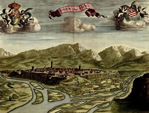
Background imageMaps Collection: City of Cuneo

City of Cuneo
2900904 City of Cuneo; (add.info.: Cuneum - Cuneo in Italy, 1700.); Buyenlarge Archive/UIG

Background imageMaps Collection: A bird's eye view of Rome in the late 19th century. From Italian Pictures by Rev

A bird's eye view of Rome in the late 19th century. From Italian Pictures by Rev. Samuel Manning, published c.1890
2963158 A bird's eye view of Rome in the late 19th century. From Italian Pictures by Rev. Samuel Manning, published c.1890

Background imageMaps Collection: Universal Geography: Italy. Advertising images edited for the brand Louit. Debut 20th century

Universal Geography: Italy. Advertising images edited for the brand Louit. Debut 20th century. (lithograph)
DUV4218144 Universal Geography: Italy. Advertising images edited for the brand Louit. Debut 20th century. (lithograph); 9.5x6.5 cm; Photo © Duvallon

Background imageMaps Collection: First World War: France, Patriotic Map showing four young girls symbolically dressed in uniforms

First World War: France, Patriotic Map showing four young girls symbolically dressed in uniforms of the French
LUX4737808 First World War: France, Patriotic Map showing four young girls symbolically dressed in uniforms of the French, Italian, English and Belgian armed forces pose with their flag

Background imageMaps Collection: First World War: France, Patriotic Map showing a French soldier

First World War: France, Patriotic Map showing a French soldier and an Italian soldier with their respective flag
LUX4737707 First World War: France, Patriotic Map showing a French soldier and an Italian soldier with their respective flag and names: 'for the defense of the right'

Background imageMaps Collection: First World War: France, Patriotic Map showing 5 young women representing the 5 countries of

First World War: France, Patriotic Map showing 5 young women representing the 5 countries of the alliance: France
LUX4739512 First World War: France, Patriotic Map showing 5 young women representing the 5 countries of the alliance: France, Russia, Italy, Belgium and England

Background imageMaps Collection: First World War: France, Patriotic Map showing France and Italy around their flag represented by

First World War: France, Patriotic Map showing France and Italy around their flag represented by two young girls
LUX4738986 First World War: France, Patriotic Map showing France and Italy around their flag represented by two young girls, titled 'The Two Sisters'

Background imageMaps Collection: First World War: France, Patriotic Map showing an Italian soldier in uniform with his rifle

First World War: France, Patriotic Map showing an Italian soldier in uniform with his rifle
LUX4737736 First World War: France, Patriotic Map showing an Italian soldier in uniform with his rifle and flag entitled 'Long live Italy'

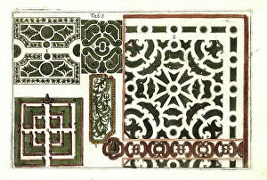
Background imageMaps Collection: Plans for formal gardens, 18th century. Handcoloured copperplate engraving after Mario Cammerari

Plans for formal gardens, 18th century. Handcoloured copperplate engraving after Mario Cammerari from Professor Filippo
FLO4563195 Plans for formal gardens, 18th century. Handcoloured copperplate engraving after Mario Cammerari from Professor Filippo Arena's La natura e cultura dei fiori fisicamente esposta

Background imageMaps Collection: First World War: Patriotic map showing an Italian soldier in uniform posing with his flag

First World War: Patriotic map showing an Italian soldier in uniform posing with his flag
LUX4744843 First World War: Patriotic map showing an Italian soldier in uniform posing with his flag and his famous feather helmet

Background imageMaps Collection: First World War: Patriotic map showing in a Russian vase eggs painted with angelots bearing

First World War: Patriotic map showing in a Russian vase eggs painted with angelots bearing the flags of the allies
LUX4744935 First World War: Patriotic map showing in a Russian vase eggs painted with angelots bearing the flags of the allies, 1915, 'Glorious Easter

Background imageMaps Collection: Bronze statue of a drunken faun from the house of the Patrician, Regio IX, Insula VIII

Bronze statue of a drunken faun from the house of the Patrician, Regio IX, Insula VIII. Now in the Museum of Naples
FLO4687177 Bronze statue of a drunken faun from the house of the Patrician, Regio IX, Insula VIII. Now in the Museum of Naples. Chromolithograph by J.G

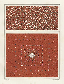
Background imageMaps Collection: Floors with colourful marble stones from the House of the Epigrams, Regio V, Insula 1, 18

Floors with colourful marble stones from the House of the Epigrams, Regio V, Insula 1, 18
FLO4687149 Floors with colourful marble stones from the House of the Epigrams, Regio V, Insula 1, 18. Chromolithograph by Victor Steeger after an illustration by Geremia Discanno from Emile Presuhn

Background imageMaps Collection: Mosaic of a dog from the porter's threshold in the House of Vesonius Primus, a fuller

Mosaic of a dog from the porter's threshold in the House of Vesonius Primus, a fuller
FLO4687127 Mosaic of a dog from the porter's threshold in the House of Vesonius Primus, a fuller. Chromolithograph by Victor Steeger after an illustration by Geremia Discanno from Emile Presuhn

Background imageMaps Collection: Mosaic picture of a guard dog in the house of Lucius Caecilius Iucundus

Mosaic picture of a guard dog in the house of Lucius Caecilius Iucundus. Chromolithograph by Victor Steeger after an
FLO4687103 Mosaic picture of a guard dog in the house of Lucius Caecilius Iucundus. Chromolithograph by Victor Steeger after an illustration by Geremia Discanno from Emile Presuhn (1844-1878)

Background imageMaps Collection: Mural from unidentified building in Pompeii. Chromolithograph by Victor Steeger after an

Mural from unidentified building in Pompeii. Chromolithograph by Victor Steeger after an illustration by Geremia
FLO4686891 Mural from unidentified building in Pompeii. Chromolithograph by Victor Steeger after an illustration by Geremia Discanno from Emile Presuhn (1844-1878)

Background imageMaps Collection: Caesar, Gallic War: Oppidum Atuatucorum (litho)

Caesar, Gallic War: Oppidum Atuatucorum (litho)
8636506 Caesar, Gallic War: Oppidum Atuatucorum (litho) by English School, (20th century); Private Collection; (add.info.: Oppidum Atuatucorum)

Background imageMaps Collection: Grecian Empire; Roman Empire (colour litho)

Grecian Empire; Roman Empire (colour litho)
8630309 Grecian Empire; Roman Empire (colour litho) by English School, (19th century); Private Collection; (add.info.: Grecian Empire; Roman Empire)

Background imageMaps Collection: 8626707

8626707

Background imageMaps Collection: Map of Switzerland (litho)

Map of Switzerland (litho)
8661130 Map of Switzerland (litho) by English School, (20th century); Private Collection; (add.info.: Map of Switzerland. The Swiss nation offers an instance of a unique historical freak)

Background imageMaps Collection: Aerial view of Pompeii showing the large theatre, small theatre, Quadriportico dei Teatri, etc

Aerial view of Pompeii showing the large theatre, small theatre, Quadriportico dei Teatri, etc
FLO4688237 Aerial view of Pompeii showing the large theatre, small theatre, Quadriportico dei Teatri, etc. Chromolithograph after an illustration by S

Background imageMaps Collection: Map of Florence. 15th century (Italian map)

Map of Florence. 15th century (Italian map)
542886 Map of Florence. 15th century (Italian map); Universal History Archive/UIG

Background imageMaps Collection: Battlements at Milan, 1700

Battlements at Milan, 1700
2900910 Battlements at Milan, 1700; (add.info.: Fortifications for the City of Milan or Milano, Italy.); Buyenlarge Archive/UIG

Background imageMaps Collection: Atlas or collection of geographic maps established on the new observations of gentlemen of

Atlas or collection of geographic maps established on the new observations of gentlemen of the Royal Academy of
JEB4874666 Atlas or collection of geographic maps established on the new observations of gentlemen of the Royal Academy of Sciences

Background imageMaps Collection: Cup on the length of the Teatro Farnese, theatre realized by Italian theatral architect Giovan

Cup on the length of the Teatro Farnese, theatre realized by Italian theatral architect Giovan Battista Aleotti dit
VEN5027730 Cup on the length of the Teatro Farnese, theatre realized by Italian theatral architect Giovan Battista Aleotti dit l'Argenta (1576-1636), National Archive of Parma

Background imageMaps Collection: Nice on the Mediterranean, 1700

Nice on the Mediterranean, 1700
2900900 Nice on the Mediterranean, 1700; (add.info.: Throughout the ages the town changed hands many times. Its strategic location and port significantly contributed to its maritime strength)

Background imageMaps Collection: Michelangelo Buonarroti dit Michel Ange (Michelangelo or Michelangelo, 1475-1564)

Michelangelo Buonarroti dit Michel Ange (Michelangelo or Michelangelo, 1475-1564)
GIM5037965 Michelangelo Buonarroti dit Michel Ange (Michelangelo or Michelangelo, 1475-1564): Fortification project with a modern stronghold of the walls of Florence in anticipation of the Siege of

Background imageMaps Collection: Plate extracted from a historical Atlas by Vidal Lablache, beg of 20th century (print)

Plate extracted from a historical Atlas by Vidal Lablache, beg of 20th century (print)
PCT4292088 Plate extracted from a historical Atlas by Vidal Lablache, beg of 20th century (print); (add.info.: Plate extracted from a historical Atlas by Vidal Lablache (Vidal-Lablache)

Background imageMaps Collection: Map of Western Mediterran Sea

Map of Western Mediterran Sea
3499621 Map of Western Mediterran Sea; (add.info.: Map of Western Mediterran Sea. European coast from Cartagena (Spain) until the southof Naples. Corsica and Sardinia islands. North African coast

Background imageMaps Collection: Portulan representing the Mediterranean basin (the coasts of Italy)

Portulan representing the Mediterranean basin (the coasts of Italy, southern France and northern Africa)
VEN5027752 Portulan representing the Mediterranean basin (the coasts of Italy, southern France and northern Africa). The city of Venice, Marseille and Budva (= Budua)

Background imageMaps Collection: Map of Venice, c.1900 (engraving)

Map of Venice, c.1900 (engraving)
532878 Map of Venice, c.1900 (engraving); (add.info.: Map of Venice, Italy, circa 1900, from the 10th edition of Encyclopaedia Britannica.); Encyclopaedia Britannica/UIG

Background imageMaps Collection: Vincenza, Italy

Vincenza, Italy
2901900 Vincenza, Italy; (add.info.: Founded by Ligurians in 1st cen. BCE; gained independence in 1164 and joined Lombard League; was destroyed by Emperor Frederick II in 1236; ruled by Della Scala)

Background imageMaps Collection: Painting of a still life showing meat, wine, bread and a knife from the ala at house 16, Regio IX

Painting of a still life showing meat, wine, bread and a knife from the ala at house 16, Regio IX, Insula V
FLO4687085 Painting of a still life showing meat, wine, bread and a knife from the ala at house 16, Regio IX, Insula V. Chromolithograph by J.G

Background imageMaps Collection: Elevation and floor plan of a house in Pompeii, showing the oecus, exedra, triclinium, cubiculum

Elevation and floor plan of a house in Pompeii, showing the oecus, exedra, triclinium, cubiculum, peristylium
FLO4686908 Elevation and floor plan of a house in Pompeii, showing the oecus, exedra, triclinium, cubiculum, peristylium, viridarium, piscina, apotheca, tablinum, libreca, atrium, ala, impluvium

Background imageMaps Collection: Map of the Eastern Roman Empire (Byzantine Empire) and the Kingdom of the Lombards

Map of the Eastern Roman Empire (Byzantine Empire) and the Kingdom of the Lombards
ELD4928045 Map of the Eastern Roman Empire (Byzantine Empire) and the Kingdom of the Lombards, 553-774 (Map of byzantine empire and Kingdom of the Lombards)

Background imageMaps Collection: The geography lesson, c.1750-1752. Creator: Longhi, Pietro (1701-1785)

The geography lesson, c.1750-1752. Creator: Longhi, Pietro (1701-1785)
The geography lesson, c.1750-1752. Found in the Collection of the Fondazione Querini Stampalia

Background imageMaps Collection: Italiy Map

Italiy Map
Studio Dolci

Background imageMaps Collection: AI IMAGE - Portrait of Christopher Columbus, 1490s, (2023). Creator: Heritage Images

AI IMAGE - Portrait of Christopher Columbus, 1490s, (2023). Creator: Heritage Images
AI IMAGE - Portrait of Christopher Columbus, 1490s, (2023). Columbus (1451-1506) was an Italian explorer, navigator and colonist who was sponsored by the Catholic Monarchs of Spain

Background imageMaps Collection: Le Champ de Bataille de L'Italie; mouvement des operations Italiennes jusqu'a la fin... 1917

Le Champ de Bataille de L'Italie; mouvement des operations Italiennes jusqu'a la fin... 1917. Creator: Unknown
Le Champ de Bataille de L'Italie; mouvement des operations Italiennes jusqu'a la fin de l'annee 1917, 1917. First World War

Background imageMaps Collection: Plan of Naples, 1860. Creator: John Dower

Plan of Naples, 1860. Creator: John Dower
Plan of Naples, 1860. Naples is built at the base and on the slopes of a range of hills which have the general form of an amphitheatre

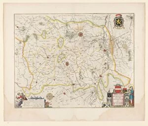
Background imageMaps Collection: Map of Brabant, 1635. Creator: Michael van Langren

Map of Brabant, 1635. Creator: Michael van Langren
Map of Brabant, 1635. Prima pars Brabantiae cuius caput Lovanivm'. Top right: a coat of arms; bottom right: title in a cartouche with King David playing the harp

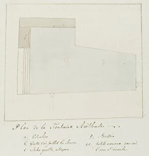
Background imageMaps Collection: Plan of the Fountain of Arethusa on Orhtygia Island, Syracuse, 1778. Creator: Louis Ducros

Plan of the Fountain of Arethusa on Orhtygia Island, Syracuse, 1778. Creator: Louis Ducros
Plan of the Fountain of Arethusa on Orhtygia Island, Syracuse, 1778. Drawing from the album Voyage to Italy, Sicily and Malta

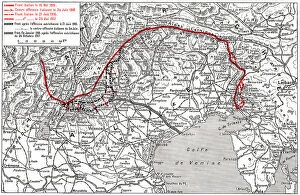
Background imageMaps Collection: 'Le front italien; sur la Brenta au 4 juillet, 1916. Creator: Unknown

'Le front italien; sur la Brenta au 4 juillet, 1916. Creator: Unknown
Le front italien; sur la Brenta au 4 juillet, 1916. From "Collection de la Guerre IV. L'Illustration Tome CXLVIII. La Guerre Juillet, Aout, Septembre, Octobre, Novembre, Decembre 1916"

Background imageMaps Collection: 'Afrique Orientale; Le Nord-Est Africain, 1914. Creator: Unknown

'Afrique Orientale; Le Nord-Est Africain, 1914. Creator: Unknown
'Afrique Orientale; Le Nord-Est Africain, 1914. From "Grande Geographie Bong Illustree", 1914


All Professionally Made to Order for Quick Shipping


-

Maps Collection

Maps of Italy Europe are invaluable resources for anyone looking to explore the country. They provide detailed information about the terrain, roads, cities, and other points of interest, and are be found in a variety of formats such as paper maps, online maps, and apps. Paper they can great for planning trips or getting an overview of the area while online maps provide more detailed information such as street names and directions. Apps are also useful for navigating while on-the-go. Maps of Italy Europe can help travelers find their way around unfamiliar places with ease and make sure they don’t miss out on any must-see attractions along their journey.
+

Our beautiful pictures are available as Framed Prints, Photos, Wall Art and Photo Gifts

The Maps of Italy Europe collection from Media Storehouse is a stunning range of wall art and framed prints that showcase the beauty and diversity of Italy. Our collection features an extensive selection of maps, ranging from antique maps dating back to the 16th century to modern-day cartography. Each map has been carefully selected for its historical significance or aesthetic appeal, making it a perfect addition to any home or office space. The Maps of Italy Europe collection offers something for everyone, with maps depicting different regions and cities across Italy. From the rolling hills of Tuscany to the bustling streets of Rome, these maps capture the essence of this beautiful country in intricate detail. Whether you are looking for a unique piece of wall art or a thoughtful gift for someone special, the Maps of Italy Europe collection is sure to impress. With high-quality printing and framing options available, these prints are designed to last a lifetime and bring joy to all who view them.
+

What are Maps of Italy Europe art prints?

Maps of Italy Europe art prints are high-quality reproductions of vintage and contemporary maps that showcase the intricate details and beauty of Italy and other European countries. These prints are perfect for those who love to travel, history enthusiasts, or anyone looking to add a touch of sophistication to their home decor. These art prints come in various sizes and styles, from colorful antique maps depicting the regions of Italy to modern minimalist designs highlighting the country's famous landmarks. They are printed on premium paper using archival inks that ensure long-lasting color vibrancy. Maps of Italy Europe art prints make great gifts for friends or family members who have a special connection with Italy or Europe. They can also be used as educational tools in classrooms or offices. Whether you're looking for a unique piece to decorate your living room wall or want to add some character to your workspace, Maps of Italy Europe art prints offer endless possibilities for personalization and creativity.
+

What Maps of Italy Europe art prints can I buy from Media Storehouse?

We offer a wide range of Maps of Italy Europe art prints that you can buy. These maps are available in various sizes and styles to suit your preferences. You can choose from antique, vintage, or contemporary designs that showcase the beauty and history of Italy and Europe. The collection includes detailed maps of Italian cities such as Rome, Florence, Venice, Milan, Naples, and many others. You can also find regional maps that highlight the diverse landscapes and cultures across Italy's 20 regions. In addition to Italian maps, Media Storehouse also offers European continent maps that feature neighboring countries such as France, Spain, Germany, Switzerland among others. These prints come in different formats including canvas prints or framed wall art for easy display on your walls. Whether you're looking for decorative pieces for your home or office space or educational resources for schools or libraries; Media Storehouse has got you covered with their extensive selection of Maps of Italy Europe art prints.
+

How do I buy Maps of Italy Europe art prints?

To buy Maps of Italy Europe art prints from Media Storehouse, you can browse our extensive collection online. We offer a variety of sizes and framing options to suit your preferences. Once you have found the print that you like, simply add it to your cart and proceed to checkout. You will be prompted to enter your shipping information and payment details before completing the purchase. We offer high-quality prints on premium paper using state-of-the-art printing technology. Their maps are sourced from reputable archives and collections around the world, ensuring accuracy and authenticity. Whether you are looking for a vintage map of Italy or a contemporary interpretation of Europe's geography, we have something for everyone. With our easy-to-use website and secure checkout process, buying Maps of Italy Europe art prints has never been easier.
+

How much do Maps of Italy Europe art prints cost?

We offer a wide range of Maps of Italy Europe art prints at various price points to suit different budgets. Our collection includes vintage maps, contemporary designs, and everything in between. The cost of our Maps of Italy Europe art prints depends on several factors such as the size, framing options, and materials used for printing. We use high-quality paper and ink to ensure that every print is vibrant and long-lasting. Our you can choose from a variety of sizes ranging from small to large formats depending on their preferences. Whether you're looking for a simple poster or an intricately framed piece, we have something for everyone. Our selection also includes canvas prints which provide a unique texture and depth to your artwork. The cost of our Maps of Italy Europe art prints varies based on individual choices but we strive to provide affordable options without compromising quality.
+

How will my Maps of Italy Europe art prints be delivered to me?

We take great care in ensuring that your Maps of Italy Europe art prints are delivered to you safely and securely. Our delivery process is designed to be hassle-free and convenient for our customers. Once you have placed your order with us, your Maps of Italy Europe art prints will be carefully packaged and dispatched from our warehouse. We use reliable courier services to ensure that your artwork arrives at its destination in perfect condition. We offer a range of delivery options depending on the size and weight of your order, as well as the destination address. You can choose standard or express delivery options at checkout. Our team is committed to providing excellent customer service throughout the entire ordering process. If you have any questions about shipping or delivery, please don't hesitate to contact us via email or phone. We're always happy to help.