Fraud Blocker Skip to main content

Home > Europe > Germany > Maps

Maps Collection (#8)

Germany is a country located in Central Europe, and is bordered by nine other countries, including Austria, Belgium, Czech Republic, Denmark, France

5,916 Items

Background imageMaps Collection: Great moas (Dinornis Robustus) hunted by prehistoric men with bows and arrows

Great moas (Dinornis Robustus) hunted by prehistoric men with bows and arrows
FLO4639311 Great moas (Dinornis Robustus) hunted by prehistoric men with bows and arrows. The Moas, a species endemic to New Zealand, were birds that could not fly

Background imageMaps Collection: Map of Japan, 1727. Creator: Kaempfer, Engelbert (1651-1716)

Map of Japan, 1727. Creator: Kaempfer, Engelbert (1651-1716)
Map of Japan, 1727. Private Collection

Background imageMaps Collection: Paris. From Topographia Galliae, 1655-1660. Creator: Merian, Caspar (1627-1686)

Paris. From Topographia Galliae, 1655-1660. Creator: Merian, Caspar (1627-1686)
Paris. From Topographia Galliae, 1655-1660. Private Collection

Background imageMaps Collection: Formula One World Championship, Rd10, German Grand Prix, Race, Hockenheim, Germany

Formula One World Championship, Rd10, German Grand Prix, Race, Hockenheim, Germany, Sunday 22 July 2012
Ted Kravitz (GBR) Sky TV reads the Stewards directive over the Red Bull Racing engine map. Formula One World Championship, Rd10, German Grand Prix, Race, Hockenheim, Germany, Sunday 22 July 2012

Background imageMaps Collection: Statue of Artemis, goddess of the hunt in Greek mythology, from Ephesus (engraving)

Statue of Artemis, goddess of the hunt in Greek mythology, from Ephesus (engraving)
7147480 Statue of Artemis, goddess of the hunt in Greek mythology, from Ephesus (engraving) by German School, (19th century); Private Collection; (add.info.: Statue of Artemis)

Background imageMaps Collection: Berlin City Centre Street Map

Berlin City Centre Street Map
A detailed street level map of central Berlin. Covers from Osloer Strasse in the north to Reuterkiez in the south and from Rummelsburg in the east to Beusselstrasse in the west

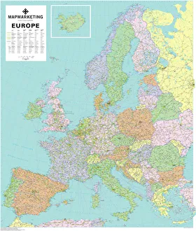
Background imageMaps Collection: Europe Political Map

Europe Political Map
This detailed Europe map covers the whole of the continent of Europe, going east as far as Moscow and south to North Africa

Background imageMaps Collection: City map of Stettin, Germany (today Szczecin, Poland), lithograph, 1897

City map of Stettin, Germany (today Szczecin, Poland), lithograph, 1897
Historical city map of Stettin, Germany (today Szczecin, Poland). Lithograph, published in 1897

Background imageMaps Collection: Geological map of the Black Forest, Baden-Wurttemberg, Germany, lithograph, 1897

Geological map of the Black Forest, Baden-Wurttemberg, Germany, lithograph, 1897
Geological map of the Black Forest, Baden-Wurttemberg, Germany. Lithograph, published in 1897

Background imageMaps Collection: Geological map of the Harz Mountains, Germany, lithograph, published 1897

Geological map of the Harz Mountains, Germany, lithograph, published 1897
Geological map of the Harz Mountains in Germany. Lithograph, published in 1897

Background imageMaps Collection: Topographic map of South Africa and Namibia, lithograph, published 1897

Topographic map of South Africa and Namibia, lithograph, published 1897
Topographic map of South Africa during the Dutch and British colonial era as well as Namibia (Deutsch-SAOEdwestafrika) during the German colonial era at the end of the 19th century

Background imageMaps Collection: City map of Liepuja (German: Libau), Latvia, woodcut, published 1897

City map of Liepuja (German: Libau), Latvia, woodcut, published 1897
City map of Liepuja (German: Libau), Latvia. Wood engraving, published in 1897

Background imageMaps Collection: 1866 Johnson Map Of Prussia And Germany Topography

1866 Johnson Map Of Prussia And Germany Topography
1866, Johnson Map of Prussia and Germany

Background imageMaps Collection: 1865 Spruner Map Of Germany In Antiquity Topography

1865 Spruner Map Of Germany In Antiquity Topography
1865, Spruner Map of Germany in Antiquity

Background imageMaps Collection: 1864 Mitchell Map Of Prussia And Germany Topography

1864 Mitchell Map Of Prussia And Germany Topography
1864, Mitchell Map of Prussia and Germany

Background imageMaps Collection: 1862 Stieler Map Of Prussia And Northeastern Germany

1862 Stieler Map Of Prussia And Northeastern Germany
1862, Stieler Map of Prussia and Northeastern Germany

Background imageMaps Collection: 1862 Stieler Map Of Northern Germany Topography

1862 Stieler Map Of Northern Germany Topography
1862, Stieler Map of Northern Germany

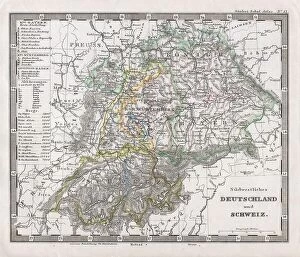
Background imageMaps Collection: 1862 Stieler Map Of Southern Germany And Switzerland

1862 Stieler Map Of Southern Germany And Switzerland
1862, Stieler Map of Southern Germany and Switzerland

Background imageMaps Collection: 1855 Spruneri Map Of Germany Or Germania Magna In Ancient Times

1855 Spruneri Map Of Germany Or Germania Magna In Ancient Times
1855, Spruneri Map of Germany or Germania Magna in Ancient Times

Background imageMaps Collection: 1853 Mitchell Map Of Germany Topography Cartography

1853 Mitchell Map Of Germany Topography Cartography
1853, Mitchell Map of Germany

Background imageMaps Collection: 1850 Mitchell Map Of Prussia Germany Topography

1850 Mitchell Map Of Prussia Germany Topography
1850, Mitchell Map of Prussia Germany

Background imageMaps Collection: 1837 Malte-Brun Map Of Northern Germany Or Prussia

1837 Malte-Brun Map Of Northern Germany Or Prussia
1837, Malte-Brun Map of Northern Germany or Prussia

Background imageMaps Collection: 1837 Malte-Brun Map Of Germany Topography Cartography

1837 Malte-Brun Map Of Germany Topography Cartography
1837, Malte-Brun Map of Germany

Background imageMaps Collection: 1840 S.D.U.K. Map Of Germany Topography Cartography

1840 S.D.U.K. Map Of Germany Topography Cartography
1840, S.D.U.K. Map of Germany

Background imageMaps Collection: 1832 Delamarche Map Of Germany In Roman Times

1832 Delamarche Map Of Germany In Roman Times
1832, Delamarche Map of Germany in Roman Times

Background imageMaps Collection: 1827 Finley Map Of Germany Anthony Finley Mapmaker Of The United States In The 19th Century

1827 Finley Map Of Germany Anthony Finley Mapmaker Of The United States In The 19th Century
1827, Finley Map of Germany, Anthony Finley mapmaker of the United States in the 19th century

Background imageMaps Collection: 1804 German Edition Of The Rennel Map Of India

1804 German Edition Of The Rennel Map Of India
1804, German Edition of the Rennel Map of India

Background imageMaps Collection: 1799 Celement Cruttwell Map Of Germany Topography

1799 Celement Cruttwell Map Of Germany Topography
1799, Celement Cruttwell Map of Germany

Background imageMaps Collection: 1794 Delarochette Wall Map Of The Empire Of Germany

1794 Delarochette Wall Map Of The Empire Of Germany
1794, Delarochette Wall Map of the Empire of Germany

Background imageMaps Collection: 1775 Rizzi-Zannoni Map Of The German Empire And Poland

1775 Rizzi-Zannoni Map Of The German Empire And Poland
1775, Rizzi-Zannoni Map of the German Empire and Poland

Background imageMaps Collection: 1771 Rizzi-Zannoni Map Of Germany And Poland

1771 Rizzi-Zannoni Map Of Germany And Poland
1771, Rizzi-Zannoni Map of Germany and Poland

Background imageMaps Collection: 1883 German Map View Of Lower Manhattan The Brooklyn Bridge

1883 German Map View Of Lower Manhattan The Brooklyn Bridge
1883, German Map View of Lower Manhattan, the Brooklyn Bridge, and Brooklyn

Background imageMaps Collection: 1872 Mitchell Map Of Prussia Germany Topography

1872 Mitchell Map Of Prussia Germany Topography
1872, Mitchell Map of Prussia, Germany

Background imageMaps Collection: 1866 Johnson Map Of Prussia Germany Topography

1866 Johnson Map Of Prussia Germany Topography
1866, Johnson Map of Prussia, Germany

Background imageMaps Collection: 1862 Stieler Map Of Holland Belgium And Western Germany

1862 Stieler Map Of Holland Belgium And Western Germany
1862, Stieler Map of Holland, Belgium and Western Germany

Background imageMaps Collection: 1862 Johnson Map Of Western Germany Bohemia Westphalia

1862 Johnson Map Of Western Germany Bohemia Westphalia
1862, Johnson Map of Western Germany, Bohemia, Westphalia, Luxemburg

Background imageMaps Collection: 1862 Johnson Map Of Northern Germany Holstein And Hanover

1862 Johnson Map Of Northern Germany Holstein And Hanover
1862, Johnson Map of Northern Germany, Holstein and Hanover

Background imageMaps Collection: 1856 Colton Map Of Prussia And Saxony Germany

1856 Colton Map Of Prussia And Saxony Germany
1856, Colton Map of Prussia and Saxony, Germany

Background imageMaps Collection: 1855 Colton Map Of Western Germany Westphalia

1855 Colton Map Of Western Germany Westphalia
1855, Colton Map of Western Germany, Westphalia, Rheinland

Background imageMaps Collection: 1855 Colton Map Of Hanover And Holstein Germany

1855 Colton Map Of Hanover And Holstein Germany
1855, Colton Map of Hanover and Holstein, Germany

Background imageMaps Collection: 1855 Colton Map Of Bavaria Wurtemberg And Baden

1855 Colton Map Of Bavaria Wurtemberg And Baden
1855, Colton Map of Bavaria, Wurtemberg and Baden, Germany

Background imageMaps Collection: 1837 S.D.U.K. City Map Or Plan Of Frankfort Germany

1837 S.D.U.K. City Map Or Plan Of Frankfort Germany
1837, S.D.U.K. City Map or Plan of Frankfort, Germany

Background imageMaps Collection: 1843 Malte-Brun Map Of Prussia Germany Topography

1843 Malte-Brun Map Of Prussia Germany Topography
1843, Malte-Brun Map of Prussia, Germany

Background imageMaps Collection: 1818 Pinkerton Map Of Southwestern Germany Bavaria

1818 Pinkerton Map Of Southwestern Germany Bavaria
1818, Pinkerton Map of Southwestern Germany, Bavaria, Swabia, John Pinkerton, 1758 - 1826, Scottish antiquarian, cartographer, UK

Background imageMaps Collection: 1815 Thomson Map Of Prussia Germany John Thomson

1815 Thomson Map Of Prussia Germany John Thomson
1815, Thomson Map of Prussia, Germany, John Thomson, 1777 - 1840, was a Scottish cartographer from Edinburgh, UK

Background imageMaps Collection: 1814 Thomson Map Of Bavaria Germany John Thomson

1814 Thomson Map Of Bavaria Germany John Thomson
1814, Thomson Map of Bavaria, Germany, John Thomson, 1777 - 1840, was a Scottish cartographer from Edinburgh, UK

Background imageMaps Collection: 1801 Cary Map Of Westphalia Germany John Cary

1801 Cary Map Of Westphalia Germany John Cary
1801, Cary Map of Westphalia, Germany, John Cary, 1754 - 1835, English cartographer

Background imageMaps Collection: 1801 Cary Map Of Upper Saxony Germany Berlin

1801 Cary Map Of Upper Saxony Germany Berlin
1801, Cary Map of Upper Saxony, Germany, Berlin, Dresden, John Cary, 1754 - 1835, English cartographer


All Professionally Made to Order for Quick Shipping


-

Maps Collection

Germany is a country located in Central Europe, and is bordered by nine other countries, including Austria, Belgium, Czech Republic, Denmark, France, Luxembourg, Netherlands, Poland and Switzerland. Germany has a rich history and culture that can be seen through its many maps. Maps of Germany Europe provide an overview of the country's geography as well as its political divisions and major cities. They also show the location of rivers and lakes throughout the country. Additionally, they often include information about transportation networks such as roads and railways. Maps of Germany Europe are useful for travelers who want to explore this fascinating country or for those who wish to learn more about its history and culture.
+

Our beautiful Wall Art and Photo Gifts include Framed Prints, Photo Prints, Poster Prints, Canvas Prints, Jigsaw Puzzles, Metal Prints and so much more

The Maps of Germany Europe collection from Media Storehouse is a stunning array of wall art and framed prints that showcase the rich history and geography of Germany. Our collection features an extensive range of maps, including antique maps dating back to the 16th century as well as modern-day cartography. These maps offer a unique perspective on the evolution of German territories over time, highlighting changes in borders, cities, and landmarks. Each map is beautifully reproduced using high-quality printing techniques that capture every detail with remarkable clarity. Whether you're looking for a vintage map to add character to your home decor or a contemporary piece to inspire your wanderlust, our collection has something for everyone. With its wide selection of sizes and framing options available at affordable prices, the Maps of Germany Europe collection from Media Storehouse offers an excellent opportunity to own a piece of history while enhancing your living space with beautiful artwork.
+

What are Maps of Germany Europe art prints?

Maps of Germany Europe art prints are high-quality reproductions of vintage or contemporary maps depicting the geography, topography, and political boundaries of Germany and other European countries. These art prints are created using advanced printing techniques that ensure a sharp and vivid image with accurate colors and details. Maps have always been an important tool for navigation, exploration, and education. They provide a visual representation of the world around us, helping us understand our place in it. Maps of Germany Europe art prints offer not only practical information but also aesthetic value as they can be used to decorate homes, offices or public spaces. These art prints come in various sizes and styles to suit different tastes and purposes. Some feature intricate illustrations while others focus on clear lines and labels for easy reading. Whether you're looking for a historical map to display your love for history or a modern one to plan your next trip abroad, Maps of Germany Europe art prints from Media Storehouse offer something for everyone.
+

What Maps of Germany Europe art prints can I buy from Media Storehouse?

We offer a wide range of Maps of Germany Europe art prints that are perfect for decorating your home or office. These maps come in various sizes and styles, including vintage, antique, and modern designs. You can choose from different types of maps such as political maps, physical maps, topographical maps, roadmaps and more. Our collection includes high-quality prints that capture the intricate details of these beautiful maps. Whether you're looking to add some historical charm to your space or want to display your love for geography and travel, their selection has something for everyone. Their Maps of Germany Europe art prints are printed on premium quality paper using state-of-the-art printing technology which ensures they will last a lifetime without fading or losing their vibrancy. So if you're looking for unique wall decor that is both stylish and informative then our Maps of Germany Europe art prints are definitely worth checking out.
+

How do I buy Maps of Germany Europe art prints?

To buy Maps of Germany Europe art prints from Media Storehouse, you can browse our extensive collection online. Simply search for the specific map or location you are interested in and select the print size and format that suits your needs. You can choose from a range of high-quality paper options to ensure your print looks its best. Once you have made your selection, add it to your cart and proceed to checkout. You will be prompted to enter your shipping information and payment details. We accept a variety of payment methods including credit cards, PayPal, and Apple Pay. After completing your purchase, Media Storehouse will process your order and ship it directly to you. Your Map of Germany Europe art print will arrive ready for framing or display as desired. We offer a wide selection of maps from different regions around the world so if you're looking for other locations beyond Germany Europe they may have what you need too.
+

How much do Maps of Germany Europe art prints cost?

We offer a wide range of Maps of Germany and Europe art prints at varying prices. The cost of these prints depends on various factors such as the size, quality, and type of paper used for printing. Our collection includes vintage maps, contemporary designs, and artistic interpretations that cater to different tastes and preferences. We take pride in providing high-quality art prints that are affordable yet visually appealing. Our selection is carefully curated to ensure that customers have access to unique pieces that add character to their homes or offices. We also offer framing options for those who prefer ready-to-hang artwork. The cost of our Maps of Germany and Europe art prints varies depending on several factors. However, we strive to provide our customers with value for money by offering competitive prices without compromising on quality.
+

How will my Maps of Germany Europe art prints be delivered to me?

We take great care in delivering your Maps of Germany Europe art prints to you. We use high-quality packaging materials to ensure that your artwork arrives in perfect condition. Your print will be carefully rolled and placed inside a sturdy tube for protection during transit. We work with trusted shipping partners who offer reliable and secure delivery services worldwide. Once your order is dispatched, you will receive an email notification with tracking information so that you can monitor the progress of your delivery. We understand the importance of timely delivery and strive to ensure that all orders are processed promptly. However, please note that delivery times may vary depending on your location and other factors beyond our control. Rest assured that when you order from us, you can expect a hassle-free experience from start to finish. We pride ourselves on providing excellent customer service and look forward to serving you soon.