Fraud Blocker Skip to main content

Home > Europe > Germany > Maps

Maps Collection (page 5)

Germany is a country located in Central Europe, and is bordered by nine other countries, including Austria, Belgium, Czech Republic, Denmark, France

6,532 items

Background imageMaps Collection: Map of England, Ireland, Scotland and Isle of Man, 1100-1280 (Map of England, Ireland)

Map of England, Ireland, Scotland and Isle of Man, 1100-1280 (Map of England, Ireland, Scotland and island of Man)
ELD4928123 Map of England, Ireland, Scotland and Isle of Man, 1100-1280 (Map of England, Ireland, Scotland and island of Man, 1100 - 1280) Engraving from " Atlas Universel" by Houze

Background imageMaps Collection: Map ' Hamburg and the surrounding in the year 1070 ', 1866 (engraving)

Map " Hamburg and the surrounding in the year 1070 ", 1866 (engraving)
UTD4919047 Map " Hamburg and the surrounding in the year 1070 ", 1866 (engraving); (add.info.: Germany, Hamburg, map " Hamburg and the surrounding in the year 1070 ")

Background imageMaps Collection: Italy, Temple of Hera former called Temple of Poseidon, in Paestum illustration

Italy, Temple of Hera former called Temple of Poseidon, in Paestum illustration
UTD4921792 Italy, Temple of Hera former called Temple of Poseidon, in Paestum illustration from : " Kunsthistorische Bilderbogen " (Art history image gallery), first part, published by E

Background imageMaps Collection: Map of Germania following Treaty of Verdun in 843 dividing the Charlemagne Empire into three parts

Map of Germania following Treaty of Verdun in 843 dividing the Charlemagne Empire into three parts among the sons of
ELD4924537 Map of Germania following Treaty of Verdun in 843 dividing the Charlemagne Empire into three parts among the sons of Louis the Pious: the Western Francie

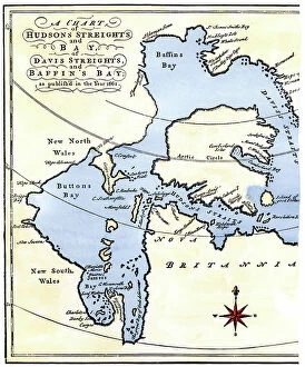
Background imageMaps Collection: Map of Hudson Bay and Detroit in the Arctic in Canada, 1662. From the travels of Henry Hudson

Map of Hudson Bay and Detroit in the Arctic in Canada, 1662. From the travels of Henry Hudson (1570-1611)
NWI4851002 Map of Hudson Bay and Detroit in the Arctic in Canada, 1662. From the travels of Henry Hudson (1570-1611), English explorer

Background imageMaps Collection: Map of the United States in 1819 showing the territory under occupation of the Spanish

Map of the United States in 1819 showing the territory under occupation of the Spanish
NWI4846207 Map of the United States in 1819 showing the territory under occupation of the Spanish and English colonial populations

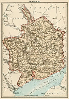
Background imageMaps Collection: Map of the Earl of Monmouth (England), circa 1870. 19th century lithography

Map of the Earl of Monmouth (England), circa 1870. 19th century lithography
NWI4875183 Map of the Earl of Monmouth (England), circa 1870. 19th century lithography.; (add.info.: Map of the Earl of Monmouth (England), circa 1870

Background imageMaps Collection: Map of the Earl of Lincolnshire (England), circa 1870. 19th century lithography

Map of the Earl of Lincolnshire (England), circa 1870. 19th century lithography
NWI4875140 Map of the Earl of Lincolnshire (England), circa 1870. 19th century lithography.; (add.info.: Map of the Earl of Lincolnshire (England), circa 1870

Background imageMaps Collection: Map of the Earl of Hereford (England), circa 1870. 19th century lithography

Map of the Earl of Hereford (England), circa 1870. 19th century lithography
NWI4874937 Map of the Earl of Hereford (England), circa 1870. 19th century lithography.; (add.info.: Map of the Earl of Hereford (England), circa 1870

Background imageMaps Collection: Geological map of England and Wales (composition and structure of the soils)

Geological map of England and Wales (composition and structure of the soils and natural resources of Great Britain)
NWI4874678 Geological map of England and Wales (composition and structure of the soils and natural resources of Great Britain), circa 1870

Background imageMaps Collection: Map of the Earl of Warwick (England), circa 1870. 19th century lithography

Map of the Earl of Warwick (England), circa 1870. 19th century lithography
NWI4875464 Map of the Earl of Warwick (England), circa 1870. 19th century lithography.; (add.info.: Map of the Earl of Warwick (England), circa 1870

Background imageMaps Collection: Map of the Earl of Surrey (England), circa 1870. 19th century lithography

Map of the Earl of Surrey (England), circa 1870. 19th century lithography
NWI4875424 Map of the Earl of Surrey (England), circa 1870. 19th century lithography.; (add.info.: Map of the Earl of Surrey (England), circa 1870

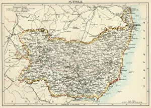
Background imageMaps Collection: Map of the Earl of Suffolk (England), circa 1870. 19th century lithography

Map of the Earl of Suffolk (England), circa 1870. 19th century lithography
NWI4875395 Map of the Earl of Suffolk (England), circa 1870. 19th century lithography.; (add.info.: Map of the Earl of Suffolk (England), circa 1870

Background imageMaps Collection: Map of the Counts of Shropshire, Stafford and Cheshire (England), circa 1870

Map of the Counts of Shropshire, Stafford and Cheshire (England), circa 1870. 19th century lithography
NWI4875335 Map of the Counts of Shropshire, Stafford and Cheshire (England), circa 1870. 19th century lithography.; (add.info.: Map of the Counts of Shropshire, Stafford and Cheshire (England)

Background imageMaps Collection: Map of the Earl of Nottingham (England), circa 1870. 19th century lithography

Map of the Earl of Nottingham (England), circa 1870. 19th century lithography
NWI4875298 Map of the Earl of Nottingham (England), circa 1870. 19th century lithography.; (add.info.: Map of the Earl of Nottingham (England), circa 1870

Background imageMaps Collection: Map of the Earl of Northumberland (England), circa 1870. 19th century lithography

Map of the Earl of Northumberland (England), circa 1870. 19th century lithography
NWI4875266 Map of the Earl of Northumberland (England), circa 1870. 19th century lithography.; (add.info.: Map of the Earl of Northumberland (England), circa 1870

Background imageMaps Collection: Map of the Earl of Norfolk (England), circa 1870. 19th century lithography

Map of the Earl of Norfolk (England), circa 1870. 19th century lithography
NWI4875227 Map of the Earl of Norfolk (England), circa 1870. 19th century lithography.; (add.info.: Map of the Earl of Norfolk (England), circa 1870

Background imageMaps Collection: Map of the Earl of Lancashire (England), circa 1870. 19th century lithography

Map of the Earl of Lancashire (England), circa 1870. 19th century lithography
NWI4875033 Map of the Earl of Lancashire (England), circa 1870. 19th century lithography.; (add.info.: Map of the Earl of Lancashire (England), circa 1870

Background imageMaps Collection: Map of the Earl of Hertford (England), circa 1870. 19th century lithography

Map of the Earl of Hertford (England), circa 1870. 19th century lithography
NWI4874966 Map of the Earl of Hertford (England), circa 1870. 19th century lithography.; (add.info.: Map of the Earl of Hertford (England), circa 1870

Background imageMaps Collection: Map of the British Empire in the 10th and 11th centuries showing the counts

Map of the British Empire in the 10th and 11th centuries showing the counts and vassalite domain of the kingdom
NWI4874308 Map of the British Empire in the 10th and 11th centuries showing the counts and vassalite domain of the kingdom

Background imageMaps Collection: Geographic map of England during the Norman Conquete (1066-1081)

Geographic map of England during the Norman Conquete (1066-1081). Norman invasion by William the Conquerant
NWI4873980 Geographic map of England during the Norman Conquete (1066-1081). Norman invasion by William the Conquerant. Colour engraving of the 19th century; (add.info)

Background imageMaps Collection: Geographic map of England and France when King Henry II came to power (1133-1189) in 1154

Geographic map of England and France when King Henry II came to power (1133-1189) in 1154
NWI4874482 Geographic map of England and France when King Henry II came to power (1133-1189) in 1154. Lithograph of the 19th century.; (add.info)

Background imageMaps Collection: Map of the Kingdom of Saxony (Germany) with Silesia, Boheme and Baviere, circa 1870

Map of the Kingdom of Saxony (Germany) with Silesia, Boheme and Baviere, circa 1870. 19th century lithography
NWI4871588 Map of the Kingdom of Saxony (Germany) with Silesia, Boheme and Baviere, circa 1870. 19th century lithography.; (add.info.: Map of the Kingdom of Saxony (Germany) with Silesia

Background imageMaps Collection: Geologist William Smith

Geologist William Smith
NWI4947941 Geologist William Smith.; (add.info.: Geologist William Smith.); Photo © North Wind Pictures

Background imageMaps Collection: Dress during the Protectorate, 1653-1659. She wears five ribbons in her hair, a tall lace collar

Dress during the Protectorate, 1653-1659. She wears five ribbons in her hair, a tall lace collar
FLO4594692 Dress during the Protectorate, 1653-1659. She wears five ribbons in her hair, a tall lace collar, a black dress with green sleeves and scarlet shoulders over embroidered petticoats

Background imageMaps Collection: Map of an estate in East Sheen, Surrey, surveyed and delineated using a theodolite by James

Map of an estate in East Sheen, Surrey, surveyed and delineated using a theodolite by James Wadmore, 1811
FLO4593042 Map of an estate in East Sheen, Surrey, surveyed and delineated using a theodolite by James Wadmore, 1811. Copperplate engraving by W

Background imageMaps Collection: A European auroch has big horns attacked by wolves. Also called Ure (Bos primigenius)

A European auroch has big horns attacked by wolves. Also called Ure (Bos primigenius)
FLO4639223 A European auroch has big horns attacked by wolves. Also called Ure (Bos primigenius), the extinct ancestor of domestic cattle was a wild species, which lived in Europe

Background imageMaps Collection: Ichthyosaurus (fish lezard), is a genus of marine giant reptiles from the Jurassic period

Ichthyosaurus (fish lezard), is a genus of marine giant reptiles from the Jurassic period
FLO4639209 Ichthyosaurus (fish lezard), is a genus of marine giant reptiles from the Jurassic period. Colour illustration by Heinrich Harder (1858-1935)

Background imageMaps Collection: Megatherium americanum or large American bete, a terrestrial mammal 6 meters long

Megatherium americanum or large American bete, a terrestrial mammal 6 meters long and weighing 3 tons
FLO4639207 Megatherium americanum or large American bete, a terrestrial mammal 6 meters long and weighing 3 tons, living in America in the Pleistocene era

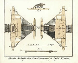
Background imageMaps Collection: Plan of a large boat, with balancers and platform, built by the natives of the island Tinian

Plan of a large boat, with balancers and platform, built by the natives of the island Tinian (Mariana Islands, USA)
FLO4636310 Plan of a large boat, with balancers and platform, built by the natives of the island Tinian (Mariana Islands, USA)

Background imageMaps Collection: Ethnographische karte von Europa (ethnographic map of Europe) published in Germany

Ethnographische karte von Europa (ethnographic map of Europe) published in Germany
PCT4292188 Ethnographische karte von Europa (ethnographic map of Europe) published in Germany, late 19th century (around 1894)

Background imageMaps Collection: Plan of Aubusson Gardens (18th century)

Plan of Aubusson Gardens (18th century)
LSE4087254 Plan of Aubusson Gardens (18th century).; Private Collection; (add.info.: Plan of Aubusson Gardens (18th century).); Photo © Leonard de Selva

Background imageMaps Collection: Bronze statue of a drunken faun from the house of the Patrician, Regio IX, Insula VIII

Bronze statue of a drunken faun from the house of the Patrician, Regio IX, Insula VIII. Now in the Museum of Naples
FLO4687177 Bronze statue of a drunken faun from the house of the Patrician, Regio IX, Insula VIII. Now in the Museum of Naples. Chromolithograph by J.G

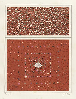
Background imageMaps Collection: Floors with colourful marble stones from the House of the Epigrams, Regio V, Insula 1, 18

Floors with colourful marble stones from the House of the Epigrams, Regio V, Insula 1, 18
FLO4687149 Floors with colourful marble stones from the House of the Epigrams, Regio V, Insula 1, 18. Chromolithograph by Victor Steeger after an illustration by Geremia Discanno from Emile Presuhn

Background imageMaps Collection: Mosaic of a dog from the porter's threshold in the House of Vesonius Primus, a fuller

Mosaic of a dog from the porter's threshold in the House of Vesonius Primus, a fuller
FLO4687127 Mosaic of a dog from the porter's threshold in the House of Vesonius Primus, a fuller. Chromolithograph by Victor Steeger after an illustration by Geremia Discanno from Emile Presuhn

Background imageMaps Collection: Mosaic picture of a guard dog in the house of Lucius Caecilius Iucundus

Mosaic picture of a guard dog in the house of Lucius Caecilius Iucundus. Chromolithograph by Victor Steeger after an
FLO4687103 Mosaic picture of a guard dog in the house of Lucius Caecilius Iucundus. Chromolithograph by Victor Steeger after an illustration by Geremia Discanno from Emile Presuhn (1844-1878)

Background imageMaps Collection: Mural from unidentified building in Pompeii. Chromolithograph by Victor Steeger after an

Mural from unidentified building in Pompeii. Chromolithograph by Victor Steeger after an illustration by Geremia
FLO4686891 Mural from unidentified building in Pompeii. Chromolithograph by Victor Steeger after an illustration by Geremia Discanno from Emile Presuhn (1844-1878)

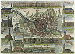
Background imageMaps Collection: Map of Berlin showing the fortress and numerous churches. Late 17th century (chromolithograph)

Map of Berlin showing the fortress and numerous churches. Late 17th century (chromolithograph)
529595 Map of Berlin showing the fortress and numerous churches. Late 17th century (chromolithograph); Universal History Archive/UIG

Background imageMaps Collection: Map of the German Empire with Berlin and Hamburg, c.1900 (engraving)

Map of the German Empire with Berlin and Hamburg, c.1900 (engraving)
532964 Map of the German Empire with Berlin and Hamburg, c.1900 (engraving); (add.info.: Map showing the eastern part of the German Empire, with inset maps of Berlin and Hamburg, circa 1902)

Background imageMaps Collection: Man, Map, Men, Mob, Mow, Mug, Nag, Net, Nut, Nut, Oak, Oar (engraving)

Man, Map, Men, Mob, Mow, Mug, Nag, Net, Nut, Nut, Oak, Oar (engraving)
8649982 Man, Map, Men, Mob, Mow, Mug, Nag, Net, Nut, Nut, Oak, Oar (engraving) by German School, (19th century) (after); Private Collection; (add.info.: Man, Map, Men, Mob, Mow, Mug, Nag, Net, Nut)

Background imageMaps Collection: Overview of the sewage system of Berlin (colour litho)

Overview of the sewage system of Berlin (colour litho)
8663951 Overview of the sewage system of Berlin (colour litho) by German School, (19th century) (after); Private Collection; (add.info.: Overview of the sewage system of Berlin)

Background imageMaps Collection: Map of Switzerland (litho)

Map of Switzerland (litho)
8661130 Map of Switzerland (litho) by English School, (20th century); Private Collection; (add.info.: Map of Switzerland. The Swiss nation offers an instance of a unique historical freak)

Background imageMaps Collection: Canal connecting the Nile and the Red Sea, 500 BC (engraving)

Canal connecting the Nile and the Red Sea, 500 BC (engraving)
8663872 Canal connecting the Nile and the Red Sea, 500 BC (engraving) by German School, (16th century) (after); Private Collection; (add.info.: Canal connecting the Nile and the Red Sea, Egypt)

Background imageMaps Collection: Duck-beaked dinosaur of the family Hardrosaurides, herbivores of the Upper Cretace

Duck-beaked dinosaur of the family Hardrosaurides, herbivores of the Upper Cretace
FLO4639177 Duck-beaked dinosaur of the family Hardrosaurides, herbivores of the Upper Cretace. Colour illustration by Heinrich Harder (1858-1935)

Background imageMaps Collection: Map of the Count of Devon (England), circa 1870. 19th century lithography

Map of the Count of Devon (England), circa 1870. 19th century lithography
NWI4874798 Map of the Count of Devon (England), circa 1870. 19th century lithography.; (add.info.: Map of the Count of Devon (England), circa 1870

Background imageMaps Collection: The diagram of the globe of 1492 by Martin Behaim (1459-1507, German cartographer and navigator)

The diagram of the globe of 1492 by Martin Behaim (1459-1507, German cartographer and navigator)
NWI4846980 The diagram of the globe of 1492 by Martin Behaim (1459-1507, German cartographer and navigator), describing the totality of the world, without the New World (American continent)

Background imageMaps Collection: Map of New England by John Smith of Jamestown (1580-1631) with his portrait, circa 1620

Map of New England by John Smith of Jamestown (1580-1631) with his portrait, circa 1620. Engraving of the 19th century
NWI4851262 Map of New England by John Smith of Jamestown (1580-1631) with his portrait, circa 1620. Engraving of the 19th century.; (add.info)

Background imageMaps Collection: World Map and Wind Map

World Map and Wind Map
2531457 World Map and Wind Map; (add.info.: Science. Geography. Mappemonde and wind map. Woodcut in: Geography, by Claudius Ptolemy, Basel (Switzerland), 1545


All Professionally Made to Order for Quick Shipping


-

Maps Collection

Germany is a country located in Central Europe, and is bordered by nine other countries, including Austria, Belgium, Czech Republic, Denmark, France, Luxembourg, Netherlands, Poland and Switzerland. Germany has a rich history and culture that can be seen through its many maps. Maps of Germany Europe provide an overview of the country's geography as well as its political divisions and major cities. They also show the location of rivers and lakes throughout the country. Additionally, they often include information about transportation networks such as roads and railways. Maps of Germany Europe are useful for travelers who want to explore this fascinating country or for those who wish to learn more about its history and culture.
+

Our beautiful pictures are available as Framed Prints, Photos, Wall Art and Photo Gifts

The Maps of Germany Europe collection from Media Storehouse is a stunning array of wall art and framed prints that showcase the rich history and geography of Germany. Our collection features an extensive range of maps, including antique maps dating back to the 16th century as well as modern-day cartography. These maps offer a unique perspective on the evolution of German territories over time, highlighting changes in borders, cities, and landmarks. Each map is beautifully reproduced using high-quality printing techniques that capture every detail with remarkable clarity. Whether you're looking for a vintage map to add character to your home decor or a contemporary piece to inspire your wanderlust, our collection has something for everyone. With its wide selection of sizes and framing options available at affordable prices, the Maps of Germany Europe collection from Media Storehouse offers an excellent opportunity to own a piece of history while enhancing your living space with beautiful artwork.
+

What are Maps of Germany Europe art prints?

Maps of Germany Europe art prints are high-quality reproductions of vintage or contemporary maps depicting the geography, topography, and political boundaries of Germany and other European countries. These art prints are created using advanced printing techniques that ensure a sharp and vivid image with accurate colors and details. Maps have always been an important tool for navigation, exploration, and education. They provide a visual representation of the world around us, helping us understand our place in it. Maps of Germany Europe art prints offer not only practical information but also aesthetic value as they can be used to decorate homes, offices or public spaces. These art prints come in various sizes and styles to suit different tastes and purposes. Some feature intricate illustrations while others focus on clear lines and labels for easy reading. Whether you're looking for a historical map to display your love for history or a modern one to plan your next trip abroad, Maps of Germany Europe art prints from Media Storehouse offer something for everyone.
+

What Maps of Germany Europe art prints can I buy from Media Storehouse?

We offer a wide range of Maps of Germany Europe art prints that are perfect for decorating your home or office. These maps come in various sizes and styles, including vintage, antique, and modern designs. You can choose from different types of maps such as political maps, physical maps, topographical maps, roadmaps and more. Our collection includes high-quality prints that capture the intricate details of these beautiful maps. Whether you're looking to add some historical charm to your space or want to display your love for geography and travel, their selection has something for everyone. Their Maps of Germany Europe art prints are printed on premium quality paper using state-of-the-art printing technology which ensures they will last a lifetime without fading or losing their vibrancy. So if you're looking for unique wall decor that is both stylish and informative then our Maps of Germany Europe art prints are definitely worth checking out.
+

How do I buy Maps of Germany Europe art prints?

To buy Maps of Germany Europe art prints from Media Storehouse, you can browse our extensive collection online. Simply search for the specific map or location you are interested in and select the print size and format that suits your needs. You can choose from a range of high-quality paper options to ensure your print looks its best. Once you have made your selection, add it to your cart and proceed to checkout. You will be prompted to enter your shipping information and payment details. We accept a variety of payment methods including credit cards, PayPal, and Apple Pay. After completing your purchase, Media Storehouse will process your order and ship it directly to you. Your Map of Germany Europe art print will arrive ready for framing or display as desired. We offer a wide selection of maps from different regions around the world so if you're looking for other locations beyond Germany Europe they may have what you need too.
+

How much do Maps of Germany Europe art prints cost?

We offer a wide range of Maps of Germany and Europe art prints at varying prices. The cost of these prints depends on various factors such as the size, quality, and type of paper used for printing. Our collection includes vintage maps, contemporary designs, and artistic interpretations that cater to different tastes and preferences. We take pride in providing high-quality art prints that are affordable yet visually appealing. Our selection is carefully curated to ensure that customers have access to unique pieces that add character to their homes or offices. We also offer framing options for those who prefer ready-to-hang artwork. The cost of our Maps of Germany and Europe art prints varies depending on several factors. However, we strive to provide our customers with value for money by offering competitive prices without compromising on quality.
+

How will my Maps of Germany Europe art prints be delivered to me?

We take great care in delivering your Maps of Germany Europe art prints to you. We use high-quality packaging materials to ensure that your artwork arrives in perfect condition. Your print will be carefully rolled and placed inside a sturdy tube for protection during transit. We work with trusted shipping partners who offer reliable and secure delivery services worldwide. Once your order is dispatched, you will receive an email notification with tracking information so that you can monitor the progress of your delivery. We understand the importance of timely delivery and strive to ensure that all orders are processed promptly. However, please note that delivery times may vary depending on your location and other factors beyond our control. Rest assured that when you order from us, you can expect a hassle-free experience from start to finish. We pride ourselves on providing excellent customer service and look forward to serving you soon.