Fraud Blocker Skip to main content

Home > Europe > France > Maps

Maps Collection (#33)

Maps of France Europe are essential tools for travelers and tourists who want to explore the continent

11,165 Items

Background imageMaps Collection: Le Theatre de Notre Offensive de la Somme; Nos progres et le developpement de la bataille du 1er

Le Theatre de Notre Offensive de la Somme; Nos progres et le developpement de la bataille du 1er ju Creator: Unknown
Le Theatre de Notre Offensive de la Somme; Nos progres et le developpement de la bataille du 1er juillet au mois d'octobre 1916, 1916

Background imageMaps Collection: Le grand effort ennemi de la Derniere Annee, 1918. Creator: Unknown

Le grand effort ennemi de la Derniere Annee, 1918. Creator: Unknown
Le grand effort ennemi de la Derniere Annee, 1918. From "L'Album de la Guerre 1914-1919, Volume 2" [L'Illustration, Paris, 1924]

Background imageMaps Collection: Portrait of Major General Paul Mascarene, 1729. Creator: John Smibert

Portrait of Major General Paul Mascarene, 1729. Creator: John Smibert
Portrait of Major General Paul Mascarene, 1729. Paul Mascarene was born Jean-Paul Mascarene in France in 1684 or 1685. He was educated in Geneva and in 1706 began a military career in England

Background imageMaps Collection: Nouvelle Carte des Sept Departemens de la Hollande/ New map of the seven Dutch...(1811-1812)

Nouvelle Carte des Sept Departemens de la Hollande/ New map of the seven Dutch...(1811-1812). Creator: Jan Gerritsz
Nouvelle Carte des Sept Departemens de la Hollande (...) / New map of the seven Dutch departments. Divided pursuant to the decree of his Majesty the Emperor and King of October 21, 1811

Background imageMaps Collection: Map of North Holland, c.1700-c.1710. Creator: Nicolaes Visscher

Map of North Holland, c.1700-c.1710. Creator: Nicolaes Visscher
Map of North Holland, c.1700-c.1710. Kennemaria et Westfrisia vulgo et vernacule Noord-Holland tam in minores quam Praecipuas Ditiones...'

Background imageMaps Collection: Map of Rijnland and Amstelland, c.1675. Creator: Workshop of Nicolaes Visscher

Map of Rijnland and Amstelland, c.1675. Creator: Workshop of Nicolaes Visscher
Map of Rijnland and Amstelland, c.1675. Rhenolandia, Amstelandia et circumjacentia aliquot territoria: cum aggeribus omnibus terminisq. suis'

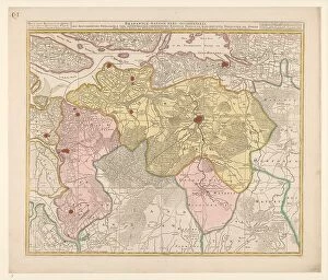
Background imageMaps Collection: Map of the Baronie van Breda, c.1780. Creator: Nicolaes Visscher

Map of the Baronie van Breda, c.1780. Creator: Nicolaes Visscher
Map of the Baronie van Breda, c.1780. At the top left list of towns and villages. At the top right the scale in German and French miles

Background imageMaps Collection: Map of the Republic of the Seven United Netherlands, 1677-1679. Creator: Nicolaes Visscher

Map of the Republic of the Seven United Netherlands, 1677-1679. Creator: Nicolaes Visscher
Map of the Republic of the Seven United Netherlands, 1677-1679. At the bottom right, the Maas from Maastricht to Wessem. At the top left the title in a cartouche surrounded by putti

Background imageMaps Collection: Map of South Holland, c.1675. Creator: Nicolaes Visscher

Map of South Holland, c.1675. Creator: Nicolaes Visscher
Map of South Holland, c.1675. With the west above. Scale in Dutch and French miles. Warships in a naval battle on the North Sea, the mouths of the Haringvliet and the Maas

Background imageMaps Collection: Map of North Flanders, c.1695. Creator: Nicolaes Visscher

Map of North Flanders, c.1695. Creator: Nicolaes Visscher
Map of North Flanders, c.1695. Showing part of Zeeland. Top right the scale in German and French miles

Background imageMaps Collection: Le Front D'Orient, de L'Adriatique a L'Egee; Le developpement des operations... 1918

Le Front D'Orient, de L'Adriatique a L'Egee; Le developpement des operations... 1918. Creator: Unknown
Le Front D'Orient, de L'Adriatique a L'Egee; Le developpement des operations, de Septembre 1916 A Octobre 1918, 1918. From "L'Album de la Guerre 1914-1919, Volume 2" [L'Illustration, Paris

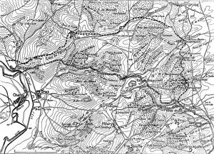
Background imageMaps Collection: Episodes de la bataille de Verdun; La derniere phase de la resistance du fort de Vaux, 1916

Episodes de la bataille de Verdun; La derniere phase de la resistance du fort de Vaux, 1916. Creator: Unknown
Episodes de la bataille de Verdun; La derniere phase de la resistance du fort de Vaux. La lacis de traits noirs represente les positions allemandes devant le fort a la fin de mai; le double trait

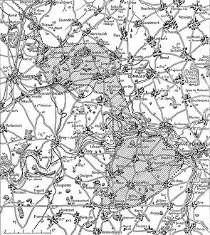
Background imageMaps Collection: La guerre 13-19 juillet 1916; Nord et sud de la Somme: Croquis du terrain de l'offensive... 1916

La guerre 13-19 juillet 1916; Nord et sud de la Somme: Croquis du terrain de l'offensive... 1916. Creator: Unknown
La guerre 13-19 juillet 1916; Nord et sud de la Somme: Croquis du terrain de l'offensive franco-britannique commencee la 1er juillet

Background imageMaps Collection: Le front italien; sur la Brenta au 4 juillet, 1916. Creator: Unknown

Le front italien; sur la Brenta au 4 juillet, 1916. Creator: Unknown
Le front italien; sur la Brenta au 4 juillet, 1916. From "Collection de la Guerre IV. L'Illustration Tome CXLVIII. La Guerre Juillet, Aout, Septembre, Octobre, Novembre, Decembre 1916"

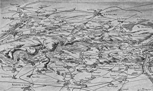
Background imageMaps Collection: Croquis perspectif de terrain de l'offensive franco-britannique sur les deux rives de la Somme

Croquis perspectif de terrain de l'offensive franco-britannique sur les deux rives de la Somme
Croquis perspectif de terrain de l'offensive franco-britannique sur les deux rives de la Somme. Front au 1er juillet (la ligne plus legere de points blancs indique l'avance au 12 juillet), 1916

Background imageMaps Collection: La bataille de Vaux ; plan sommaire du fort de Vaux, 1916. Creator: Unknown

La bataille de Vaux ; plan sommaire du fort de Vaux, 1916. Creator: Unknown
La bataille de Vaux ; plan sommaire du fort de Vaux, 1916. From "Collection de la Guerre IV. L'Illustration Tome CXLVIII

Background imageMaps Collection: Le Fort de Douaumont ; plan sommaire (rez de chaussee), 1916. Creator: Unknown

Le Fort de Douaumont ; plan sommaire (rez de chaussee), 1916. Creator: Unknown
Le Fort de Douaumont ; plan sommaire (rez de chaussee), 1916. From "Collection de la Guerre IV. L'Illustration Tome CXLVIII

Background imageMaps Collection: La Bataille de la Somme; De L'Yser a L'Aisne, 1916. Creator: Unknown

La Bataille de la Somme; De L'Yser a L'Aisne, 1916. Creator: Unknown
La Bataille de la Somme; De L'Yser a L'Aisne, 1916. From "Collection de la Guerre IV. L'Illustration Tome CXLVIII. La Guerre Juillet, Aout, Septembre, Octobre, Novembre, Decembre 1916"

Background imageMaps Collection: Carte des bassins miniers et des usines metallurgiques de la Lorraine et de la Sarre, 1916

Carte des bassins miniers et des usines metallurgiques de la Lorraine et de la Sarre, 1916. Creator: Unknown
Carte des bassins miniers et des usines metallurgiques de la Lorraine et de la Sarre. 1916. From "Collection de la Guerre IV. L'Illustration Tome CXLVII

Background imageMaps Collection: Map of Holland, Utrecht and part of Gelderland, 1726-1727. Creator: Caspar Specht

Map of Holland, Utrecht and part of Gelderland, 1726-1727. Creator: Caspar Specht
Map of Holland, Utrecht and part of Gelderland, 1726-1727. Map of the county of Holland, the seigneury of Utrecht and most of the Duchy of Gelderland. Texel and Vlieland in the top left

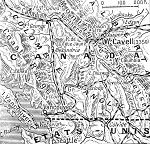
Background imageMaps Collection: A la memoire de Miss Edith Cavell; les Montagnes Rocheuses canadiennes et le Mont Cavell, 1916

A la memoire de Miss Edith Cavell; les Montagnes Rocheuses canadiennes et le Mont Cavell, 1916. Creator: Unknown
A la memoire de Miss Edith Cavell; les Montagnes Rocheuses canadiennes et le Mont Cavell. 1916. From "Collection de la Guerre IV. L'Illustration Tome CXLVII

Background imageMaps Collection: Fleury-devant-Douamont: Fleury et le terrain environnant, 1916. Creator: Unknown

Fleury-devant-Douamont: Fleury et le terrain environnant, 1916. Creator: Unknown
Fleury-devant-Douamont: Fleury et le terrain environnant. 1916. From "Collection de la Guerre IV. L'Illustration Tome CXLVII

Background imageMaps Collection: Map of the southern (Austrian) Netherlands, 1719. Creator: Joachim Ottens

Map of the southern (Austrian) Netherlands, 1719. Creator: Joachim Ottens
Map of the southern (Austrian) Netherlands, 1719. Novissima et accuratissima decem Austriacarum in Belgio provinciarum tabula, ut sunt ducatus Brabantiae, Luxembergensis, Limburgensis, et Geldriae

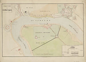
Background imageMaps Collection: Map of Antwerp during the siege by the French, 1832, (1832-1833)

Map of Antwerp during the siege by the French, 1832, (1832-1833). Creators: Anon, Johannes Paulus Houtman
Plan showing Schelde and Antwerp with the location of the forts in Dutch hands, during the siege of the Citadel by the French, 1832, (1832-1833). Dutch gunboats on the Scheldt

Background imageMaps Collection: Map of Thionville, c.1710. Creator: Anon

Map of Thionville, c.1710. Creator: Anon
Map of Thionville, c.1710. Map of the Fortress of Thionville (here spelled Theonville) on the Moselle. A scale at the bottom left

Background imageMaps Collection: Map of Avesnes, c.1710. Creator: Anon

Map of Avesnes, c.1710. Creator: Anon
Map of Avesnes, c.1710

Background imageMaps Collection: Map of Sint-Omaars, 1650-1700. Creator: Anon

Map of Sint-Omaars, 1650-1700. Creator: Anon
Map of Sint-Omaars, 1650-1700

Background imageMaps Collection: L'avance realisee le 15 decembre, au Nord de Verdun, par les divisions du groupement Mangin, 1916

L'avance realisee le 15 decembre, au Nord de Verdun, par les divisions du groupement Mangin, 1916. Creator: Unknown
L'avance realisee le 15 decembre, au Nord de Verdun, par les divisions du groupement Mangin, 1916. From "Collection de la Guerre IV. L'Illustration Tome CXLVIII

Background imageMaps Collection: Terrain de l'offensive britannique sur les deux rives de l'Ancre, 1916. Creator: Unknown

Terrain de l'offensive britannique sur les deux rives de l'Ancre, 1916. Creator: Unknown
Terrain de l'offensive britannique sur les deux rives de l'Ancre, 1916. From "Collection de la Guerre IV. L'Illustration Tome CXLVIII

Background imageMaps Collection: Au quartier general du roi de Roumanie; le roi Ferdinand et son fils aine, le prince... 1916

Au quartier general du roi de Roumanie; le roi Ferdinand et son fils aine, le prince... 1916. Creator: Unknown
Au quartier general du roi de Roumanie; le roi Ferdinand et son fils aine, le prince Charles, etudiant la carte, 1916. From "Collection de la Guerre IV. L'Illustration Tome CXLVIII

Background imageMaps Collection: Frontiere greco-serbe; terrain ou s'est deployee l'offensive de septembre a la frontiere... 1916

Frontiere greco-serbe; terrain ou s'est deployee l'offensive de septembre a la frontiere... 1916
Frontiere greco-serbe; terrain ou s'est deployee l'offensive de septembre a la frontiere greco-serbe, de part et d'autre du lac d'Ostrovo. 1916. From "Collection de la Guerre IV

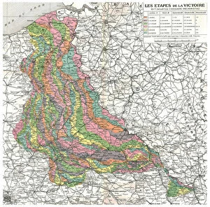
Background imageMaps Collection: Les Etapes de la Victoire. Du 1er juillet au 11 novembre 1918 (Armistice). Reduction de la

Les Etapes de la Victoire. Du 1er juillet au 11 novembre 1918 (Armistice). Reduction de la... 1918 Creator: Unknown
Les Etapes de la Victoire. Du 1er juillet au 11 novembre 1918 (Armistice). Reduction de la carte d'Etat-major placee dans le cabinet de travail du marechal Foch, a son quartier general de Senlis

Background imageMaps Collection: Bigre!... j'ai eu tort de me mettre... 19th century. Creator: Honore Daumier

Bigre!... j'ai eu tort de me mettre... 19th century. Creator: Honore Daumier
Bigre!... j'ai eu tort de me mettre... 19th century. Blimey! I was wrong to put the whole of Europe in my hands

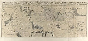
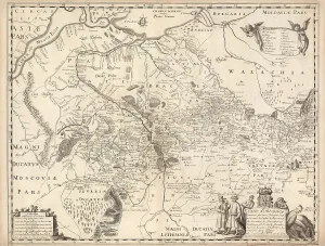
Background imageMaps Collection: Map of Ukraine, 1650. Creator: Le Vasseur de Beauplan, Guillaume (ca 1600-1673)

Map of Ukraine, 1650. Creator: Le Vasseur de Beauplan, Guillaume (ca 1600-1673)
Map of Ukraine, 1650. Private Collection

Background imageMaps Collection: Map of Ukraine, 1660. Creator: Le Vasseur de Beauplan, Guillaume (ca 1600-1673)

Map of Ukraine, 1660. Creator: Le Vasseur de Beauplan, Guillaume (ca 1600-1673)
Map of Ukraine, 1660. Private Collection

Background imageMaps Collection: Nouveau plan de Paris (Map of Paris showing illustrations, streets, main monuments, and... 1817)

Nouveau plan de Paris (Map of Paris showing illustrations, streets, main monuments, and... 1817. Creator: Anonymous)
Nouveau plan de Paris (Map of Paris showing illustrations, streets, main monuments, and public buildings), 1817. Private Collection

Background imageMaps Collection: Plan de Paris, 1890. Offert par l'Hôtel Moderne, Place de la République, Paris, 1890

Plan de Paris, 1890. Offert par l'Hôtel Moderne, Place de la République, Paris, 1890. Creator: Anonymous
Plan de Paris, 1890. Offert par l'Hotel Moderne, Place de la Republique, Paris, 1890. Private Collection

Background imageMaps Collection: L'Imerina; Iles Africaines de la mer des Indes, 1914. Creator: Unknown

L'Imerina; Iles Africaines de la mer des Indes, 1914. Creator: Unknown
L'Imerina; Iles Africaines de la mer des Indes, 1914. From "Grande Geographie Bong Illustree", 1914

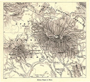
Background imageMaps Collection: Kilima Ndjaro et Meru; Afrique Australe, 1914. Creator: Unknown

Kilima Ndjaro et Meru; Afrique Australe, 1914. Creator: Unknown
Kilima Ndjaro et Meru; Afrique Australe, 1914. From "Grande Geographie Bong Illustree", 1914

Background imageMaps Collection: Grande vallee de fracture de lAfrique orientale; Afrique Australe, 1914. Creator: Unknown

Grande vallee de fracture de lAfrique orientale; Afrique Australe, 1914. Creator: Unknown
Grande vallee de fracture de lAfrique orientale; Afrique Australe, 1914. From "Grande Geographie Bong Illustree", 1914

Background imageMaps Collection: Region septentrionale du Nyassa; Afrique Australe, 1914. Creator: Unknown

Region septentrionale du Nyassa; Afrique Australe, 1914. Creator: Unknown
Region septentrionale du Nyassa; Afrique Australe, 1914. From "Grande Geographie Bong Illustree", 1914

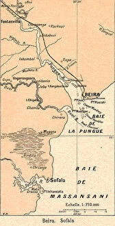
Background imageMaps Collection: Beira. Sofala; Afrique Australe, 1914. Creator: Unknown

Beira. Sofala; Afrique Australe, 1914. Creator: Unknown
Beira. Sofala; Afrique Australe, 1914. From "Grande Geographie Bong Illustree", 1914

Background imageMaps Collection: Lourenco-Marques; Afrique Australe, 1914. Creator: Unknown

Lourenco-Marques; Afrique Australe, 1914. Creator: Unknown
Lourenco-Marques; Afrique Australe, 1914. From "Grande Geographie Bong Illustree", 1914

Background imageMaps Collection: Le plateau de Bihe; Afrique Australe, 1914. Creator: Unknown

Le plateau de Bihe; Afrique Australe, 1914. Creator: Unknown
Le plateau de Bihe; Afrique Australe, 1914. From "Grande Geographie Bong Illustree", 1914

Background imageMaps Collection: Baie de Luderitz; Afrique Australe, 1914. Creator: Unknown

Baie de Luderitz; Afrique Australe, 1914. Creator: Unknown
Baie de Luderitz; Afrique Australe, 1914. From "Grande Geographie Bong Illustree", 1914

Background imageMaps Collection: Chutes Victoria; Afrique Australe, 1914. Creator: Unknown

Chutes Victoria; Afrique Australe, 1914. Creator: Unknown
Chutes Victoria; Afrique Australe, 1914. From "Grande Geographie Bong Illustree", 1914

Background imageMaps Collection: Depressoin du Ngami Kalahari; Afrique Australe, 1914. Creator: Unknown

Depressoin du Ngami Kalahari; Afrique Australe, 1914. Creator: Unknown
Depressoin du Ngami Kalahari; Afrique Australe, 1914. From "Grande Geographie Bong Illustree", 1914

Background imageMaps Collection: Region de Pretoria et de Johannesburg; Afrique Australe, 1914. Creator: Unknown

Region de Pretoria et de Johannesburg; Afrique Australe, 1914. Creator: Unknown
Region de Pretoria et de Johannesburg; Afrique Australe, 1914. From "Grande Geographie Bong Illustree", 1914


All Professionally Made to Order for Quick Shipping


-

Maps Collection

Maps of France Europe are essential tools for travelers and tourists who want to explore the continent. They provide an overview of the country, its major cities, and its attractions and are show roads, rivers, mountains, lakes, and other natural features that make up the landscape. Additionally, they often include information about local customs and culture as well as points of interest such as museums or monuments, and are be found in bookstores or online in various formats including paper maps or digital versions that can be accessed on mobile devices. With a map of France Europe in hand travelers will have no trouble navigating their way around this beautiful country.
+

Our beautiful Wall Art and Photo Gifts include Framed Prints, Photo Prints, Poster Prints, Canvas Prints, Jigsaw Puzzles, Metal Prints and so much more

The Maps of France Europe collection is a stunning assortment of wall art and framed prints that showcase the beauty and diversity of France. Our collection features an extensive range of maps, including antique maps dating back to the 16th century, as well as modern-day maps highlighting the country's cities, regions, and landmarks. Each print in our collection has been carefully curated by Media Storehouse to provide customers with a unique glimpse into French history and culture. From detailed depictions of Parisian streets to panoramic views of the Alps, these prints are sure to captivate anyone who loves France or European geography. Whether you're looking for a beautiful piece of artwork for your home or office or want to give someone special a thoughtful gift, Maps of France Europe offers something for everyone. With its high-quality printing techniques and durable framing options, our collection is sure to impress even the most discerning art enthusiasts.
+

What are Maps of France Europe art prints?

Maps of France Europe art prints are high-quality reproductions of vintage and contemporary maps showcasing the geography, topography, and landmarks of France and its neighboring European countries. These prints are perfect for those who love history, travel, or simply appreciate the beauty of cartography. The collection includes a wide range of styles, from antique maps dating back to the 16th century to modern designs featuring vibrant colors and intricate details. Some prints focus on specific regions or cities within France or Europe while others provide an overview of the entire continent. These art prints can be used to decorate any room in your home or office, adding a touch of sophistication and elegance to your space. They also make great gifts for anyone with an interest in geography or history. Whether you're looking for a unique piece to add to your personal collection or want to give someone special a thoughtful gift they'll treasure forever, Maps of France Europe art prints from Media Storehouse are sure to impress.
+

What Maps of France Europe art prints can I buy from Media Storehouse?

We offer a wide range of Maps of France Europe art prints that are perfect for those who love to travel or have an interest in geography. These maps come in various styles and designs, including vintage, antique, and modern versions. You can choose from different sizes and formats such as canvas prints, framed prints, posters or photographic prints. Some popular options include the Antique Map of France by John Speed which dates back to 1626; the Vintage Map of Paris which showcases the city's famous landmarks; and the Modern Map of Europe which highlights all major cities across the continent. Whether you're looking for a decorative piece for your home or office space or want to gift it to someone who loves history or geography- Media Storehouse has got you covered with their vast collection of Maps of France Europe art prints.
+

How do I buy Maps of France Europe art prints?

To buy Maps of France Europe art prints from Media Storehouse, you can browse through our extensive collection of maps and select the ones that interest you. Once you have made your selection, add them to your cart and proceed to checkout. You will be prompted to enter your shipping and payment information before completing the purchase. We offer a variety of sizes for their art prints, so make sure to choose the one that best fits your needs. The maps are printed on high-quality paper using state-of-the-art printing technology, ensuring that they look great in any setting. If you have any questions or concerns about purchasing Maps of France Europe art prints from Media Storehouse, our customer service team is available to assist you. They can provide additional information about the products or help with any issues that may arise during the ordering process.
+

How much do Maps of France Europe art prints cost?

We offer a wide range of Maps of France Europe art prints at varying prices. The cost of these prints depends on several factors such as the size, quality, and type of print you choose. Our standard paper prints are more affordable than our premium canvas or framed options. Additionally, some maps may be more intricate and detailed than others which can also impact the price. We strive to provide high-quality products at reasonable prices for all customers. Our Maps of France Europe art prints make great additions to any home or office decor and are perfect for history buffs or those who love travel. With a variety of sizes and styles available, there is something for everyone's taste and budget. We encourage customers to browse our selection online to find the perfect map print that fits their needs and preferences without breaking the bank.
+

How will my Maps of France Europe art prints be delivered to me?

We take great care in delivering your Maps of France Europe art prints to you. We use high-quality packaging materials to ensure that your artwork arrives in pristine condition. Your print will be carefully rolled and placed inside a sturdy tube for protection during transit. We work with trusted shipping partners who offer reliable delivery services. Once your order has been dispatched, you will receive an email notification with tracking information so that you can monitor the progress of your shipment. Our team is dedicated to providing excellent customer service, and we are always available to answer any questions or concerns you may have about the delivery process. If there are any issues with your order upon arrival, please contact us immediately so that we can resolve them as quickly as possible. You can trust Media Storehouse to deliver your Maps of France Europe art prints safely and efficiently straight to your doorstep.